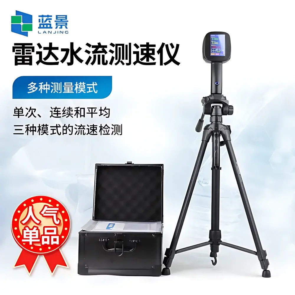
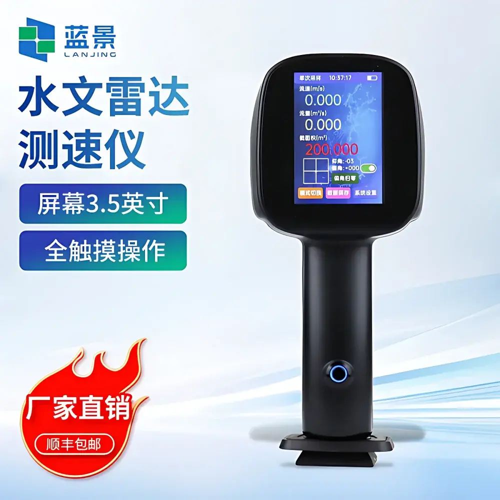
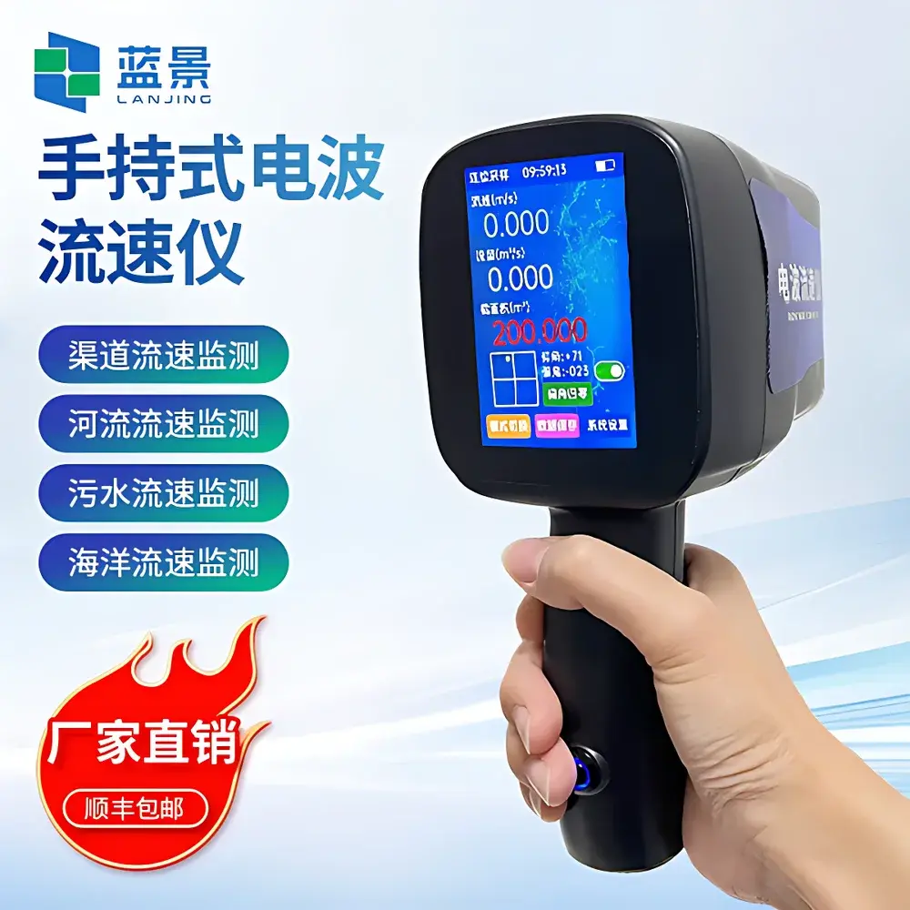
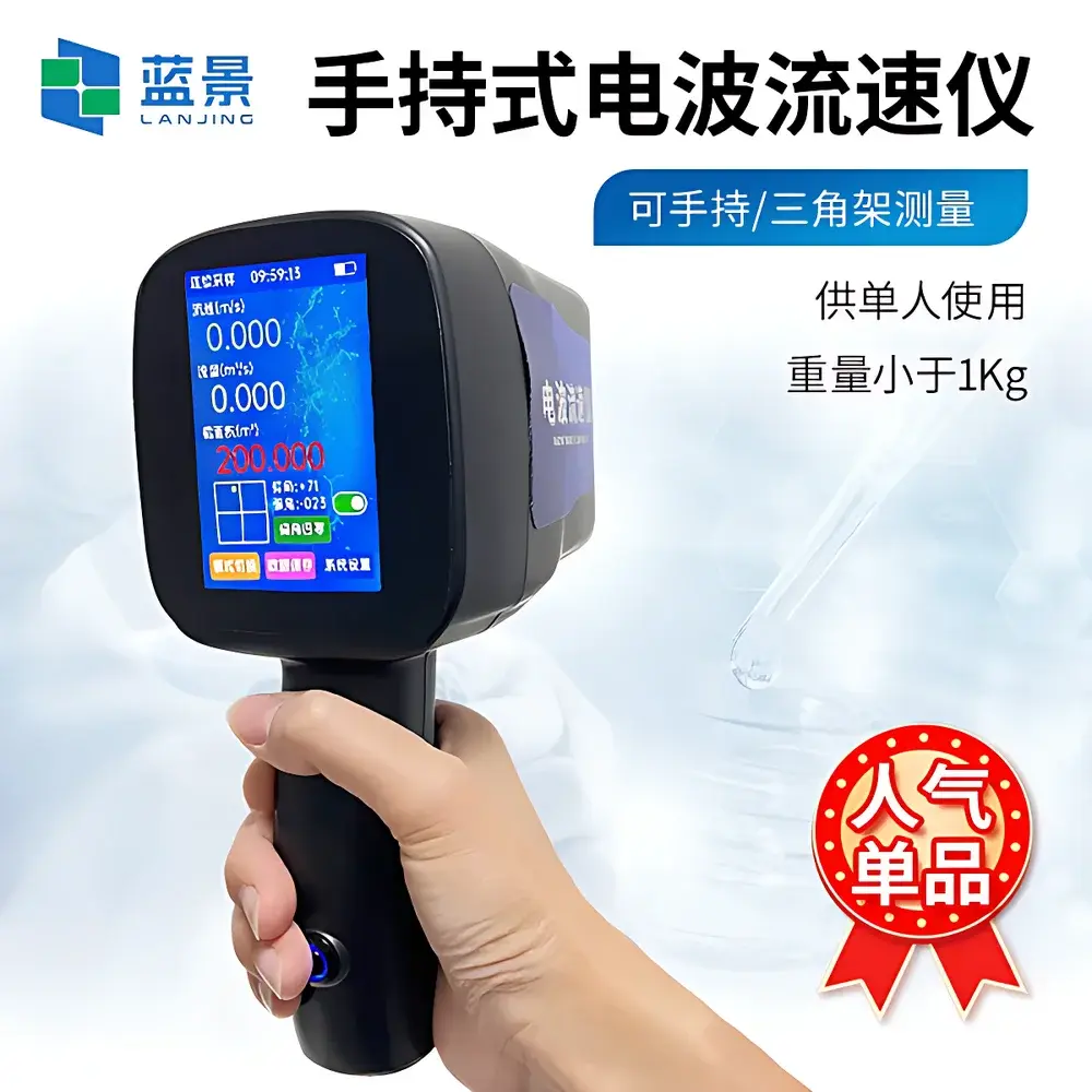
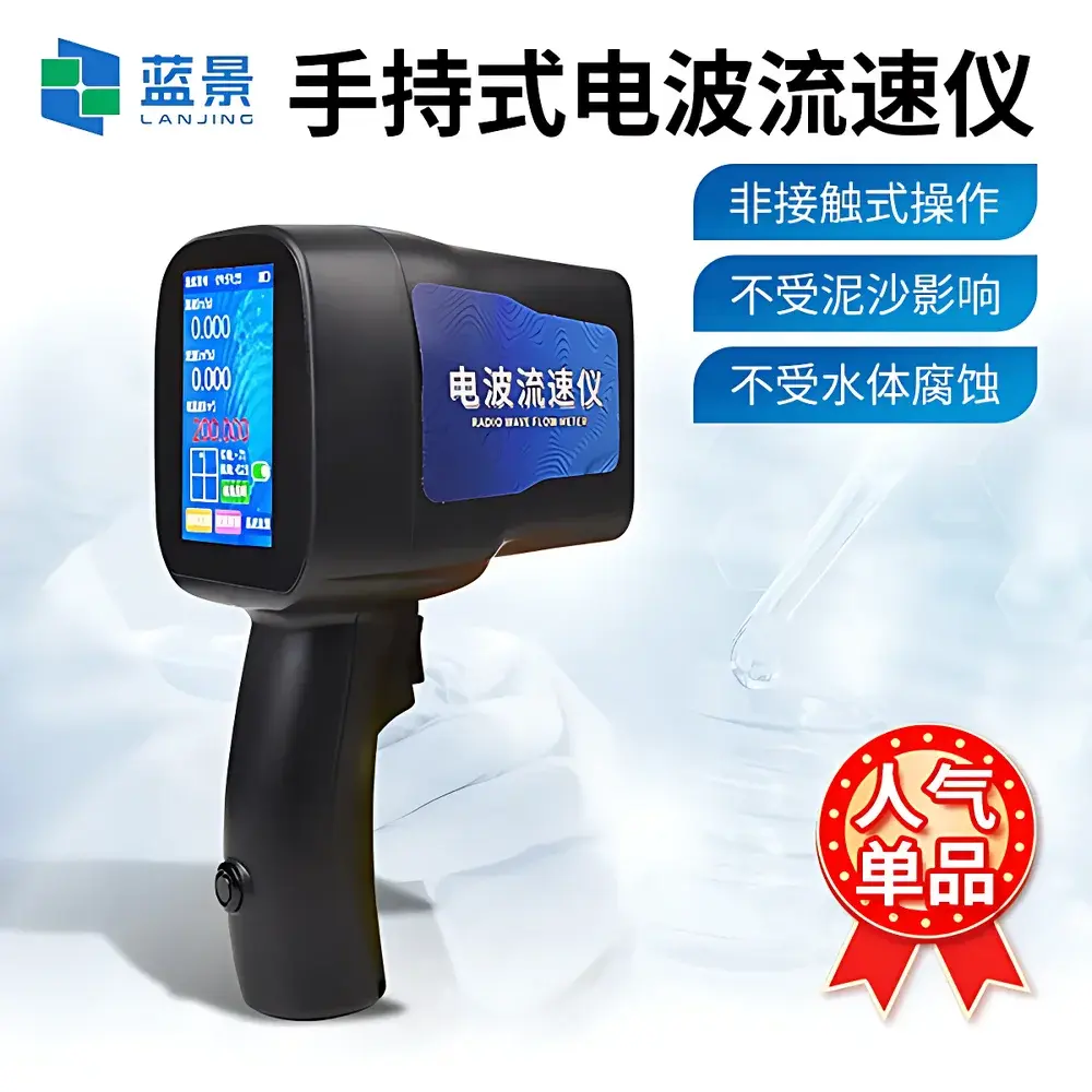
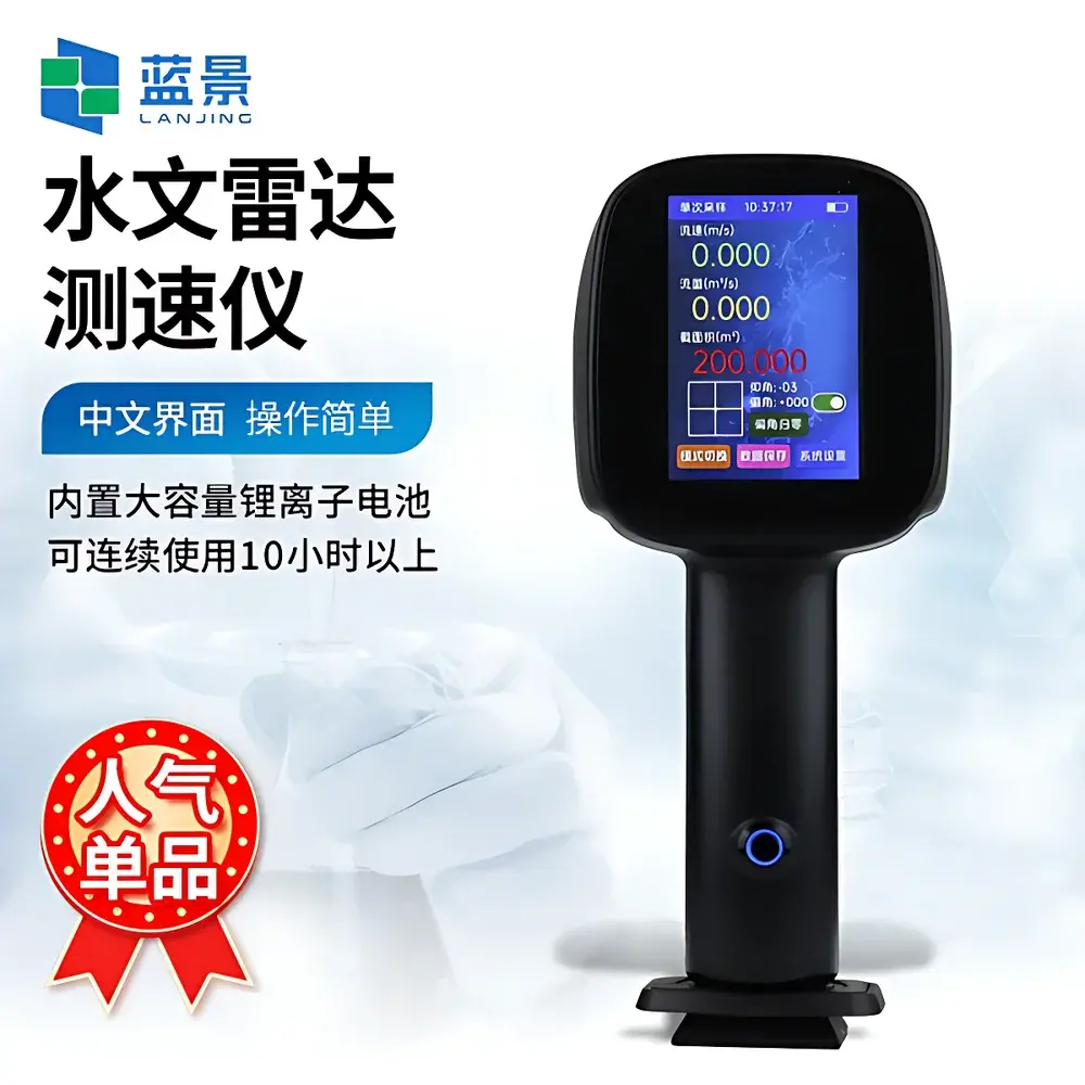
Lanjing LJ-LS5+ Handheld Radar Surface Velocity Meter
| Brand | Lanjing |
|---|---|
| Origin | Shandong, China |
| Manufacturer Type | Manufacturer |
| Country of Origin | China |
| Model | LJ-LS5+ |
| Price | USD 1,200 (FOB) |
| Measurement Range | 0.1–30 m/s |
| Accuracy | ±3% FS or ±0.01 m/s (whichever is greater) |
| Radar Frequency | 24 GHz |
| Beam Angle | 24° × 12° (elevation × azimuth) |
| Transmit Power | 18 dBm (63 mW peak), nominal 10 mW average |
| Max Measurement Distance | ≤100 m |
| Operating Temperature | −30 °C to +70 °C |
| Storage Temperature | −30 °C to +70 °C |
| Relative Humidity | 20–80% RH |
| Ingress Protection | IP67 |
| Battery Capacity | 3600 mAh Li-ion |
| Continuous Operation | >10 h |
| Data Storage | 10,000 records |
| Display | 3.5″ capacitive touchscreen |
| Interface | USB Type-A for USB flash drive data export |
| Built-in Tilt Sensor | Automatic horizontal & vertical angle compensation |
| Housing Material | ABS resin enclosure with aluminum frame |
| Weight | <1 kg |
Overview
The Lanjing LJ-LS5+ Handheld Radar Surface Velocity Meter is a K-band (24 GHz) continuous-wave Doppler radar instrument engineered for non-contact, real-time surface velocity measurement of open-channel flows. It operates on the principle of Doppler shift detection: microwave energy transmitted toward the water surface reflects off moving surface ripples and backscatter features; the frequency shift between transmitted and received signals is directly proportional to the surface flow velocity component along the radar line-of-sight. By integrating an embedded dual-axis tilt sensor and applying trigonometric correction in real time, the device automatically compensates for both pitch and yaw angles—enabling accurate horizontal velocity derivation without manual leveling or external survey equipment. Designed for field-deployable hydrological monitoring, it eliminates immersion-based sensor limitations—including fouling, corrosion, sediment interference, and mechanical wear—while maintaining operational safety during high-flow, flood-stage, or hazardous wastewater conditions.
Key Features
- True handheld form factor (<1 kg) with ergonomic grip and integrated tripod mount for stable single-operator deployment
- 3.5-inch capacitive touchscreen display with tri-color dynamic visualization of instantaneous velocity, cross-sectional area, and calculated flow rate (in real time)
- Bilingual (English/Chinese) menu interface with guided workflow navigation and one-touch language switching
- Integrated stopwatch function for timed observation intervals and event synchronization
- Onboard angle compensation: automatic real-time correction of vertical and horizontal aiming deviations using MEMS-based inclinometers
- Dual-mode operation: single-shot capture for spot checks or continuous logging up to 30 minutes with configurable sampling interval
- Single-unit flow estimation algorithm for prismatic channels (e.g., trapezoidal or rectangular conduits), accepting user-input geometry parameters
- Ruggedized housing: impact-resistant ABS polymer shell reinforced with aluminum structural frame; rated IP67 for dust-tightness and submersion resistance up to 1 m for 30 min
- Rechargeable 3600 mAh lithium-ion battery supporting >10 hours of continuous field use under typical ambient conditions
- USB-A port enabling direct export of CSV-formatted measurement logs to standard USB flash drives—no proprietary software required
Sample Compatibility & Compliance
The LJ-LS5+ is validated for velocity profiling across heterogeneous open-channel media including freshwater rivers, tidal estuaries, stormwater runoff, municipal wastewater effluents, industrial slurry discharges, and coastal surf zones. Its 24 GHz radar beam exhibits minimal attenuation in rain, fog, or suspended solids—ensuring reliable performance under adverse meteorological or turbid hydraulic conditions. The instrument complies with IEC 60529 (IP67), FCC Part 15 Subpart C (unlicensed ISM band operation), and EN 61000-6-3 (EMC emission limits). While not certified for safety-critical control loops, its measurement traceability aligns with ISO 748:2021 (Measurement of liquid flow in open channels — Velocity-area method) for auxiliary velocity input in discharge computations. No calibration certificate is supplied by default; users are advised to perform field verification against known reference velocities (e.g., GPS-tracked float methods per ASTM D3858) at installation and annually thereafter.
Software & Data Management
Data acquisition and export are fully embedded—no host PC or driver installation is required. All measurements are timestamped (RTC-backed), geotagged (optional external Bluetooth GNSS receiver support), and stored internally with full metadata: raw Doppler frequency, compensated velocity vector, tilt angles, signal strength (RSSI), distance-to-surface, and operator-defined channel ID. Exported CSV files include columns compatible with common hydrological analysis platforms (e.g., HEC-RAS, QGIS, Excel). Audit trail integrity is maintained via immutable internal logging; however, the device does not implement FDA 21 CFR Part 11-compliant electronic signatures or role-based access control. For regulated environments requiring ALCOA+ data governance, integration with third-party LIMS or cloud telemetry gateways (via optional RS-485 or LoRaWAN modules) is supported through documented API protocols.
Applications
- Real-time flood stage response: rapid velocity assessment during emergency river level rises without wading or bridge access
- Wastewater infrastructure management: inflow/outflow monitoring at pump stations, CSO outfalls, and treatment plant influent channels
- Environmental compliance reporting: periodic discharge verification per NPDES or local regulatory mandates
- Construction site hydrology: flow characterization upstream/downstream of cofferdams, culvert installations, or bridge piers
- Academic field hydrology: student-led stream gauging campaigns and watershed-scale surface velocity mapping
- Coastal zone monitoring: nearshore current profiling during dredging operations or sediment transport studies
FAQ
What is the effective measurement range for low-velocity flows?
The LJ-LS5+ maintains reliable detection down to 0.1 m/s under optimal signal-to-noise conditions (calm water surface, distance <30 m, minimal wind-induced surface noise). Below this threshold, accuracy degrades due to reduced Doppler shift resolution.
Can the device measure through vegetation or floating debris?
No. The radar requires a relatively unobstructed line-of-sight to the water surface. Dense surface scum, emergent reeds, or thick algal mats will attenuate or scatter the beam, resulting in invalid or no readings.
Is firmware update capability available?
Yes—field-upgradable via USB flash drive using signed binary packages distributed through Lanjing’s authorized technical support portal. Version history and release notes are publicly accessible.
Does the unit require annual recalibration?
Radar velocity sensors do not drift with time; however, annual functional verification against traceable reference methods is recommended per ISO/IEC 17025 guidance for field instrumentation used in accredited testing.
How is angle compensation validated during operation?
The internal MEMS inclinometer undergoes factory calibration against precision goniometers and is self-tested at power-on. Real-time tilt values are displayed alongside velocity output to allow visual confirmation of alignment stability.