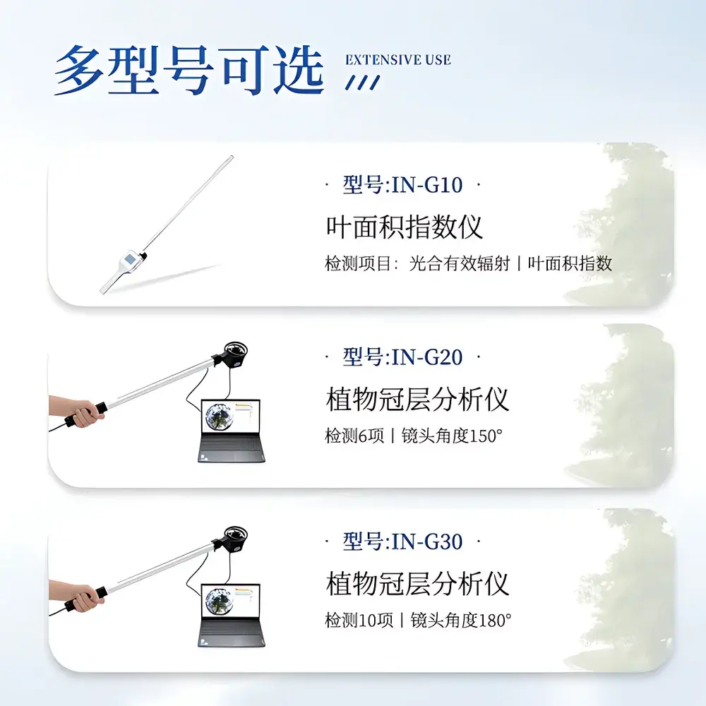
COMECAUSE IN*G30 Portable Canopy Analyzer
| Brand | COMECAUSE |
|---|---|
| Origin | Shandong, China |
| Manufacturer Type | OEM/ODM Manufacturer |
| Country of Origin | China |
| Model | IN*G30 |
| Instrument Principle | Hemispherical Image Analysis (Fisheye Photography) |
| Instrument Type | Portable |
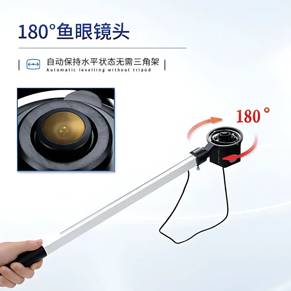
| Lens Field of View | 180° |
| Image Resolution | 2592 × 1944 |
| PAR Spectral Range | 400–700 nm |
| PAR Measurement Range | 0–3000 μmol·m⁻²·s⁻¹ |
| Angular Partitioning | Zenith angle 0°–90° (10 zones), Azimuth 0°–360° (10 zones) |
| Operating Temperature | −10°C to +55°C |
| Relative Humidity Limit | ≤85% RH |
| Weight | 500 g |
| Interface | USB |
| Software | COMECAUSE Canopy Analysis System v3.x |
| GPS Integration | Built-in GNSS module with real-time coordinate logging |
| Data Export | Cloud-sync enabled (COMECAUSE AgriCloud Platform) |
| Language Support | English & Chinese (switchable) |
Overview
The COMECAUSE IN*G30 Portable Canopy Analyzer is a field-deployable optical instrument engineered for quantitative structural and radiative characterization of plant canopies using hemispherical photography. It operates on the physical principle of gap fraction analysis—leveraging the Beer–Lambert law under standardized assumptions of canopy geometry and light extinction—to derive biophysically meaningful parameters from fisheye-lens-captured sky images acquired beneath vegetation. Unlike passive PAR sensors or empirical indices, the IN*G30 applies geometrically constrained image segmentation and pixel-level thresholding to compute spatially resolved canopy architecture metrics. Its design adheres to internationally recognized methodologies outlined in ISO 11727:2017 (Optics and photonics — Instruments for measuring plant canopy structure) and aligns with protocols recommended by the FAO’s Crop Water Productivity Guidelines and USDA-ARS canopy modeling frameworks. The system is calibrated for use across diverse growth stages—from early canopy closure in row crops to mature forest understory profiling—and delivers traceable, repeatable outputs suitable for peer-reviewed ecological modeling and agronomic decision support.
Key Features
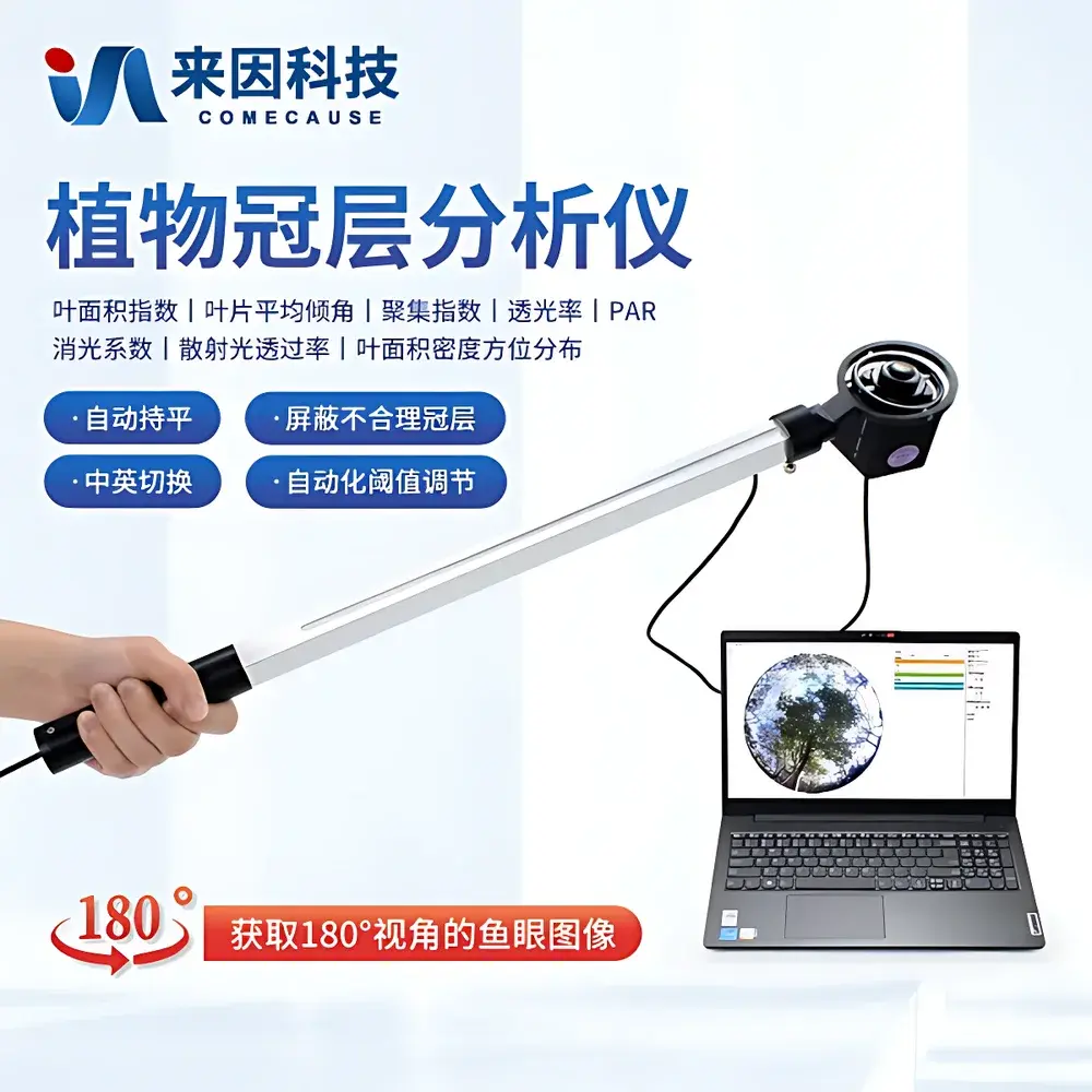
- Fisheye imaging probe with automatic horizon leveling via integrated gimbal mount—enabling stable, tripod-free acquisition without manual leveling.
- Extendable measurement arm (telescoping boom) with 180° fisheye lens at distal end—permitting stratified vertical profiling at multiple heights within dense or layered canopies.
- Dual-sensor hybrid architecture: high-resolution CMOS imager (2592 × 1944) co-located with 25 discrete quantum PAR sensors along the boom—providing synchronized optical and radiometric data streams.
- Real-time GNSS geotagging: embedded multi-constellation receiver logs WGS84 latitude/longitude, altitude, and UTC timestamp with each image capture—essential for spatially explicit time-series analysis.
- Adaptive thresholding algorithm: dynamically adjusts binary segmentation thresholds based on local histogram statistics, minimizing user-induced bias and enhancing inter-operator reproducibility.
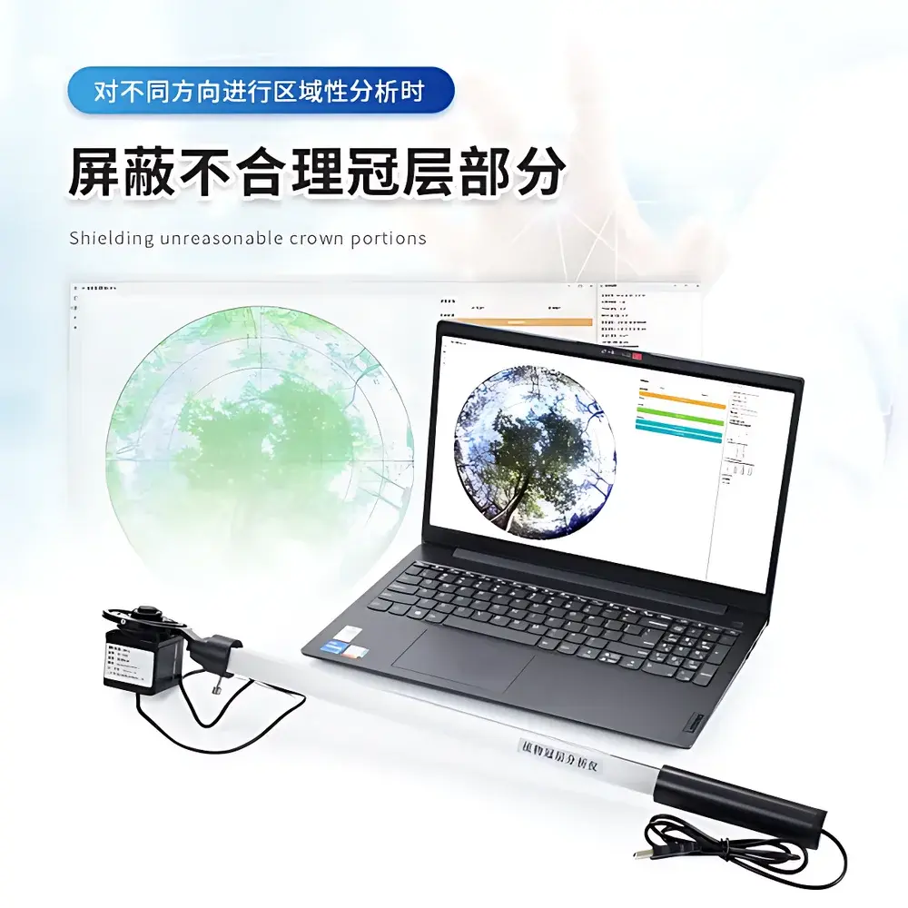
- Modular software interface supporting region-of-interest (ROI) definition across ten zenith-angle bands (0°–90°) and ten azimuth sectors (0°–360°)—enabling directional gap fraction mapping and anisotropic LAI estimation.
- Cloud-integrated workflow: encrypted USB transfer or direct Wi-Fi sync to COMECAUSE AgriCloud—a secure, ISO/IEC 27001-aligned platform compliant with GDPR and FDA 21 CFR Part 11 audit-trail requirements for regulated agricultural trials.
Sample Compatibility & Compliance
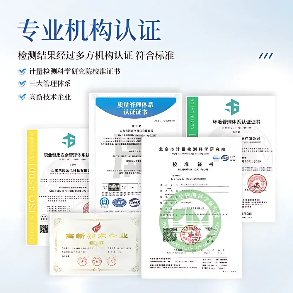
The IN*G30 supports measurement across herbaceous monocots and dicots, shrub layers, orchard canopies, agroforestry systems, and young forest stands. It is validated for use under natural daylight conditions with solar zenith angles ≥15° to minimize lens flare artifacts. While not intended for submerged or highly reflective surfaces (e.g., snow-covered canopies), it accommodates partial occlusion scenarios—including edge-row effects, gaps due to missing plants, or heterogeneous stand density—via configurable masking tools in the analysis suite. The instrument conforms to IEC 61000-6-3:2020 (EMC emission limits) and meets IP54 ingress protection standards for dust and water resistance during field deployment. All firmware and software modules undergo annual GLP-compliant verification per internal SOP-CA-2023, with calibration certificates traceable to NIM (National Institute of Metrology, China) reference standards.
Software & Data Management
The COMECAUSE Canopy Analysis System (v3.4+) runs on Windows 10/11 x64 platforms and provides full audit-log functionality including user login tracking, parameter change history, and export timestamps. Raw images are stored in lossless TIFF format; processed outputs include CSV tables (with SI units), PDF summary reports, and GeoJSON-compatible spatial metadata. Batch processing supports time-series LAI trend visualization, seasonal PAR transmittance curves, and azimuthal gap fraction heatmaps. Data exports comply with ISA-Tab metadata standards for interoperability with Crop Ontology and FAO’s WaPOR database schema. For GxP-regulated environments, optional 21 CFR Part 11 add-on enables electronic signatures, role-based access control, and immutable archive generation.
Applications
- Quantifying leaf area index (LAI), foliage inclination distribution, and clumping index (Ω₁, Ω₂) for crop growth modeling and yield forecasting.
- Evaluating canopy openness and diffuse/direct radiation partitioning to inform precision irrigation scheduling and nitrogen management strategies.
- Validating satellite-derived vegetation indices (e.g., NDVI, EVI) against ground-truthed structural parameters in remote sensing calibration campaigns.
- Assessing light interception efficiency in intercropping systems and vertical farming configurations.
- Monitoring canopy structural resilience under drought stress or pest infestation—tracking temporal changes in gap fraction distribution.
- Supporting carbon sequestration modeling in afforestation projects through LAI-driven net primary productivity (NPP) estimation.
FAQ
Does the IN*G30 require external power sources in the field?
No—the fisheye probe and measurement arm operate autonomously via internal lithium-polymer battery (rated for ≥8 hours continuous operation); the companion laptop is powered separately.
Can the system be used under overcast conditions?
Yes—diffuse sky illumination improves contrast for gap detection; however, low-light performance is optimized when ambient PAR exceeds 200 μmol·m⁻²·s⁻¹.
Is third-party software integration supported?
Yes—CSV and GeoJSON exports enable direct import into R (‘raster’, ‘lidR’), Python (‘scikit-image’, ‘xarray’), ArcGIS Pro, and QGIS workflows.
What is the calibration frequency recommendation?
Annual factory recalibration is advised; users may perform field validation using the included certified neutral-density reference card and standardized test canopy phantom.
How does the IN*G30 handle mixed-species canopies?
It does not classify species optically; rather, it quantifies aggregate structural properties—users must define species-specific ROI masks manually or via external GIS layer overlay.