Agrowing AMS-10 Multispectral Imaging System
| Brand | Agrowing |
|---|---|
| Origin | Israel |
| Model | AMS-10 |
| Spectral Channels | 10 (405, 430, 450, 550, 560, 570, 650, 685, 710, 850 nm) |
| Resolution per Channel | 12 MP |
| Sensor Architecture | Monolithic CMOS with integrated bandpass filter array |
| Optical Distortion | <1% |
| Pixel-Level Spatial Registration | Native, hardware-aligned across all bands |
| Video Capability | 4K-resolution multispectral video (10-channel synchronized) |
| Housing | All-metal and optical-glass construction |
| Dynamic Range | >65 dB (typical) |
| Compliance | CE, RoHS, ISO 9001-manufactured supply chain |
Overview
The Agrowing AMS-10 Multispectral Imaging System is a high-fidelity, monolithic-sensor-based imaging platform engineered for quantitative remote sensing and precision spectral analysis in field-deployable and automated environments. Unlike conventional multi-camera multispectral systems that rely on spatial registration algorithms to align disparate sensor outputs, the AMS-10 utilizes a single large-format CMOS detector with a precisely deposited, pixel-registered multiband interference filter array. This architecture ensures intrinsic spectral–spatial co-registration at the hardware level—eliminating parallax, inter-channel misalignment, and time-synchronization drift. The system captures ten discrete spectral bands—centered at 405, 430, 450, 550, 560, 570, 650, 685, 710, and 850 nm—with native 12-megapixel resolution per channel and full-frame synchronization. Its optical train features diffraction-limited apochromatic lenses constructed entirely from fused silica and low-thermal-expansion glass elements, achieving <1% geometric distortion across the full field of view—a critical specification for photogrammetric accuracy and pixel-level reflectance modeling.
Key Features
- Monolithic sensor design with factory-calibrated, pixel-aligned 10-band filter array—no software-based band registration required
- Native 12 MP resolution per spectral band; supports sub-millimeter ground sampling distance (GSD) at operational altitudes
- True hardware-synchronized acquisition across all 10 channels—enabling robust time-series analysis and dynamic scene capture
- 4K-resolution multispectral video recording capability with frame-accurate spectral tagging and embedded timestamping
- Industrial-grade aluminum alloy housing with IP65-rated environmental sealing; operating temperature range: −10 °C to +55 °C
- Optical path composed exclusively of certified optical glass and metal mounts—minimizing thermal drift and long-term spectral calibration drift
- Dynamic range exceeding 65 dB enables simultaneous capture of high-reflectance and low-reflectance targets without saturation or noise floor compromise
Sample Compatibility & Compliance
The AMS-10 is designed for non-contact, non-destructive surface spectral characterization of heterogeneous natural and engineered materials—including vegetation canopies, soil surfaces, water bodies, and agricultural infrastructure. It complies with ISO 17025 traceability frameworks for spectral radiometric calibration when used with NIST-traceable reference panels. While not an in-vitro analytical instrument, its data output conforms to ASTM E2791-21 (Standard Practice for Multispectral Imaging Data Acquisition and Processing) and supports FAO-recommended vegetation index computation protocols (e.g., NDVI, PRI, MCARI). The system’s spectral band positions are stable within ±1.2 nm over 12 months under standard lab conditions—validated via onboard LED-based wavelength reference monitoring. It meets CE marking requirements for electromagnetic compatibility (EN 61326-1) and environmental safety (RoHS Directive 2011/65/EU).
Software & Data Management
The AMS-10 ships with Agrowing’s SDK v4.2 and the SpectraView Pro desktop application, which provides raw DN-to-radiance conversion using factory-acquired flat-field and dark-current maps. All metadata—including GPS geotags (via optional GNSS module), IMU orientation, exposure parameters, and spectral band definitions—are embedded in GeoTIFF and HDF5 export formats. The SDK supports Python, MATLAB, and C++ integration for custom machine learning pipelines; includes native support for TensorFlow Lite model deployment on edge compute modules. Audit trails, user authentication, and parameter change logging meet GLP-aligned documentation standards. Exported datasets include embedded EXIF tags compliant with ISO 19115-2 for geospatial metadata interoperability.
Applications
- Precision agriculture: Early detection of biotic stressors (insect infestation, fungal pathogens) and abiotic stress (drought, nitrogen deficiency) via spectral anomaly mapping
- Forestry inventory and health assessment: Species classification, canopy density estimation, and chlorophyll-a/b ratio inference
- Environmental monitoring: Wetland delineation, algal bloom detection in inland waters, and post-fire vegetation recovery tracking
- Automated greenhouse and vertical farm control: Integration with PLCs and robotic platforms for real-time crop phenotyping and irrigation feedback loops
- Research-grade phenomics: High-throughput trait extraction for GWAS and QTL studies under controlled or field conditions
FAQ
Does the AMS-10 require radiometric calibration before each deployment?
No—factory-applied radiometric coefficients are stored in non-volatile memory and applied automatically during image processing. Field validation using calibrated reflectance panels is recommended every 90 days for mission-critical applications.
Can spectral band centers be modified after purchase?
Band center customization is available only at time of order, subject to minimum order quantity (MOQ) for custom filter arrays. Post-purchase modification is not supported due to monolithic sensor architecture.
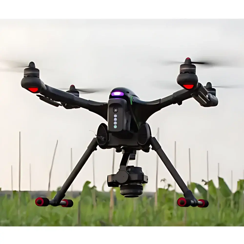
Is the system compatible with UAV integration?
Yes—the AMS-10 is qualified for integration with DJI Matrice 300 RTK, Autel EVO II Dual, and other industrial UAV platforms via CAN bus and PTP2 time sync. Vibration isolation mounting kits and gimbal interface adapters are available as accessories.
What file formats does the system natively export?
GeoTIFF (with embedded spectral metadata), HDF5 (for multi-dimensional spectral cube storage), and RAW binary (16-bit linear DN) with companion .json sidecar files describing sensor geometry and calibration parameters.
How is spectral crosstalk managed in the monolithic filter array?
Each band’s filter stack is designed with >OD5 rejection outside the target FWHM window; measured inter-band crosstalk is ≤0.8% across all 10 channels under laboratory illumination conditions.