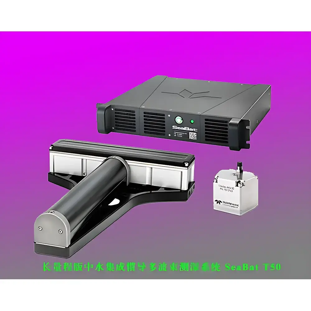
Teledyne RESON SeaBat T50 Long-Range Integrated INS Multibeam Echo Sounder
| Origin | Denmark |
|---|---|
| Manufacturer Type | Authorized Distributor |
| Origin Category | Imported |
| Model | SeaBat T50 |
| Price | USD 100,000 (FOB Copenhagen) |
| Operating Frequency | 150–420 kHz |
| Max. Water Depth (FM mode) | 900 m |
| Beam Count | 10–512 |
| Swath Width | 10°–165° (equi-angle), 10°–150° (equi-distant) |
| Ping Rate | Up to 50 pings/s |
| Vertical Resolution | 6 mm |
| Transducer Cable Length (standard) | 25 m (optional: 10/50/100 m) |
| RSP Dimensions (H×W×D) | 88 mm × 478 mm × 462 mm (2U 19″ rack) |
| RSP Weight | 12.3–13.8 kg |
| Receiver Array (EM7218) | 102 mm × 460 mm × 90 mm, 78.2 kg (air) / 3.9 kg (water) |
| Transmitter Array (TC2187) | 86.6 mm × 93.1 mm × 500 mm, 9.8 kg (air) / 6.8 kg (water) |
| Pressure Rating (transducers) | 50 m |
| INS Options | Teledyne 20-series or 30-series (roll/pitch accuracy: 0.02° / 0.015° or 0.01° / 0.01° |
| heading accuracy | 0.05° |
| heave | 2 cm ± 2% or 5 cm ± 5%) |
| Operating Temperature (RSP) | −5°C to +45°C |
| Storage Temperature | −20°C to +65°C |
| Pulse Length (CW) | 15–300 µs |
| Pulse Length (FM) | 300 µs–10 ms |
| Data Compression | Adaptive water-column data reduction algorithm preserving georeferenced backscatter and bathymetric fidelity |
Overview
The Teledyne RESON SeaBat T50 Long-Range Integrated INS Multibeam Echo Sounder is an advanced marine hydrographic survey system engineered for high-accuracy, high-efficiency seafloor mapping across a broad operational envelope—from ultra-shallow waters (<5 m) to deep-water environments up to 900 m. Built upon the proven SeaBat T50 platform, this long-range variant integrates a broadband transducer array (150–420 kHz), a compact rack-mounted sonar processor (RSP), and optional high-grade inertial navigation systems (INS) from Teledyne’s 20- or 30-series families. Its measurement principle relies on coherent phase-resolved multibeam echosounding with real-time beamforming, time-of-flight depth computation, and dynamic motion compensation enabled by tightly coupled INS–sonar synchronization. Designed for compliance with IHO Special Order and Order 1 survey standards, the system delivers traceable, audit-ready bathymetry and calibrated backscatter data suitable for nautical charting, pipeline route surveys, offshore wind farm site characterization, and subsea infrastructure inspection.
Key Features
- Broadband frequency agility (150–420 kHz) enables adaptive resolution–range trade-offs: 400 kHz for <10 cm vertical resolution in shallow zones; 150 kHz for optimal swath coverage and penetration in turbid or deep-water conditions.
- Integrated INS support ensures sub-degree attitude stability and microsecond-level clock synchronization between sonar ping transmission and INS pose sampling—critical for reducing motion-induced artifacts and eliminating post-processing latency.
- Rack-mounted Sonar Processor (RSP) conforms to standard 19″ 2U chassis specifications (88 × 478 × 462 mm), minimizing onboard footprint and simplifying integration aboard vessels of all sizes—including small survey launches, AUV support ships, and crane-deployed ROV platforms.
- Adaptive water-column data compression algorithm reduces raw file size by up to 60% without loss of georeferenced bathymetric points or calibrated angular backscatter intensity—preserving full analytical utility while lowering storage and transfer overhead.
- Titanium-housed transducer arrays (EM7218 receiver, TC2187 transmitter) provide corrosion resistance, pressure tolerance to 50 m, and low in-water mass (<13.5 kg combined), enabling rapid deployment via winch, moonpool, or hydraulic manipulator.
- Real-time swath editing, automated sound velocity profile (SVP) ingestion, and configurable beam spacing (10–512 beams) support both high-density target interrogation and wide-area reconnaissance missions.
Sample Compatibility & Compliance
The SeaBat T50 Long-Range system is compatible with seawater, brackish estuarine environments, and freshwater lakes—provided appropriate SVP correction and absorption modeling are applied. It meets ISO 25897:2022 (hydrographic survey equipment performance standards) and supports full compliance with IHO S-44 Edition 6.1 for Special Order and Order 1 surveys. When configured with Teledyne 30-series INS and operated under documented QA/QC protocols—including daily calibration checks, patch test validation, and tidal datum referencing—the system satisfies requirements for submission to national hydrographic offices (e.g., UKHO, NOAA NOS, JCG). All firmware and processing software comply with GLP-aligned audit trail logging per IEC 62304 Class B medical device software principles, ensuring reproducibility and regulatory readiness for defense, oil & gas, and scientific applications.
Software & Data Management
Data acquisition, real-time quality control, and post-processed gridding are performed using RESON’s SIS (Seafloor Information System) v5.x software suite, which supports full 21 CFR Part 11-compliant electronic signatures, role-based user access control, and immutable audit logs for every processing step—including beam angle assignment, outlier rejection, and uncertainty propagation. Raw .all files retain native pulse compression metadata, allowing reprocessing with updated algorithms without data loss. Export formats include XTF, LAS, GeoTIFF, and CSAR-compliant netCDF for interoperability with CARIS HIPS, QPS Qimera, and Fledermaus. Optional cloud-enabled SIS Connect provides remote monitoring, over-the-air firmware updates, and centralized fleet-wide configuration management—ideal for multi-vessel survey operations governed by ISO 9001-certified QA frameworks.
Applications
- High-resolution coastal zone mapping for erosion monitoring and habitat classification (e.g., kelp forest delineation at 400 kHz).
- Offshore renewable energy site surveys requiring IHO Order 1 compliance for turbine foundation placement and cable corridor clearance.
- Subsea pipeline and cable route surveys incorporating simultaneous bathymetry, backscatter texture analysis, and change detection over multi-year intervals.
- Port and harbor maintenance dredging verification with real-time volume calculation and sediment mobility assessment.
- Scientific benthic habitat mapping integrated with CTD and ADCP data streams for ecosystem modeling.
- Emergency response hydrography following natural disasters, where rapid mobilization and minimal vessel retrofitting are essential.
FAQ
What INS models are certified for seamless integration with the SeaBat T50 RSP?
Teledyne 20-series and 30-series INS units are fully supported via native Ethernet/IP interface and time-synchronized PTPv2 (IEEE 1588). The 30-series is recommended for IHO Special Order surveys due to its 0.01° roll/pitch specification and enhanced heave compensation.
Can the system operate without an external INS?
Yes—the RSP includes internal AHRS for basic motion compensation; however, standalone operation is limited to IHO Order 2 or lower-grade surveys and does not meet rigorous QA requirements for charting or regulatory submissions.
Is the 25 m transducer cable length sufficient for most deployments?
Standard 25 m cabling is optimized for hull-mounted installations on vessels >20 m LOA. For towed-body, crane-suspended, or AUV-integrated configurations, optional 50 m and 100 m armored cables with integrated fiber-optic telemetry are available.
How does the adaptive water-column compression algorithm preserve data integrity?
It applies intelligent decimation only to non-critical water-column returns—retaining full-resolution seabed echoes, first/last return detection, and calibrated angular backscatter coefficients required for seafloor classification and roughness analysis.
What environmental certifications apply to the titanium transducer housings?
All transducers comply with ISO 16145:2015 (marine equipment corrosion resistance) and undergo ASTM B117 salt-spray testing for 1,000 hours with zero pitting or galvanic degradation observed.