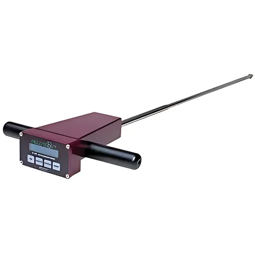
Spectrum SC-900 Field Soil Compaction Meter
| Brand | Spectrum |
|---|---|
| Origin | USA |
| Model | 6110FS |
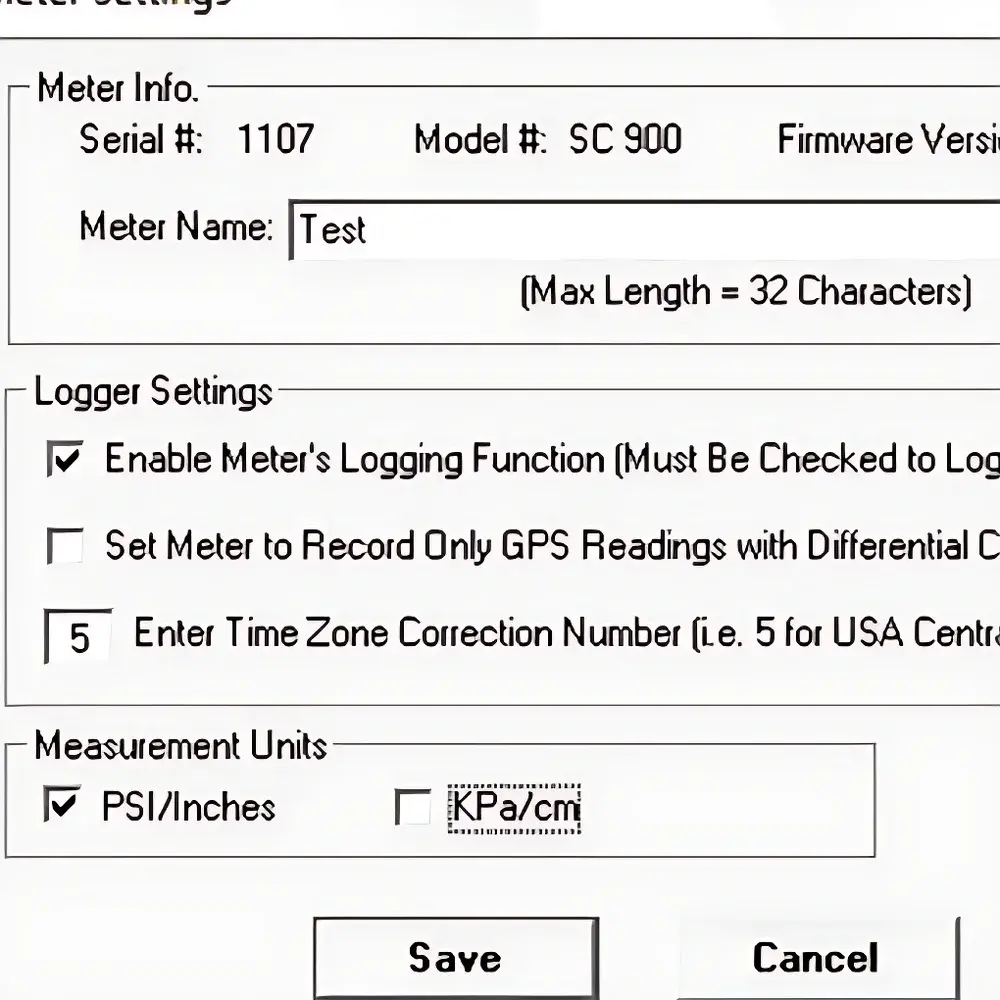
| Measurement Unit | psi or kPa |
| Data Resolution | 1-inch depth intervals |
| Data Storage | Internal SD card |
| Probe Tip | ASAE-standard cone (2.5° apex angle, 0.5-in base diameter) |
| Interface | USB and RS-232 |
| GPS Compatibility | Optional 2950CV5 GPS/DGPS cable support |
| Software | SC-900 Data Manager v3.x (Windows-based) |
Overview
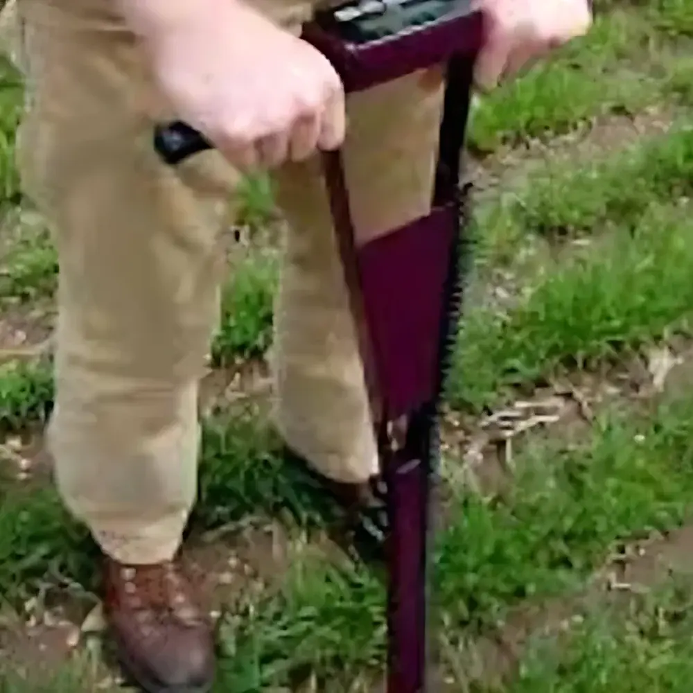
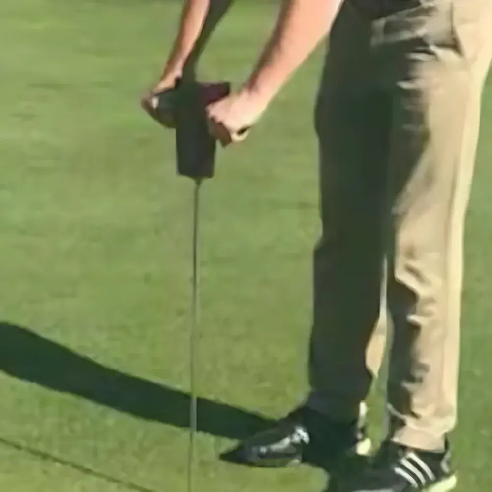
The Spectrum SC-900 Field Soil Compaction Meter is a portable, field-deployable penetrometer engineered for quantitative assessment of soil mechanical resistance—commonly referred to as soil compaction. It operates on the principle of cone penetration testing (CPT), wherein a standardized conical probe is driven vertically into the soil at a controlled rate, and the force required per unit surface area (expressed in psi or kPa) is measured continuously with depth. This method aligns with ASAE S313.3 (American Society of Agricultural and Biological Engineers) standards for soil cone penetrometers, ensuring measurement consistency across agricultural research, precision farming, and environmental monitoring applications. Unlike qualitative manual assessments, the SC-900 delivers objective, depth-resolved profiles that directly correlate with root growth impedance, water infiltration capacity, and gas diffusion limitations—key biophysical constraints affecting crop productivity and soil health.
Key Features
- ASAE-compliant 2.5° conical tip (0.5-inch base diameter) for repeatable, standardized penetration geometry
- Real-time force measurement with automatic logging at 1-inch depth increments (0–48 inches typical range)
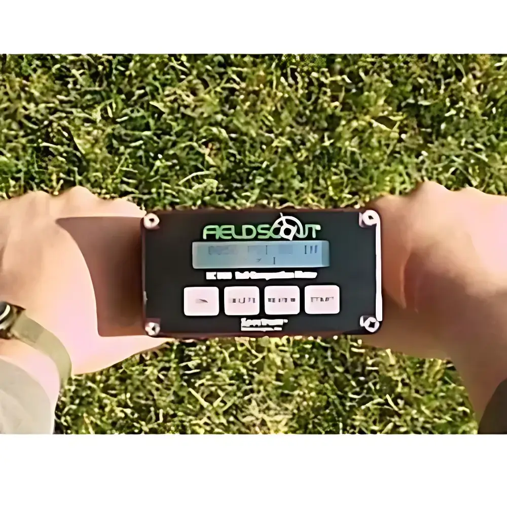
- Integrated data logger with removable SD card storage—no manual recording required
- Dual-unit display and export: selectable psi or kPa output with factory-calibrated transducer
- USB and RS-232 connectivity for direct download and configuration via Windows-based SC-900 Data Manager software
- Optional integration with 2950CV5 GPS/DGPS module for georeferenced compaction mapping (WGS84 datum, sub-meter accuracy)
- Rugged, weather-resistant housing rated IP65 for extended field use under variable ambient conditions
- Battery-powered operation (rechargeable Li-ion, >12 hours continuous use) with low-power sleep mode
Sample Compatibility & Compliance
The SC-900 is validated for use in mineral soils ranging from sandy loam to heavy clay, including tilled, no-till, and pasture systems. It is not intended for saturated, frozen, or highly stony substrates (>15% gravel fraction), where probe deflection or sensor overload may compromise data integrity. The instrument conforms to ASAE S313.3 for mechanical design and reporting format, and its data structure supports compliance with USDA-NRCS soil survey protocols and ISO 23470:2022 (Soil quality — Determination of soil resistance to penetration). When paired with GPS, datasets meet FAO’s Digital Soil Mapping metadata requirements for spatial reproducibility and traceability. All firmware and software adhere to GLP-aligned audit trail principles, including timestamped operator ID, calibration log history, and immutable raw file generation.
Software & Data Management
The SC-900 Data Manager v3.x provides full lifecycle data handling: import of binary .sc9 files, visualization of depth-force curves with overlay comparison tools, export to CSV/Excel for GIS integration (e.g., ArcGIS, QGIS), and customizable report generation compliant with internal QA/QC documentation standards. The software supports user-defined site metadata tagging (field ID, date, operator, soil type), automatic outlier detection based on ASAE-recommended force thresholds, and batch processing of multi-location surveys. Calibration certificates and sensor drift logs are embedded in each project archive. While not FDA 21 CFR Part 11 certified out-of-the-box, the software architecture permits configuration for electronic signature and audit trail extension in regulated agronomic trials requiring GxP alignment.
Applications
- Identifying compacted layers (plow pans, traffic pans) to guide subsoiling or deep tillage decisions
- Evaluating long-term impacts of machinery traffic, grazing intensity, or irrigation practices on soil structure
- Validating efficacy of cover cropping, organic amendments, or reduced-input management strategies
- Supporting site-specific nutrient management by correlating compaction zones with variable-rate fertilizer prescriptions
- Baseline soil health assessment for conservation program enrollment (e.g., USDA EQIP, CSP)
- Academic research in soil physics, agroecology, and climate-smart agriculture field trials
FAQ
What depth resolution does the SC-900 provide?
The device records force values at precisely 1-inch (2.54 cm) depth intervals from surface to maximum penetration.
Can the SC-900 be used in wet or frozen soils?
No—it is not designed for saturated, frozen, or high-gravel-content soils, as these conditions risk mechanical damage and non-representative readings.
Is calibration traceable to NIST standards?
Yes; each unit ships with a factory calibration certificate referencing NIST-traceable deadweight standards, and field recalibration kits are available through Spectrum Technical Support.
Does the system support real-time GPS mapping during data collection?
Only when connected to the optional 2950CV5 GPS/DGPS cable; standalone operation provides depth-force data without geolocation.
How is data security and version control managed in multi-user environments?
SC-900 Data Manager supports project-level password protection, operator login tracking, and SHA-256 checksum verification for exported datasets to ensure data integrity and chain-of-custody compliance.


