Acclima RD1200 Portable Soil Water, Salinity & Temperature Profiler
| Brand | Acclima, Inc. |
|---|---|
| Origin | USA |
| Model | RD1200 |
| Instrument Type | Soil Moisture / Water Potential Analyzer |
| Measurement Principles | TDR (Time Domain Reflectometry) with Integrated Dielectric, Thermal, and Conductivity Sensing |
| Soil Volumetric Water Content Range | 0–100% VWC |
| Resolution | 0.1% VWC |
| Accuracy | ±1% VWC (coarse-medium soils), ±2.5% VWC (fine-textured soils) |
| Soil Temperature Range | −40 to +60 °C |
| Resolution | 0.1 °C |
| Accuracy | ±0.25 °C |
| Dielectric Constant Range | 1–80 |
| Resolution | 0.1 |
| Accuracy | ±1% (coarse-medium), ±2% (fine-textured) |
| Bulk Electrical Conductivity (ECb) | 0–5000 μS/cm |
| Pore Water Electrical Conductivity (ECw) | 0–55,000 μS/cm |
| EC Resolution | 1 μS/cm |
| EC Accuracy | ±25 μS/cm (0–1000 μS/cm), ±2.5% (1000–2000 μS/cm), ±5% (2000–5000 μS/cm) |
| GPS Module | Integrated SDI-12-compatible GNSS receiver (latitude, longitude, altitude, UTC time sync) |
| Data Storage | Internal non-volatile memory + USB 2.0 interface supporting up to 25 GB flash drives |
| Power Supply | 5 VDC @ 1 A (AC adapter: 100–240 VAC input) |
| Dimensions | 150 × 80 × 25 mm |
| Weight | 0.3 kg |
Overview
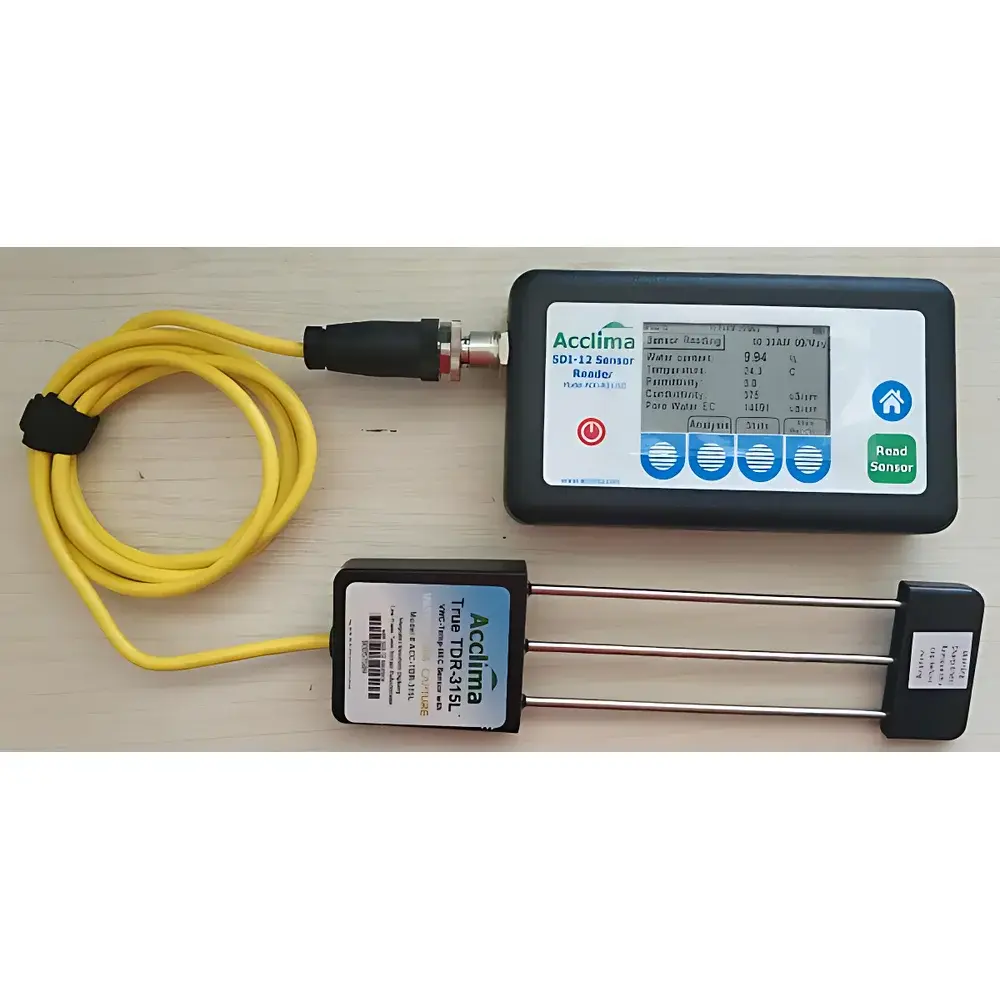
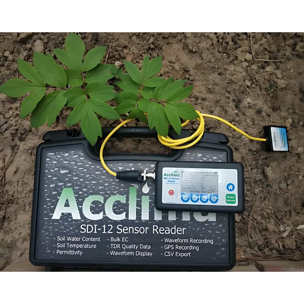
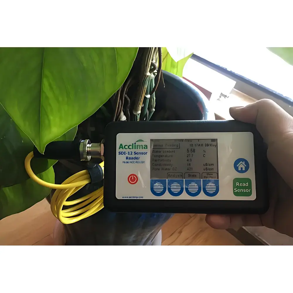
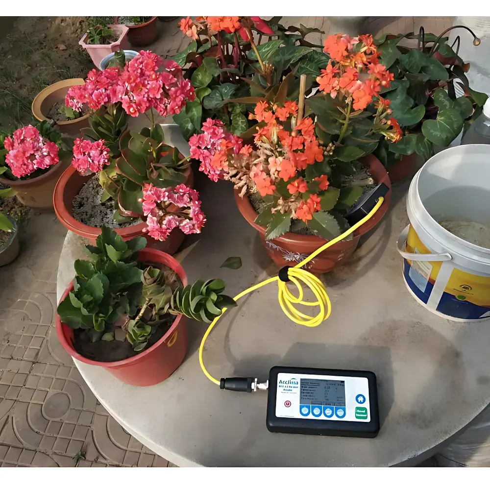
The Acclima RD1200 Portable Soil Water, Salinity & Temperature Profiler is a field-deployable, multi-parameter soil characterization instrument engineered for high-fidelity in situ measurement of volumetric water content (VWC), soil temperature, dielectric permittivity, bulk electrical conductivity (ECb), and pore water electrical conductivity (ECw). Based on time-domain reflectometry (TDR) technology, the RD1200 utilizes the TDR315L sensor probe—a calibrated, three-rod waveguide design—to generate precise electromagnetic pulse reflections whose travel time and attenuation are directly correlated to soil dielectric properties and ionic mobility. Unlike capacitance-based systems, TDR is inherently insensitive to soil texture, salinity-induced polarization effects, or contact resistance variations—making it suitable for long-term monitoring across heterogeneous geologic settings. The integrated GNSS module enables spatially referenced data acquisition compliant with ISO 11272:2020 (soil physical property sampling protocols) and ASTM D5792 (standard practice for soil moisture monitoring). Designed for operation in extreme ambient conditions (−40 to +60 °C), the RD1200 meets IEC 60529 IP67 environmental ingress protection requirements for dust and temporary immersion.
Key Features
- TDR315L sensor probe with factory calibration traceable to NIST-standard reference soils and verified against gravimetric validation protocols
- Simultaneous acquisition of five core soil parameters per measurement cycle: VWC, temperature, εr, ECb, and derived ECw
- On-device statistical computation: real-time display of min/max/mean/last values per parameter set
- Embedded SDI-12 communication interface compatible with third-party dataloggers (Campbell Scientific CR1000X, Onset HOBO RX3000)
- Internal non-volatile memory (≥1 million records) plus dual-mode export via USB 2.0 flash drive (up to 25 GB)
- Auto-synchronized UTC timestamping and georeferenced metadata (WGS84 coordinates, ellipsoidal height, PDOP)
- Energy-efficient architecture: >12 hours continuous operation on single 18650 Li-ion charge; AC adapter supports concurrent charging and measurement
Sample Compatibility & Compliance
The RD1200 is validated for use across mineral soils ranging from coarse sand (USDA textural class: 40% clay), including volcanic ash, loess, alluvial sediments, and anthropogenically amended substrates. Its TDR-based methodology eliminates calibration drift associated with electrode fouling or electrolyte saturation—critical for extended deployments in saline-alkali or organic-rich environments. The system complies with GLP-aligned data integrity requirements: all measurements include embedded audit trails (timestamp, GPS fix quality, battery voltage, sensor impedance diagnostics). Raw TDR waveform data is retained in binary format for post-acquisition reprocessing using Acclima’s open-format .tdr files—supporting traceable recalibration under ISO/IEC 17025-accredited laboratory workflows. Device firmware adheres to FDA 21 CFR Part 11 principles for electronic records where used in regulatory environmental monitoring programs (e.g., US EPA Region 10 groundwater compliance).
Software & Data Management
Data export follows FAIR (Findable, Accessible, Interoperable, Reusable) principles: CSV and NetCDF4 outputs include CF-1.8-compliant metadata headers (units, coordinate reference system, sensor model, uncertainty annotations). Acclima’s free RD1200 Desktop Utility (Windows/macOS) enables batch processing of temporal profiles, spatial interpolation via inverse distance weighting (IDW), and ECw derivation using the Rhoades–van Genuchten–Hillel mixing model (n and m parameters pre-loaded for 12 USDA soil classes). All firmware updates are cryptographically signed and delivered via HTTPS—ensuring integrity verification prior to installation. Exported datasets embed SHA-256 hashes for long-term archival verification per ISO 16363:2012 (Trusted Digital Repository standards).
Applications
- Irrigation scheduling and precision agriculture decision support (ASABE EP418.4-compliant VWC thresholds)
- Soil salinity mapping for land degradation assessment (UNCCD indicator LD.2.1)
- Critical zone observatory (CZO) network instrumentation requiring sub-daily temporal resolution
- Geotechnical stability monitoring in embankments and landfill caps (ASTM D2487 classification correlation)
- Ecological restoration site evaluation (soil moisture stress indices for native species establishment)
- Calibration/validation of satellite-based soil moisture products (SMAP L2_SM_P, Sentinel-1 SAR backscatter inversion)
FAQ
Does the RD1200 require soil-specific calibration for accurate ECw calculation?
No. ECw is computed in real time using the built-in Rhoades–van Genuchten–Hillel model with default n and m coefficients optimized for 12 USDA-defined soil textural classes. Users may load custom coefficients if high-precision lab-derived parameters are available.
Can the TDR315L probe be installed permanently for long-term monitoring?
Yes. The probe features stainless-steel housing rated to ASTM A240 Type 316 and is certified for burial at depths up to 2 m in saturated, anaerobic, or sulfide-rich strata without signal degradation over 5+ years.
Is raw TDR waveform data accessible for advanced spectral analysis?
Yes. The .tdr binary format includes full 100-ps-resolution reflection traces, enabling user-defined time-window integration, dispersion correction, and complex permittivity modeling in MATLAB or Python.
How does the RD1200 handle frozen soil conditions?
The system detects ice phase transitions via abrupt dielectric drop (<2.5) and automatically flags VWC readings as invalid below −2 °C unless configured for cryosol research mode (requires firmware v3.2+).
What GPS accuracy specifications apply under canopy or urban canyon conditions?
With SBAS (WAAS/EGNOS) enabled, horizontal accuracy is ≤3 m CEP (95%) under open sky; multipath mitigation algorithms maintain ≤10 m CEP under partial canopy (e.g., orchard understory) per NMEA 0183 GGA message reporting.
Related Products


