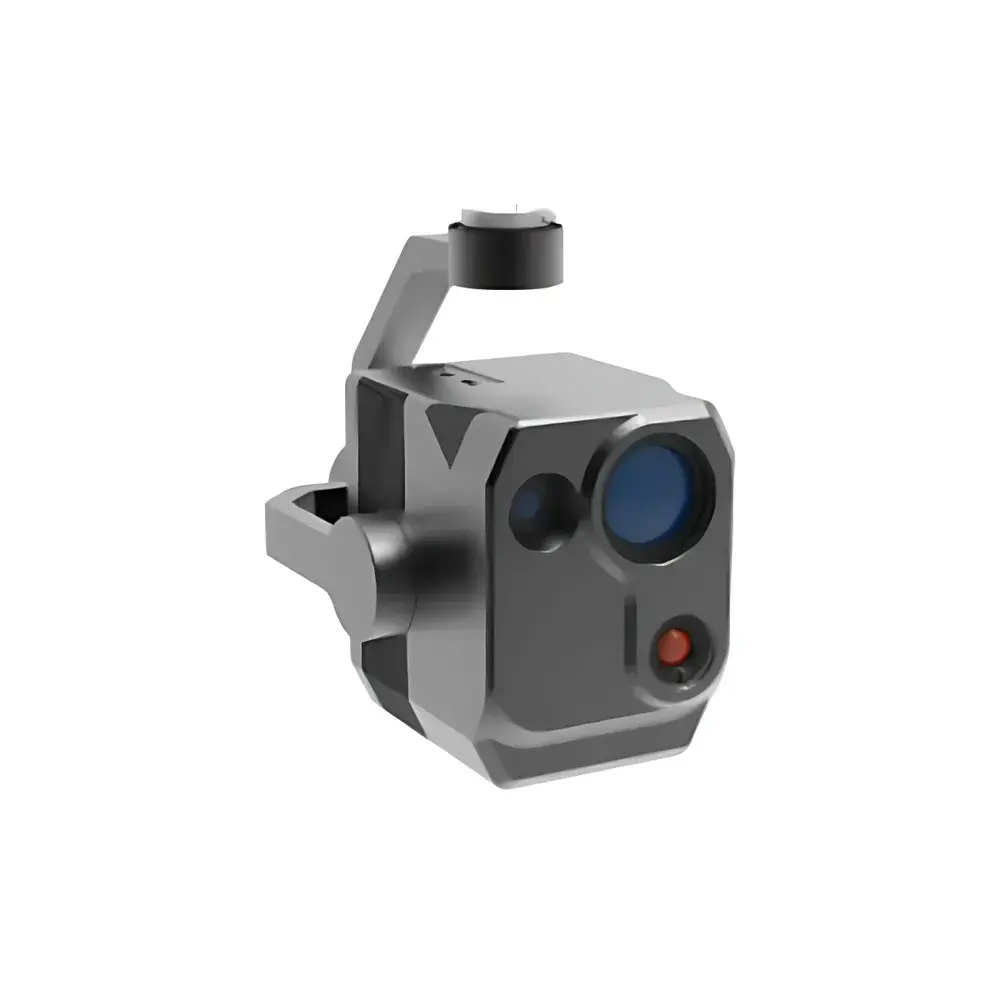
AERO AFX1000-IR Integrated Visible-NIR/SWIR and Thermal Hyperspectral Imaging System
| Brand | AERO |
|---|---|
| Origin | Beijing, China |
| Manufacturer Type | Authorized Distributor |
| Origin Category | Domestic (China) |
| Model | AFX1000-IR |
| Operating Principle | Push-broom |
| Imaging Method | Dispersive |
| Deployment Mode | Ground-based & UAV-mounted |
| Spectral Range | 400–1000 nm (HSI) + 8–14 µm (LWIR) |
| Thermal Imaging Resolution | 640 × 512 pixels (full-frame radiometric temperature mapping) |
| Frame Acquisition Rate | ≥300 Hz (full spectral cube acquisition) |
| Total Field of View (TFOV) | 30.5° |
| Instantaneous Field of View (IFOV) | 2.7 mrad |
| RGB Camera | 26 MP synchronized capture |
| System Mass | <2.5 kg |
Overview
The AERO AFX1000-IR is an integrated push-broom hyperspectral imaging system engineered for dual-domain remote sensing—simultaneously acquiring high-fidelity visible–near-infrared–shortwave infrared (VNIR-SWIR: 400–1000 nm) spectral data and calibrated long-wave infrared (LWIR: 8–14 µm) thermal radiometry. Unlike conventional snapshot or tunable-filter systems, the AFX1000-IR employs a dispersive optical architecture with line-scan detection, ensuring high spectral fidelity and spatial consistency across the full field of view. Its core design targets operational flexibility in both ground-based survey configurations and UAV-integrated payloads, where weight, power, and real-time data integrity are critical constraints. The instrument embeds a high-precision inertial measurement unit (IMU), on-board control firmware, and solid-state storage—enabling georeferenced, time-synchronized acquisition without external computing hardware. This architecture supports traceable radiometric calibration per pixel and conforms to foundational requirements for quantitative remote sensing applications under ISO 17025-aligned laboratory practices.
Key Features
- Co-registered dual-modality imaging: Simultaneous VNIR-SWIR hyperspectral cubes (400–1000 nm) and LWIR thermal radiometric frames (8–14 µm) at native spatial alignment.
- Push-broom scanning mechanism with motorized slit aperture, enabling user-selectable spectral band subsets for targeted data acquisition and reduced storage overhead.
- 640 × 512-pixel uncooled microbolometer array for full-frame radiometric temperature mapping, calibrated to NIST-traceable blackbody references across the 8–14 µm atmospheric window.
- Integrated 26-megapixel global-shutter RGB camera with hardware-triggered synchronization to hyperspectral and thermal frame timestamps.
- Compact, ruggedized enclosure with thermal management optimized for sustained operation in ambient temperatures ranging from −10 °C to +50 °C.
- Onboard IMU (gyro + accelerometer) with ≤0.05° attitude resolution, supporting post-processing geometric correction and orthorectification via bundle adjustment workflows.
Sample Compatibility & Compliance
The AFX1000-IR is designed for non-contact, standoff characterization of heterogeneous surfaces—including vegetation canopies, mineral outcrops, industrial infrastructure, and urban materials—without sample preparation. Its spectral coverage enables identification of key absorption features: chlorophyll-a/b (650–680 nm), water vapor bands (940 nm), cellulose (1650 nm), and emissivity-driven thermal contrast in silicates and oxides (8–14 µm). The system complies with electromagnetic compatibility standards IEC 61000-6-3 (emissions) and IEC 61000-6-2 (immunity), and its radiometric calibration protocol aligns with ASTM E1933-19 (Standard Test Methods for Measuring and Compensating for Emissivity Using Infrared Imaging Systems). Data provenance is maintained through embedded timestamping, IMU metadata logging, and optional GPS PPS synchronization—supporting GLP-compliant field documentation.
Software & Data Management
The AFX1000-IR ships with AERO Hyperspectral Studio—a cross-platform application supporting real-time preview, radiometric correction (dark current, non-uniformity, flat-field), spectral library matching (USGS, ECOSTRESS, and custom endmembers), and ENVI-compatible BIL/BIP export. All raw data are stored in HDF5 format with embedded metadata per frame (wavelength vectors, integration time, IMU quaternions, GPS coordinates). Audit trails record all processing steps, satisfying FDA 21 CFR Part 11 requirements for electronic records when deployed in regulated environmental monitoring or precision agriculture validation studies. Optional Python SDK provides API-level access for integration into automated classification pipelines (e.g., SVM, Random Forest, or CNN-based segmentation).
Applications
- Agricultural phenotyping: Quantitative stress assessment via red-edge NDVI, canopy water content (970 nm), and transpiration-derived surface temperature anomalies.
- Mineralogical mapping: Discrimination of clay species (kaolinite, smectite), carbonates, and sulfides using combined reflectance/emissivity spectral signatures.
- Industrial thermal inspection: Detection of insulation degradation, electrical hotspot localization, and composite delamination via sub-pixel thermal gradient analysis.
- Environmental compliance monitoring: Identification of hydrocarbon spills (SWIR C–H absorption), landfill gas plume tracking (LWIR CO₂/CH₄ windows), and wetland boundary delineation.
- Defense and security: Camouflage detection through spectral–thermal discordance and concealed object screening under low-visibility conditions.
FAQ
Does the AFX1000-IR support real-time onboard processing?
No—data are acquired in raw sensor format and require post-processing; however, real-time preview and basic radiometric correction are supported via the embedded GPU-accelerated firmware.
What calibration standards are used for LWIR radiometry?
Factory calibration uses two-point blackbody sources (−10 °C and 60 °C) traceable to NIST SRM 1900 series; field recalibration is supported via portable blackbodies compliant with ASTM E1543.
Is the system compatible with DJI Matrice 300 RTK and Autel EVO Max 4T platforms?
Yes—mechanical, electrical, and communication interfaces meet UAV payload integration guidelines per DJI Payload SDK v4.2 and Autel Payload Integration Specification Rev. 2.1.
Can spectral data be exported in ENVI .hdr/.dat format?
Yes—HDF5 files include embedded wavelength arrays and can be directly imported into ENVI, QGIS (via GDAL), or Python (hyperspy, scikit-image) without conversion loss.
What is the minimum integration time for full-spectrum acquisition at 300 Hz?
At maximum frame rate, integration time is fixed at 1.2 ms per line; longer exposures reduce effective frame rate but improve SNR in low-light conditions.
Related Products
")