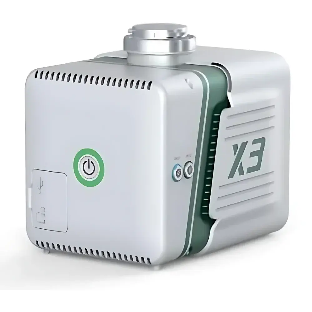
AERO LiDAR X3-H Airborne Laser Scanning System
| Brand | AERO |
|---|---|
| Model | LiDAR X3-H |
| Application | Airborne Topographic Mapping, Forestry Inventory, Power Line Inspection |
| Laser Wavelength | 905 nm |
| Laser Safety Class | IEC 60825-1 Class 1 |
| Maximum Range | 190 m @ 10% reflectivity, 450 m @ 80% reflectivity |
| Integrated Camera Resolution | 26 MP |
| Mounting Compatibility | DJI Matrice 350 RTK, Matrice 600 Pro |
| Operational Mode | GNSS-INS Direct Georeferencing (Base Station–Free) |
| Weight | < 2.8 kg (system, typical configuration) |
| Dimensions | ≤ 220 × 180 × 140 mm |
| Data Output Format | LAS/LAZ, E57, PLY, GeoTIFF, POS files |
Overview
The AERO LiDAR X3-H is a compact, high-performance airborne laser scanning system engineered for direct georeferenced point cloud acquisition from small unmanned aerial vehicles (UAVs). Built upon a tightly integrated GNSS-INS (Global Navigation Satellite System–Inertial Navigation System) architecture, the X3-H operates in base station–free mode—leveraging real-time kinematic (RTK) and post-processed kinematic (PPK) GNSS solutions to deliver centimeter-level absolute positioning accuracy without requiring ground-based reference stations. Its measurement principle relies on time-of-flight (ToF) pulsed laser ranging at 905 nm, compliant with IEC 60825-1 Class 1 safety standards for unenclosed operation. The system combines a high-repetition-rate scanning LiDAR sensor with a synchronized 26-megapixel RGB imaging module, enabling simultaneous capture of geometrically accurate 3D point clouds and radiometrically calibrated imagery. Designed specifically for integration with DJI Matrice 350 RTK and Matrice 600 Pro platforms, the X3-H supports rapid mechanical mounting, hot-swap battery operation, and seamless firmware synchronization with UAV flight control systems.
Key Features
- Base station–free direct georeferencing: Achieves ≤ 3 cm horizontal and ≤ 5 cm vertical absolute accuracy (RMS) under open-sky GNSS conditions using dual-antenna GNSS-INS fusion.
- Compact and lightweight design: Total system mass < 2.8 kg (including IMU, LiDAR head, camera, and housing), optimized for payload-constrained UAVs.
- Dual-antenna GNSS configuration: Reduces in-air dynamic alignment time to under 60 seconds, minimizing pre-flight setup and improving mission repeatability.
- Automated data processing pipeline: Embedded software performs integrated GNSS/INS trajectory optimization, point cloud georeferencing, intensity calibration, and orthoimage generation in a single workflow.
- Robust environmental rating: IP54 ingress protection ensures operational reliability in light rain, dust, and temperature gradients typical of field deployment in forestry or utility corridor environments.
- Multi-return capability: Records up to three discrete echoes per pulse, supporting vegetation penetration analysis and understory modeling in forested terrain.
Sample Compatibility & Compliance
The LiDAR X3-H is validated for use across heterogeneous terrain types—including dense canopy, bare-earth topography, linear infrastructure (e.g., transmission corridors), and urban fringe zones. Its 905 nm wavelength provides optimal balance between atmospheric transmission and detector sensitivity for sub-decimeter point spacing at operational altitudes of 50–150 m AGL. The system complies with international regulatory frameworks including IEC 60825-1:2014 (laser safety), RTCA DO-160G Section 21 (environmental testing for airborne equipment), and ISO 19115-1:2014 (geospatial metadata). All delivered point cloud datasets conform to ASPRS LAS 1.4 specification and support mandatory metadata fields required for national mapping programs (e.g., USGS 3DEP, China’s National Basic Geographic Information Center standards). Audit-ready processing logs and trajectory validation reports are generated in accordance with GLP-aligned workflows for QA/QC traceability.
Software & Data Management
The AERO LiDAR X3-H ships with AERO-Process Suite v3.x—a desktop application supporting Windows 10/11 (64-bit) and compatible with NVIDIA CUDA-enabled GPUs. The suite implements rigorous INS/GNSS observables reconciliation using extended Kalman filtering, followed by rigorous boresight calibration estimation via iterative least-squares adjustment. Output formats include industry-standard LAS/LAZ (with classification codes 1–18), E57 for interoperability with Autodesk ReCap and Bentley ContextCapture, and GeoTIFF orthomosaics with embedded RPC models. All processing steps maintain full audit trails: timestamps, sensor status flags, covariance matrices, and raw IMU/GNSS binary logs are archived alongside final products. The software supports FDA 21 CFR Part 11–compliant user authentication, electronic signatures, and immutable processing history—enabling compliance with regulated surveying workflows in energy infrastructure inspection and government-contracted geospatial deliverables.
Applications
- Forestry resource assessment: Individual tree detection (ITD), canopy height model (CHM) derivation, biomass estimation, and change detection across multi-temporal acquisitions.
- Topographic mapping for engineering surveys: Generation of 10–20 cm GSD digital terrain models (DTMs) compliant with national mapping specifications (e.g., China GB/T 18314–2009, USGS NGP Level 2).
- Power transmission line corridor monitoring: Conductor sag analysis, vegetation encroachment detection (using classified ground/non-ground returns), and clearance verification against ANSI C2–2020 clearance thresholds.
- Mining and quarry volume calculation: Stockpile volumetric reporting with ±1.5% relative uncertainty (validated per ASTM D6625–21 Annex A1).
- Emergency response and disaster assessment: Rapid post-event terrain reconstruction following landslides or flood events, supporting FEMA P-361 and ISO 22320 incident command integration.
FAQ
Does the LiDAR X3-H require ground control points (GCPs) for high-accuracy mapping?
No—when operated in PPK mode with sufficient satellite visibility and proper lever-arm calibration, the system achieves ≤ 5 cm vertical RMSE without GCPs. GCPs are recommended only for validation or in GNSS-challenged environments (e.g., deep gorges or urban canyons).
What coordinate reference systems (CRS) does the system support out-of-the-box?
WGS84 (EPSG:4326), CGCS2000 (EPSG:4490), and custom local projected CRS via user-defined PROJ string import.
Can the X3-H be integrated with third-party flight planning software?
Yes—it exposes standardized MAVLink telemetry interfaces and supports mission file ingestion from UgCS, DroneDeploy, and Pix4Dcapture via GPX/KML import.
Is raw IMU and GNSS observables data accessible for independent post-processing?
Yes—binary .ubx (u-blox), .imu, and .nav files are logged onboard and exported via USB-C; compatible with commercial PPK engines including NovAtel Inertial Explorer and Trimble Business Center.
What is the typical point density achievable at 100 m AGL flight altitude?
Approximately 120–180 pts/m² (depending on forward speed, scan rate, and overlap settings), meeting ASPRS Quality Level 1 requirements for medium-scale topographic mapping.