AERO X20P-LV Integrated LiDAR-Hyperspectral Imaging System
| Brand | AERO |
|---|---|
| Origin | Beijing, China |
| Model | X20P-LV |
| Spectral Range | 350–1000 nm (hyperspectral) + 905 nm (LiDAR) |
| Spatial Resolution | 1886 × 1886 pixels per hyperspectral cube |
| Frame Rate | 2 cubes/s |
| Spectral Channels | 164 (expandable) |
| LiDAR Range | 450 m (@ 80% reflectivity) |
| LiDAR Accuracy | ±2 cm (1σ @ 20 m) |
| FOV | 0.008° |
| IFOV | 2 cubes/s, 1886 × 1886 pixels/cube |
| IMU Accuracy | Heading ±0.038°, Attitude ±0.008° |
| Data Interface | 2× GigE, 2× USB, HDMI |
| Onboard Storage | 256 GB SSD + 8 GB RAM |
| Sensor Configuration | 20 MP hyperspectral CMOS + 3.5 MP panchromatic sensor + solid-state 905 nm LiDAR |
Overview
The AERO X20P-LV Integrated LiDAR-Hyperspectral Imaging System is an engineered solution for synchronized, high-fidelity geospatial data acquisition in airborne and ground-based remote sensing applications. Combining push-broom–free snapshot hyperspectral imaging with time-of-flight (ToF) solid-state LiDAR, the system captures co-registered spectral, spatial, and topographic information in a single pass. Its optical architecture leverages light-field imaging principles to eliminate motion-induced geometric distortion—critical for UAV-mounted operation where platform stability is inherently limited. The hyperspectral module operates across the visible to near-infrared (VNIR) spectrum (350–1000 nm) with 164 discrete spectral bands, while the integrated 905 nm Class 1 eye-safe LiDAR provides precise range measurements up to 450 m at 80% target reflectance. All modalities—including 20 MP hyperspectral data, 3.5 MP panchromatic imagery, and point-cloud LiDAR—are acquired simultaneously and time-stamped via hardware-level triggering, ensuring sub-millisecond synchronization essential for rigorous radiometric and geometric calibration.
Key Features
- Snapshot hyperspectral imaging with no scanning mechanism: 1886 × 1886 pixel full-frame spatial resolution per spectral cube, enabling distortion-free capture under dynamic platform conditions.
- Real-time fusion of VNIR hyperspectral data (350–1000 nm), high-resolution panchromatic imagery, and LiDAR-derived elevation models—all acquired in strict temporal alignment.
- Onboard inertial navigation system (INS) with dual-antenna GNSS (GPS/GLONASS/BeiDou), delivering heading accuracy of ±0.038° and attitude accuracy of ±0.008°—meeting requirements for photogrammetric-grade orthorectification.
- Integrated solid-state 905 nm LiDAR with ±2 cm ranging precision (1σ at 20 m), compliant with IEC 60825-1:2014 Class 1 safety standards.
- Dual Gigabit Ethernet and USB 3.0 interfaces support real-time data streaming or buffered acquisition; HDMI output enables direct field monitoring without external processing units.
- Embedded 256 GB SSD and 8 GB RAM enable autonomous, long-duration missions; internal storage supports lossless compression formats compatible with ENVI, PCI Geomatica, and QGIS workflows.
Sample Compatibility & Compliance
The X20P-LV is designed for non-contact, stand-off analysis of heterogeneous natural and anthropogenic surfaces—including vegetation canopies, mineral outcrops, agricultural fields, and urban infrastructure. Its spectral fidelity supports quantitative retrieval of biophysical parameters (e.g., chlorophyll content, leaf area index, water stress indices) and material identification (e.g., mineralogy, plastic polymer classification). The system complies with ISO 17025:2017 general requirements for competence of testing and calibration laboratories when operated within validated acquisition protocols. Data provenance is maintained through embedded audit trails, timestamped sensor logs, and GNSS/IMU metadata—enabling traceability required under GLP (Good Laboratory Practice) and environmental monitoring frameworks such as EPA Method 184.1 and ASTM E2790-22 (Standard Guide for Hyperspectral Imaging Systems).
Software & Data Management
AERO provides the X20P-LV Control Suite—a cross-platform application supporting mission planning, real-time telemetry visualization, and post-acquisition radiometric correction (dark current subtraction, flat-field normalization, spectral calibration). Raw data are stored in HDF5 format with embedded GeoTIFF-compatible georeferencing tags. The suite includes batch processing modules for atmospheric correction (using MODTRAN-based look-up tables), spectral unmixing (via constrained least-squares), and LiDAR point-cloud classification (based on statistical outlier removal and region-growing segmentation). Export options include ENVI .hdr/.dat, GDAL-compatible GeoPackage, and netCDF-4 for interoperability with Python (scikit-image, rasterio, laspy) and MATLAB toolboxes. All software modules adhere to FDA 21 CFR Part 11 requirements for electronic records and signatures, including role-based access control, electronic audit trails, and immutable log archiving.
Applications
- Agricultural monitoring: Detection of nutrient deficiency, pest infestation, and irrigation stress through spectral vegetation indices (e.g., NDVI, PRI, MCARI) combined with canopy height models derived from LiDAR.
- Environmental surveying: Mapping invasive species distribution, wetland delineation, and soil organic carbon estimation using calibrated reflectance spectra and terrain-corrected elevation data.
- Geological prospecting: Discrimination of alteration minerals (e.g., kaolinite, smectite) and lithological boundaries via continuum-removed absorption feature analysis in the 2100–2300 nm region (extended via optional SWIR module).
- Infrastructure inspection: Corrosion assessment on metallic structures using spectral slope analysis in the 700–900 nm range, augmented by LiDAR-derived surface roughness metrics.
- Disaster response: Rapid generation of digital surface models (DSMs) and change detection maps following floods or landslides, leveraging synchronized multi-modal data for improved feature discrimination.
FAQ
Is the X20P-LV certified for flight on commercial UAV platforms?
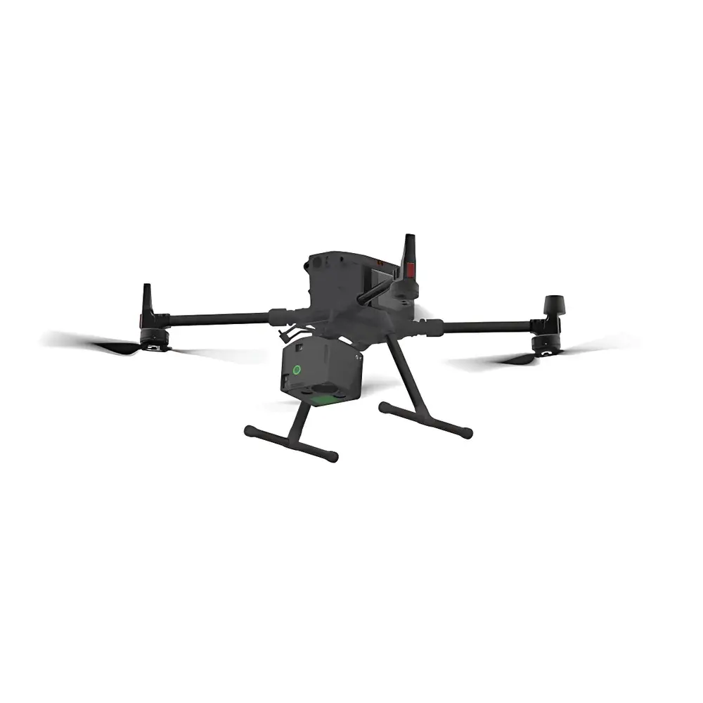
Yes—the system meets DO-160G Section 21 environmental test standards for vibration, shock, and temperature cycling. It has been validated on DJI Matrice 300 RTK, Freefly Alta X, and custom fixed-wing platforms with payload capacities ≥3.2 kg.
Can spectral calibration be performed in-field?
Yes—integrated onboard reference panels (certified 99% reflectance, NIST-traceable) enable radiometric recalibration before and after each mission without requiring laboratory intervention.
What level of geometric correction is supported in post-processing?
The system delivers direct georeferencing (DG) accuracy of ≤5 cm RMSE (horizontal) and ≤8 cm RMSE (vertical) when paired with PPK/RTK GNSS and validated IMU calibration—sufficient for Level 2 (LPIS) land parcel mapping per EU Regulation No 1290/2013.
Does the software support automated spectral library matching?
Yes—the Spectral Match Engine supports both spectral angle mapper (SAM) and binary encoding (BE) algorithms against user-defined libraries (e.g., USGS, ECOSTRESS, JPL AVIRIS-NG), with false-match suppression via confidence thresholding and spatial contiguity filtering.
Is firmware update capability available over-the-air?
Firmware updates are delivered via secure HTTPS endpoint with SHA-256 signature verification; updates require manual confirmation and reboot—no automatic background installation is permitted to ensure operational integrity during field campaigns.