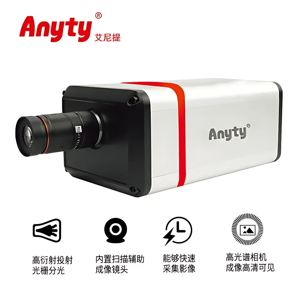
Anyty 3R-PPSC410 Portable Hyperspectral Imaging Camera (400–1000 nm)
| Brand | Anyty |
|---|---|
| Origin | Beijing, China |
| Manufacturer Type | Direct Manufacturer |
| Regional Origin | Domestic (China) |
| Model | 3R-PPSC410 |
| Spectral Range | 400–1000 nm |
| Spectral Resolution | 5 nm |
| Spatial Resolution | 1920 × 1920 pixels |
| Total Field of View (TFOV) | 25° |
| Platform Compatibility | Ground-based and UAV-mounted operation |
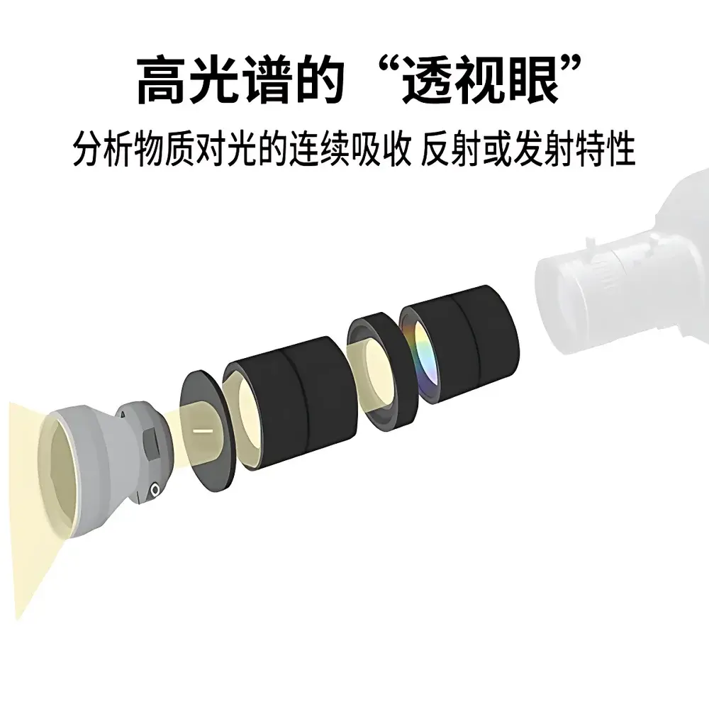
| Working Principle | Push-broom hyperspectral imaging with integrated CMOS sensor and transmission grating spectrometer |
Overview
The Anyty 3R-PPSC410 is a compact, field-deployable push-broom hyperspectral imaging camera engineered for quantitative spectral analysis across the visible to near-infrared (VNIR) spectrum (400–1000 nm). Unlike broadband RGB or multispectral systems, it acquires contiguous spectral bands—each with 5 nm resolution—enabling pixel-wise reflectance spectra reconstruction. Its optical architecture integrates a high-throughput transmission grating spectrometer with a scientific-grade CMOS image sensor, delivering full hyperspectral datacubes (x, y, λ) without scanning mechanics or moving parts. Designed for operational flexibility, the system supports both handheld terrestrial surveys and integration onto rotary- or fixed-wing UAV platforms, maintaining radiometric stability under variable lighting and motion conditions. The instrument adheres to fundamental principles of spectroscopic remote sensing: incident light is dispersed spatially along the slit axis, captured line-by-line as the platform moves, and reconstructed into georeferenced hypercubes using synchronized position and attitude metadata.
Key Features
- Continuous spectral coverage from 400 nm (violet edge) to 1000 nm (NIR cutoff), capturing chlorophyll absorption features, water band depths, and cellulose/lignin signatures critical for plant and soil characterization.
- 5 nm spectral resolution ensures discrimination of narrowband absorption features—such as the 680 nm chlorophyll-a peak or 970 nm water absorption shoulder—without band aliasing or interpolation artifacts.
- 1920 × 1920 spatial resolution provides high-fidelity ground sampling—enabling sub-centimeter pixel size at typical UAV altitudes (e.g., <10 cm GSD at 30 m AGL with appropriate lens).
- 25° total field of view balances wide-area coverage with minimal optical distortion; compatible with interchangeable lenses (e.g., 12 mm, 25 mm) for mission-specific ground sampling distance (GSD) optimization.
- Ruggedized aluminum housing rated IP54 for dust and splash resistance; operating temperature range: −10 °C to +50 °C; power consumption <3.5 W (12 V DC input), supporting extended battery operation in field deployments.
- Onboard FPGA-based real-time preprocessing including dark current subtraction, non-uniformity correction (NUC), and spectral calibration lookup table (LUT) application—reducing post-processing latency and ensuring measurement consistency across environmental gradients.
Sample Compatibility & Compliance
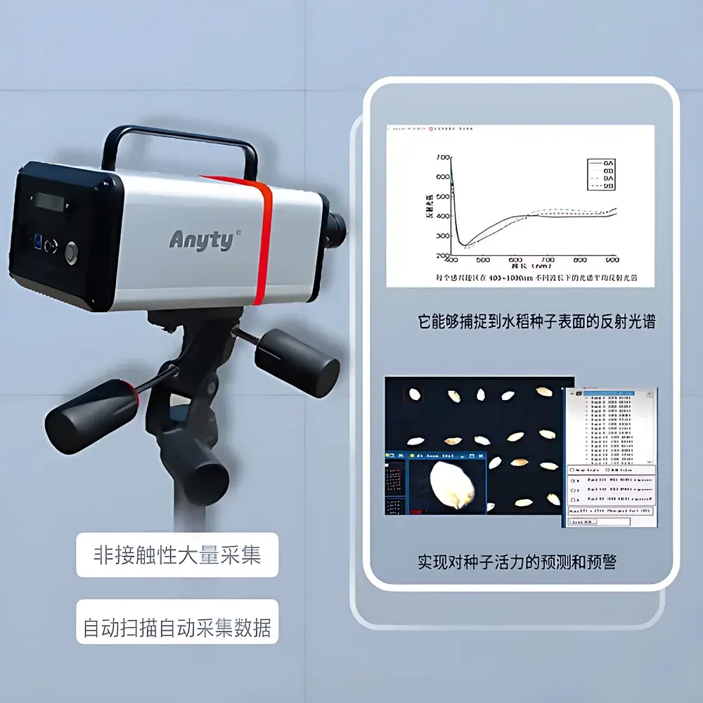
The 3R-PPSC410 is optimized for non-contact, non-destructive analysis of heterogeneous natural and agricultural surfaces—including live vegetation canopies, soil profiles, rock outcrops, and aqueous surface films. Its VNIR sensitivity aligns with ASTM E2738 (Standard Practice for Spectral Reflectance Measurements of Soil and Vegetation), ISO 19833:2021 (Imaging spectroscopy — Terminology and performance parameters), and USDA ARS protocols for precision agriculture spectral validation. While not certified to FDA 21 CFR Part 11 or GLP/GMP by default, raw data export formats (ENVI .hdr/.bin, TIFF hyperstack) support traceable, audit-ready workflows when paired with validated acquisition software and metadata logging (GPS, IMU, exposure time, integration time). Calibration certificates (NIST-traceable reflectance standard verification) are available upon request for QA/QC documentation.
Software & Data Management
The system ships with Anyty’s proprietary HyperCapture Suite v3.2, a Windows-based application supporting real-time preview, spectral library matching (via spectral angle mapper, SAM), and ROI-based spectral averaging. Export options include ENVI-compatible BIL/BIP formats, CSV spectral profiles, and GeoTIFF-embedded georeferenced mosaics (when used with RTK-GNSS and IMU). API access (C++/Python SDK) enables integration into custom processing pipelines—for example, coupling with scikit-learn or TensorFlow for supervised classification of crop stress phenotypes or soil organic carbon regression modeling. All acquired data retain embedded EXIF-like metadata: timestamp, GPS coordinates (WGS84), pitch/yaw/roll angles, integration time, and sensor temperature—facilitating reproducible, FAIR-compliant (Findable, Accessible, Interoperable, Reusable) data management per OECD guidelines.
Applications
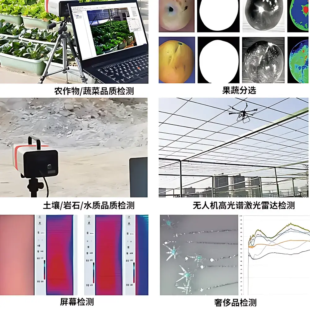
- Agricultural Phenotyping: Detection of nitrogen deficiency, water stress, and early fungal infection (e.g., powdery mildew on cucurbits) via spectral indices such as NDVI, PRI, and MCARI/OSAVI.
- Post-Harvest Sorting: Real-time classification of fruit/vegetable quality attributes—including sugar content (Brix), firmness, and bruise detection—using partial least squares regression (PLSR) models trained on lab-validated reference samples.
- Geological & Environmental Surveying: Discrimination of mineralogical composition (e.g., kaolinite vs. smectite clays), hydrocarbon seepage indicators, and suspended sediment concentration in shallow water bodies.
- Soil Health Assessment: Quantification of organic matter, iron oxide content, and salinity through continuum-removed absorption features near 550 nm, 700 nm, and 900 nm.
- UAV-Based Precision Monitoring: Integration with DJI M300 RTK or Autel EVO Max platforms for hectare-scale mapping with centimeter-level orthorectification accuracy when combined with ground control points (GCPs) and photogrammetric processing engines (e.g., Pix4Dmapper, Agisoft Metashape).
FAQ
Is radiometric calibration included with the system?
Yes—each unit ships with a NIST-traceable white reference panel (99% reflectance, 400–1000 nm) and factory spectral response curve. Users perform routine calibration before each flight or survey session.
Can the camera be triggered externally via TTL or GPIO?
Yes—the 3R-PPSC410 supports hardware triggering (rising-edge TTL) and programmable GPIO for synchronization with LiDAR, GNSS-INS, or external illumination sources.
What is the maximum acquisition speed in push-broom mode?
At full spatial resolution (1920 px cross-track), the maximum line rate is 120 Hz; effective frame rate depends on platform velocity and desired ground sampling density.
Does the system support real-time onboard spectral analysis?
Basic indices (NDVI, NDRE) and threshold-based anomaly detection are supported in real time; advanced ML inference requires offloading to edge computing units (e.g., NVIDIA Jetson) via GigE Vision interface.
Are software updates and firmware upgrades provided free of charge?
Yes—registered users receive two years of complimentary software maintenance, including security patches, bug fixes, and minor feature enhancements.