Auniontech Geoshark MG30M High-Precision Optically Pumped Magnetometer / UAV-Based Airborne Magnetic Survey System
| Brand | Auniontech |
|---|---|
| Model | Geoshark MG30M |
| Magnetometer Type | Optically Pumped (Rubidium Vapor) |
| Measurement Principle | Quantum Optical Pumping & Larmor Precession Detection |
| Operating Temperature Range | −20 °C to +40 °C |
| Magnetic Field Range | 20,000–100,000 nT |
| Sensitivity | 0.1–0.5 pT/√Hz |
| Measurement Rate | 1,000 Hz |
| Closed-Loop Bandwidth | 30 Hz |
| Sensor Tilt Tolerance | ±45° |
| Typical Bias Stability | <0.3 nT |
| UAV Platform | Geoscan 401 Industrial Quadcopter |
| Ground Track Accuracy | ≤0.6 m deviation from planned route |
| Typical Survey Speed | 10 m/s (36 km/h) |
| Operational Altitude | 25–500 m AGL |
| Max Flight Duration (single battery) | ~60 min |
| Daily Coverage (12–16 flights) | 160–220 km |
| Data Output Format | GeoTIFF, ASCII Grid, CSV with full georeferencing |
| Software Suite | QMCentre (acquisition & real-time monitoring), Geoscan Mission Planner, Agisoft Metashape PRO (photogrammetric integration) |
Overview
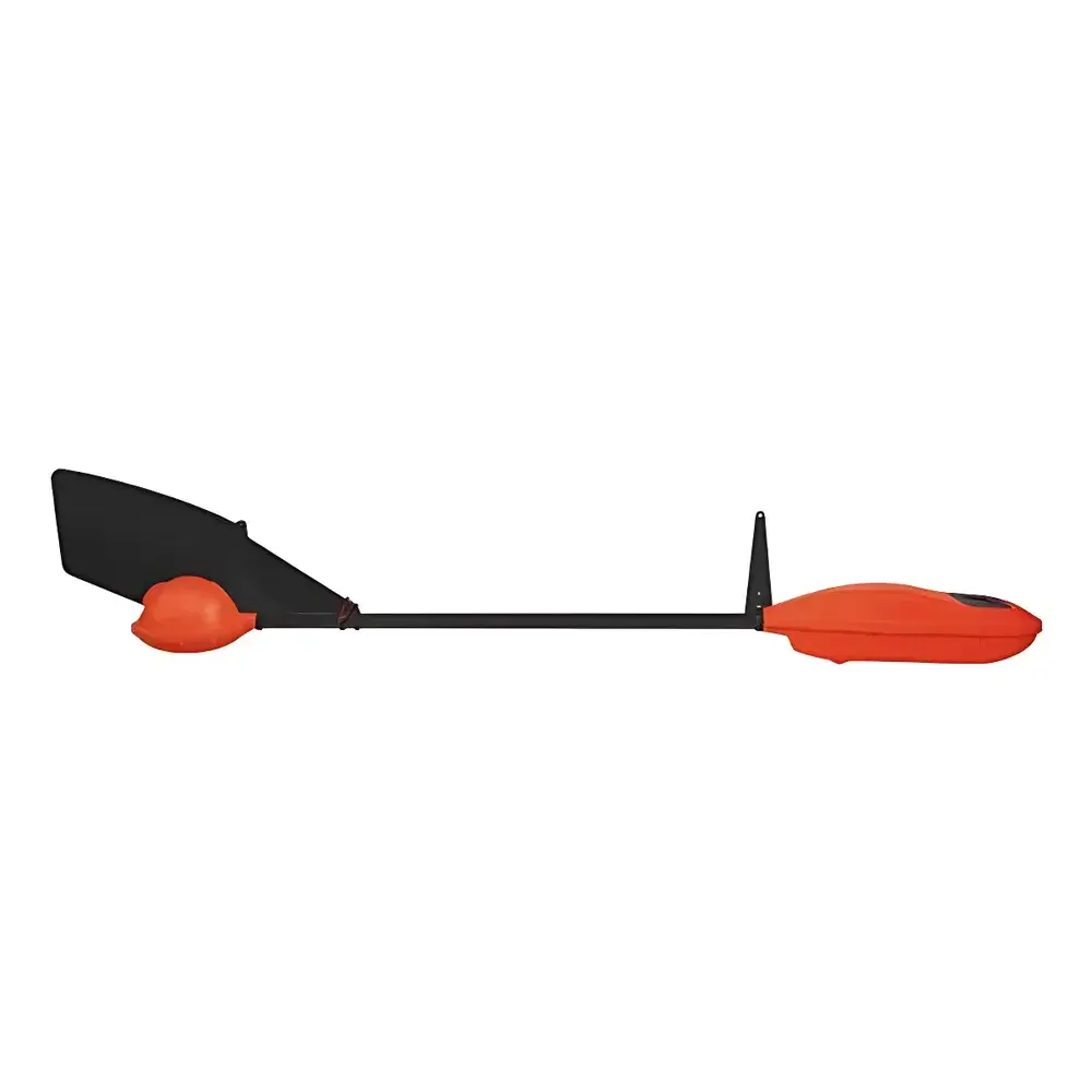
The Auniontech Geoshark MG30M is a quantum-optical airborne magnetometer system engineered for high-fidelity, low-altitude magnetic surveying in geophysical exploration, UXO detection, geological mapping, and infrastructure assessment. Unlike fluxgate or proton precession magnetometers, the Geoshark MG30M employs rubidium vapor optically pumped magnetometry — a technique based on laser-induced polarization of Rb atoms and precise measurement of their Larmor precession frequency in ambient magnetic fields. This principle delivers sub-picotesla sensitivity (0.1–0.5 pT/√Hz), intrinsic linearity across its 20,000–100,000 nT dynamic range, and immunity to sensor orientation drift within ±45° tilt — critical for stable operation on agile UAV platforms. The system operates as a fully autonomous payload: it requires no electrical or navigational interface with the host drone, minimizing electromagnetic interference and simplifying integration onto the Geoscan 401 industrial quadcopter. Its self-contained architecture includes dual hot-swappable batteries, ruggedized transport casing, and real-time telemetry via digital communication channels — enabling continuous acquisition at 1,000 Hz with closed-loop bandwidth up to 30 Hz for responsive compensation of platform motion artifacts.
Key Features
- Quantum-grade optically pumped rubidium vapor sensor with factory-calibrated sensitivity and temperature-compensated bias stability (<0.3 nT typical)
- True plug-and-play UAV integration: zero wiring or software coupling required with Geoscan 401 flight controller or navigation stack
- Real-time onboard data logging and GPS-synchronized timestamping compliant with ITRF2014 geodetic reference frame
- Robust mechanical design rated for −20 °C to +40 °C operational envelope and vibration spectra per MIL-STD-810G Method 514.6 Cat. 24
- Dual-battery redundancy supporting >60-minute continuous flight; field-replaceable modules enable rapid turnaround between sorties
- Integrated QMCentre acquisition software providing live spectral analysis, noise floor monitoring, and automatic gain optimization
Sample Compatibility & Compliance
The Geoshark MG30M is not a sample-contact instrument; it measures ambient vector-free total magnetic intensity (TMI) at standoff distances. As such, it imposes no material restrictions — compatible with all geological substrates, anthropogenic structures, submerged targets, and vegetated or urban terrain. Its measurement methodology conforms to established geophysical survey standards including ASTM D6429-18 (Standard Guide for Geophysical Mapping of Subsurface Features) and ISO 19901-7:2021 (Offshore Structures — Geophysical Survey Requirements). All firmware and data handling protocols are designed to support audit-ready workflows under GLP-compliant project frameworks. Raw magnetic time-series data retain full traceability to NIST-traceable calibration certificates issued at time of manufacture.
Software & Data Management
Data acquisition, processing, and interpretation are supported by a validated three-tier software suite. QMCentre manages real-time sensor control, raw data streaming, and on-the-fly noise filtering (e.g., adaptive notch filtering for powerline harmonics). Geoscan Mission Planner enables centimeter-accurate autonomous flight path generation with vertical gradient profiling capability and automatic terrain-following logic. Post-processing leverages Agisoft Metashape PRO for photogrammetric orthomosaic alignment, allowing precise co-registration of magnetic anomalies with surface morphology. Final deliverables include georeferenced magnetic grids (GeoTIFF), interpolated anomaly maps with customizable contour intervals, vertical gradient derivatives, and ASCII/CSV exports suitable for inversion modeling in industry-standard packages (e.g., GM-SYS, EarthImager MT). All software modules log immutable audit trails meeting FDA 21 CFR Part 11 requirements for electronic records and signatures.
Applications
- High-resolution aeromagnetic surveys for mineral prospecting (e.g., iron oxide-copper-gold systems, kimberlite pipes)
- Shallow-depth UXO and buried ordnance detection in post-conflict zones and former military ranges
- Geotechnical site characterization: mapping subsurface faults, lava tubes, sinkholes, and paleochannels
- Archaeological prospection: non-invasive identification of buried foundations, ditches, and kilns
- Infrastructure integrity monitoring: detecting corrosion-induced magnetic anomalies in pipelines and reinforced concrete
- Environmental baseline studies: delineating landfill boundaries and leachate plumes via magnetic susceptibility contrasts
FAQ
Does the Geoshark MG30M require external GPS or IMU input for magnetic compensation?
No. The sensor is self-contained and does not rely on external navigation data for magnetic field computation. However, synchronized GPS timestamps are used during post-processing to geolocate measurements with sub-meter accuracy.
Can the system operate in real time without ground station telemetry?
Yes. All data are recorded internally on high-endurance microSD cards. Telemetry is optional and used only for remote status monitoring and emergency abort commands.
What is the minimum detectable magnetic anomaly at 30 m altitude?
Under typical survey conditions (10 m/s speed, 30 m AGL, 1,000 Hz sampling), the system resolves anomalies ≥1.2 nT at spatial wavelengths >5 m, consistent with theoretical resolution limits governed by sensor noise floor and platform dynamics.
Is the Geoscan 401 airframe certified for BVLOS operations?
Certification is jurisdiction-specific. The airframe meets EASA STS-02-01 technical specifications for Class C1 UAS, and operators must obtain national regulatory approval for beyond-visual-line-of-sight deployment.
How is thermal drift managed across the −20 °C to +40 °C operating range?
The rubidium cell and optical pumping laser are housed in a thermally stabilized chamber with active feedback control, maintaining cell temperature within ±0.1 °C of setpoint. Factory calibration includes multi-point thermal characterization across the full range.


