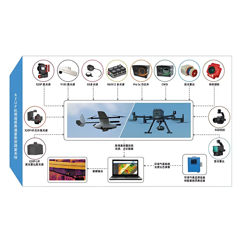
AZUP PTA Series Airborne High-Throughput Plant Phenotyping System
| Brand | AZUP |
|---|---|
| Origin | Beijing, China |
| Manufacturer Type | Original Equipment Manufacturer (OEM) |
| Product Origin | Domestic (China) |
| Model | PTA Series |
| Pricing | Available Upon Request |
Overview
The AZUP PTA Series Airborne High-Throughput Plant Phenotyping System is an integrated remote sensing platform engineered for quantitative, non-destructive, and spatially explicit acquisition of plant phenotypic traits across field-scale agricultural and ecological environments. Built upon a modular unmanned aerial vehicle (UAV) architecture, the system leverages multi-sensor synergies—including hyperspectral imaging (400–1000 nm or 900–1700 nm configurable), multispectral imaging (e.g., Red Edge, NIR, NDVI-capable bands), thermal infrared radiometry (7.5–13.5 µm), and full-waveform LiDAR (1550 nm, ±2 cm vertical accuracy)—to capture structural, biochemical, and physiological parameters in situ. Its measurement principle relies on passive solar reflectance spectroscopy (for pigment, water, and nitrogen estimation), active laser scanning (for canopy height, leaf area index, and 3D biomass modeling), and thermal emission analysis (for stomatal conductance proxies and water stress indices). Designed for operational robustness under variable ambient light and wind conditions, the PTA Series supports repeatable data collection at sub-decimeter ground sampling distance (GSD) with georeferenced metadata compliant with ISO 19115 and OGC SensorML standards.
Key Features
- Modular UAV integration: Compatible with fixed-wing and VTOL platforms (e.g., DJI Matrice 300 RTK, senseFly eBee X) with payload capacity ≥3.5 kg and flight endurance ≥45 min.
- Multi-sensor synchronization: Hardware-triggered acquisition ensures temporal alignment of spectral, thermal, and LiDAR datasets within ±10 ms latency.
- Onboard real-time georeferencing: Dual-frequency GNSS (GPS + GLONASS + BeiDou) with RTK/PPK support delivers horizontal positioning accuracy <1 cm + 1 ppm and vertical accuracy <2 cm + 1 ppm.
- Calibration-ready optical chain: Includes onboard radiometric calibration panels (Spectralon®-based), thermal blackbody references, and LiDAR range correction algorithms traceable to NIST standards.
- Ruggedized environmental operation: IP54-rated enclosure; operational temperature range −10 °C to +50 °C; vibration-damped gimbal stabilization (±0.02° RMS).
Sample Compatibility & Compliance
The PTA Series is validated for deployment over diverse vegetation types—including cereal crops (wheat, maize, rice), legumes, orchard canopies, and natural grassland ecosystems—across growth stages from emergence to senescence. Data outputs conform to FAO’s Agroecological Zoning Framework and support compliance with ISO 11146 (laser beam parameters), ASTM E1933 (infrared thermography), and ISO 18632 (hyperspectral data format). System metadata generation adheres to MIAPPE v1.1 (Minimum Information About a Plant Phenotyping Experiment) and is compatible with BreedBase and CyVerse data ingestion pipelines. All firmware and sensor drivers are developed under ISO/IEC 12207-compliant software lifecycle management.
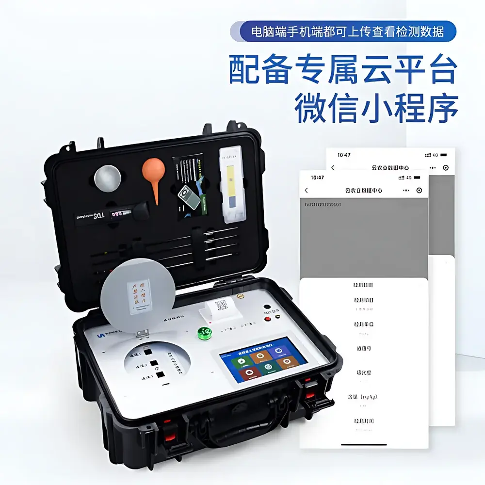
Software & Data Management
The system ships with AZUP Phenosuite™ v3.x—a desktop and cloud-enabled processing suite supporting automated orthomosaic generation, point-cloud classification (via LAStools and PDAL), spectral unmixing (using constrained least-squares and vertex component analysis), and trait extraction (e.g., PRI, CIrededge, TCARI/OSAVI, CWSI). Raw data are stored in vendor-neutral formats: GeoTIFF (raster), LAS/LAZ (LiDAR), and NetCDF-4 (multidimensional time-series). Audit trails, user permissions, and electronic signatures comply with FDA 21 CFR Part 11 requirements for regulated research environments. Integration with QGIS, ENVI, and Python-based libraries (scikit-learn, rasterio, open3d) is natively supported via documented RESTful APIs.
Applications
- Field-scale high-throughput phenotyping for genomic selection and GWAS studies in crop breeding programs.
- Dynamic monitoring of abiotic stress responses—including drought, heat, salinity, and nutrient deficiency—through time-series spectral-temporal indices.
- Canopy architecture modeling for yield prediction, planting density optimization, and harvest timing decisions.
- Ecological assessment of vegetation health, species composition, and land-cover change in protected areas and agroforestry systems.
- Validation of satellite-derived biophysical products (e.g., MODIS LAI, Sentinel-2 LST) through cross-platform scale transfer protocols.
FAQ
Is the PTA Series suitable for regulatory submission in GLP-compliant trials?
Yes—full audit trail logging, instrument calibration history, and electronic signature support meet OECD GLP Principles and FDA 21 CFR Part 11 requirements.
Can raw hyperspectral data be exported in ENVI-compatible format?
Yes—all hyperspectral cubes are delivered as BIL/BIP-formatted .hdr/.dat files with complete wavelength and FWHM metadata.
What level of technical support is provided for algorithm customization?
AZUP offers optional extended support contracts including on-site workflow optimization, custom trait model development (e.g., chlorophyll estimation models trained on local cultivars), and HPC cluster integration assistance.
Does the system include atmospheric correction capability?
Yes—integrated QUAC (Quick Atmospheric Correction) and FLAASH modules are licensed and validated for UAV-altitude deployment (50–120 m AGL).
How is geometric distortion corrected in LiDAR and thermal data?
Boresight calibration is performed pre-flight using a 3-axis precision turntable; post-processing applies IMU-GNSS fusion and iterative closest point (ICP) registration against ground control points.