Azure Cloud & Wind Confluence SkyPheno Pro Phenological Monitoring System
| Brand | Azure Cloud & Wind Confluence |
|---|---|
| Origin | Jiangsu, China |
| Manufacturer Type | Authorized Distributor |
| Country of Origin | China |
| Model | SkyPheno Pro |
| Price | USD 4,200 (FOB Jiangsu) |
| Sensor Type | 1/2.4" Progressive Scan CMOS |
| Min. Illumination | 0.0005 lux (color, F1.0, 1000x gain) |
| WDR | 120 dB |
| Day/Night Switching | ICR infrared cut filter |
| Lens Mount | M12 |
| Optional Focal Lengths | 2.8 mm (HFOV 104°), 4 mm (78°), 6 mm (50°), 8 mm (47°) |
| Max Aperture | F1.6 |
| IR Illumination | 850 nm, up to 30 m |
| Max Image Resolution | 3200 × 1800 |
| Primary Stream | 3200 × 1800 @ 20 fps |
| Video Compression | H.265 / H.264 |
| Network Protocols | TCP/IP, HTTP, FTP, RTSP |
| Operating Temperature | −30 °C to +60 °C |
| Operating Humidity | ≤95% RH (non-condensing) |
| Dimensions | 189.2 × 92.7 × 87.6 mm |
| Derived Indices | NDVI, NDSI, GCC, RCC, BCC, Snow Cover, Green-Up Timing |
Overview
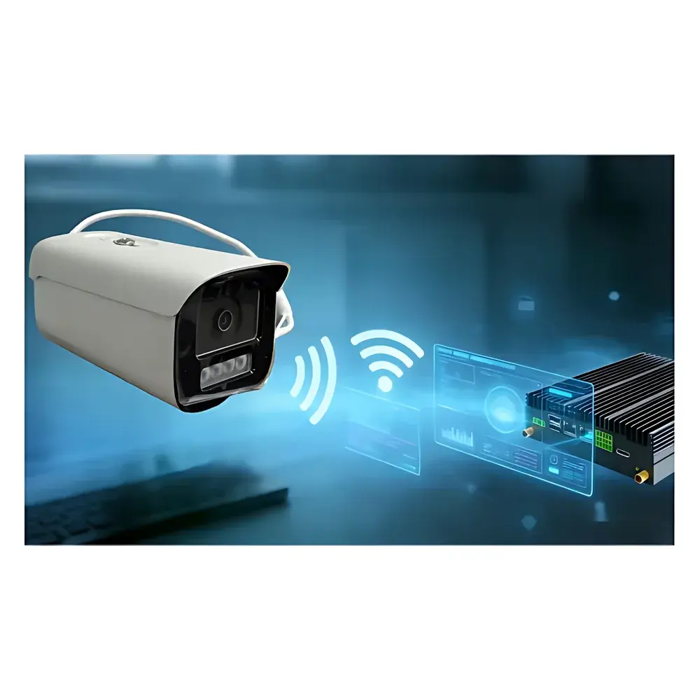
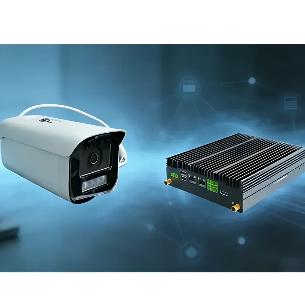
The Azure Cloud & Wind Confluence SkyPheno Pro Phenological Monitoring System is a purpose-built, edge-integrated imaging platform engineered for long-term, unattended phenological observation in ecological research, agricultural monitoring, and climate impact studies. Unlike legacy systems relying on discrete data loggers and proprietary cloud infrastructures, the SkyPheno Pro embeds intelligent image acquisition, on-device spectral index computation, and protocol-agnostic data routing into a single ruggedized enclosure. It operates on the principle of multispectral time-series imaging—capturing synchronized RGB and near-infrared (NIR) frames at user-defined intervals—and computes standardized vegetation and snow indices—including NDVI (Normalized Difference Vegetation Index), NDSI (Normalized Difference Snow Index), GCC (Green Chromatic Coordinate), RCC (Red Chromatic Coordinate), BCC (Blue Chromatic Coordinate), snow cover fraction, and green-up onset—directly on the device using calibrated radiometric pipelines. This architecture eliminates dependency on external data loggers or vendor-locked cloud platforms, reducing system latency, minimizing data transmission overhead, and ensuring continuity under intermittent network conditions.
Key Features
- Integrated Edge Intelligence: Onboard ARM-based processing unit executes real-time image registration, radiometric correction, and index derivation without requiring external computing hardware or custom scripting.
- Hardware-Optimized Imaging Stack: Features a 1/2.4″ progressive-scan CMOS sensor with ultra-low-light sensitivity (0.0005 lux color), 120 dB wide dynamic range, and mechanical ICR filter for reliable day/night operation across seasonal light gradients.
- Modular Optical Design: M12 lens mount supports interchangeable fixed-focal lenses (2.8 mm to 8 mm), enabling field-of-view customization—from broad-canopy surveys (104° HFOV) to targeted plot-level monitoring (47° HFOV)—without recalibration.
- Protocol-Flexible Data Export: Native support for HTTP POST, FTP upload, and RTSP streaming allows direct integration with institutional servers, GIS platforms (e.g., QGIS, ArcGIS Enterprise), or third-party cloud environments—including backward compatibility with existing Huawei Cloud deployments.
- Ruggedized Environmental Rating: IP66-rated housing, −30 °C to +60 °C operational range, and condensation-resistant thermal management enable deployment in alpine tundra, boreal forests, agricultural fields, and peri-urban green infrastructure without auxiliary enclosures.
Sample Compatibility & Compliance
The SkyPheno Pro is designed for non-invasive, continuous optical monitoring of terrestrial vegetation canopies, snowpack dynamics, and land surface phenophases. Its spectral response aligns with established remote sensing conventions: RGB channels conform to sRGB chromaticity standards, while the NIR channel (centered at ~850 nm) satisfies requirements for NDVI and NDSI calculation per ASTM E2939-22 and ISO 19130-2:2020. The system supports GLP-aligned metadata embedding—including GPS timestamp, UTC synchronization via NTP, sensor temperature, and exposure parameters—in EXIF and XMP headers. All firmware updates and configuration changes are logged with immutable timestamps, supporting auditability under ISO/IEC 17025:2017 Clause 7.7 (control of records) and facilitating traceability in long-term ecological research programs compliant with LTER (Long Term Ecological Research) data standards.
Software & Data Management
The SkyPheno Pro includes web-based configuration interface accessible via HTTPS, supporting role-based access control (admin/operator modes), scheduled capture profiles, manual trigger events, and remote firmware upgrades over TLS 1.2. Image and index data are exported as time-stamped TIFF (for raw analysis) and JPEG (for visualization), accompanied by CSV-formatted metadata logs containing computed indices, environmental sensor readings (if integrated), and system health metrics. While no proprietary cloud subscription is required, optional integration with open-data frameworks such as OGC SensorThings API (Part 1: Sensing) or NASA’s LP DAAC data ingestion pipeline is supported through configurable RESTful endpoints. Audit trails—including login attempts, parameter modifications, and export history—are retained locally for ≥90 days and exportable in JSON format for institutional compliance reporting.
Applications
- Long-term ecological monitoring networks tracking interannual variability in leaf-out, flowering, senescence, and snowmelt timing.
- Agricultural phenotyping trials assessing cultivar-specific responses to drought, heat stress, or elevated CO₂ under field conditions.
- Urban ecology studies quantifying green infrastructure performance (e.g., green roof phenology, street tree vitality) across climatic gradients.
- Climate model validation using ground-truthed phenological transition dates derived from multi-year NDVI/GCC time series.
- Remote site surveillance for protected area management, where low-bandwidth operation and solar-powered deployment are critical constraints.
FAQ
Does the SkyPheno Pro require a separate data logger or CR-series controller?
No. All image acquisition scheduling, sensor triggering, index computation, and data routing are performed internally. No external data logger is needed.
Can it interface with existing institutional data infrastructure instead of a vendor cloud?
Yes. It supports HTTP POST, FTP, and RTSP protocols, enabling direct ingestion into university servers, national observatory databases, or open science platforms like Zenodo or DataONE.
Is calibration traceable to recognized standards?
Radiometric response is factory-characterized against NIST-traceable reference targets; spectral bandpasses meet ANSI PH2.19-2019 guidelines for vegetation index cameras.
How is time synchronization maintained during network outages?
The onboard RTC maintains microsecond-level accuracy via temperature-compensated crystal oscillator (TCXO); NTP sync resumes automatically upon reconnection.
What maintenance is required for long-term deployment?
Lens cleaning and IR window inspection every 6–12 months depending on dust/pollen load; no routine recalibration is necessary due to embedded thermal drift compensation algorithms.
Related Products