
COMECAUSE IN-G20 Portable Canopy Analyzer for Plant Physiology & Ecology Research
| Brand | COMECAUSE |
|---|---|
| Model | IN-G20 |
| Origin | Shandong, China |
| Manufacturer Type | Direct Manufacturer |
| Instrument Principle | Hemispherical Image Analysis (Fisheye Lens + CCD) |
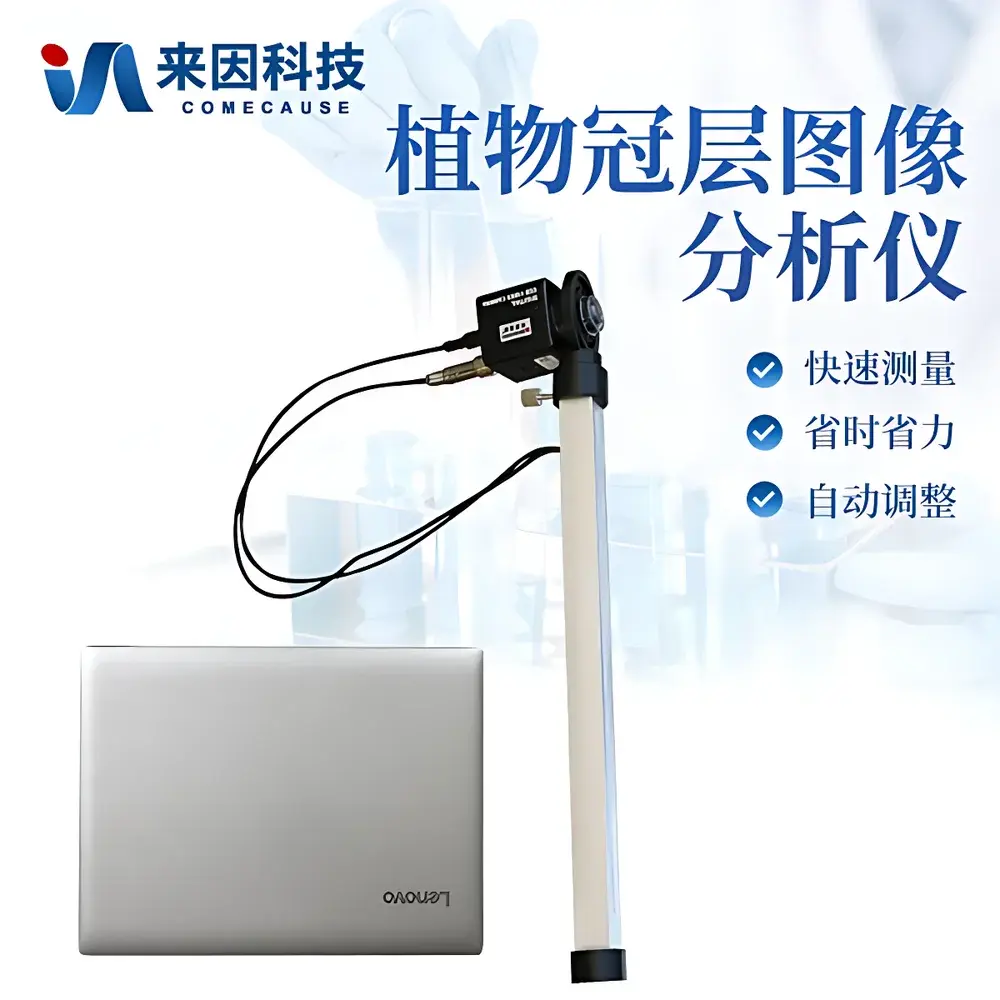
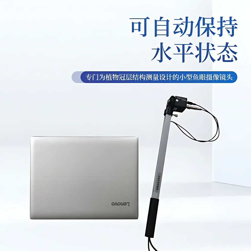
| Instrument Type | Handheld Portable |
| PAR Spectral Range | 400–700 nm |
| PAR Measurement Range | 0–2000 μmol·m⁻²·s⁻¹ |
| Field of View | 150° (Hemispherical) |
| Image Resolution | 768 × 494 pixels |
| Zenith Angle Partitioning | 0°–75° (10 zones) |
| Azimuthal Partitioning | 0°–360° (10 zones) |
| Probe Dimensions | Ø6 cm × 10 cm |
| Weight | 500 g (probe only, excluding laptop) |
| Operating Temperature | 0–55 °C |
| Interface | USB |
| GPS Integration | Built-in Real-time Geotagging |
| Software | COMECAUSE Canopy Analysis System v3.x |
Overview
The COMECAUSE IN-G20 Portable Canopy Analyzer is an engineering-grade field instrument designed for quantitative, non-destructive assessment of plant canopy architecture and light interception dynamics. It operates on the established physical principle of hemispherical photography—leveraging fisheye lens optics to capture a full 150° zenith-angle view of the sky above the canopy, followed by pixel-level radiometric analysis of gap fraction distribution. This approach is grounded in Beer-Lambert law assumptions and validated semi-empirical models widely adopted in agronomy and ecosystem science (e.g., ISO 11727:2021, ASTM E2914-19). Unlike point-sensor PAR meters or destructive LAI sampling, the IN-G20 delivers spatially resolved structural metrics—including leaf area index (LAI), canopy openness, clumping index, and angular transmittance profiles—within seconds per measurement location. Its portability, real-time georeferencing, and standardized image segmentation protocol make it suitable for repeated longitudinal monitoring across heterogeneous field plots, orchards, forest understories, and controlled-environment trials.
Key Features
- Integrated 150° fisheye imaging probe with auto-leveling gimbal mount—ensures consistent horizon alignment without tripods or manual leveling.
- Dual-mode acquisition: simultaneous hemispherical image capture and real-time PAR flux measurement via 25 embedded quantum sensors along the telescoping measurement rod.
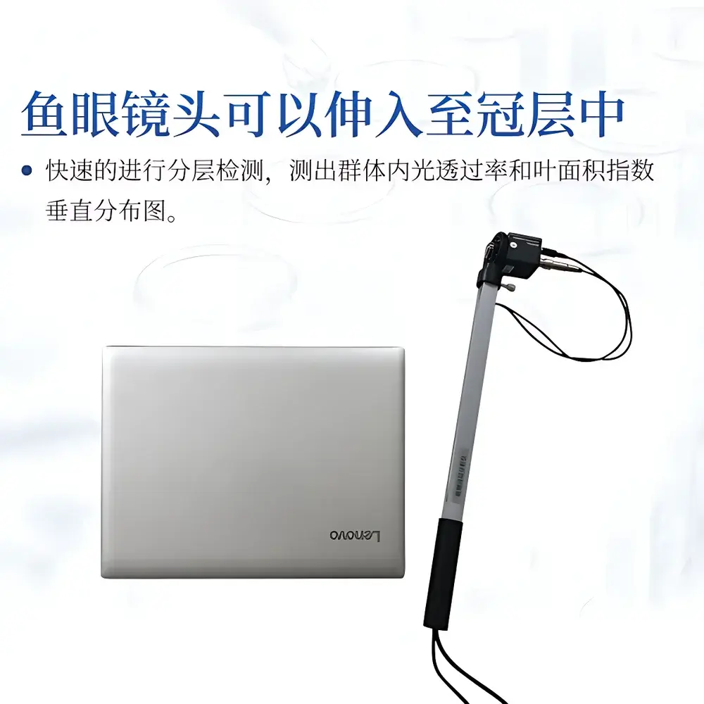
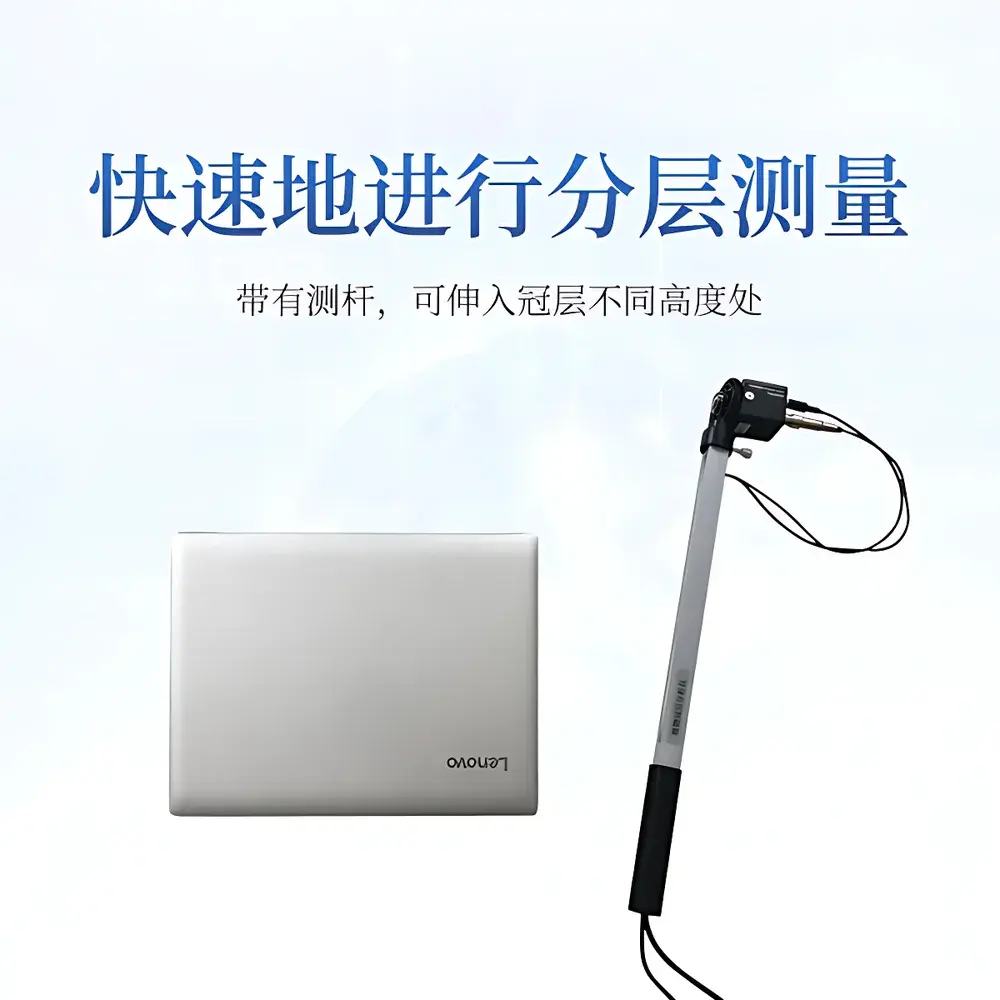
- Modular stratified profiling: extendable arm enables rapid vertical insertion into canopies up to 3 m height, supporting layer-specific LAI and light attenuation profiling (e.g., top/mid/bottom strata).
- Configurable angular partitioning: zenith angle segmented into 10 discrete bands (0°–75°), azimuth into 10 sectors (0°–360°), enabling directional analysis of leaf orientation and light heterogeneity.
- Region-of-interest masking: software allows manual exclusion of non-canopy elements (e.g., gaps from missing plants, edge effects, infrastructure shadows) prior to metric computation.
- Adaptive thresholding engine: user-adjustable grayscale thresholds optimize gap detection accuracy under variable lighting conditions (e.g., overcast vs. direct sun).
Sample Compatibility & Compliance
The IN-G20 is validated for use across herbaceous and woody species—from cereal monocultures and legume intercrops to vineyards, orchards, and young forest stands—with canopy heights ranging from 0.3 m to 3.0 m. Its optical design minimizes parallax error and accommodates dense, overlapping foliage typical of high-yield agricultural systems. Data outputs comply with FAO-recommended protocols for LAI validation (FAO CropWat Manual, Ch. 5) and align with ISO 11727’s requirements for hemispherical image metadata tagging (geolocation, timestamp, solar geometry). The system supports GLP-aligned data integrity through encrypted local storage, audit-trail-enabled software logging, and traceable calibration certificates for PAR sensors (NIST-traceable reference irradiance source used during factory calibration).
Software & Data Management
The bundled COMECAUSE Canopy Analysis System v3.x provides a deterministic, scriptable workflow—from raw image ingestion and geometric correction to parameter derivation and statistical summarization. All processing steps are fully documented and reproducible; no black-box interpolation is applied. Export formats include CSV (for LAI, gap fraction, extinction coefficient per zone), GeoTIFF (georeferenced canopy openness maps), and XML (structured metadata compliant with ISA-Tab standards). Cloud synchronization is implemented via TLS 1.3–secured API endpoints to the COMECAUSE AgriCloud Platform, where users access role-based dashboards, time-series visualization tools, and automated report generation (PDF/HTML). Data retention policies support 21 CFR Part 11–compliant electronic signatures and version-controlled analysis pipelines for regulatory submissions.
Applications
- Optimizing planting density and row orientation in cereal, maize, and soybean production systems via LAI–yield response modeling.
- Evaluating pruning efficacy and light penetration in apple, citrus, and grapevine orchards to improve fruit coloration and sugar accumulation.
- Quantifying canopy closure dynamics during cover crop establishment to inform termination timing and reduce soil evaporation.
- Supporting remote sensing ground-truthing campaigns by providing sub-hectare scale validation points for satellite-derived LAI products (e.g., Sentinel-2, Landsat 9).
- Assessing microclimate buffering capacity of agroforestry systems through vertical PAR gradient profiling.
- Long-term ecological monitoring of canopy structural change in restoration plots or climate manipulation experiments (e.g., Free-Air CO₂ Enrichment sites).
FAQ
Does the IN-G20 require external power sources in the field?
No—the fisheye probe and measurement rod operate on internal rechargeable lithium-ion batteries (≥8 hours continuous operation); the connected laptop supplies power via USB.
Can the software process images captured with third-party fisheye lenses?
Only calibrated COMECAUSE-branded probes are supported; proprietary lens distortion coefficients and sensor alignment matrices are embedded in the firmware and required for geometric correction.
How is PAR sensor accuracy maintained over time?
Each unit ships with a NIST-traceable calibration certificate; annual recalibration is recommended using the optional COMECAUSE PAR Reference Kit (Model CAL-PAR-2024).
Is the cloud platform compatible with institutional LIMS or GIS infrastructure?
Yes—AgriCloud provides RESTful APIs and OGC-compliant WFS/WMS endpoints for integration with enterprise data ecosystems.
What is the minimum detectable LAI value and associated uncertainty?
Under optimal conditions (full sun, uniform canopy), LAI resolution is 0.1 units with ±0.15 absolute uncertainty (k=2, based on inter-laboratory validation studies across 12 crop types).