COMECAUSE IN-GD10 Vegetation Cover Analyzer
| Brand | COMECAUSE |
|---|---|
| Origin | Shandong, China |
| Manufacturer Type | OEM/ODM Producer |
| Country of Origin | China |
| Model | IN-GD10 |
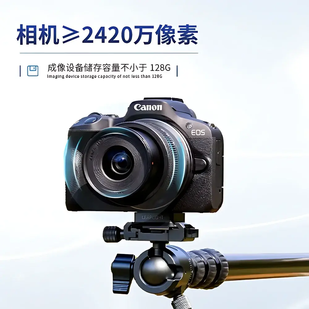
| Imaging Sensor | Canon EOS R50 (24.2 MP, APS-C CMOS) |
| Lens | 18–45 mm f/4.5–6.3 IS STM (optical zoom, autofocus) |
| Onboard Storage | ≥128 GB microSD (UHS-I compatible) |
| Operating Temperature | −25 °C to +55 °C |
| Relative Humidity | ≤80% RH |
| Wireless Range | ≤10 m (Wi-Fi AP mode, IEEE 802.11 b/g/n) |
| Image Format Support | JPEG, PNG, BMP |
| Max Input Image Size | ≥50 MB |
| Cover Calculation Precision | ≥90% (vs. ground-truth manual delineation) |
| Output Resolution | Two-decimal percentage (0.00–100.00%) |
| Software Platform | Android 6.0+ native app with geotagging, batch processing, and cloud sync |
| Compliance | Designed for field-deployable GLP-aligned data collection |
Overview
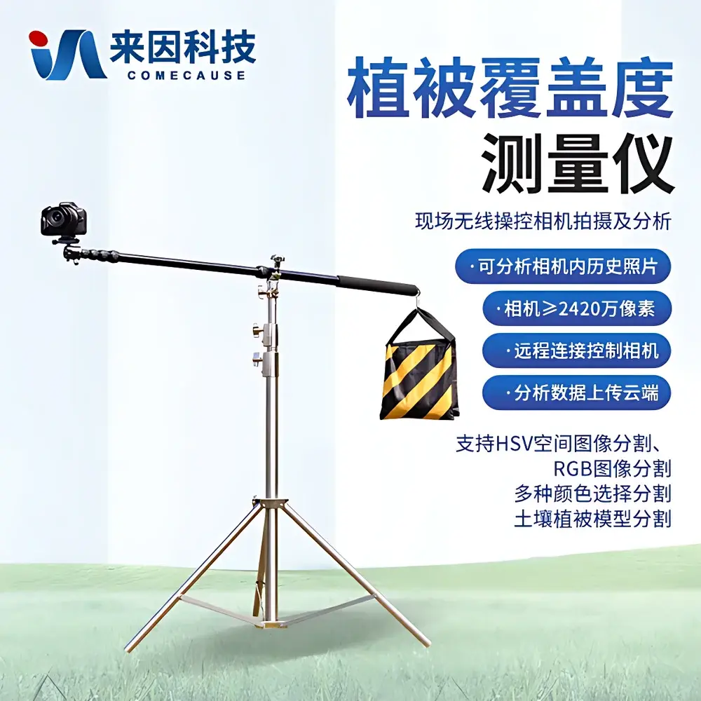
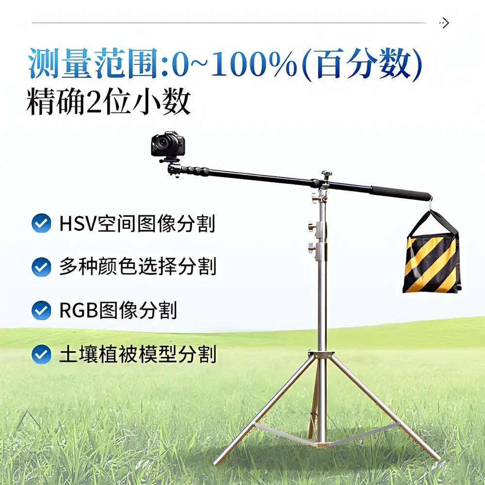
The COMECAUSE IN-GD10 Vegetation Cover Analyzer is a field-portable, image-based quantification system engineered for rapid, non-destructive measurement of vegetation fractional cover (VFC) and canopy closure (i.e.,郁闭度, or canopy closure index). It operates on the principle of digital image segmentation—leveraging spectral and spatial characteristics in RGB and HSV color spaces—to distinguish photosynthetically active vegetation from soil, litter, rock, or other background substrates. Unlike passive remote sensing platforms (e.g., satellite or UAV multispectral sensors), the IN-GD10 delivers ground-truth–referenced, operator-controlled measurements at plot scale (0.5–5 m² typical field-of-view), enabling high-reproducibility data acquisition under variable illumination and terrain conditions. Its architecture integrates a calibrated imaging subsystem (Canon EOS R50 mirrorless camera), an Android-based analytical application, and a ruggedized mobile tripod—forming a complete, self-contained field laboratory for ecological monitoring, agricultural phenotyping, and land management verification.
Key Features
- High-fidelity imaging module: Canon EOS R50 APS-C sensor (24.2 MP), optical autofocus, auto-exposure control, flash compensation, and 18–45 mm variable focal length lens for consistent geometric scaling across heterogeneous terrain.
- Dual-space segmentation engine: Supports both RGB thresholding and HSV-based hue-saturation-value segmentation, with built-in vegetation-soil spectral models trained across temperate, arid, and semi-humid biomes.
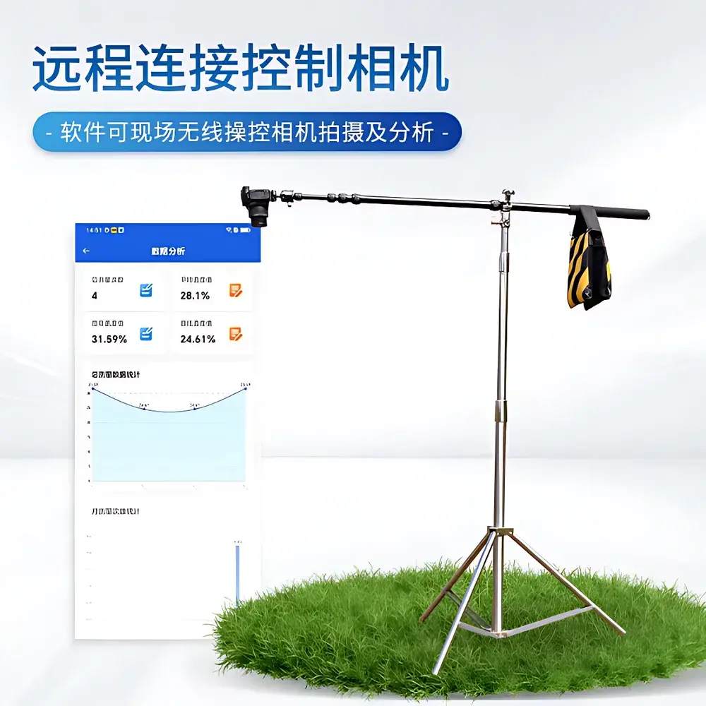
- Georeferenced analysis workflow: All captured images retain embedded GPS coordinates (via Android device GNSS), enabling spatially explicit mapping and longitudinal site-level tracking.
- Robust offline operation: Camera hotspot functionality permits direct Wi-Fi pairing without external network infrastructure—critical for remote field sites lacking cellular coverage.
- Batch-capable software: Processes single images or folders of ≥50 MB files; outputs include binary masks, color-comparison overlays, statistical summaries (mean, min, max, SD), and Excel-exportable metadata logs.
- Modular hardware design: Lightweight aluminum tripod (≤2.3 kg total system mass), quick-mount camera interface, and weather-resistant housing suitable for deployment across gradients from −25 °C to +55 °C.
Sample Compatibility & Compliance
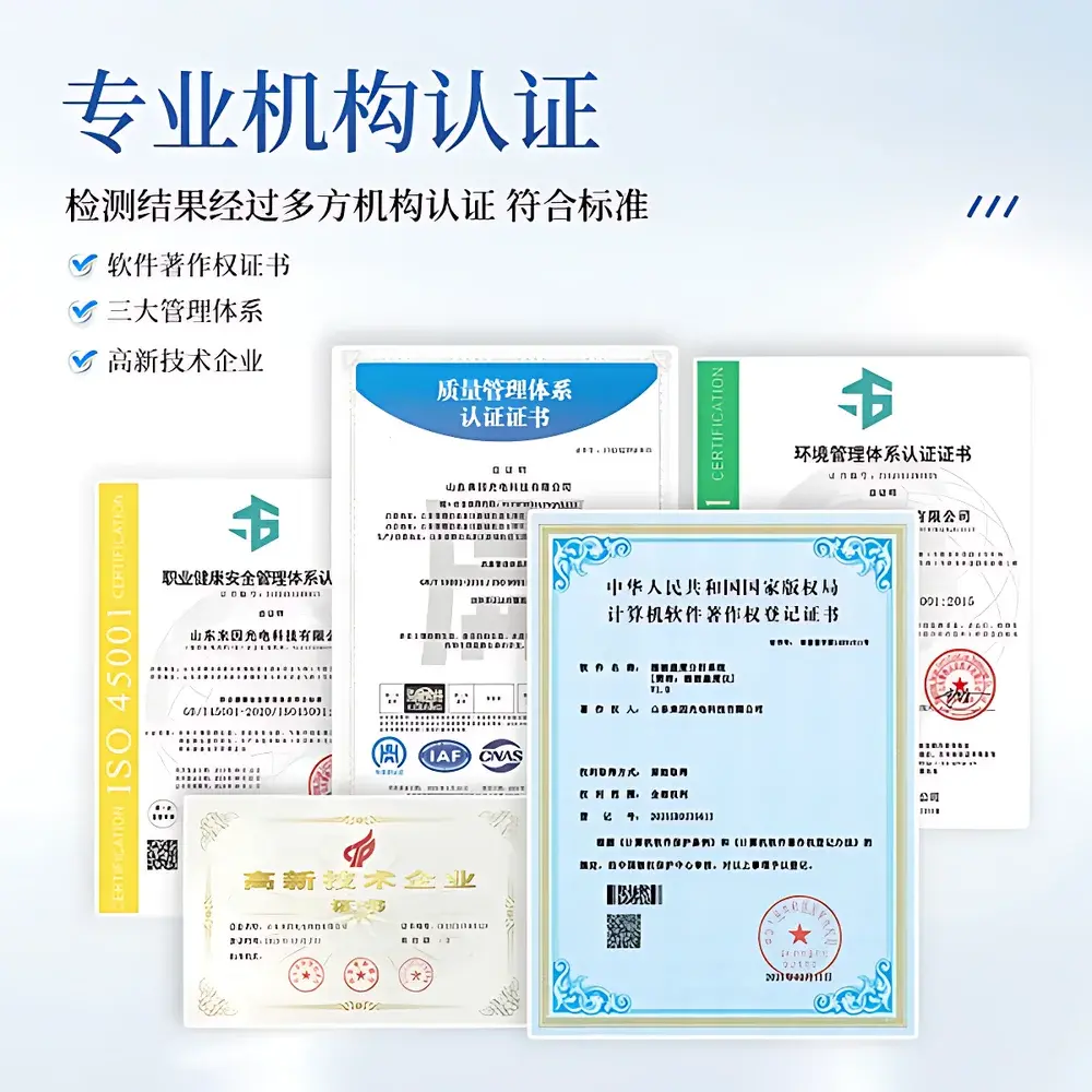
The IN-GD10 is validated for use across herbaceous canopies (e.g., grasslands, cereal crops, legume intercrops), low-stature shrublands, orchard understories, and early-successional forest floors. It is not intended for tall closed-canopy forests (>5 m height) where vertical layering introduces occlusion bias. The system adheres to standard protocols for ground-based VFC estimation as defined in ISO 19130-2:2018 (geographic information — imagery sensor models) and aligns with FAO’s Global Land Cover Mapping Guidelines for in situ validation. All analytical outputs include timestamped metadata, user-defined tolerance thresholds, and segmentation parameter records—supporting GLP-compliant documentation for environmental reporting, REDD+ monitoring, or national agricultural census programs.
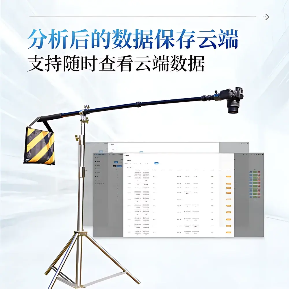
Software & Data Management
The proprietary Android application (v3.2+, API 23+) provides a traceable, version-controlled analysis environment. Each measurement session logs raw image, processed binary mask, geolocation, exposure parameters (shutter speed, ISO, aperture), and user-selected segmentation method (e.g., “HSV Green Peak”, “Soil-Veg Model v2.1”). Data export includes ZIP archives containing original JPEGs, annotated PNGs, and a structured Excel workbook (.xlsx) with columns for cover %, latitude/longitude, UTC timestamp, analysis mode, and confidence flag. Cloud synchronization (via optional COMECAUSE Cloud Portal) enables centralized dataset aggregation, cross-site trend visualization, and role-based access control—meeting baseline requirements for FDA 21 CFR Part 11–aligned electronic records when deployed in regulated agronomic trials.
Applications
- Ecological Restoration Monitoring: Quantifying post-fire or post-mining revegetation rates against baseline surveys; validating success criteria for habitat reconstruction projects.
- Agricultural Crop Vigor Assessment: Tracking seasonal canopy development in maize, wheat, soybean, and rice; detecting early-stage water stress or pest infestation via abrupt cover decline.
- Soil Erosion Risk Modeling: Providing input VFC values for RUSLE and WEPP erosion prediction models—where cover >60% reduces detachment by >85% relative to bare soil.
- Urban Green Infrastructure Auditing: Measuring street tree crown projection area, park turf density, and green roof substrate coverage for municipal sustainability reporting.
- Climate Change Impact Studies: Supporting long-term phenocam networks by standardizing ground-level cover metrics alongside NDVI time series from satellite platforms.
FAQ
What is the minimum recommended image resolution for reliable segmentation?
A minimum effective pixel count of 12 MP is advised; the bundled Canon R50 (24.2 MP) ensures sub-centimeter ground sampling distance (GSD) at 2 m working height.
Does the system require internet connectivity during field measurement?
No—Wi-Fi direct connection between Android device and camera operates independently of cellular or LAN networks.
Can I import pre-captured field images taken with other cameras?
Yes; the software accepts JPEG/PNG/BMP files with or without EXIF metadata, though geotagging and exposure traceability are only retained if embedded.
How is measurement accuracy validated?
Accuracy ≥90% is determined against manually digitized reference masks generated by three independent experts using standardized photo-interpretation guidelines (per IUCN Vegetation Classification Protocol v4.0).
Is the software compliant with data integrity standards for regulatory submissions?
The application enforces immutable metadata logging, user authentication, and revision-controlled analysis parameters—enabling compliance with ISO/IEC 17025:2017 and OECD GLP Principles when used within documented SOPs.


