COMECAUSE IN-G10 Portable Canopy Analyzer for Plant Physiology & Ecology
| Brand | COMECAUSE |
|---|---|
| Origin | Shandong, China |
| Manufacturer Type | Direct Manufacturer |
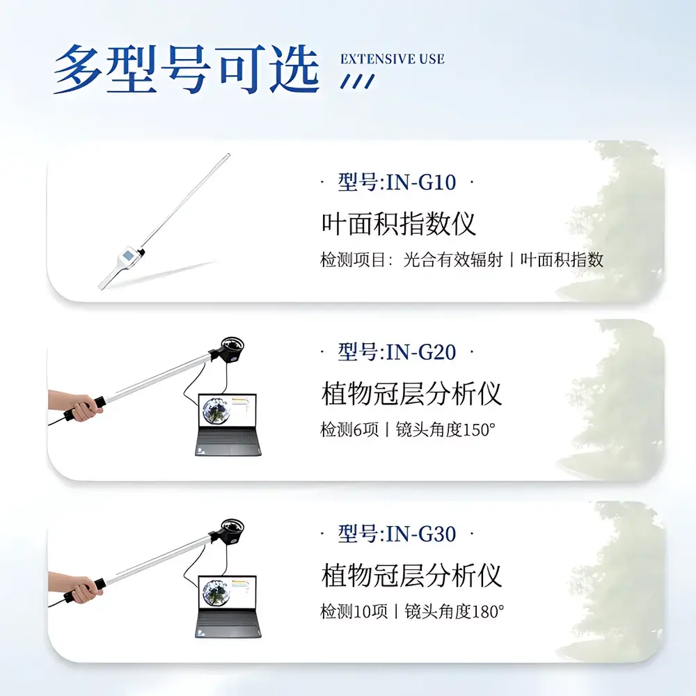
| Model | IN-G10 |
| Measurement Principle | Photosynthetically Active Radiation (PAR) Interception Method |
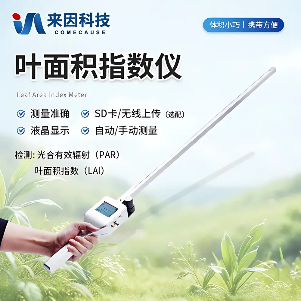
| Instrument Type | Handheld Portable |
| Spectral Range | 400–700 nm |
| PAR Sensor Resolution | 1 μmol·m⁻²·s⁻¹ |
| Operating Temperature | 0–60 °C |
| Relative Humidity | 0–100% RH |
| Power Supply | Dual 18650 Li-ion Batteries (3500 mAh each) |
| Charging Interface | USB-C, 5 V DC |
| Probe Length | 100 cm |
| Total Unit Length | 128 cm |
| Cable Length (External Sensor) | 2 m |
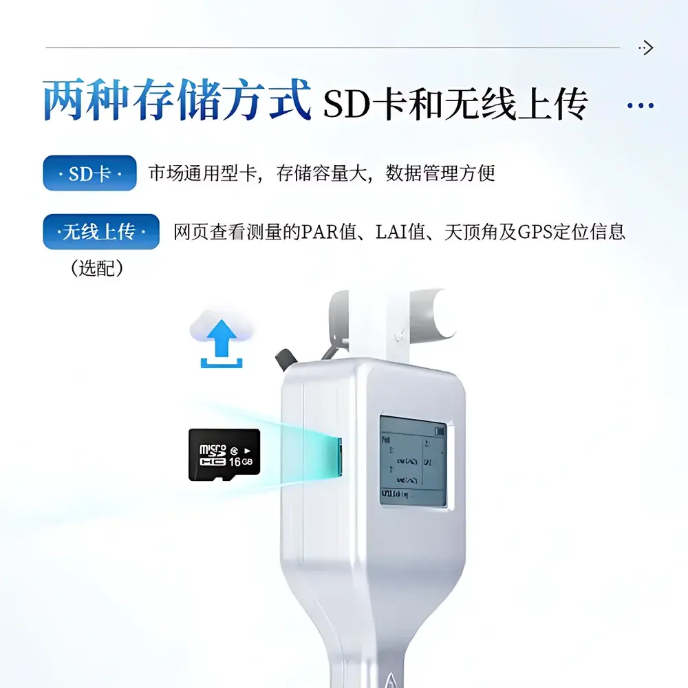
| Data Storage | 16 GB Internal + Standard SD Card Slot |
| Connectivity | Bluetooth 5.0, Optional Wi-Fi Module |
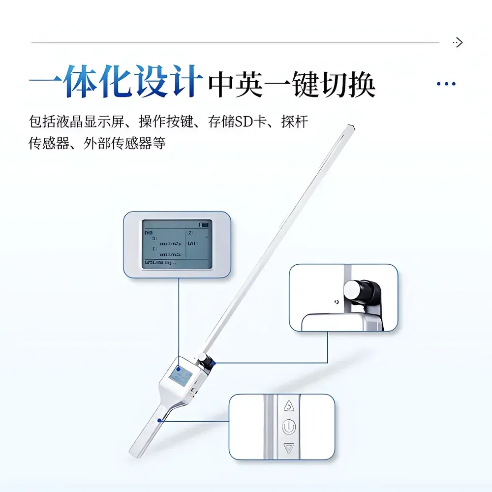
| Display | High-Brightness Touchscreen with Dual-Language UI (English/Chinese) |
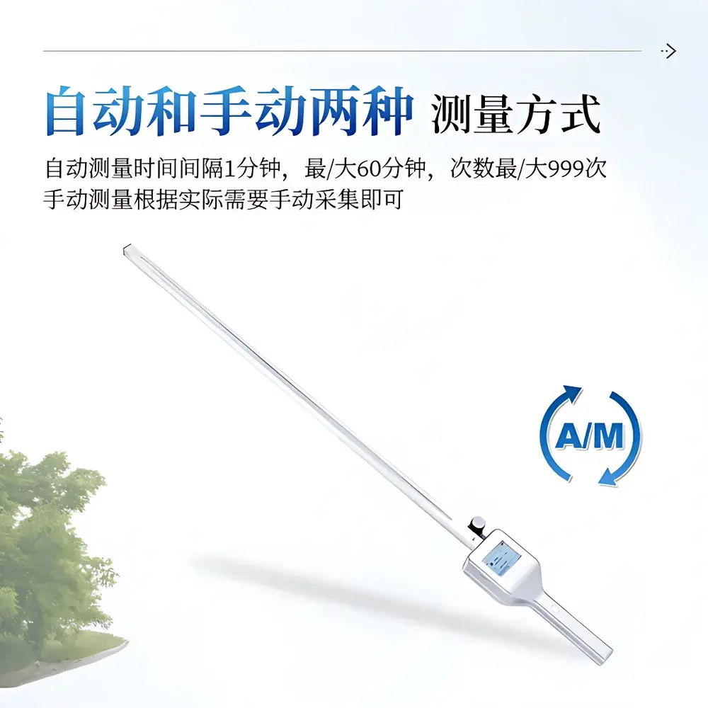
| Auto-Measurement Interval | 1–60 min (up to 999 cycles) |
| GPS Integration | Built-in GNSS Receiver for Georeferenced LAI Mapping |
Overview
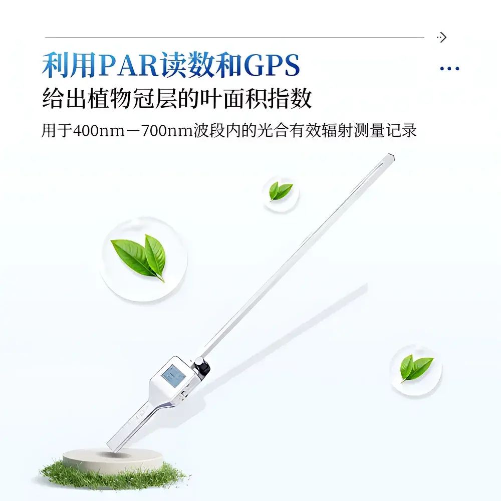
The COMECAUSE IN-G10 Portable Canopy Analyzer is an engineered field instrument designed for rapid, non-destructive assessment of plant canopy structure and light interception dynamics in situ. It operates on the photosynthetically active radiation (PAR) interception principle—measuring incident and transmitted irradiance within the 400–700 nm spectral band to derive biophysically meaningful parameters including Leaf Area Index (LAI), canopy closure, and relative light transmission profiles. Unlike laboratory-based optical scanners or destructive sampling methods, the IN-G10 enables real-time, spatially referenced measurements directly above standing vegetation—supporting high-temporal-resolution monitoring across heterogeneous agricultural fields, orchards, greenhouses, and natural ecosystems. Its measurement architecture conforms to established radiometric protocols for canopy light partitioning, aligning with ISO 11727:2022 (optical characterization of vegetation canopies) and ASTM E2913-21 (standard practice for field measurement of photosynthetic photon flux density). The device is calibrated traceably to NIST-traceable PAR standards and validated against reference quantum sensors under controlled irradiance conditions.
Key Features
- Integrated dual-sensor configuration: 80-element linear PAR sensor array mounted on a 100 cm telescoping probe for horizontal canopy profiling, plus a single high-dynamic-range (0–4000 μmol·m⁻²·s⁻¹) reference sensor for incident irradiance capture
- Ruggedized handheld enclosure rated IP65 for dust and water resistance; impact-absorbing polymer housing tested to MIL-STD-810G drop specifications (1.2 m onto concrete)
- High-brightness capacitive touchscreen with anti-glare coating—fully operable under direct sunlight (≥1000 cd/m² brightness)
- Intelligent power management system: automatic sleep/wake cycling reduces standby current to <15 μA; full charge supports ≥12 hours of continuous PAR logging at 5-minute intervals
- Onboard GNSS receiver (GPS + GLONASS + BeiDou) delivering sub-3 m CEP positional accuracy for geotagged LAI mapping and transect-based analysis
- Dual-mode data acquisition: programmable auto-sampling (1–60 min intervals) or instantaneous manual capture with visual feedback on irradiance stability
Sample Compatibility & Compliance
The IN-G10 is compatible with monocot and dicot species across diverse growth forms—including cereals (wheat, rice, maize), horticultural crops (tomato, strawberry), perennial fruit trees (apple, citrus), and native grassland or forest understory vegetation. Its probe geometry accommodates canopy heights from 0.3 m (low-stature vegetables) to 3.5 m (young orchard trees), with adjustable tilt compensation for sloped terrain. All firmware and data handling workflows comply with GLP-aligned audit trail requirements: timestamped measurements include sensor ID, calibration coefficients, battery voltage, ambient temperature, and GNSS fix status. Raw PAR time-series and derived LAI values are stored in vendor-neutral CSV and NetCDF-4 formats, facilitating interoperability with third-party ecological modeling platforms (e.g., APSIM, CropSyst, LANDIS-II). Device firmware adheres to IEC 61000-6-3 (EMC emissions) and IEC 61000-6-2 (immunity) standards for operation in electrically noisy field environments.
Software & Data Management
Data acquisition and post-processing are supported via the COMECAUSE FieldSync Desktop Suite (Windows/macOS/Linux) and companion mobile application (iOS/Android). The software implements ISO/IEC 17025-compliant uncertainty propagation for LAI calculations—accounting for sensor cosine response error, spatial heterogeneity correction factors, and sky-diffuse fraction estimation using the Goudriaan model. FieldSync provides batch processing of georeferenced transects, automatic outlier rejection based on statistical z-score thresholds (±3σ), and export of LAI raster layers compatible with QGIS and ArcGIS. Cloud synchronization uses TLS 1.3 encryption; all user accounts support role-based access control (RBAC) and optional 2FA. Audit logs record every parameter change, file export, or calibration update—meeting FDA 21 CFR Part 11 electronic record integrity requirements when deployed in regulated agronomic trials.
Applications
- Agronomic phenotyping: longitudinal tracking of LAI development curves to evaluate genotype × environment interactions in breeding programs
- Irrigation scheduling: correlating midday PAR transmission ratios with stomatal conductance proxies to optimize water use efficiency
- Pest & disease early detection: identifying localized reductions in canopy light interception preceding visible symptom expression (e.g., powdery mildew in vineyards)
- Conservation agriculture monitoring: quantifying residue cover percentage and soil surface exposure following no-till operations
- Ecosystem carbon modeling: generating ground-truth LAI inputs for upscaling eddy covariance flux tower data
- Extension service delivery: generating printable field reports with color-coded LAI deviation maps for farmer advisory sessions
FAQ
What is the measurement uncertainty for LAI derived from the IN-G10?
LAI uncertainty is ±0.25 units (k = 2) for canopies with LAI < 4.0 and ±0.4 units for LAI > 4.0, based on validation against destructive harvest and hemispherical photography across 12 crop species.
Can the IN-G10 operate under overcast or low-light conditions?
Yes—the 80-element sensor array maintains signal-to-noise ratio ≥60 dB down to 50 μmol·m⁻²·s⁻¹ incident PAR, enabling reliable measurements at dawn, dusk, or under dense cloud cover.
Is firmware upgrade supported in the field?
Yes—over-the-air (OTA) updates are delivered via Bluetooth or Wi-Fi; each release includes version-locked calibration metadata and cryptographic signature verification.
Does the device support external meteorological sensor integration?
The IN-G10 features a configurable RS-485 port compliant with Modbus RTU protocol, enabling daisy-chained connection to third-party air temperature/humidity, wind speed, or soil moisture sensors.
How is sensor calibration maintained over time?
Each unit ships with a NIST-traceable calibration certificate valid for 12 months; field recalibration is performed using the included portable PAR reference standard (model CR-REF1), requiring no return to the factory.