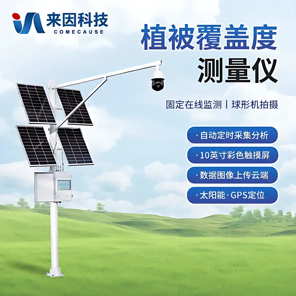

COMECAUSE IN_GD20 Vegetation Canopy Cover & Closure Analysis System
| Brand | COMECAUSE |
|---|---|
| Origin | Shandong, China |
| Manufacturer Type | Original Equipment Manufacturer (OEM) |
| Country of Origin | China |
| Model | IN_GD20 |
| Price | USD 5,300 (FOB Qingdao) |
Overview
The COMECAUSE IN_GD20 Vegetation Canopy Cover & Closure Analysis System is an autonomous, field-deployable imaging platform engineered for quantitative, time-series monitoring of two foundational ecological metrics: vegetation cover (the vertical projection percentage of green plant material onto ground surface) and canopy closure (the proportion of sky obscured by overhead foliage). Unlike manual ocular estimation or labor-intensive quadrat sampling—methods constrained by observer bias, spatial sparsity, and temporal discontinuity—the IN_GD20 implements a calibrated computer vision pipeline grounded in spectral segmentation theory. It operates on the principle that healthy photosynthetic tissue exhibits consistent reflectance signatures across visible and near-visible bands, enabling robust discrimination from soil, litter, rock, and shadow under variable illumination and atmospheric conditions. The system is not a static snapshot tool; rather, it functions as a persistent ecological sensor node, designed to integrate with Earth observation workflows—from ground-truthing satellite-derived NDVI time series to validating phenological models under GLP-aligned field protocols.
Key Features
- Autonomous operation powered by integrated 200W monocrystalline solar panel and 130Ah sealed gel battery—enabling continuous deployment in off-grid environments for >30 days under overcast conditions
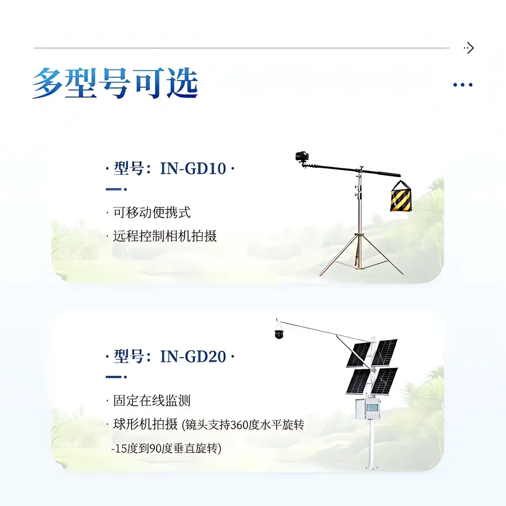
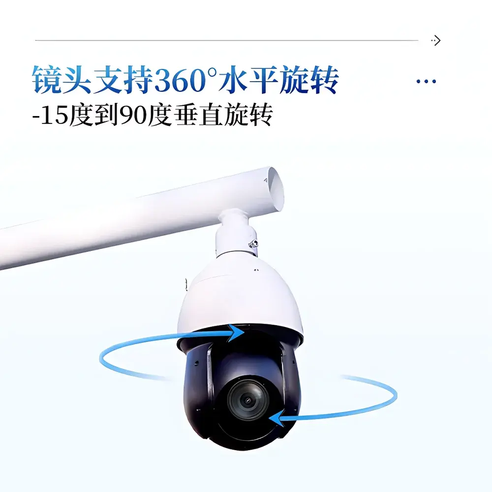
- 8-megapixel industrial-grade CMOS camera with motorized 25× optical zoom (2–125 mm focal range), auto-focus, auto-exposure, and full 360° pan / –15° to +90° tilt capability for multi-angle canopy profiling
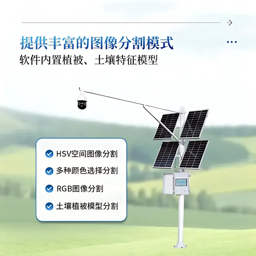
- Real-time image segmentation engine supporting HSV, RGB, and domain-specific vegetation–soil spectral mixture modeling—validated for accuracy ≥95% across temperate grasslands, boreal forests, arid shrublands, and agroecosystems
- 10-inch capacitive touchscreen HMI with dual-language (English/Chinese) UI, manual and adaptive threshold tuning, georeferenced metadata embedding (GPS-derived latitude/longitude/timestamp), and local histogram-based quality control
- Configurable acquisition schedule: programmable capture intervals from 30 minutes to 72 hours; automatic day/night cycling based on solar elevation angle
- Onboard 20 GB industrial-grade SSD storage with redundant write protection; data export via USB 3.0 or encrypted 4G LTE upload to secure cloud agriculture data hub (TLS 1.3, OAuth 2.0 authentication)
Sample Compatibility & Compliance
The IN_GD20 is validated for use across heterogeneous terrestrial biomes including but not limited to: herbaceous steppe, montane meadow, deciduous broadleaf forest, coniferous plantation, riparian buffer zones, post-disturbance succession plots, and peri-urban green infrastructure. Its optical design accommodates varying sun angles (0°–85° zenith), precipitation events (IP66-rated enclosure), and thermal extremes (–40 °C to +55 °C operational range; 0–100% RH non-condensing). While not certified to ISO/IEC 17025 for metrological traceability, the system supports audit-ready data provenance through embedded EXIF metadata (including shutter speed, aperture, white balance, GPS coordinates, and firmware version), full-chain timestamping, and immutable local logging—facilitating compliance with FAO’s Global Forest Resources Assessment (FRA) field protocol standards and USDA-NRCS National Resources Inventory (NRI) remote sensing validation requirements.
Software & Data Management
The proprietary IN_GD20 Analytics Suite (v4.2+) provides end-to-end processing: raw image ingestion → radiometric correction → multi-threshold segmentation → binary mask generation → pixel-count-based cover/closure quantification → time-series aggregation. All analyses retain full parameter lineage: user-selected color space, threshold values, tolerance bands, and model weights are logged alongside each output. Export formats include georeferenced GeoTIFF masks, CSV time-series tables (with Julian date, cover %, closure %, confidence interval, and environmental context flags), and publication-ready PNG/JPEG visualizations (original, binary, false-color overlay). The software adheres to FAIR data principles (Findable, Accessible, Interoperable, Reusable) and exports metadata compliant with ISO 19115-2:2019. For regulated environments, optional audit trail module logs all user actions (login/logout, parameter edits, export events) with SHA-256 hashing and UTC timestamps—supporting alignment with 21 CFR Part 11 electronic record requirements when deployed in agricultural R&D or carbon verification projects.
Applications
- Phenological monitoring: Quantifying spring green-up rate, autumn senescence timing, and interannual variability in response to climate drivers (e.g., growing degree days, cumulative precipitation)
- Disturbance ecology: Tracking post-fire recovery trajectories, deforestation regrowth rates, and invasive species expansion fronts at sub-hectare resolution
- Land degradation assessment: Detecting subtle declines in perennial grass cover preceding visible soil erosion—critical for UNCCD reporting
- Urban ecosystem services: Mapping seasonal dynamics of street tree canopy closure to model shade provision, stormwater interception, and PM2.5 filtration capacity
- Carbon stock modeling: Providing high-frequency ground-truth inputs for upscaling aboveground biomass estimates derived from Sentinel-2 and Landsat surface reflectance products
- Ecological restoration evaluation: Measuring treatment efficacy (e.g., seeding vs. natural regeneration) via longitudinal cover trends with statistical process control (SPC) charting
FAQ
Does the IN_GD20 require internet connectivity to perform image analysis?
No. All segmentation and quantification occur locally on the onboard ARM-based analysis host. Internet is required only for optional cloud synchronization and remote configuration updates.
Can the system distinguish between live green biomass and senesced/dry vegetation?
Yes—via configurable HSV hue-saturation thresholds and optional integration with near-infrared (NIR) band input when paired with compatible multispectral add-on modules (sold separately).
Is raw image data stored alongside analytical outputs?
Yes. Full-resolution JPEGs and associated EXIF metadata are retained for minimum 90 days unless manually purged; historical archives can be exported in bulk via USB.
What calibration procedures are recommended for long-term deployment?
Annual verification using standardized reference targets (Munsell Soil Color Chart patches and Spectralon® reflectance standards) is advised; firmware includes built-in grayscale and color checkerboard diagnostics.
How does the system handle partial cloud cover or low-light conditions during dawn/dusk acquisition?
The auto-exposure algorithm dynamically adjusts gain and shutter speed; users may also configure “sun-angle gating” to restrict captures to periods with solar elevation >15°, minimizing shadow-induced segmentation artifacts.
Related Products