COMECAUSE IN*GD20 Vegetation Cover Degree Monitoring System
| Brand | COMECAUSE |
|---|---|
| Origin | Shandong, China |
| Manufacturer Type | Direct Manufacturer |
| Country of Origin | China |
| Model | IN*GD20 |
| Price | USD 5,300 (FOB) |
Overview
The COMECAUSE IN*GD20 Vegetation Cover Degree Monitoring System is an autonomous, field-deployable imaging-based instrument engineered for quantitative, non-destructive assessment of vegetation cover fraction (VCF) and canopy closure (canopy closure index) in ecological monitoring, agricultural research, and land surface modeling applications. It operates on the principle of digital image segmentation—leveraging spectral reflectance differences between photosynthetically active vegetation and background substrates (soil, rock, litter, or bare ground)—within standardized color spaces (RGB and HSV). The system captures high-resolution imagery under variable ambient lighting conditions and applies adaptive thresholding algorithms to classify pixels as “vegetated” or “non-vegetated”, yielding statistically robust VCF estimates with ≥95% analytical accuracy validated against ground-truthed quadrat sampling protocols. Designed for unattended long-term deployment, it integrates environmental hardening, solar-renewable power, GPS-synchronized scheduling, and cloud-connected data telemetry—making it suitable for remote rangeland, alpine meadow, agroecological plot, and post-disturbance recovery monitoring.
Key Features
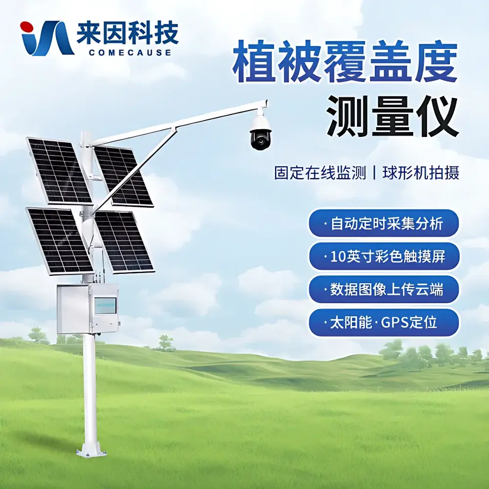
- 8-megapixel imaging module with auto-focus, auto-exposure control, and 25× motorized optical zoom (2–125 mm focal length), enabling consistent framing across heterogeneous terrain
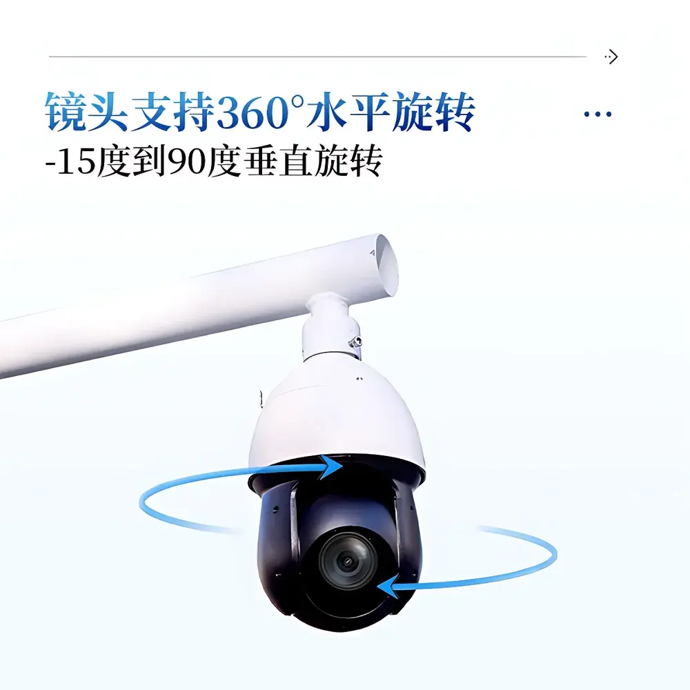
- 360° horizontal pan and –15° to +90° vertical tilt capability for flexible field-of-view configuration and multi-angle acquisition
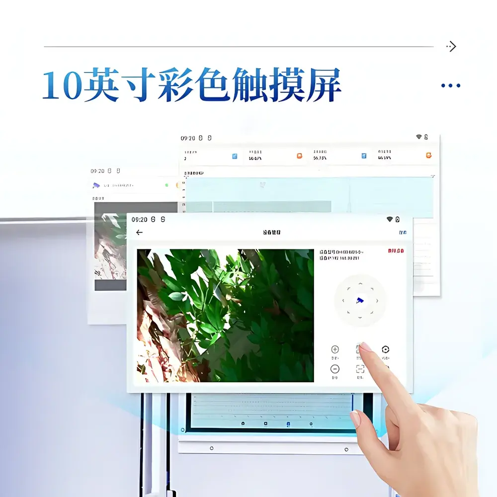
- 10-inch capacitive touchscreen display with intuitive UI supporting real-time preview, manual/automatic threshold adjustment, and on-device analysis
- Solar-powered architecture: 200 W monocrystalline PV panel + 130 Ah gel battery—engineered for continuous operation under ≤7 days of overcast conditions; AC 220 V backup input included
- GPS-enabled time-of-day scheduling: automatic daytime image capture and nighttime suspension; configurable acquisition intervals from 30 minutes to 72 hours
- Ruggedized enclosure rated IP66 for dust/water resistance; operational range: –40 °C to +55 °C, 0–100% RH
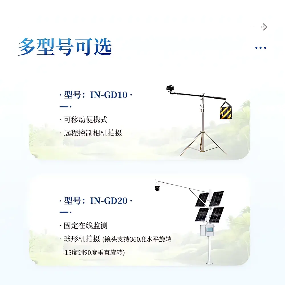
- Modular mounting system: 3 m vertical mast + 2.5 m horizontal boom (custom lengths available); rapid deployment without concrete foundation
Sample Compatibility & Compliance
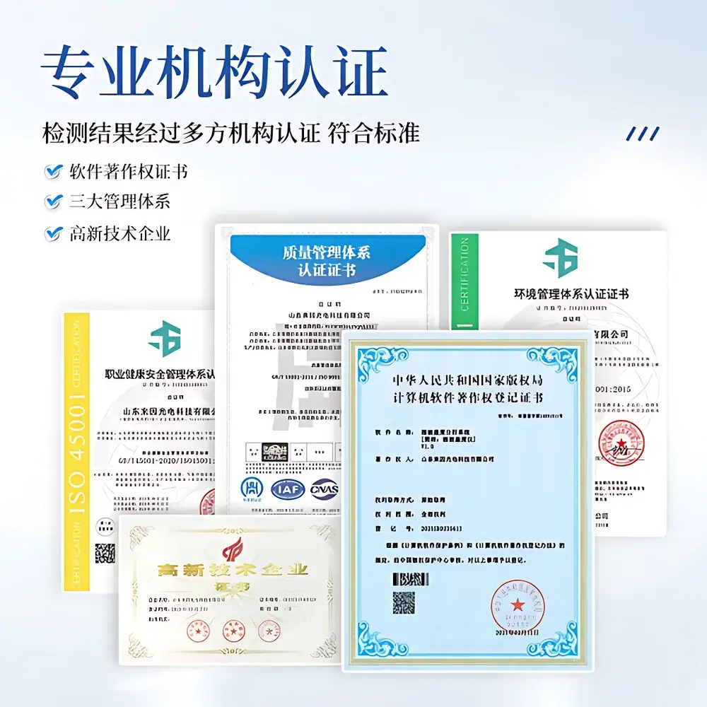
The IN*GD20 supports broad-spectrum vegetation types—including herbaceous monocots/dicots, shrubs, low-canopy trees, mosses, and lichens—across diverse soil backgrounds (sandy, loamy, clayey, rocky, or ash-covered). Its embedded vegetation–soil spectral models are calibrated using reference datasets from temperate, arid, semi-arid, and cold-steppe biomes. The system complies with ISO 19115 metadata standards for geospatial data documentation and embeds EXIF tags containing latitude, longitude, timestamp, and sensor parameters in every acquired image. All measurement outputs—including binary masks, RGB/HSV histograms, and summary statistics—are traceable to original raw images, satisfying GLP-aligned data integrity requirements for ecological long-term monitoring programs.
Software & Data Management
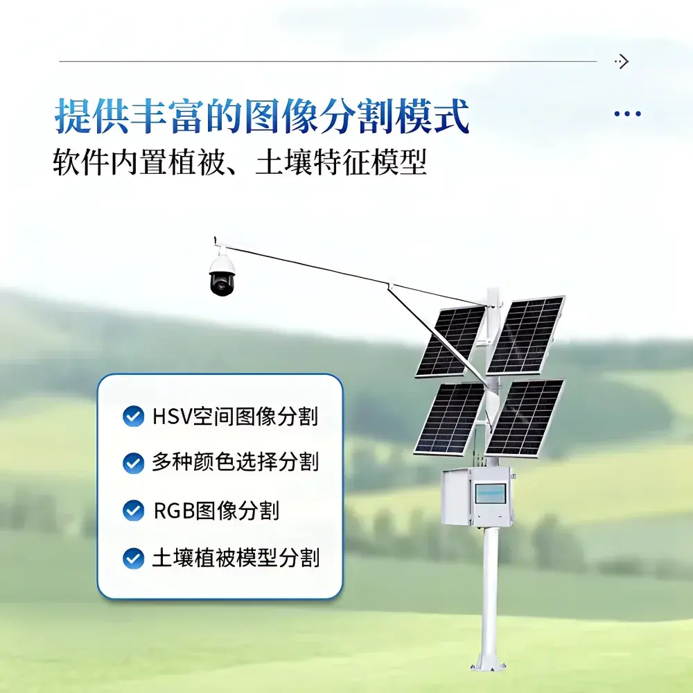
The proprietary COMECAUSE Vegetation Cover Analysis App (v3.2+) provides eight segmentation modes: automatic RGB/HSV thresholding, single/multi-color selection, pixel-based region-of-interest (ROI) masking, and physics-informed vegetation–soil dual-model classification. Each analysis session logs full provenance: tolerance values, selected color space, threshold ranges, geographic coordinates, original image, binarized output, and metadata export in CSV/Excel format. Local storage: 20 GB internal flash memory; data export via USB 3.0 or encrypted 4G LTE transmission to a secure, role-based cloud platform compliant with ISO/IEC 27001 information security standards. Audit trails record user login, parameter changes, and export events—supporting 21 CFR Part 11–aligned electronic record retention where required.
Applications
- Long-term ecological research: tracking seasonal phenology, drought-induced dieback, or post-fire succession dynamics
- Agricultural resource management: quantifying crop emergence uniformity, intercropping coverage ratios, and residue cover in conservation tillage systems
- Rangeland health assessment: estimating forage availability, erosion risk, and invasive species encroachment
- Remote sensing validation: ground-truthing satellite-derived NDVI, EVI, or fractional vegetation cover products (e.g., MOD44B, GLOBMAP)
- Environmental impact monitoring: baseline and post-construction cover assessments for infrastructure projects (roads, pipelines, wind farms)
- Educational field labs: teaching plant community structure, spatial ecology, and digital image analysis fundamentals
FAQ
What is the minimum measurable vegetation cover percentage?
The system reports cover values from 0.00% to 100.00% with 0.01% resolution—no lower detection limit is imposed by hardware; accuracy depends on image quality and scene contrast.
Can the device operate without cellular network coverage?
Yes. All image capture, onboard processing, and local storage function autonomously. 4G transmission resumes automatically when signal is restored.
Is the software compatible with third-party GIS platforms?
Exported CSV and GeoTIFF files (with embedded geotags) are interoperable with QGIS, ArcGIS Pro, ENVI, and R’s raster/sp packages.
How is data security enforced during cloud upload?
Data packets are AES-256 encrypted prior to transmission; cloud access requires two-factor authentication and role-based permissions.
Does the system support calibration against physical reference standards?
Yes. Users may import custom calibration images (e.g., printed checkerboard or known-cover synthetic targets) to refine segmentation thresholds for site-specific conditions.
Related Products


