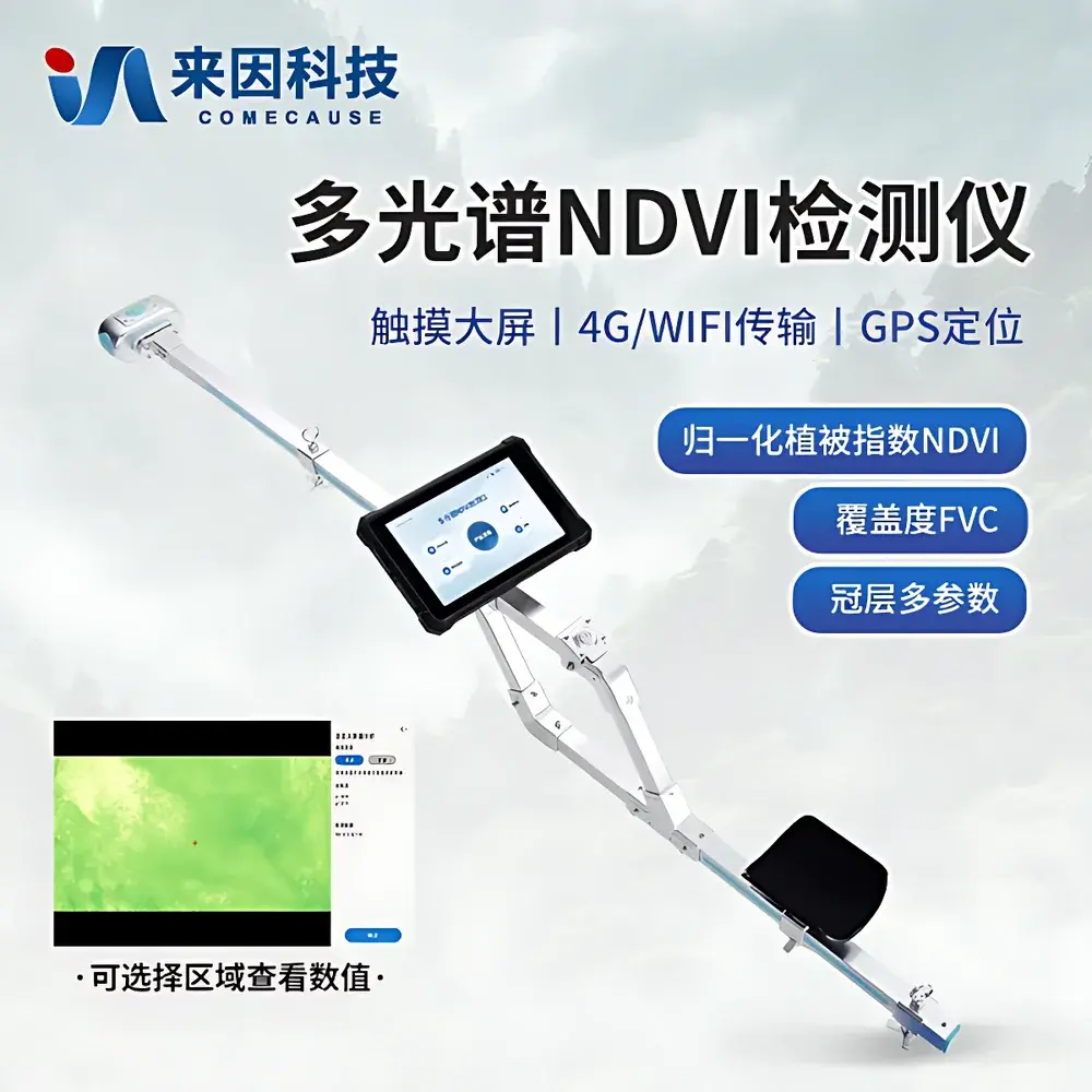
COMECAUSE IN-NDVI Multispectral NDVI Analyzer
| Brand | COMECAUSE |
|---|---|
| Origin | Shandong, China |
| Manufacturer Type | Direct Manufacturer |
| Product Category | Domestic |
| Model | IN-NDVI |
| Price | USD 12,000 (FOB) |
| Weight | 3.0 kg |
| Overall Length | 140 cm |
| Operating Temperature | −20 °C to +60 °C |
| Operating Humidity | 0–95% RH (non-condensing) |
| Battery | 5550 mAh Li-ion, ~7 h continuous operation |
| Display | 8-inch 700-nit outdoor-readable capacitive touchscreen |
| OS | Android 12 |
| Memory | 16 GB RAM, 256 GB internal storage + 240 GB dedicated image/data partition |
| Connectivity | GPS/Beidou, 4G LTE, Wi-Fi 5, Bluetooth 5.0 |
| Sensors | RGB CMOS (5 MP, 80° FOV), NIR sensor (8 MP, 80° FOV, 650 nm ±5 nm red / 850 nm ±5 nm NIR, FWHM ≤10 nm), 180° fisheye lens for canopy imaging |
| Angular Measurement | Roll 0–360°, Pitch 0–90°, Azimuth with real-time overlay |
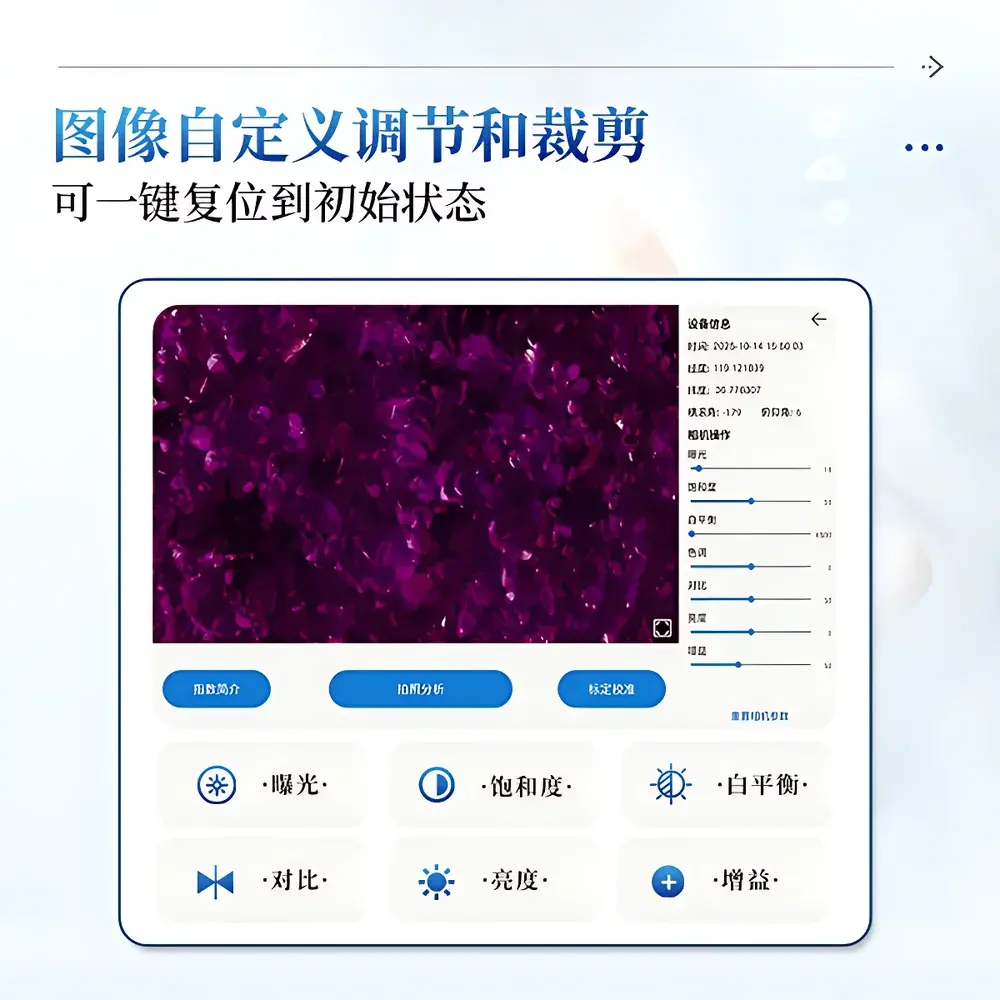
| Image Processing | Adjustable exposure, saturation, white balance, contrast, brightness, gain |
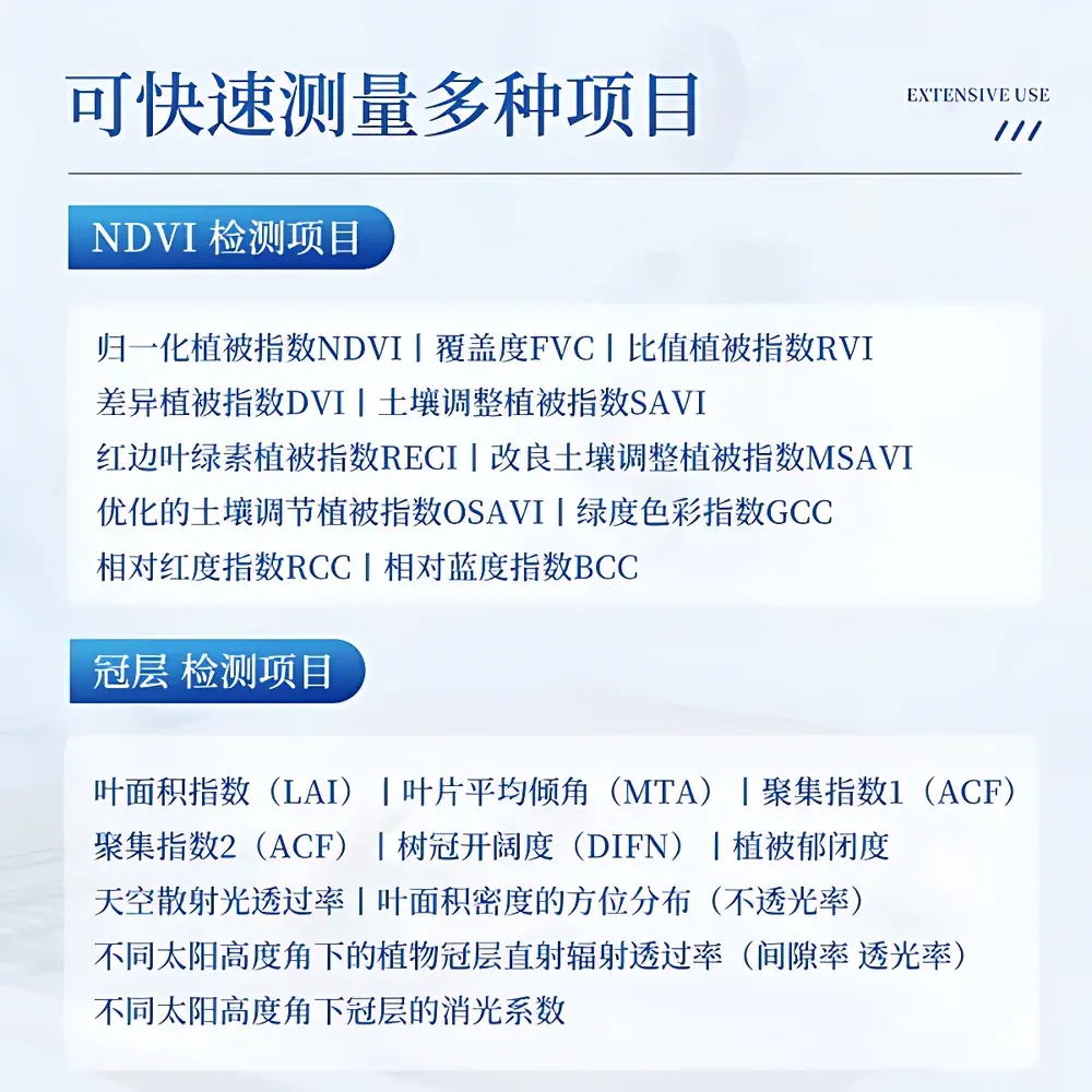
| Data Output | NDVI, FVC, RVI, DVI, SAVI, MSAVI, OSAVI, RECI, GCC, RCC, BCC |
| Analysis Modes | Ground-up & top-down canopy capture |
| Data Export | Excel reports, raw images, pseudocolor maps, metadata-rich TIFF/JPEG to USB |
| Security | Admin password protection, audit-ready local logging |
Overview
The COMECAUSE IN-NDVI Multispectral NDVI Analyzer is a field-deployable, handheld phenotyping instrument engineered for quantitative, non-destructive assessment of plant canopy structure and physiological status. It operates on the fundamental biophysical principle that healthy photosynthetic tissue exhibits strong absorption in the red spectral band (~650 nm) and high reflectance in the near-infrared (NIR) band (~850 nm), while stress-induced chlorophyll degradation or structural changes alter this spectral signature. The device captures co-registered RGB, red, and NIR imagery simultaneously using calibrated, narrowband sensors (FWHM ≤10 nm), computes the normalized difference vegetation index (NDVI = (NIR − Red)/(NIR + Red)) in real time, and extends analysis to 11 additional spectral indices—including SAVI, OSAVI, RECI, and GCC—each optimized for specific vegetation conditions or soil background correction. Unlike passive optical meters or single-band reflectometers, the IN-NDVI integrates fisheye-based hemispherical canopy imaging with directional angular segmentation (0–90° zenith, 360° azimuth, 10×10 grid), enabling rigorous estimation of leaf area index (LAI), mean tilt angle (MTA), canopy clumping (ACF), and radiation transmission profiles under variable solar geometry. Its architecture conforms to the measurement traceability framework used in ecological monitoring networks, supporting GLP-aligned field protocols through embedded GNSS geotagging, sensor orientation metadata, and timestamped audit logs.
Key Features
- Tri-sensor optical module: 5 MP RGB CMOS (80° FOV), 8 MP monochrome NIR sensor (650 nm & 850 nm bands, ±5 nm center wavelength, FWHM ≤10 nm), and 180° full-hemispheric fisheye lens for gap fraction analysis
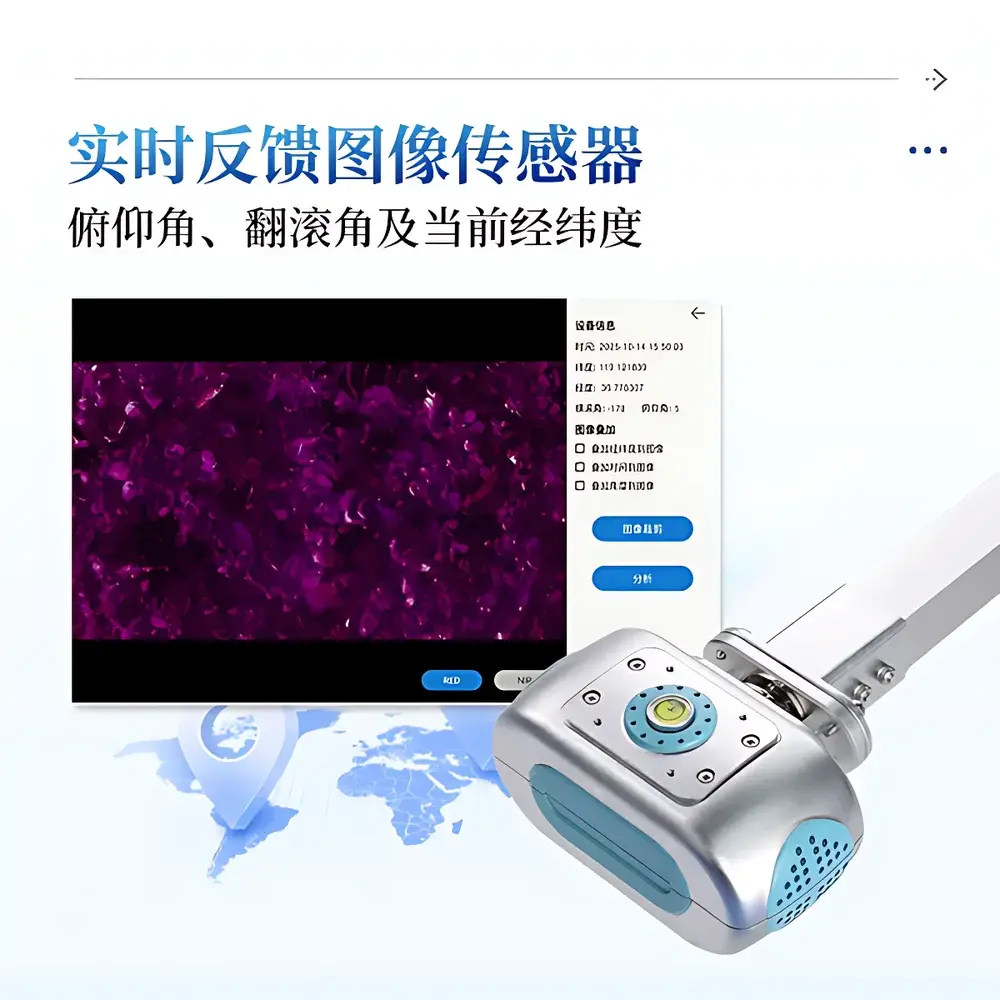
- Real-time angular metadata fusion: Integrated 9-axis IMU delivers roll (0–360°), pitch (0–90°), and azimuth data—automatically overlaid on all captured images and embedded in EXIF headers
- Dual-mode canopy analysis: Supports both upward-looking (ground-based) and downward-looking (elevated/platform-mounted) acquisition for consistent LAI, DIFN, and extinction coefficient derivation per ISO 11727 and ASTM E2933 standards
- Adaptive thresholding engine: Eliminates manual threshold selection bias by applying Otsu’s method combined with vegetation-specific histogram constraints during FVC and LAI segmentation
- Ruggedized field interface: 8-inch 700-nit sunlight-readable touchscreen with glove-compatible touch response, IP54-rated enclosure, and ergonomic shoulder strap + elbow brace system for extended survey operations
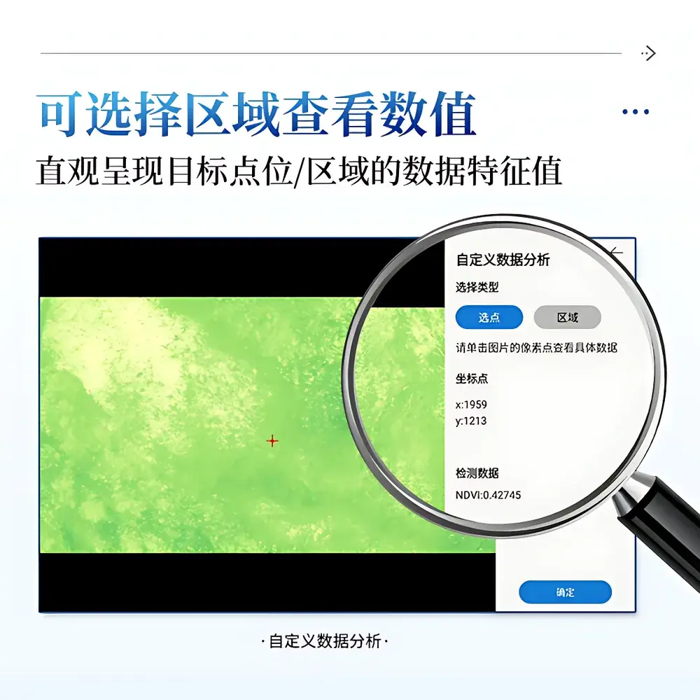
- On-device computational pipeline: Android 12 OS with dedicated GPU-accelerated image processing library; supports region-of-interest masking to exclude edge rows, bare soil patches, or non-canopy artifacts prior to index calculation
Sample Compatibility & Compliance
The IN-NDVI is validated for use across terrestrial vegetation types including herbaceous crops (maize, wheat, soybean), perennial grasslands, shrublands, and broadleaf/coniferous forest understories. It complies with the spectral bandpass definitions specified in USDA ARS protocol 2021-01 for field NDVI instrumentation and meets the angular sampling resolution requirements outlined in FAO’s “Guidelines for Remote Sensing-Based Crop Monitoring” (2022). All spectral calibrations are traceable to NIST-traceable reference panels (Spectralon® 99% reflectance), with factory calibration certificates provided per unit. Data export formats (CSV, GeoTIFF, annotated JPEG) adhere to ISO 19115 metadata schema conventions. The device satisfies electromagnetic compatibility (EMC) requirements per IEC 61326-1 and operates within safety limits defined by ICNIRP for Class 1 optical radiation.
Software & Data Management
Data acquisition, preprocessing, and reporting are managed through the proprietary COMECAUSE FieldPheno™ application, preinstalled on the device. The software implements FDA 21 CFR Part 11-compliant audit trails: every index calculation, parameter adjustment, or ROI definition is logged with user ID, timestamp, GPS coordinates, and sensor orientation. Raw multispectral stacks and processed outputs (NDVI rasters, FVC binary masks, LAI depth profiles) are stored locally in an encrypted 240 GB partition with automatic cyclic overwrite protection. Export options include USB mass storage mode (Excel .xlsx reports, uncompressed TIFFs, pseudocolor PNGs) and secure TLS 1.3–encrypted 4G upload to the COMECAUSE AgriCloud™ platform—accessible via role-based web portal with RESTful API for integration into farm management information systems (FMIS) or GIS workflows. Custom statistical dashboards support temporal aggregation (daily/weekly/monthly), comparative zone analysis, and export of trend visualizations (line/bar charts) compliant with ISO 14064-1 GHG accounting frameworks.
Applications
- Precision agriculture: Generation of variable-rate application (VRA) maps for nitrogen fertilization and irrigation scheduling based on spatial NDVI gradients and temporal delta-NDVI thresholds
- Ecological monitoring: Long-term tracking of grassland degradation, forest canopy closure dynamics, and wetland vegetation succession under IPCC AR6 land-use change scenarios
- Crop breeding trials: High-throughput phenotyping of segregating populations for drought tolerance, early vigor, and canopy architecture traits under field conditions
- Disaster impact assessment: Rapid post-event quantification of drought-induced NDVI depression, flood-related canopy submergence, or fire-scarred LAI loss—aligned with UN OCHA Common Operational Datasets (CODs)
- Carbon sequestration verification: Supporting MRV (monitoring, reporting, verification) for afforestation/reforestation projects by linking NDVI-derived FVC and LAI trends to biomass accumulation models (e.g., GLOBCARBON)
FAQ
Does the IN-NDVI require external calibration before each use?
No. Factory spectral and geometric calibration is retained across power cycles. Users may perform optional field validation using supplied Spectralon® reference tiles; calibration coefficients remain locked unless explicitly reset by administrator credentials.
Can the device operate under full cloud cover or low-light conditions?
Yes. While optimal NDVI accuracy is achieved under clear-sky illumination (solar zenith angle < 60°), the high-sensitivity NIR sensor and adaptive gain control enable robust measurements down to 10,000 lux ambient irradiance. Cloud-induced diffuse light does not invalidate NDVI, as the index is ratio-based and inherently insensitive to absolute irradiance levels.
How is geolocation accuracy ensured during data collection?
Dual-frequency GPS/Beidou receiver provides horizontal positional accuracy of ≤1.5 m CEP (95%) under open-sky conditions. Each image and index value is tagged with WGS84 coordinates, UTC timestamp, and dilution of precision (DOP) metrics—exported in standard EXIF/GPS tags and CSV metadata files.
Is raw sensor data accessible for third-party algorithm development?
Yes. Unprocessed 16-bit TIFF stacks (RGB, Red, NIR) are available via USB export. Radiometric calibration parameters (dark current, gain, spectral response curves) are provided in JSON format upon request for radiative transfer modeling or custom index development.
What regulatory documentation accompanies the instrument for institutional procurement?
Each unit ships with CE Declaration of Conformity, RoHS compliance statement, NIST-traceable calibration certificate, ISO 9001:2015 manufacturing quality assurance record, and full technical manual compliant with IEC 62304 for medical-grade software lifecycle management (applicable to embedded firmware).


