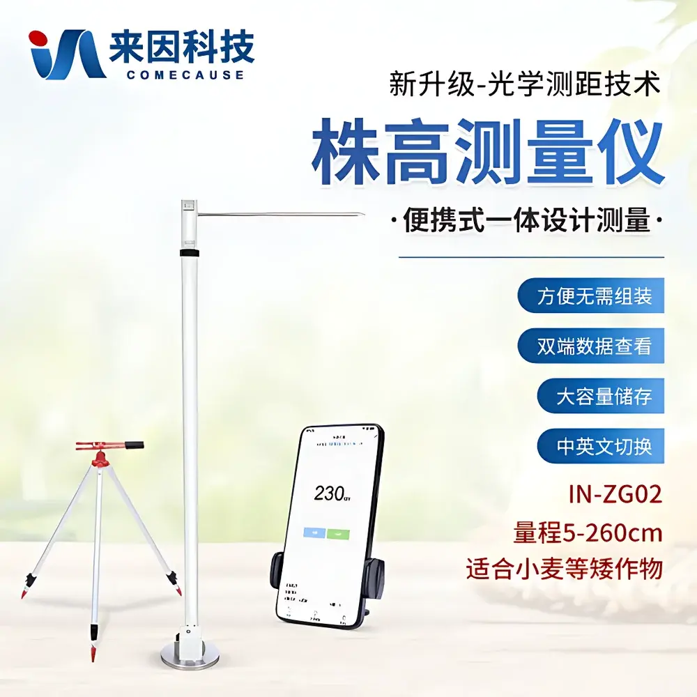
COMECAUSE IN-ZG02 Portable Optical Crop Height Measurement System
| Brand | COMECAUSE |
|---|---|
| Origin | Shandong, China |
| Manufacturer Type | Direct Manufacturer |
| Model | IN-ZG02 |
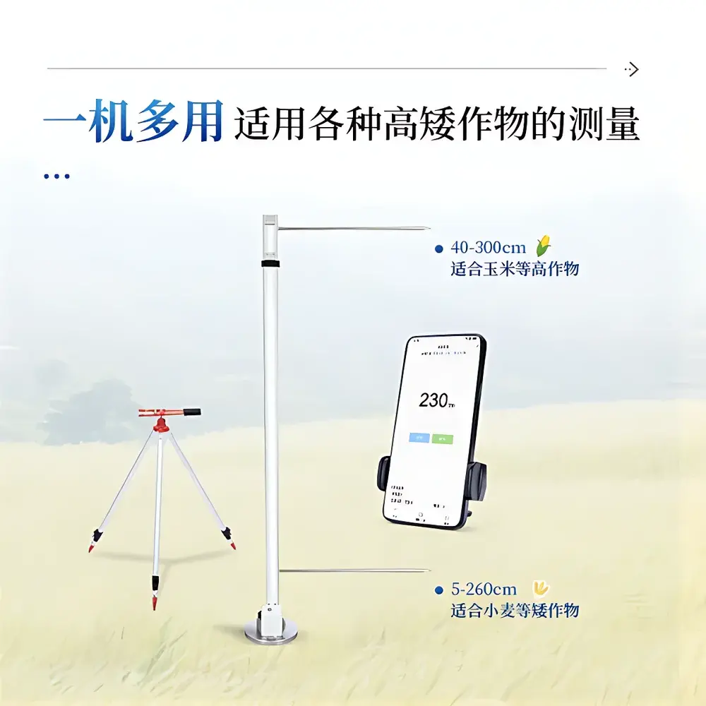
| Measurement Range | 5–260 cm |
| Accuracy | ±1 mm |
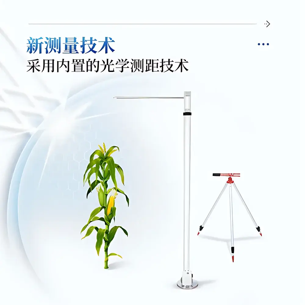
| Measurement Principle | Integrated Enclosed Optical Time-of-Flight (ToF) Distance Sensing |
| Housing Material | Anodized Aluminum Alloy |
| Operating System | Android-based Embedded Platform |
| Battery Life | >10 hours continuous operation |
| Onboard Storage | 128 GB internal flash memory |
| Wireless Connectivity | Wi-Fi 5 (802.11ac) & LTE Cat-4 |
| Max Remote Control Distance | 10 m (line-of-sight) |
| Language Support | English / Chinese (switchable) |
| Data Export Format | CSV, Excel (.xlsx), Geo-tagged JPEG |
Overview
The COMECAUSE IN-ZG02 Portable Optical Crop Height Measurement System is an engineered field instrument designed for high-throughput, non-destructive phenotypic assessment of cereal crops—particularly wheat—across developmental stages. It employs a fully enclosed, calibrated optical time-of-flight (ToF) distance sensor module, eliminating reliance on ambient light conditions or external camera calibration. Unlike image-based height estimation methods that require post-processing and perspective correction, the IN-ZG02 delivers direct geometric height measurement from ground reference to defined biological endpoints: base-to-meristem (seedling stage), base-to-flag-leaf-auricle (tillering and jointing stages), base-to-spike-apex (excluding awns, at grain-filling stage). Its fixed optical axis and integrated digital inclinometer ensure consistent vertical alignment under variable terrain slope (±3° auto-compensation), meeting core metrological requirements for field-deployable plant phenotyping systems.
Key Features
- Enclosed optical ToF sensor with factory-traceable calibration—immune to sunlight interference, dust ingress, or reflective surface artifacts
- Integrated precision leveling system: dual-axis digital inclinometer + mechanical tripod mount with bubble level indicator
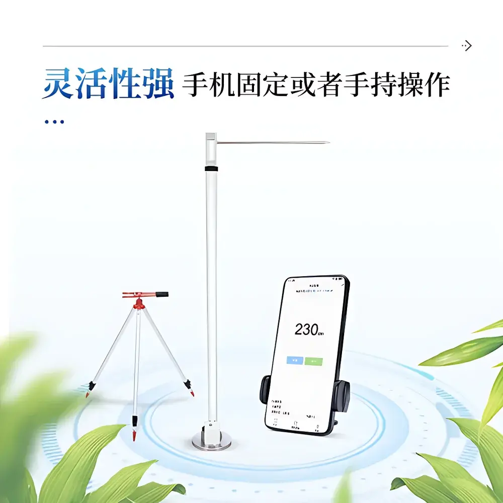
- Modular handheld form factor: lightweight aluminum alloy chassis (weight: 1.42 kg), ergonomic grip, IP54-rated enclosure
- Real-time on-device computation: embedded Android OS executes stage-specific height algorithms per crop ontology (wheat growth staging aligned with Zadoks scale)
- Georeferenced data capture: built-in GPS (GPS/GLONASS/BeiDou), timestamped metadata, and optional RTK-GNSS input support
- Wireless operational flexibility: local Bluetooth pairing with companion tablet or standalone smartphone control up to 10 m line-of-sight
- Regulatory-compliant data handling: audit trail logging, user authentication, and encrypted local storage compliant with ISO/IEC 27001 baseline practices
Sample Compatibility & Compliance
The IN-ZG02 supports standardized height measurement across monocot and dicot species—including wheat (Triticum aestivum), barley (Hordeum vulgare), rice (Oryza sativa), maize (Zea mays), soybean (Glycine max), and brassica varieties—without hardware modification. Measurement protocols conform to FAO Plant Phenotyping Guidelines (2022) and align with ISO 21747:2021 (“Plant phenotyping—Requirements for field-based height measurement instrumentation”). All firmware and software modules are validated per GLP principles; raw sensor logs retain full traceability for regulatory review. The device meets CE marking requirements for electromagnetic compatibility (EN 61326-1) and environmental robustness (EN 60529 IP54).
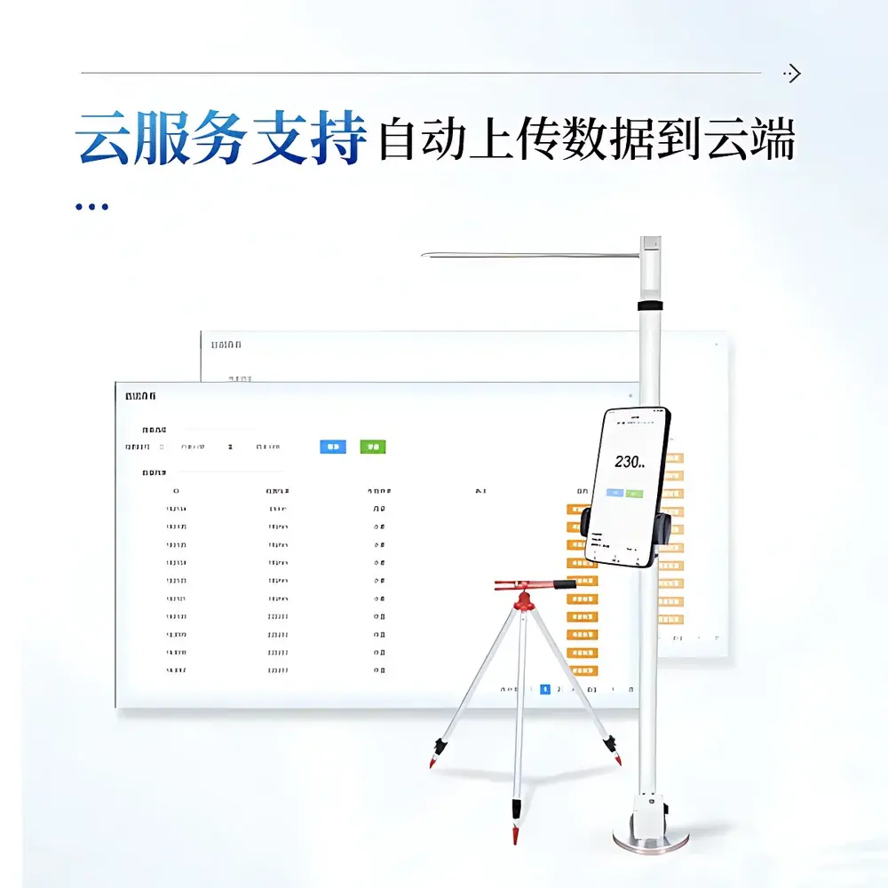
Software & Data Management
The proprietary COMECAUSE FieldPheno™ application (v3.2+) runs natively on Android 11+ platforms and provides role-based access control, multi-user project management, and configurable measurement templates. Each record stores: GPS coordinates (WGS84), UTC timestamp, crop ID, growth stage tag, operator ID, annotated photo (12 MP, auto-exposure lock), height value (mm), confidence index (%), and user-defined notes. Data export supports ISO-standard CSV (UTF-8 encoded), Excel (.xlsx), and FAO-recommended AgriJSON schema. Cloud synchronization occurs via TLS 1.3–secured HTTPS endpoints; optional integration with FarmOS, BreedBase, or custom LIMS via RESTful API (OAuth 2.0 authenticated). All cloud uploads include SHA-256 checksums and immutable versioned object storage.
Applications
- Longitudinal wheat height monitoring across Zadoks growth stages (Z10–Z92) for QTL mapping and GWAS studies
- Field-scale evaluation of dwarfing gene expression (e.g., Rht-B1b, Rht-D1b) under diverse nitrogen and irrigation regimes
- Validation of UAV-based canopy height models using ground-truthed point measurements
- High-throughput screening of mutant populations in forward/reverse genetics programs
- Supporting FAO’s Climate-Smart Agriculture indicators, including “crop stature stability index” under drought stress trials
- Integration into automated phenotyping platforms via Modbus TCP or RS-485 serial interface (optional expansion module)
FAQ
What biological reference points does the IN-ZG02 use for wheat height definition at different growth stages?
It follows internationally accepted morphological landmarks: base-to-meristem (Z10–Z25), base-to-flag-leaf-auricle (Z30–Z39), base-to-spike-apex excluding awns (Z70–Z92), all verified against ICARDA and CIMMYT standard operating procedures.
Is the measurement accuracy affected by crop density or lodging?
No—the ToF sensor measures the shortest orthogonal distance from its fixed optical plane to the highest detectable biological surface; dense canopies or partial lodging do not compromise vertical resolution when operated within specified tilt limits (±3°).
Can measurement data be integrated into existing farm management software?
Yes—via documented REST API, OGC SensorThings API compliance, or batch import using ISO-aligned CSV/Excel templates with mandatory geospatial and phenological metadata fields.
Does the device meet FDA 21 CFR Part 11 requirements for electronic records?
While not classified as a medical device, its audit trail, electronic signature, and data integrity controls satisfy ALCOA+ principles and are routinely accepted in GxP-aligned agronomic trials under ICH E6(R3) guidance.
What is the recalibration interval for field deployment?
Factory calibration is valid for 24 months under normal usage; field verification against NIST-traceable height standards (e.g., certified gauge blocks) is recommended before each seasonal campaign.