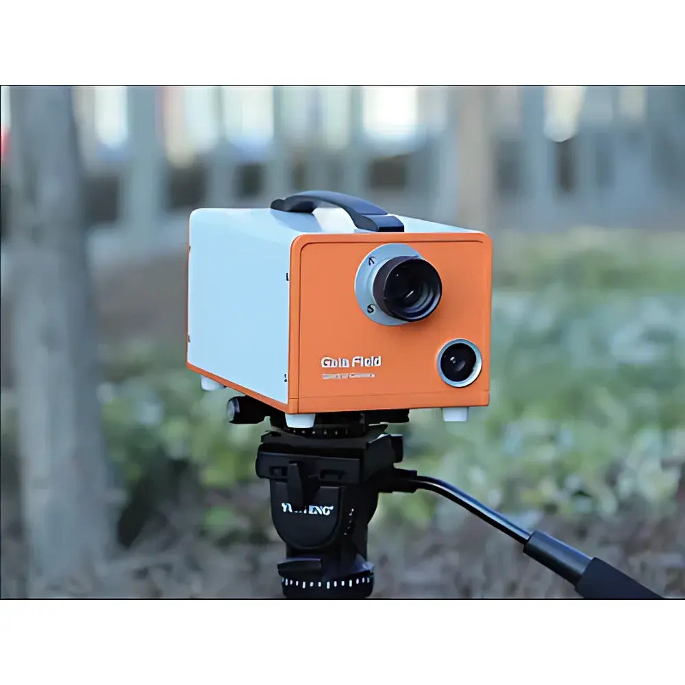
Dualix Spectral Imaging GaiaField Portable Hyperspectral Imager
| Brand | Dualix Spectral Imaging |
|---|---|
| Origin | Sichuan, China |
| Manufacturer Type | Authorized Distributor |
| Model | GaiaField |
| Operating Principle | Push-broom |
| Imaging Mode | 3D spatial-spectral data cube |
| Deployment | Ground-based |
| Spectral Range | 400–1000 nm (visible to near-infrared) |
| Spectral Resolution | <3 nm (VIS), ≤5 nm (NIR) |
| Spatial Resolution (IFOV) | Configurable via interchangeable lenses |
| Field of View (TFOV) | Lens-dependent |
| Frame Rate | Up to 120 fps (at full resolution, system-limited) |
| Battery Life | >4 hours continuous operation |
| Environmental Rating | IP5X dust resistant, IP1X water resistant |
| Interface | USB 3.0 |
| Data Format | ENVI-compatible BIL/BIP, TIFF, and raw binary |
| OS Compatibility | Windows 7/8/10 (32- & 64-bit) |
| Calibration | Radiometric, reflectance, flat-field, lens distortion, and non-uniformity correction |
Overview
The Dualix Spectral Imaging GaiaField is a field-deployable push-broom hyperspectral imager engineered for high-fidelity spectral-spatial data acquisition in both laboratory and outdoor environments. It operates on the principle of spatial scanning combined with dispersive spectroscopy: as the instrument moves relative to the target (or vice versa), a slit aperture admits light into a high-throughput imaging spectrometer, where collimated light is dispersed by a precision diffraction grating and reimaged onto a scientific CMOS sensor. This architecture yields a three-dimensional data cube—two spatial dimensions (x, y) and one spectral dimension (λ)—with over 700 contiguous spectral channels across the 400–1000 nm range. The system’s core components include a multi-axis motion controller, a calibrated hyperspectral camera module, and a suite of interchangeable f/2.0 C-mount lenses. Designed for operational robustness and measurement repeatability, the GaiaField supports quantitative reflectance and radiance analysis under variable ambient illumination, making it suitable for applications requiring trace-level spectral discrimination and spectral unmixing.
Key Features
- One-button automation suite: fully integrated auto-exposure, auto-focus, auto-scan-speed matching, and on-device data saving
- Dual-camera workflow: primary hyperspectral sensor + auxiliary HD visible-light camera for real-time region-of-interest monitoring, slit position overlay, and saturation warning
- Integrated rechargeable battery pack enabling >4 hours of uninterrupted field operation without external power
- Onboard radiometric calibration and reflectance correction pipelines—including flat-field, lens distortion, and non-uniformity compensation
- Modular optical design supporting rapid lens interchange (e.g., 12 mm, 25 mm, 50 mm focal lengths) to adapt spatial sampling to working distance and target scale
- USB 3.0 plug-and-play interface—no external frame grabber or power supply required
- Native support for industry-standard data formats (ENVI BIL/BIP, GeoTIFF, raw binary) ensuring seamless integration with SpecSight, ENVI, ERDAS, and Python-based spectral libraries (e.g., scikit-image, spectral)
- Compliance with Windows 7–10 (32-/64-bit); driver-signed and digitally verified for stable long-term deployment
Sample Compatibility & Compliance
The GaiaField is optimized for ground-based static and mobile platforms—including handheld operation, tripod mounting, UAV-integrated gimbals (via optional adapter), and vehicle-mounted survey rigs. Its spectral response covers the full visible-to-NIR continuum (400–1000 nm), aligning with ASTM E308-22 (standard practice for computing color using tristimulus values) and ISO 11664-6 (CIE standard for spectral data exchange). While not certified for regulatory submission per se, its radiometric stability and calibration traceability support GLP-compliant documentation workflows when paired with NIST-traceable reference panels (e.g., Spectralon® 99% reflectance standards). The IP5X/IP1X enclosure rating ensures functional reliability in dusty field conditions typical of agricultural, geological, and forensic deployments—though extended exposure to precipitation or high-humidity environments requires supplemental weatherproofing.
Software & Data Management
The bundled GaiaField Control Suite provides deterministic acquisition control, real-time preview, and embedded preprocessing. All calibration routines—including dark current subtraction, pixel response normalization, and geometric rectification—are applied during acquisition or post-capture with user-selectable non-destructive toggling. Metadata embedding follows the ENVI header standard and includes GPS timestamp (if external GNSS receiver connected), exposure duration, lens ID, and ambient irradiance estimates. Audit trails are maintained for all calibration parameter modifications. For regulated environments, the software supports export to CSV and HDF5 formats compatible with FDA 21 CFR Part 11–compliant LIMS systems when deployed with third-party electronic signature and version-control middleware. No cloud dependency or telemetry transmission occurs by default—data sovereignty is preserved on local storage.
Applications
- Military & defense: camouflage detection, material identification, and spectral signature library development under natural illumination
- Agricultural remote sensing: crop health assessment (NDVI, PRI, MCARI), nutrient deficiency mapping, and weed-species classification at sub-meter resolution
- Environmental monitoring: water quality analysis (chlorophyll-a, CDOM, turbidity), soil organic carbon estimation, and wetland vegetation typing
- Cultural heritage science: pigment identification in frescoes and manuscripts, degradation mapping of varnishes, and underdrawing visualization
- Forensic investigation: bloodstain differentiation, ink aging analysis, and latent print enhancement without chemical treatment
- Industrial sorting: pharmaceutical tablet coating uniformity, plastic polymer identification, and food contaminant screening
FAQ
What spectral calibration standards are supported?
The system ships with factory-applied wavelength calibration using Hg-Ar lamp lines; users may perform field recalibration using portable LED-based spectral references (e.g., Ocean Insight PX-2) via the built-in calibration wizard.
Can the GaiaField be synchronized with external GNSS or IMU units?
Yes—via TTL-triggered PPS input and ASCII NMEA 0183 serial port (RS-232), enabling georeferenced data cubes when integrated with RTK-grade positioning hardware.
Is real-time spectral unmixing available onboard?
No—onboard processing is limited to radiometric correction and preview rendering; full endmember extraction and linear unmixing require post-processing in ENVI or custom Python workflows.
What is the minimum working distance for macro-scale imaging?
With the 50 mm lens and optional close-up adapter, the system achieves IFOV ≤ 0.5 mrad, enabling sub-centimeter spatial sampling at 1 m standoff distance.
Does the system comply with CE or FCC electromagnetic compatibility directives?
Yes—the device carries CE marking (EMC Directive 2014/30/EU and RoHS 2011/65/EU) and FCC Part 15 Class B certification for commercial electromagnetic environment operation.