GeoVISION Underground Manhole Inspection System by Allegheny
| Brand | Allegheny |
|---|---|
| Origin | USA |
| Model | GeoVISION |
| Construction | PVC or Stainless Steel Housing |
| Camera Diameter | 19 mm (Nano), 29 mm, or 41 mm |
| Lens Options | Single-lens (color or monochrome) or Dual-lens (360° panoramic imaging) |
| Cable Length Options | 100 m to 600 m |
| Winch Type | Manual (plastic or steel) or Motorized |
| Monitor | 7-inch high-resolution waterproof display |
| Depth Rating | Up to 600 m |
| Compliance | IP68 submersible rating |
| Power & Control | Integrated control panel with depth-sensing OSD (optional), portable tripod support, field-replaceable optics |
Overview
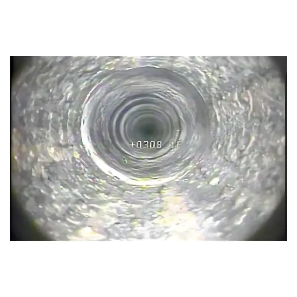
The GeoVISION Underground Manhole Inspection System is a purpose-engineered, submersible video inspection platform designed for non-destructive visual assessment of confined underground infrastructure—including sewer lines, storm drains, utility vaults, lift stations, and access shafts. Built on a modular architecture, the system operates on real-time coaxial or fiber-optic video transmission principles, delivering stable, low-latency imagery under challenging hydraulic and mechanical conditions. Its core measurement capability is not quantitative in the metrological sense, but rather qualitative and diagnostic—providing high-fidelity spatial context, defect identification (e.g., cracks, root intrusion, joint displacement, sediment accumulation), and positional reference via integrated depth encoding and orientation metadata. Engineered for field durability and rapid deployment, GeoVISION complies with ASTM D5104-22 (Standard Practice for CCTV Inspection of Sewer Lines) and supports documentation workflows aligned with ISO 17025-accredited reporting requirements when paired with validated software.
Key Features
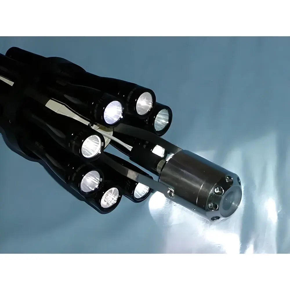
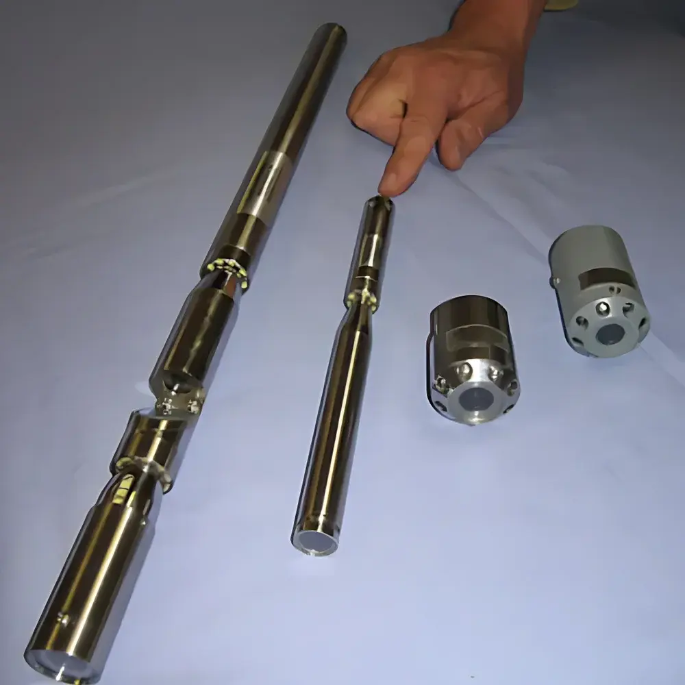
- Modular camera housing options: 19 mm Nano (stainless steel), 29 mm compact, and 41 mm standard diameters—each rated IP68 for continuous submersion up to 600 m depth.
- Dual-lens panoramic configuration enables full 360° circumferential imaging without mechanical rotation, eliminating blind spots during pipe wall evaluation.
- Field-replaceable optical modules—including color CMOS, low-light monochrome, and wide-dynamic-range variants—allow adaptation to varying illumination and turbidity conditions.
- Cable systems utilize custom-shielded, low-attenuation coaxial or hybrid fiber-coax construction; tensile strength exceeds 2,200 N for 600 m configurations, with optimized weight-to-strength ratio for manual handling.
- Winch platforms range from lightweight polymer manual reels (100–200 m) to heavy-duty steel manual winches (up to 300 m) and motorized winches with programmable speed control, torque limiting, and automatic cable tension compensation (300–600 m).
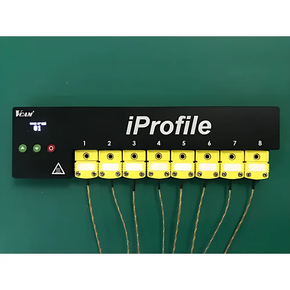
- Integrated 7-inch sunlight-readable LCD monitor features real-time depth overlay (OSD), adjustable brightness, and HDMI/SDI output for external recording or integration into asset management dashboards.
- All control units include ruggedized enclosures, sealed push-button interfaces, and dual-power options (rechargeable Li-ion battery or 12–24 V DC vehicle supply), supporting >8 hours of continuous operation.
Sample Compatibility & Compliance
GeoVISION accommodates a broad spectrum of conduit geometries—from 100 mm (4″) diameter service laterals to 3,000 mm (120″) reinforced concrete manholes—and performs reliably in wet, silt-laden, chemically aggressive (pH 2–12), and electrically noisy environments. Camera housings meet UL 61010-1 and IEC 61000-6-2 EMC immunity standards. The system adheres to ASTM F1216 (Standard Practice for Rehabilitation of Existing Pipelines Using Flexible Liners), EPA Method 1600 (for wastewater infrastructure survey documentation), and supports audit-ready data capture per FDA 21 CFR Part 11 when used with compliant third-party software (e.g., PipeLogix, WinCan VX). Optional calibration-certified depth transducers enable traceable vertical positioning within ±0.1% FS accuracy.
Software & Data Management
While GeoVISION hardware operates independently of proprietary software, its analog/digital video output and serial depth telemetry are fully compatible with industry-standard CCTV reporting platforms. Video streams embed SMPTE timecode and ASCII-formatted depth/tilt metadata via RS-485 or TTL interface, enabling synchronized georeferencing and GIS layer integration. All models support direct recording to internal SD cards or external DVD recorders (included in base configurations); H.264-encoded files conform to MPEG-4 Part 10 specifications for long-term archival. Optional firmware updates provide enhanced OSD labeling, multi-camera switching logic, and JPEG snapshot export at user-defined intervals—facilitating repeat-inspection comparison and change detection analytics.
Applications
- Routine condition assessment of municipal gravity sewers and combined overflows (CSOs)
- Pre- and post-rehabilitation verification per ASTM D5433 and NASSCO PACP/MACP coding protocols
- Industrial process drain line integrity audits in petrochemical, pharmaceutical, and food processing facilities
- Emergency response inspection following flood events, ground subsidence, or seismic activity
- Construction QA/QC for trenchless installation methods including CIPP, sliplining, and pipe bursting
- Regulatory compliance reporting for EPA NPDES permits and state-level sanitary sewer overflow (SSO) mitigation plans
FAQ
What is the maximum operational depth for each GeoVISION configuration?
Standard configurations support up to 100 m (lightweight PVC housing + manual plastic reel); reinforced stainless steel systems with motorized winches achieve certified 600 m depth rating under static load testing per ANSI/ASME B31.4.
Can the camera be replaced or upgraded in the field without returning the unit to the manufacturer?
Yes—optical modules, LED illumination arrays, and pressure housings are designed as field-serviceable components using standardized O-rings and tool-less locking mechanisms.
Is the system compatible with third-party GIS or asset management platforms?
All video outputs include embedded timecode and optional NMEA 0183 or Modbus RTU depth/heading data, enabling direct ingestion into Esri ArcGIS, Bentley OpenUtilities, or IBM Maximo via middleware drivers.
Does GeoVISION meet international certification requirements for hazardous locations?
Standard units are not intrinsically safe; however, ATEX Zone 2 and IECEx-certified variants (with explosion-proof housings and isolated power supplies) are available upon request for oil & gas or mining applications.
What maintenance intervals are recommended for long-term reliability?
O-ring replacement and pressure testing every 12 months—or after 200 submersion cycles—is advised; winch gear lubrication and cable tension calibration should occur biannually in high-use deployments.