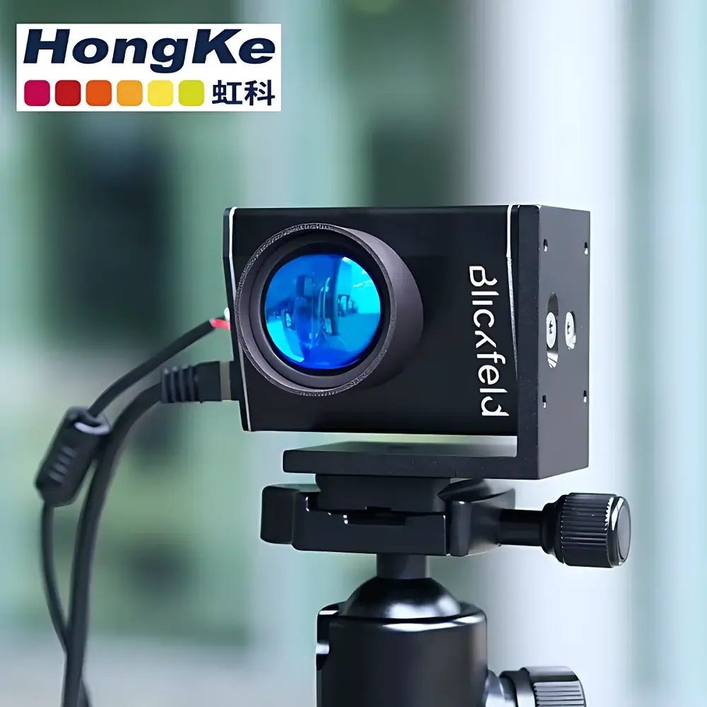
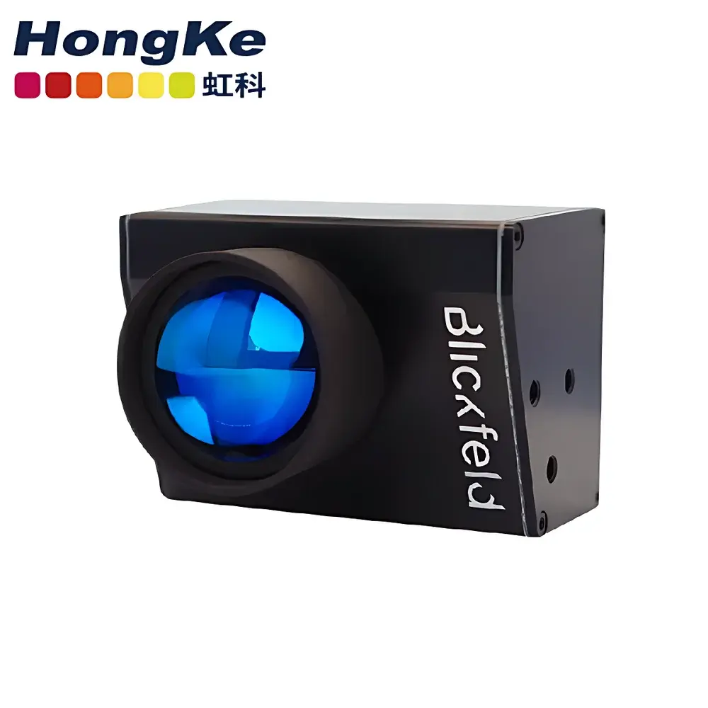
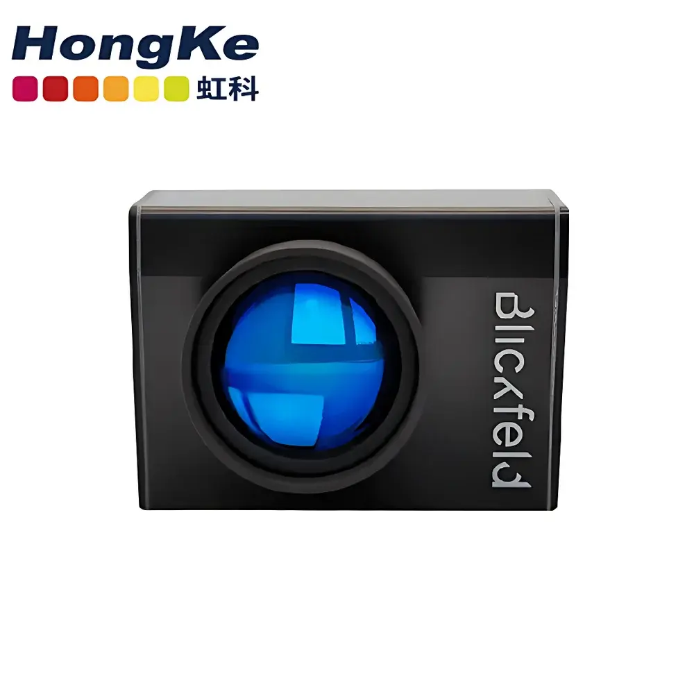
HKCube Range 1 Solid-State LiDAR Sensor
| Origin | Germany |
|---|---|
| Manufacturer Type | Authorized Distributor |
| Import Status | Imported |
| Model | HKCube Range 1 |
| Pricing | Available Upon Request |
Overview
The HKCube Range 1 is a compact, solid-state LiDAR sensor engineered for high-precision distance measurement and 3D spatial perception in resource-constrained embedded platforms. Unlike mechanical or hybrid scanning LiDAR systems, the HKCube Range 1 employs patented mirror-based beam steering technology—eliminating moving parts to ensure long-term operational reliability, shock resistance, and minimal maintenance requirements. Its core measurement principle relies on time-of-flight (ToF) detection of near-infrared laser pulses (typically 905 nm), enabling accurate range acquisition with sub-centimeter resolution under controlled ambient conditions. Designed specifically for integration into autonomous mobile platforms—including unmanned aerial vehicles (UAVs), ground-based autonomous robots, and mobile mapping systems—the HKCube Range 1 delivers consistent performance across dynamic operating environments while maintaining strict SWaP-C (Size, Weight, Power, and Cost) constraints.
Key Features
- Ultra-compact form factor: 60 mm × 80 mm × 80 mm—among the smallest industrial-grade solid-state LiDAR modules available for OEM integration.
- Patented MEMS-free mirror steering architecture ensuring >100,000 hours MTBF and immunity to vibration-induced misalignment.
- Long-range capability optimized for outdoor operation: effective detection range up to 200 m (depending on target reflectivity and ambient light conditions).
- High angular resolution: configurable horizontal field-of-view (FoV) up to 120° and vertical FoV up to 30°, supporting flexible sensor fusion architectures.
- Industrial-grade environmental rating: IP67 ingress protection for dust and water resistance; operating temperature range from −25 °C to +70 °C.
- Low-latency digital interface: Gigabit Ethernet (IEEE 802.3) and CAN FD support for real-time point cloud streaming and synchronized multi-sensor deployments.
Sample Compatibility & Compliance
The HKCube Range 1 is compatible with standard robotic operating system (ROS/ROS2) middleware and supports common point cloud formats including PCD and LAS. It complies with IEC 60825-1:2014 for Class 1 laser safety—ensuring safe operation without user-accessible laser hazards under all normal use conditions. The device meets EN 55032:2015 emission standards and EN 61000-6-2:2019 immunity requirements for industrial electromagnetic environments. While not certified for automotive ASIL-B or ISO 26262 functional safety, its architecture supports traceable calibration workflows aligned with ISO/IEC 17025 laboratory accreditation practices for metrological validation. Integration into regulated applications (e.g., survey-grade mapping or infrastructure inspection) requires end-user validation per applicable national geospatial accuracy standards (e.g., ASPRS Accuracy Standards for Digital Geospatial Data).
Software & Data Management
The HKCube Range 1 ships with a vendor-provided SDK supporting Linux (Ubuntu 20.04/22.04 LTS) and Windows 10/11 platforms. Configuration, firmware updates, and real-time diagnostics are managed via a web-based GUI or command-line interface (CLI). Point cloud data is streamed in native binary format with timestamped XYZI (intensity) values and optional confidence metrics. The SDK includes ROS2 Foxy/Humble drivers with support for TF2 coordinate transforms and sensor_msgs/PointCloud2 message serialization. For auditability and regulatory traceability, raw frame logs can be recorded with nanosecond-precision hardware timestamps. Data export functions comply with FAIR principles (Findable, Accessible, Interoperable, Reusable), and metadata embedding follows ISO 19115-3 XML schema conventions where applicable.
Applications
- Autonomous navigation for UAVs and UGVs requiring lightweight, non-rotating perception layers.
- Mobile LiDAR mapping systems used in corridor mapping, urban modeling, and cadastral surveying.
- People counting and occupancy analytics in smart building infrastructure, leveraging geometric segmentation of human-scale point clusters.
- Infrastructure monitoring—including power line inspection, railway clearance verification, and bridge deformation analysis—where long-range single-shot profiling is required.
- Research-grade environmental sensing in glaciology, forestry, and coastal erosion studies where portability and repeatable deployment matter more than ultra-high density scanning.
FAQ
Is the HKCube Range 1 suitable for automotive ADAS applications?
No—it is not designed or certified for safety-critical automotive functions governed by ISO 26262. It is intended for industrial, research, and commercial autonomy applications outside vehicle safety domains.
Does it support synchronization with GNSS or IMU sensors?
Yes—hardware PPS (pulse-per-second) input and output pins enable precise time alignment with external GNSS receivers or inertial measurement units.
What is the typical point density at maximum range?
At 200 m, nominal point density is approximately 0.5–1.2 points per square meter depending on scan pattern configuration and reflectivity of the target surface.
Can multiple HKCube Range 1 units operate simultaneously without interference?
Yes—each unit supports configurable pulse repetition frequency (PRF) and wavelength modulation to minimize crosstalk in multi-LiDAR deployments.
Is factory recalibration required after mechanical shock or thermal cycling?
No—its monolithic optical path and mirror-based steering eliminate drift-prone mechanical linkages; however, periodic verification using NIST-traceable targets is recommended per ISO/IEC 17025 quality management protocols.