Jingcheng Huatai TJSD-A Soil Compaction Tester
| Brand | Jingcheng Huatai |
|---|---|
| Origin | Beijing, China |
| Model | TJSD-A |
| Measurement Range | 0–10,000 kPa |
| Depth Range | 0–450 mm |
| Accuracy | ±1% |
| Resolution | 0.1 kPa |
| Display | Touchscreen (Bilingual: English/Chinese) |
| Data Storage | 100 measurement sets |
| Interface | DB9 serial port |
| Power | 3.7 V Li-ion battery (10 h operation) |
| Operating Temperature | −10 °C to +60 °C |
| Weight | 12.9 kg |
| GPS Integration | Built-in GNSS module for georeferenced depth-compaction profiling |
| Software Compatibility | PC-based data management with curve plotting, spatial mapping, and report generation (PDF/CSV export) |
Overview
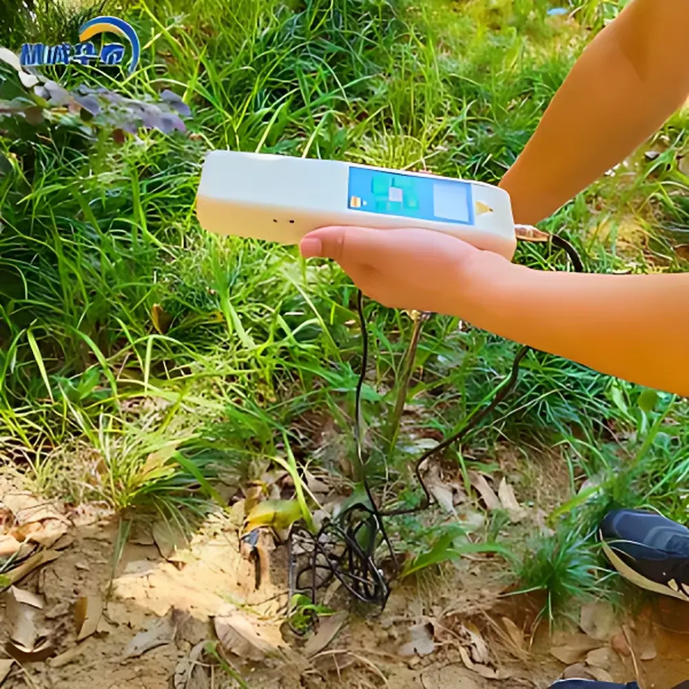
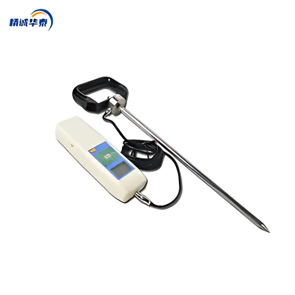
The Jingcheng Huatai TJSD-A Soil Compaction Tester is a field-deployable, hand-held penetrometer engineered for quantitative assessment of soil mechanical resistance—commonly referred to as soil compaction or soil strength. It operates on the principle of quasi-static cone penetration, where a standardized conical probe is driven vertically into undisturbed soil at controlled displacement rates, and the resulting resistance force is converted to pressure (kPa) using calibrated load cell transduction. Unlike empirical hardness scales, this instrument delivers traceable, SI-unit–compliant measurements directly in kilopascals (kPa) and kilograms-force per square centimeter (kgf/cm²), enabling cross-study comparability and integration into agronomic decision-support systems. Its primary application domain spans precision agriculture, land reclamation monitoring, civil engineering site evaluation (e.g., subgrade readiness for road construction), and environmental impact assessments where soil physical structure governs water infiltration, root penetration, and gas exchange.
Key Features
- Real-time dual-parameter display: simultaneous readout of instantaneous soil pressure (kPa) and probe penetration depth (mm) on a high-contrast resistive touchscreen interface
- Bilingual operational firmware: seamless switching between English and Chinese UI languages, supporting multilingual field teams and international training deployments
- Integrated GNSS positioning: embedded GPS/GLONASS receiver records WGS84 coordinates for each measurement point, enabling geospatial correlation without external survey equipment
- On-device data logging: internal memory stores up to 100 complete profiles—including pressure-depth curves, timestamps, location tags, and user-defined notes
- Auto-power management: programmable idle timeout and low-battery warning ensure extended field usability without manual intervention
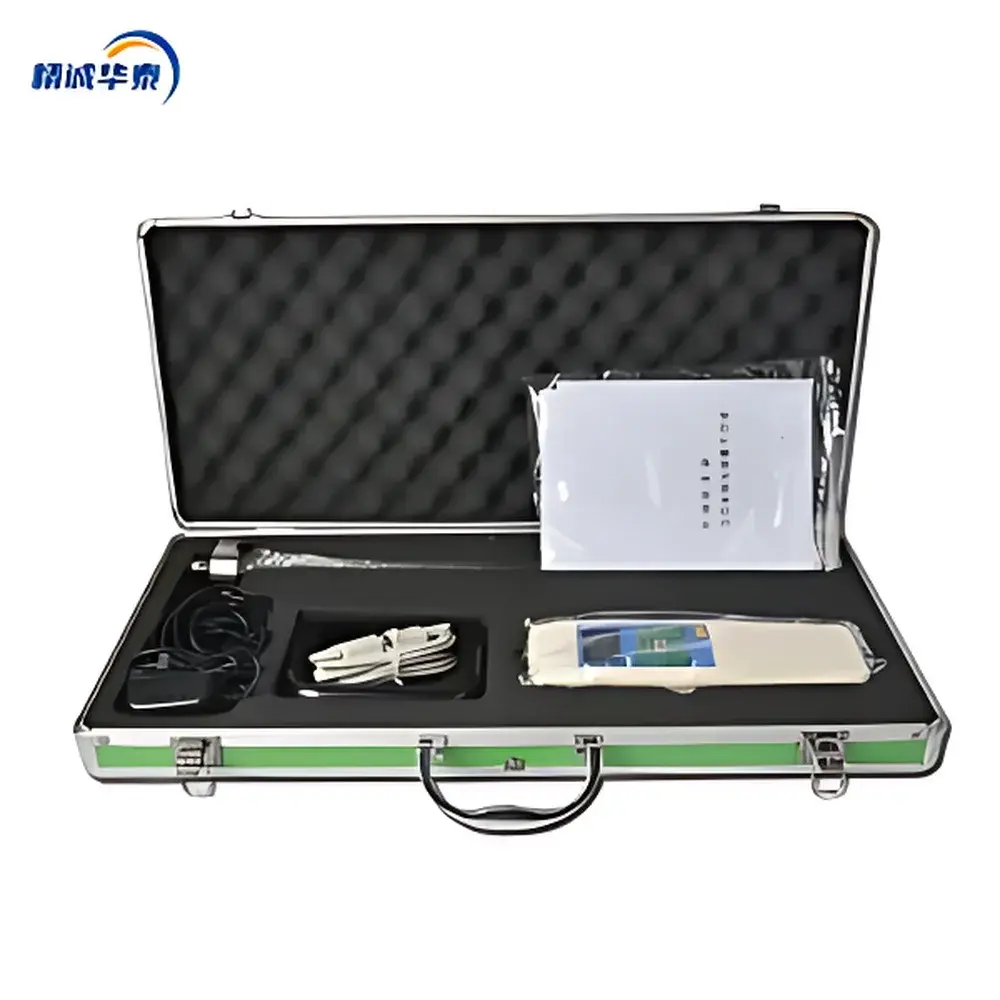
- Modular connectivity: DB9 RS-232 serial interface supports direct connection to Windows-based PCs for firmware updates, data retrieval, and calibration verification
- Ruggedized field design: IP54-rated enclosure, reinforced stainless-steel probe shaft, and shock-absorbing handle ergonomics withstand repeated use across variable terrain and weather conditions
Sample Compatibility & Compliance
The TJSD-A is validated for use in mineral soils (sandy loam to clayey silt), cultivated topsoil, compacted subsoil layers, and engineered fill materials. It is not intended for saturated, frozen, or highly gravelly (>15% stone content >2 cm) matrices where probe deflection or obstruction may compromise measurement fidelity. While not certified to ISO 23470 (Soil quality — Determination of soil compaction by penetrometry) or ASTM D6951/D6951M (Standard Test Method for Use of the Dynamic Cone Penetrometer in Shallow Pavement Applications), its mechanical design and transducer calibration align with the foundational principles outlined in these standards. Data generated meets GLP documentation requirements when paired with timestamped, georeferenced logs and audit-trail–enabled PC software.
Software & Data Management
The companion Windows application (v3.2+) provides full post-processing capability: automatic alignment of pressure-depth curves, interpolation of missing points via cubic spline fitting, overlay of multiple profiles for comparative analysis, and generation of interpolated contour maps (using inverse distance weighting) representing spatial variability of compaction across fields or construction sites. Export formats include CSV (for statistical analysis in R, Python, or JMP), PDF (print-ready reports with metadata headers), and GeoJSON (GIS interoperability). The software enforces user authentication, session logging, and electronic signature fields to support regulatory documentation workflows under ISO/IEC 17025 or internal QA protocols.
Applications
- Agricultural soil health monitoring: identifying compaction zones that restrict root elongation and reduce nitrogen-use efficiency, informing subsoiling or cover crop selection
- Pre-construction site assessment: verifying bearing capacity uniformity across embankments, airfield pavements, or landfill caps prior to grading
- Post-remediation validation: quantifying mechanical recovery of restored wetlands or mine spoils following vegetation establishment
- Educational fieldwork: teaching soil physics concepts including bulk density–porosity relationships and stress-strain behavior in unsaturated media
- Climate resilience planning: correlating long-term compaction trends with rainfall intensity changes and irrigation scheduling patterns
FAQ
What soil types are suitable for measurement with the TJSD-A?
The instrument performs reliably in cohesive and cohesionless mineral soils with moisture contents between 10–30% gravimetric water content. Avoid use in frozen, waterlogged, or stony soils (>10% particles >20 mm).
Is calibration traceable to national standards?
Yes—each unit ships with a factory calibration certificate referencing NIST-traceable dead-weight standards. Field recalibration is supported via the PC software using known reference loads.
Can the device operate without GPS signal?
Yes. GPS functionality is optional; all pressure and depth measurements remain fully functional offline. Location data will be marked as “unavailable” in exported files if GNSS lock is absent.
How is data security managed during transfer to PC?
Data transmission occurs over unencrypted serial protocol; users deploying in regulated environments should conduct transfers within secured local networks and maintain version-controlled backups per organizational IT policies.
Does the TJSD-A comply with FDA 21 CFR Part 11?
No—the device and software are not designed for pharmaceutical or clinical trial applications and lack electronic signature, audit trail, or role-based access controls required under Part 11. It is intended for environmental and agronomic field use only.
Related Products


