
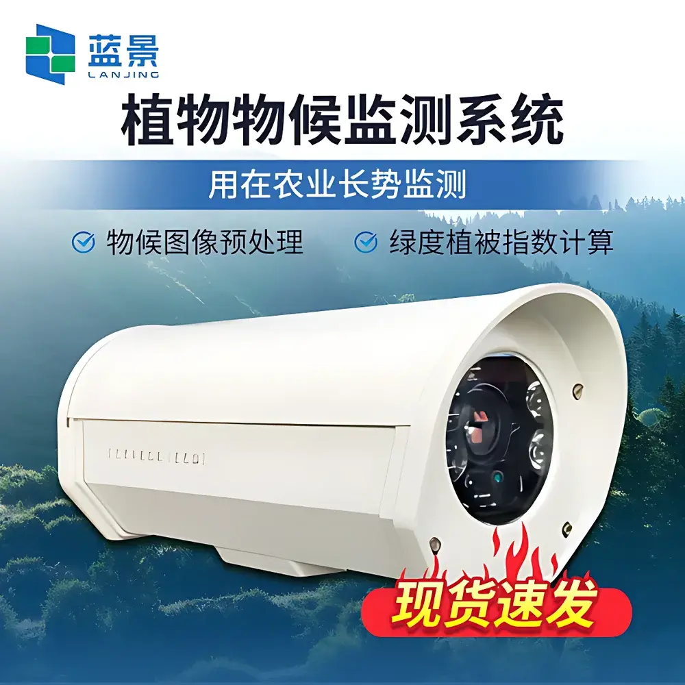
Lanjing LJ-WH1000 Multispectral Phenocam System
| Brand | Lanjing |
|---|---|
| Model | LJ-WH1000 |
| Origin | Shandong, China |
| Manufacturer Type | Direct Manufacturer |
| Country of Origin | China |
| Price | USD 8,400 (approx.) |
| Spectral Bands | 6-band configurable (RGB + narrowband green @ 550±10 nm, red @ 650±10 nm, NIR @ 850±10 nm) |
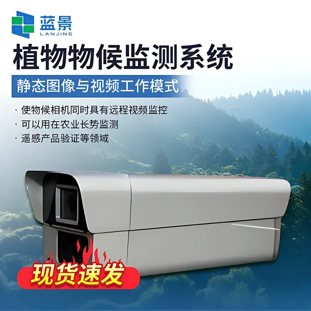
| Sensor | CMOS, 5 MP native resolution |
| Lens | 6–12 mm focal length, FOV 60°–120° |
| Storage | 16 GB internal (expandable to 128 GB) |
| Connectivity | Ethernet, Wi-Fi, 4G LTE |
| Power | Sleep mode 0.9 W (180 mA), operational 4.5–7 W (900–1400 mA) |
| Operating Temp | −40 °C to +60 °C |
| Humidity Range | 0–100 % RH |
| IP Rating | IP67 |
| Dimensions | 150 × 150 × 150 mm |
| Weight | 500 g (including mounting platform and bracket) |
Overview
The Lanjing LJ-WH1000 Multispectral Phenocam System is an autonomous, field-deployable imaging platform engineered for long-term, high-temporal-resolution phenological monitoring of terrestrial vegetation. It operates on the principle of time-series multispectral imaging—capturing synchronized visible (RGB) and narrowband spectral data aligned with satellite sensor bandpasses (e.g., Landsat, Sentinel-2). By acquiring co-registered true-color and calibrated near-infrared (NIR) imagery at user-defined intervals, the system enables quantitative derivation of vegetation indices critical to ecological phenology research, agricultural monitoring, and forest dynamics assessment. Its optical architecture supports both nadir (downward-facing) and oblique (tilted or upward-facing) configurations, allowing standardized observation of crop canopy development, forest understory transitions, or landscape-scale greenness progression. Designed for unattended operation in remote or harsh environments, the LJ-WH1000 integrates environmental resilience (IP67 enclosure, −40 °C to +60 °C operational range) with low-power embedded computing—making it suitable for solar-powered deployments and integration into distributed ecological observatory networks.
Key Features
- Configurable 6-band multispectral acquisition: Standard RGB + narrowband green (550±10 nm), red (650±10 nm), and NIR (850±10 nm); optional bands available per application-specific calibration requirements.
- Simultaneous dual-output imaging: Real-time generation of georeferenced true-color JPEGs and radiometrically consistent NDVI rasters—both aligned pixel-for-pixel without post-hoc registration.
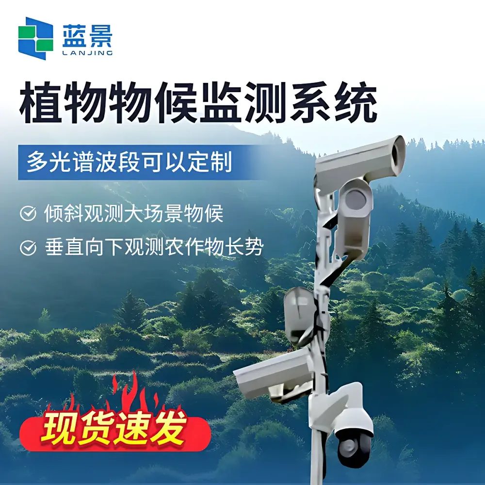
- Adaptable deployment geometry: Supports vertical downward (crop monitoring), horizontal oblique (ecotone or riparian zone tracking), and upward-looking (forest canopy closure, LAI estimation) mounting via modular bracket system.
- Embedded scheduling and edge processing: Onboard timer-driven image capture (1 min to 24 h intervals), local storage buffering (16 GB default, expandable to 128 GB microSD), and automatic compression/transmission over Ethernet, Wi-Fi, or 4G LTE.
- Low-power architecture: 0.9 W sleep-mode consumption enables multi-month battery or small-panel solar operation; active imaging cycle draws ≤7 W peak, minimizing thermal drift and power-system complexity.
Sample Compatibility & Compliance
The LJ-WH1000 is validated for continuous monitoring of herbaceous canopies (e.g., wheat, maize, grasslands), woody perennials (orchards, shrublands), and closed-canopy forests. Its spectral response is traceable to NIST-calibrated reference panels and aligns with USDA ARS and NASA PhenoCam network spectral band definitions. The system meets IEC 60529 (IP67) for dust and water ingress protection, and complies with CE EMC Directive 2014/30/EU for electromagnetic compatibility. Data output formats—including GeoTIFF, CSV time-series exports, and standardized JSON metadata—support interoperability with FAO WaPOR, GEOGLAM, and USGS Land Cover Monitoring System pipelines. While not FDA- or ISO 17025-accredited as a metrological instrument, its index outputs are suitable for GLP-aligned ecological field studies and peer-reviewed phenological modeling where reproducibility and temporal consistency are prioritized over absolute radiometric accuracy.
Software & Data Management
The bundled Lanjing Phenodata Suite v3.2 provides end-to-end desktop-based processing for time-series phenocam data. It includes automated dark-frame correction, vignetting compensation, cloud-shadow masking, and ROI-based pixel averaging. Vegetation index computation covers RCC (Relative Canopy Cover), GCC (Green Chromatic Coordinate), BCC (Blue Chromatic Coordinate), Red-Green Ratio (RGR), and atmospherically insensitive NDVI (using calibrated red/NIR band ratios). Advanced modules support Savitzky-Golay smoothing, logistic curve fitting, and objective extraction of Start-of-Season (SOS), Mid-Season (MOS), and End-of-Season (EOS) metrics per ROI. All processing steps are logged with timestamped audit trails, and export options include NetCDF-4 (CF-compliant), Excel-compatible CSV, and GIS-ready shapefile overlays. The software adheres to FAIR data principles (Findable, Accessible, Interoperable, Reusable) and supports batch ingestion from multiple LJ-WH1000 units deployed across heterogeneous sites.
Applications
- Agricultural phenology: Tracking crop emergence, heading, flowering, and senescence for irrigation scheduling, yield forecasting, and pest risk modeling.
- Forest ecology: Quantifying budburst, leaf-out, autumn coloration, and canopy closure dynamics to assess climate-driven shifts in growing season length.
- Remote sensing validation: Ground-truthing satellite-derived NDVI, EVI, and LAI products across spatial scales—from field plots to watershed-level validation sites.
- Urban green infrastructure: Monitoring street tree phenology, park vegetation health, and green roof performance under anthropogenic microclimates.
- Long-term ecological research (LTER): Supporting NEON-style observatories and national phenology networks requiring standardized, open-format, low-maintenance instrumentation.
FAQ
Is the LJ-WH1000 compatible with existing phenocam networks such as the PhenoCam Network?
Yes—the system outputs time-stamped, geotagged JPEGs and NDVI rasters in standard naming conventions and directory structures aligned with PhenoCam v2.0 specifications. Metadata fields (latitude, longitude, elevation, orientation, focal length) are embeddable in EXIF or exported separately as CSV.
Can spectral band configurations be modified after purchase?
Band selection is hardware-defined at manufacturing; however, users may request factory reconfiguration (e.g., swapping 850 nm NIR for 940 nm water vapor band) prior to shipment. Post-deployment filter replacement is not supported due to optical alignment sensitivity.
Does the system support external triggering or synchronization with other sensors?
Yes—via TTL-compatible GPIO port (3.3 V logic), enabling hardware-synchronized capture with eddy covariance towers, soil moisture probes, or weather stations using pulse-per-second (PPS) or custom trigger signals.
What level of radiometric calibration is provided?
Each unit ships with factory-applied relative spectral response (RSR) curves and grayscale reference panel coefficients. Absolute radiometric calibration (e.g., reflectance factor) requires periodic in-field validation using certified Spectralon® panels and is recommended every 12 months for quantitative remote sensing applications.
Is firmware update capability available over-the-air?
Firmware updates are delivered via secure HTTPS download and applied through the web interface or Lanjing Phenodata Suite. Updates retain all user-configured schedules, ROI definitions, and network settings without reset.