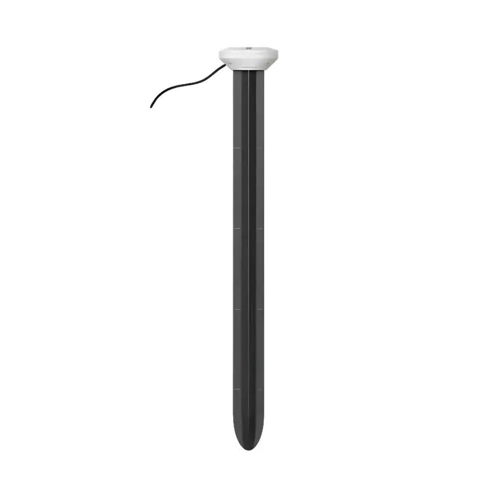
METER TEROS 54 Soil Profile Moisture and Temperature Sensor
| Brand | METER |
|---|---|
| Origin | Italy |
| Model | TEROS 54 |
| Measurement Depths | 15, 30, 45, and 60 cm |
| Volumetric Water Content Range (mineral soils) | 0.00–0.70 m³/m³ |
| Temperature Range | −20 to +60 °C |
| Accuracy (VWC, mineral soils, EC < 8 dS/m) | ±0.05 m³/m³ |
| Accuracy (Temperature) | ±0.25 °C (0–60 °C) |
| Operating Frequency | 70 MHz |
| Output Protocols | SDI-12 (3- and 4-wire), DDI serial, RS-485 Modbus RTU, tensioLINK |
| Power Supply | 4.0–24.0 VDC |
| Cable Length | Standard 5 m (custom up to 75 m) |
| Enclosure | IP68-rated ruggedized profile probe |
| Compliance | CE-marked per EM ISO/IEC 17050:2010 |
Overview
The METER TEROS 54 Soil Profile Moisture and Temperature Sensor is an integrated, research-grade instrumentation system engineered for high-fidelity, multi-depth monitoring of volumetric water content (VWC) and temperature across the critical root zone. It employs time-domain transmission (TDT) combined with high-frequency (70 MHz) capacitance-based dielectric measurement—calibrated to the complex permittivity (εa) of soil media—to deliver robust, physics-based VWC quantification without reliance on empirical soil-specific regression models. Unlike conventional single-point or segmented rod sensors, the TEROS 54 integrates four independent sensing wings into a single rigid profile structure, enabling simultaneous, co-located measurements at 15 cm, 30 cm, 45 cm, and 60 cm depths. This configuration eliminates spatial interpolation uncertainty and captures vertical moisture gradients essential for evapotranspiration modeling, irrigation scheduling, and vadose zone hydrology studies. Its low-profile, 2 cm installation borehole requirement significantly reduces site disturbance—making it ideal for long-term field trials, agronomic rotation systems, and ecological restoration sites where minimal ground disruption is mandated.
Key Features
- Four integrated sensing wings provide concurrent VWC and temperature readings at 15, 30, 45, and 60 cm depths—covering the full active root zone of most annual crops and perennial grasses.
- Direct-insertion design eliminates need for access tubes or pilot holes; installation requires only a single 2 cm diameter auger borehole, minimizing soil compaction and structural disturbance.
- Ruggedized stainless-steel and polymer composite housing ensures mechanical integrity during insertion and long-term deployment in abrasive, freeze-thaw, or high-moisture environments.
- Single-cable interface supports multiple communication protocols—including SDI-12 (3- and 4-wire variants), DDI serial, RS-485 Modbus RTU, and tensioLINK—enabling seamless integration with METER ZL6 and EM60 data loggers, as well as third-party systems compliant with industry-standard physical and protocol layers.
- Each TEROS 54 occupies only one analog/digital port on a compatible data acquisition unit, yet delivers eight discrete measurement channels (four depths × two parameters), optimizing channel utilization and reducing infrastructure cost per data point.
- Tool-assisted extraction allows rapid, non-destructive removal and re-deployment—critical for seasonal cropping systems, plot-level experimental replication, and sensor recalibration cycles.
- Low-power architecture: typical sleep-state current draw is 0.1 mA; active measurement cycle (≤800 ms) consumes ≤35 mA—supporting extended operation on solar-charged battery systems.
Sample Compatibility & Compliance
The TEROS 54 is validated for use in mineral soils with bulk electrical conductivity (EC) up to 8 dS/m. For non-soil porous media—including growing substrates, peat, vermiculite, and engineered landfill caps—user-specific calibration improves accuracy to ±0.02–0.03 m³/m³. Its sealed, IP68-rated construction ensures reliable operation under saturated conditions, repeated wet-dry cycling, and prolonged exposure to UV radiation and soil-borne microbial activity. The sensor complies with CE marking requirements per EM ISO/IEC 17050:2010, confirming conformity with EU electromagnetic compatibility (EMC) and low-voltage directives. While not intrinsically certified for hazardous locations, its passive dielectric measurement principle and absence of high-voltage excitation render it suitable for Class I, Division 2 environments when deployed with appropriate barrier-protected data loggers. Data traceability aligns with GLP-aligned field practices, supporting audit-ready metadata logging when paired with ZENTRA Cloud’s timestamped, version-controlled dataset ingestion pipeline.
Software & Data Management
Data from the TEROS 54 is natively ingested into METER’s ZENTRA Cloud platform—a secure, ISO 27001-aligned SaaS environment designed for environmental sensor networks. ZENTRA Cloud provides real-time visualization of vertical moisture profiles, automated anomaly detection (e.g., abrupt desiccation fronts or thermal hysteresis), and configurable alerting via email or SMS. All raw and processed values are stored with full provenance—including sensor ID, firmware revision, measurement timestamp (UTC), and environmental context tags (e.g., crop stage, precipitation event). Export options include CSV, NetCDF, and direct API access (RESTful JSON) for integration into GIS platforms (e.g., QGIS, ArcGIS Pro) or statistical analysis workflows (R, Python Pandas). For regulated applications, ZENTRA Cloud supports 21 CFR Part 11-compliant user role management, electronic signatures, and immutable audit trails—enabling use in USDA NRCS monitoring programs, EPA-approved LIDAR-ground truthing campaigns, and academic studies requiring FAIR (Findable, Accessible, Interoperable, Reusable) data principles.
Applications
- Irrigation optimization in precision agriculture—quantifying depth-resolved water depletion to inform dynamic scheduling algorithms.
- Vadose zone process studies—including infiltration dynamics, capillary rise, and preferential flow path identification in heterogeneous soils.
- Soil-plant-atmosphere continuum (SPAC) modeling, where synchronized multi-depth temperature and VWC inputs constrain boundary condition parameterization.
- Long-term climate observatory networks requiring low-maintenance, high-reproducibility soil hydric state monitoring across diverse pedoclimatic zones.
- Evaluation of soil amendment efficacy (e.g., biochar, hydrogels) by tracking vertical redistribution kinetics over seasonal time scales.
- Calibration and validation of satellite-based soil moisture products (e.g., SMAP, Sentinel-1) through representative in situ profile reference measurements.
FAQ
Can the TEROS 54 be used in saline or sodic soils?
Yes—with caution. The standard mineral soil calibration remains valid for EC ≤ 8 dS/m. Above this threshold, dielectric loss increases signal attenuation; we recommend performing a site-specific calibration using gravimetric sampling or deploying alongside a calibrated ECH2O-TE or GS3 sensor for cross-validation.
Is factory recalibration required after field deployment?
No. The TEROS 54 features non-drifting solid-state electronics and stable ceramic dielectric elements. Field verification against known standards (e.g., oven-dry gravimetric samples) is recommended annually for QA/QC, but hardware recalibration is not routine.
What is the maximum cable length supported without signal degradation?
Standard configurations ship with 5 m cables. Custom lengths up to 75 m are available with shielded, twisted-pair construction and impedance-matched terminations to maintain SDI-12 and RS-485 signal integrity under field EMI conditions.
Does the sensor support time-synchronized measurements across multiple units?
Yes. When connected to a ZL6 or EM60 logger configured with internal clock synchronization, all TEROS 54 units on the same bus report timestamps aligned to within ±10 ms—enabling high-resolution comparative analysis of lateral moisture flux.
How does the four-wing geometry improve measurement representativeness compared to cylindrical probes?
The winged design increases effective sampling volume by ~3.2× versus a 2 cm-diameter cylinder at equivalent depth, reducing point-scale heterogeneity bias and improving detection sensitivity to macropore-driven water movement—particularly relevant in structured clay or bioturbated soils.
Related Products


