OSEN-Z-71 Mobile Noise Monitoring System for Urban Acoustic Environment Surveillance
| Brand | OSEN |
|---|---|
| Model | OSEN-Z-71 |
| Mounting Type | Vehicle-mounted (Magnetic, Non-destructive) |
| Power Source | Integrated with Electric Vehicle Platform |
| Data Transmission | 4G/5G + GPS + Cloud API |
| Environmental Compliance Support | ISO 1996-1:2016, ISO 1996-2:2017, GB/T 3222-2023, ANSI S1.4-2014 |
| Real-time Audio Trigger | Configurable Threshold & Duration |
| Meteorological Compensation | Integrated Temp/Humidity/Wind Speed Sensor |
| Software Platform | OSEN Cloud v4.2 (Web + Mobile App) |
| Data Output Format | JSON/XML via RESTful API |
| Certification | CE, RoHS, CMA-accredited Calibration Report Available |
Overview
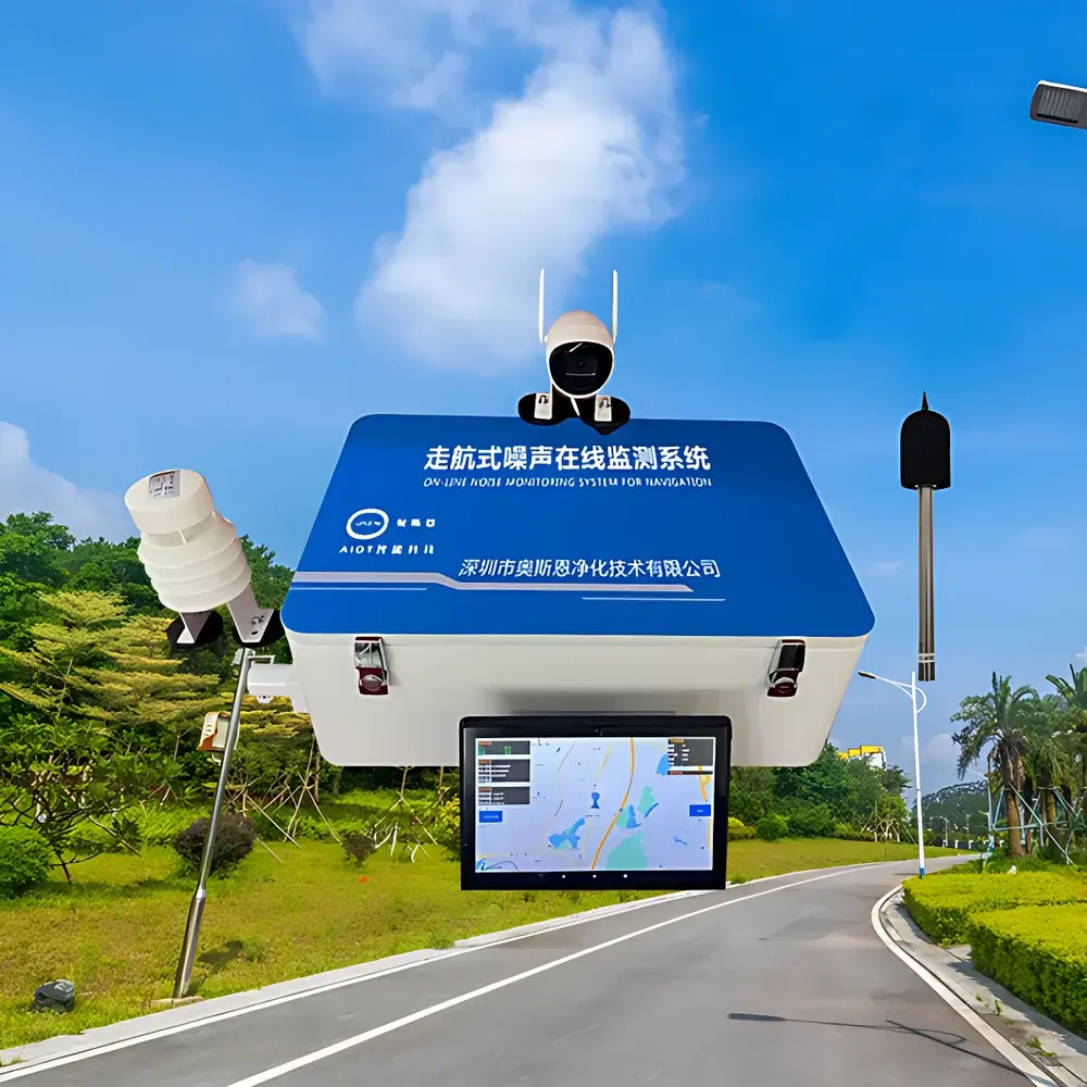
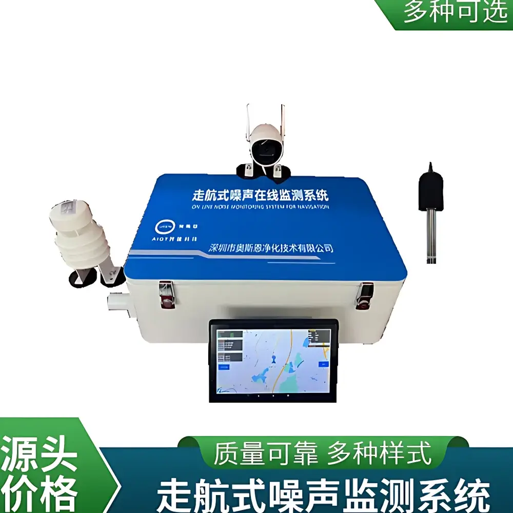
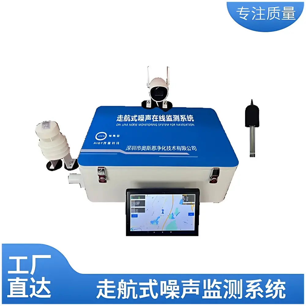
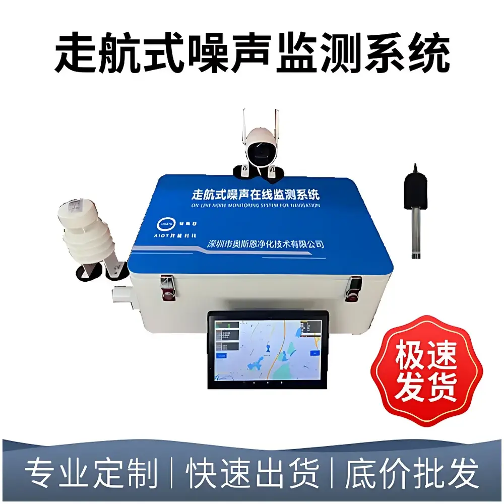
The OSEN-Z-71 Mobile Noise Monitoring System is an engineered solution for dynamic, high-spatial-resolution acoustic mapping in urban environments. Designed for integration with electric or hybrid municipal service vehicles—including environmental patrol cars, sanitation fleets, and public transport—this system implements real-time sound pressure level (SPL) measurement based on IEC 61672-1 Class 1 compliant instrumentation. It operates on the principle of time-weighted A-weighted equivalent continuous sound pressure level (LAeq) calculation, synchronized with georeferenced GPS coordinates at 1 Hz sampling resolution. Unlike static monitoring networks, the Z-71 enables macro-scale noise pattern recognition across heterogeneous land-use zones (e.g., residential corridors, commercial districts, transit hubs), while resolving micro-scale anomalies such as illegal construction, unlicensed street vendors, or nighttime industrial activity. Its architecture supports both regulatory compliance verification (e.g., EU Directive 2002/49/EC, China’s “Technical Specification for Environmental Noise Monitoring” HJ 972–2018) and predictive modeling through temporal-spatial interpolation algorithms.
Key Features
- Non-invasive magnetic mounting system enabling rapid deployment (<5 min) and zero structural modification to host vehicle surfaces.
- Integrated meteorological sensor suite (temperature, relative humidity, wind speed) for real-time atmospheric correction of SPL data, minimizing false positives from wind-induced noise artifacts.
- Dual-mode audio capture: threshold-triggered WAV recording (configurable LAmax threshold and 10–60 s duration) with remote playback capability via encrypted cloud interface.
- Embedded Android tablet with OSEN NoiseView™ application: live SPL contour rendering along vehicle trajectory, customizable alert thresholds, and exportable KML/CSV reports.
- GPS+GLONASS dual-frequency positioning module delivering <2.5 m CEP accuracy; trajectory replay functionality with timestamp-synchronized noise heatmaps.
- Optional HD IP camera integration with ONVIF protocol support: automatic video snapshot upon LAeq exceedance, with embedded metadata overlay (GPS coordinate, timestamp, dB(A) value, alarm level).
- Robust EMC design meeting IEC 61000-6-2/6-4 standards to ensure stable operation amid variable electromagnetic environments (e.g., EV motor inverters, traffic signal RF emissions).
Sample Compatibility & Compliance
The OSEN-Z-71 is validated for continuous operation under ambient temperature ranges of −20 °C to +55 °C and relative humidity up to 95% non-condensing. All acoustic transducers are factory-calibrated traceable to NIM (National Institute of Metrology, China) and include annual recalibration certificates per ISO/IEC 17025 requirements. Data acquisition firmware adheres to ISO 1996-1:2016 (basic quantities and assessment procedures) and ISO 1996-2:2017 (data reporting formats). For international deployments, optional calibration against PTB (Physikalisch-Technische Bundesanstalt) reference standards is available. The system satisfies audit readiness for GLP-compliant noise impact assessments and supports electronic signature workflows compliant with FDA 21 CFR Part 11 when deployed with OSEN Cloud’s role-based access control and immutable audit logs.
Software & Data Management
OSEN Cloud v4.2 serves as the central data hub, providing RESTful APIs for integration with municipal GIS platforms (e.g., ArcGIS Enterprise, QGIS Server) and third-party analytics engines (e.g., Python Pandas, MATLAB). Raw data streams include LAF, LAS, LAI, LAeq,T, LA10, LA50, LA90, and statistical percentiles—all timestamped to UTC with nanosecond precision via PPS synchronization. The platform implements automated QA/QC flagging for sensor drift (>0.5 dB deviation over 24 h), GPS signal loss (>30 s), or meteorological outliers (e.g., wind >5 m/s invalidating outdoor measurements). All data exports include digital signatures compliant with China’s Cryptography Law and support long-term archival in accordance with ISO 14721 (OAIS reference model).
Applications
- Urban noise zoning validation and dynamic updating of municipal acoustic maps.
- Post-construction noise impact verification for infrastructure projects (e.g., elevated rail lines, highway expansions).
- Enforcement support for environmental law agencies during night-time noise violation patrols.
- Longitudinal trend analysis of transportation-related noise evolution across electrification transitions.
- Acoustic baseline establishment prior to large-scale redevelopment initiatives.
- Real-time public information dissemination via municipal smart city dashboards (e.g., noise index displays at subway stations).
FAQ
Does the system meet international metrological traceability requirements?
Yes—transducers are calibrated against national primary standards with documented uncertainty budgets; full calibration certificates comply with ISO/IEC 17025 and include measurement uncertainty statements.
Can the system operate independently without cellular connectivity?
Yes—onboard SD card storage retains 30 days of raw data at 1 Hz resolution; synchronization occurs automatically upon network restoration.
Is meteorological compensation applied in real time or post-processing?
Compensation is applied in real time using embedded algorithms derived from ISO 9613-2 atmospheric absorption models, with user-adjustable parameters for local climate conditions.
What data security protocols are implemented for cloud transmission?
All communications use TLS 1.3 encryption; device authentication employs X.509 certificates; stored data is AES-256 encrypted at rest.
How is GPS drift mitigated during tunnel or dense urban canyon operation?
The system fuses GPS, IMU (inertial measurement unit), and odometry inputs via Kalman filtering to maintain positional integrity during signal occlusion periods exceeding 90 seconds.
Related Products


