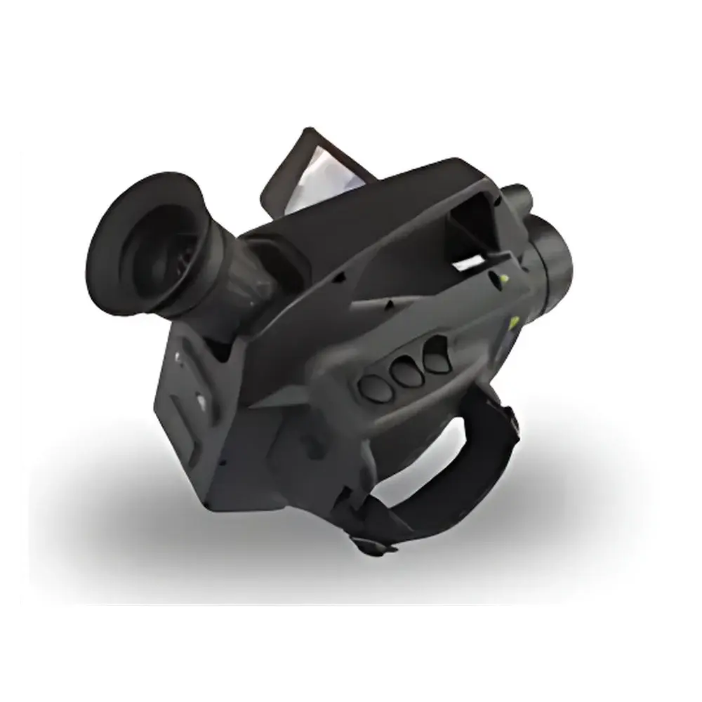
SAIL HERO XHIRVOC100 Portable VOC Leak Detection Imaging System
| Brand | SAIL HERO |
|---|---|
| Origin | Hebei, China |
| Manufacturer Type | Original Equipment Manufacturer (OEM) |
| Country of Origin | China |
| Model | XHIRVOC100 |
| Operating Temperature | Cooled Detector Operation |
| Measurement Method | Non-Contact Optical Imaging |
| Spectral Range | 3.2–3.5 µm |
| Thermal Sensitivity (NETD) | ≤15 mK @ 25 °C |
| Infrared Resolution | 320 × 256 |
| Enclosure Rating | IP54 |
| Explosion Protection | Intrinsic Safety (Ex ib IIB T4 Gb) |
| Application Domain | Environmental Compliance Monitoring, Industrial Leak Detection, Regulatory Field Enforcement |
Overview
The SAIL HERO XHIRVOC100 is a portable, cooled mid-wave infrared (MWIR) optical imaging system engineered for real-time visualization and localization of volatile organic compound (VOC) gas plumes in ambient air. Unlike point-sampling or photoionization detector (PID)-based instruments, the XHIRVOC100 employs passive infrared absorption imaging based on spectral radiometry within the 3.2–3.5 µm atmospheric transmission window — a region where many hydrocarbon-based VOCs (e.g., methane, propane, butane, ethylene, benzene derivatives) exhibit strong fundamental vibrational absorption bands. This enables selective, non-contact, wide-area scanning of industrial facilities—including refineries, chemical plants, storage terminals, and petrochemical processing units—without requiring physical access to suspected leak sources. The system integrates a Stirling-cooled indium antimonide (InSb) focal plane array detector, delivering high thermal contrast and low-noise performance essential for detecting subtle temperature differentials between background radiation and gas-phase absorption signatures.
Key Features
- Cooled MWIR detector with NETD ≤15 mK @ 25 °C ensures high thermal contrast sensitivity for low-concentration, low-velocity VOC plume detection under variable ambient conditions.
- Optimized spectral bandpass (3.2–3.5 µm) enhances selectivity for aliphatic and aromatic hydrocarbons while minimizing interference from water vapor and CO₂.
- Real-time gas visualization via false-color overlay on native thermal imagery, enabling immediate operator interpretation and qualitative plume morphology assessment.
- Intrinsic safety certification (Ex ib IIB T4 Gb) and IP54 ingress protection support deployment in Zone 1 hazardous locations and outdoor field environments subject to dust and light rain.
- Ergonomic handheld form factor with integrated rechargeable battery, ruggedized magnesium alloy housing, and intuitive touchscreen interface for single-operator field use.
- On-device image capture (JPEG/RAW), video recording (AVI), and timestamped metadata logging compliant with EPA Method 21–adjacent operational protocols.
Sample Compatibility & Compliance
The XHIRVOC100 is validated for detection of gaseous VOCs with significant absorption cross-sections in the 3.2–3.5 µm range, including but not limited to: propane, butane, pentane, hexane, propylene, ethylene, toluene, xylene, and styrene. It does not detect non-absorbing species (e.g., H₂, O₂, N₂) or weakly absorbing compounds outside its spectral band (e.g., methanol, formaldehyde). The instrument meets requirements outlined in China’s “Guiding Standard for Standardization of Comprehensive Ecological and Environmental Law Enforcement Equipment (2020 Edition)” and supports implementation of GB 37822–2019 (“Control Standard for Volatile Organic Compounds Unorganized Emissions”). While not a certified quantitative analyzer per ASTM D7099 or ISO 16000–28, it functions as a Tier 1 screening tool aligned with EPA OTM-33A conceptual frameworks for optical gas imaging (OGI) surveys.
Software & Data Management
The XHIRVOC100 ships with proprietary PC-based analysis software supporting post-capture enhancement, plume trajectory estimation, comparative image stacking, and annotation-driven reporting. All stored media include embedded GPS coordinates (when enabled), device serial number, operator ID, date/time stamp, and environmental metadata (ambient temperature, humidity, wind direction if external sensor connected). Audit trails comply with GLP principles; file integrity is preserved via SHA-256 hashing. Export formats include PDF inspection reports, CSV metadata logs, and georeferenced GeoTIFF overlays compatible with GIS platforms. No cloud synchronization or remote telemetry is implemented by default—data remains under full user control per data sovereignty requirements.
Applications
- Regulatory enforcement inspections for LDAR (Leak Detection and Repair) programs in petrochemical and pharmaceutical manufacturing.
- Routine facility-wide OGI surveys prior to startup/shutdown or after maintenance interventions.
- Emergency response triage for unidentified odor complaints or suspected fugitive emissions near community boundaries.
- Verification of vapor recovery system performance at gasoline dispensing facilities (RVP compliance support).
- Training and demonstration of VOC dispersion behavior for environmental health & safety (EHS) personnel.
FAQ
Does the XHIRVOC100 provide quantitative concentration measurements?
No. It is a qualitative and semi-quantitative optical gas imaging tool designed for leak localization and plume visualization—not real-time ppm-level quantification.
Can it detect methane specifically?
Yes, methane exhibits a strong absorption feature near 3.3 µm and is reliably visualized under favorable thermal contrast conditions (e.g., >2 K ΔT between plume and background).
Is calibration required before each use?
A non-uniformity correction (NUC) is automatically performed during startup; no user-performed gas-phase calibration is needed. Reference blackbody calibration is factory-performed and traceable to NIM standards.
What is the typical effective detection distance?
Under standard atmospheric conditions and moderate plume density, reliable visualization ranges from 5 m to 30 m, depending on target size, gas concentration, and background emissivity contrast.
Does the system support integration with third-party GIS or CMMS platforms?
Yes—via standardized CSV and GeoTIFF exports. API-based integration is not supported in current firmware versions.


