STT OS-2 UAV-Mounted Electromagnetic Environment Monitoring System
| Brand | STT |
|---|---|
| Origin | Beijing, China |
| Manufacturer | STT Senfu Technology |
| Type | Domestic |
| Model | OS-2 |
| Frequency Ranges | 1 Hz–100 kHz |
| Measurement Accuracy | ±0.8 dB |
| Electric Field Measurement Range | 100 kHz–6 GHz |
Overview
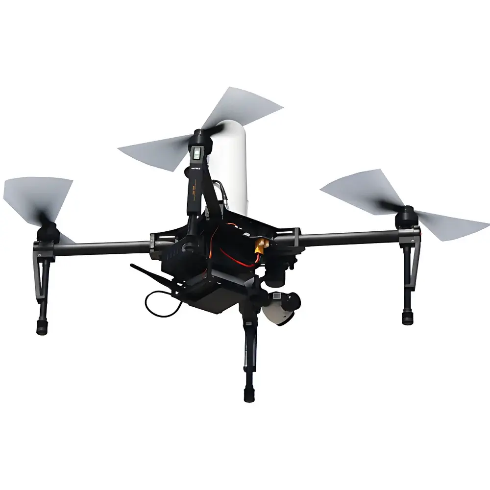
The STT OS-2 UAV-Mounted Electromagnetic Environment Monitoring System is an integrated airborne measurement platform engineered for spatially resolved electromagnetic field (EMF) characterization in three-dimensional airspace. Unlike ground-based survey systems constrained by terrain, infrastructure access, or line-of-sight limitations, the OS-2 leverages autonomous unmanned aerial vehicle (UAV) navigation to position calibrated RF electric field probes at precisely defined altitudes and coordinates. It operates on the principle of broadband isotropic field sensing—using triaxial active dipole sensors synchronized with high-precision GNSS (GPS/BeiDou/GLONASS) positioning—to capture real-time EMF magnitude and vector components across five discrete frequency bands. Designed for regulatory compliance assessment and environmental impact evaluation, the system supports quantitative assessment of electromagnetic radiation exposure against national and international reference levels (e.g., ICNIRP 2020, IEEE C95.1-2019, and China’s GB 8702-2014). Its core application domain includes spatial mapping of radiated emissions from fixed and mobile RF infrastructure without requiring physical access to elevated or hazardous locations.
Key Features
- Lightweight airframe (standard configuration: 3.4 kg), compliant with CAAC Class III UAV operational regulations—no pilot license required for deployment in non-restricted airspace.
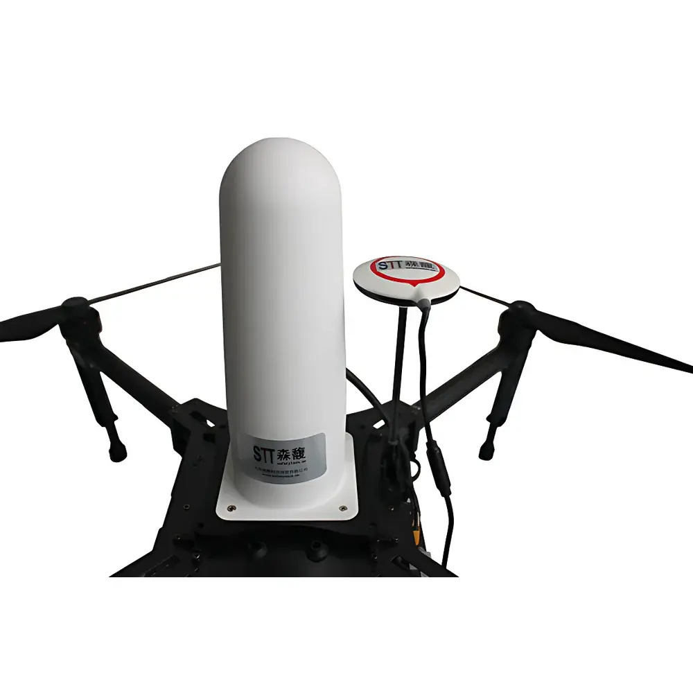
- RF-hardened probe architecture: Active electric field sensors incorporate shielding, differential signal conditioning, and adaptive filtering to suppress interference from UAV telemetry, video downlink, and onboard power electronics.
- Multi-sensor data fusion: Simultaneous acquisition of electric field strength (V/m), GNSS-derived 3D position (latitude/longitude/altitude), inertial velocity, ambient temperature/humidity, UAV battery status, and signal-to-noise ratio (SNR) metrics.
- Programmable autonomous flight modes: Predefined mission templates include hotspot circumnavigation (user-defined radius, altitude, azimuthal resolution), vertical profile scanning (constant-radius ascent/descent), horizontal attenuation profiling (radial distance decay), and grid-based volumetric sampling.
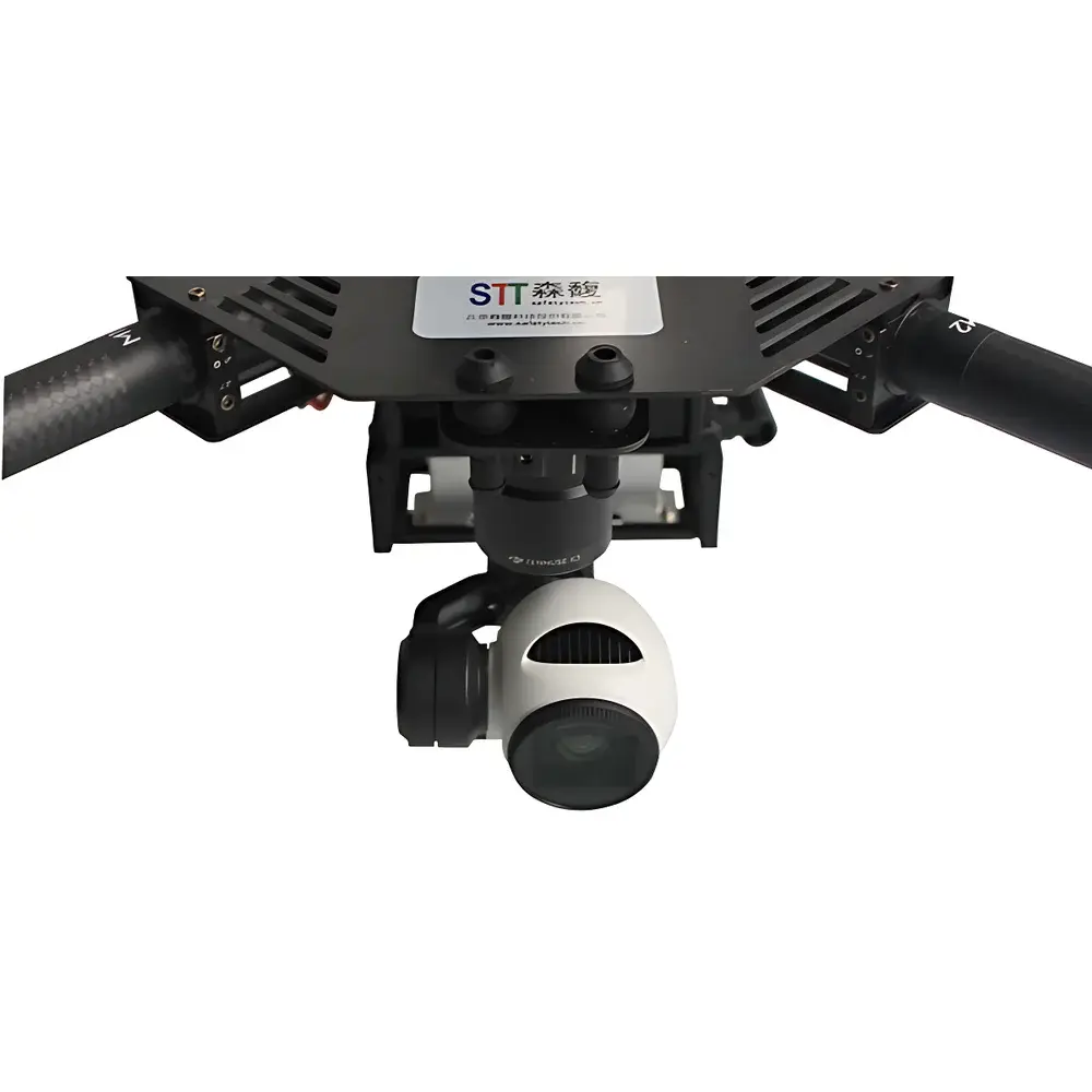
- Integrated HD electro-optical payload: Stabilized gimbal-mounted camera enables real-time visual verification of probe orientation relative to emission sources and georeferenced image/video logging synchronized with EMF timestamps.
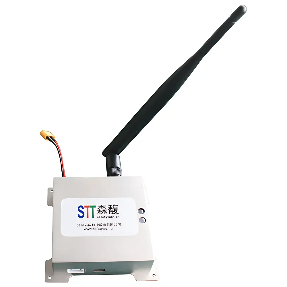
- Real-time telemetry link: Encrypted 2.4 GHz/5.8 GHz dual-band uplink/downlink ensures sub-second latency for remote command execution and live sensor data streaming to the ground control station (GCS).
Sample Compatibility & Compliance
The OS-2 system is validated for use in heterogeneous electromagnetic environments typical of telecommunications, broadcast, defense, and power transmission infrastructure. It supports measurements across civilian and industrial RF bands—from ELF power-frequency harmonics (1 Hz–100 kHz) through UHF broadcast (5 Hz–400 kHz), cellular macro/micro-cellular bands (100 kHz–6 GHz), and satellite communication/military radar bands (3 MHz–18 GHz). All hardware modules comply with EMC Directive 2014/30/EU and RoHS 2011/65/EU. Data acquisition firmware implements audit-trail logging per GLP/GMP-aligned workflows; raw datasets retain traceable metadata including sensor calibration certificate ID, GNSS time stamp (UTC + leap second offset), and environmental context tags. The system meets technical requirements for field surveys referenced in China’s HJ 972-2018 (Technical Specification for Electromagnetic Environment Monitoring of Mobile Communication Base Stations) and aligns with ISO/IEC 17025:2017 competence criteria for measurement uncertainty reporting.
Software & Data Management
The STT EMF Ground Control Station (GCS) software suite—running on Windows 10/11 x64—provides end-to-end mission planning, real-time visualization, and post-processing analytics. Mission parameters are configured via intuitive drag-and-drop interface: users define waypoints, hover durations, sensor sampling intervals (1–10 Hz configurable), and spectral averaging windows. Live data streams display E-field magnitude heatmaps overlaid on orthorectified satellite basemaps, with dynamic color scaling and iso-contour generation. Post-flight analysis exports include CSV-formatted time-series logs, KML/KMZ files for GIS integration, and automated PDF reports containing spatial distribution plots (2D polar/azimuthal, 3D surface mesh), statistical summaries (min/mean/max/std dev), and compliance margin calculations against applicable exposure limits. All data files are digitally signed and timestamped; optional 21 CFR Part 11-compliant electronic signature module available upon request.
Applications
- Spatial EMF mapping of mobile communication base stations (2G–5G NR), including near-field antenna pattern validation and beam tilt verification at operational heights.
- Compliance monitoring of AM/FM radio and digital TV broadcast towers—including directional antenna lobe characterization and ground-wave propagation modeling.
- Environmental impact assessment of high-voltage transmission lines, substations, and converter stations—quantifying magnetic field decay profiles perpendicular to conductor corridors.
- Military and civil radar site characterization: sidelobe detection, clutter analysis, and co-location interference screening in shared spectrum environments.
- Pre-deployment RF safety audits for temporary installations (e.g., event broadcasting, emergency comms hubs) where rapid aerial assessment is operationally critical.
- Research-grade EMF dosimetry studies supporting epidemiological investigations into long-term low-level exposure scenarios.
FAQ
What regulatory standards does the OS-2 system support for compliance reporting?
The system is configured to compute exposure ratios against ICNIRP 2020, IEEE C95.1-2019, and GB 8702-2014 limits; custom limit tables can be imported via XML schema.
Can the OS-2 perform simultaneous multi-band measurements?
No—it sequentially sweeps predefined frequency ranges using time-multiplexed sensor channel switching; total cycle time per waypoint is typically 3–8 seconds depending on bandwidth and averaging settings.
Is the system compatible with third-party UAV platforms?
The OS-2 is certified for integration only with STT-validated airframes (DJI Matrice 300 RTK and STT proprietary VTOL variants); cross-platform adaptation requires factory recalibration and firmware revalidation.
How is measurement traceability maintained during flight?
Each measurement packet embeds UTC time (PPS-synced), GNSS position covariance matrix, sensor temperature drift compensation coefficients, and a cryptographic hash of the active calibration file.
Does the GCS software support batch processing of multiple flight missions?
Yes—mission archives can be grouped by site, date, or operator; comparative analysis tools enable delta-E-field trending, inter-site correlation, and longitudinal exposure change detection.
Related Products


