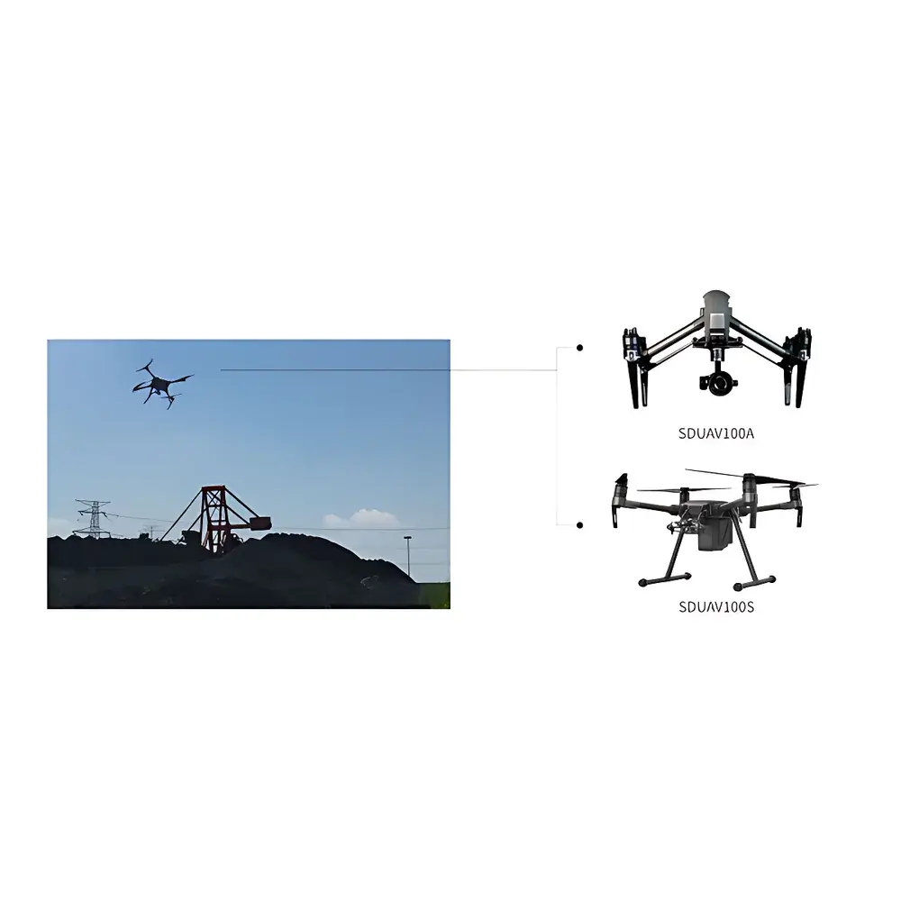
Sundy SDUAV Drone-Based Stockpile Volume Measurement System
| Brand | Sundy |
|---|---|
| Origin | Hunan, China |
| Manufacturer Type | Authorized Distributor |
| Product Origin | Domestic (China) |
| Model | SDUAV |
| Pricing | Available Upon Request |
| Endurance | 40 min |
| Wind Resistance | 12 m/s |
| Camera Resolution | 20 MP |
| Volumetric Measurement Accuracy | < 0.5% |
| Ground Sampling Distance (GSD) | 4 cm |
| Operating Temperature Range | −35 °C to +50 °C |
| UAV Weight | 915 g |
Overview
The Sundy SDUAV Drone-Based Stockpile Volume Measurement System is an industrial-grade photogrammetric surveying solution engineered for high-accuracy, non-contact volumetric quantification of bulk material stockpiles in open-air environments. Leveraging structure-from-motion (SfM) photogrammetry principles, the system captures georeferenced, overlapping aerial imagery using a calibrated 20-megapixel测绘-grade camera mounted on a purpose-built UAV platform. These images are processed through proprietary bundle adjustment and dense point cloud generation algorithms to reconstruct a geometrically accurate 3D surface model (digital surface model, DSM) of the stockpile. Volume computation is performed by differencing the DSM against a reference ground plane (e.g., bare-earth DTM or pre-surveyed base surface), enabling traceable, auditable, and repeatable volume determination per ISO 17123-8 (Optics and optical instruments — Field procedures for testing geodetic and surveying instruments — Part 8: GNSS receivers) and ASTM D6530 (Standard Practice for Determining Stockpile Volumes Using Aerial Photogrammetry). Designed for operational continuity in demanding industrial settings, the SDUAV system supports routine inventory management, logistics optimization, and regulatory compliance reporting across energy, mining, construction, and port operations.
Key Features
- Sub-0.5% volumetric measurement accuracy validated against terrestrial laser scanning (TLS) benchmarks under controlled field conditions;
- Full-coverage autonomous flight mission planning with obstacle-aware path optimization and real-time GNSS/IMU fusion navigation;
- Integrated intelligent collision avoidance system utilizing multi-sensor fusion (stereo vision + ultrasonic + barometric altimetry) for dynamic hazard detection and reactive maneuvering;
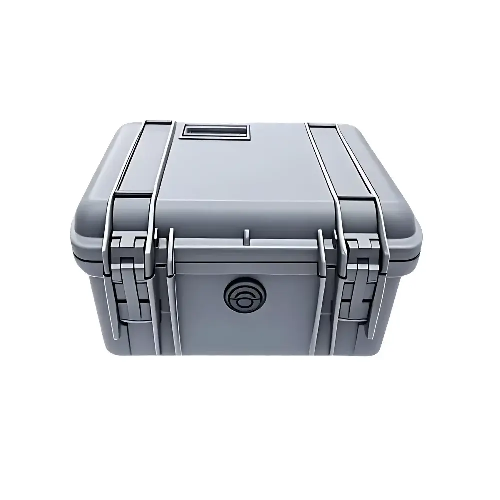
- Ruggedized airframe with IP54-rated enclosure, enabling reliable operation in light rain, dust-laden atmospheres, and ambient temperatures from −35 °C to +50 °C;
- Onboard redundant IMU and dual-frequency GNSS receiver (GPS + BeiDou) supporting RTK/PPK positioning for centimeter-level georeferencing accuracy;
- Modular payload architecture accommodating interchangeable sensors (e.g., multispectral, thermal) for future extensibility beyond volume estimation.
Sample Compatibility & Compliance
The SDUAV system is validated for volumetric analysis of heterogeneous, non-reflective, and irregularly shaped bulk materials including coal, iron ore, limestone, sand, gravel, ash, and slag. It accommodates both fully exposed outdoor stockpiles and semi-enclosed dry-storage facilities (e.g., open-sided covered sheds) where roof structures do not obstruct vertical imaging geometry. The workflow complies with data integrity requirements outlined in ISO/IEC 17025:2017 (General requirements for the competence of testing and calibration laboratories) and supports audit-ready documentation including raw image logs, GCP coordinates, processing parameters, and version-controlled project files. All software modules adhere to IEC 62443-3-3 cybersecurity standards for industrial automation systems.
Software & Data Management
The SDUAV Professional Processing Suite provides a unified, offline-capable desktop environment for mission configuration, photogrammetric reconstruction, and volumetric analytics. Core capabilities include automated tie-point extraction, robust camera self-calibration, adaptive mesh simplification, cross-section profiling, cut-fill analysis, and customizable reporting templates compliant with GLP/GMP documentation practices. Data export formats include LAS/LAZ (point clouds), OBJ/PLY (meshes), GeoTIFF (DSMs), CSV (volumes and statistics), and PDF reports with embedded metadata (EXIF, XMP). Audit trails record all user actions, parameter changes, and processing timestamps—fully aligned with FDA 21 CFR Part 11 electronic record and signature requirements when deployed in regulated environments.
Applications
- Power plant coal inventory reconciliation and fuel consumption forecasting;
- Port terminal bulk cargo throughput verification and berth occupancy analytics;
- Mining site reserve estimation, overburden removal tracking, and pit volume change monitoring;
- Cement plant raw material yard management and kiln feed stock control;
- Environmental compliance reporting for stockpile emissions (PM10/PM2.5 dispersion modeling inputs);
- Construction aggregate yard logistics optimization and delivery scheduling;
- Geotechnical monitoring of landfill cap volumes and leachate containment integrity assessments.
FAQ
What geospatial reference systems does the SDUAV support?
The system natively supports WGS84 (EPSG:4326), CGCS2000 (EPSG:4490), and user-defined local coordinate systems via Proj.4 string import.
Can the system operate without ground control points (GCPs)?
Yes—RTK/PPK-enabled workflows achieve ≤4 cm horizontal and ≤6 cm vertical absolute accuracy without GCPs; GCPs further improve consistency for long-term multi-temporal comparisons.
Is the software compatible with third-party GIS platforms?
All output formats (GeoTIFF, LAS, CSV, KML) are interoperable with Esri ArcGIS Pro, QGIS, Bentley ContextCapture, and AutoCAD Civil 3D.
How is measurement traceability ensured?
Each volume report embeds cryptographic hashes of raw imagery, processing logs, and calibration certificates—enabling full reproducibility and forensic validation.
What maintenance intervals are recommended for field deployment?
Pre-flight visual inspection and IMU/GNSS calibration before each mission; comprehensive firmware and sensor recalibration every 200 flight hours or annually—whichever occurs first.