
TW WY1 GNSS Slope Monitoring Station
| Brand | TW (Shandong Tianwei Environmental Technology) |
|---|---|
| Origin | Shandong, China |
| Manufacturer Type | OEM/ODM Manufacturer |
| Country of Origin | China |
| Model | TW-WY1 |
| Measurement Principle | GNSS-based Real-Time Kinematic (RTK) Displacement Monitoring with Ultrasonic Auxiliary Sensor Integration |
| Static Accuracy (Differential Mode) | Horizontal ±(2.5 mm + 1 ppm), Vertical ±(5 mm + 1 ppm) |
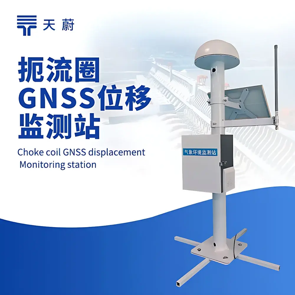
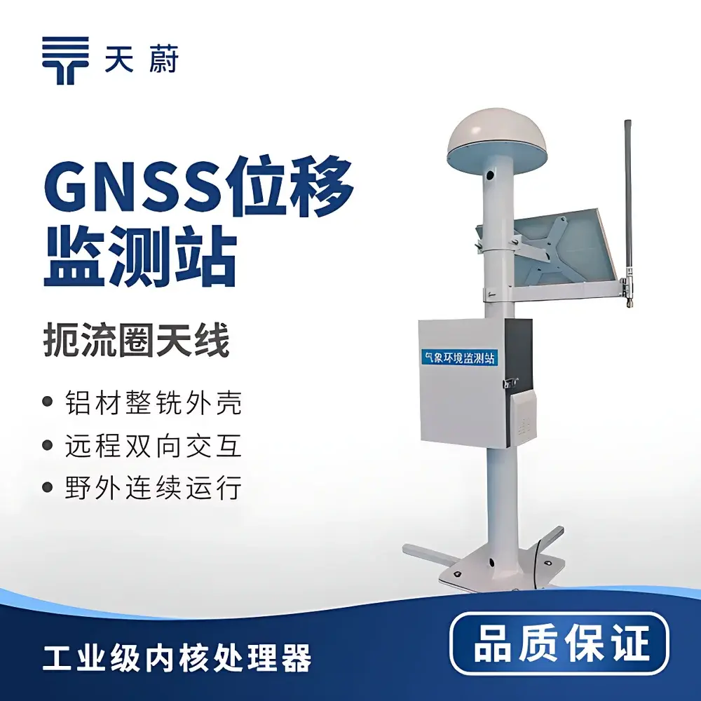
| Antenna Type | Choke-Ring Antenna with Magnetic Absorbing Material |
| Communication Protocols | Modbus-RTU, RTCM3 v3.x |
| Data Output Interfaces | RS485 (ASCII & Modbus-RTU), TCP/HTTP/UDP |
| Power Supply | DC 10–15 V (sensor) |
| Operating Temperature | −40 °C to +85 °C |
| Humidity Range | 0–95% RH (non-condensing) |
| Enclosure Dimensions | Ø360 mm × H163 mm |
| Typical Power Consumption | 0.6 W (sensor + LoRa), 0.96 W (with cloud upload) |
| Compliance | Supports ISO/IEC 17025-aligned field calibration workflows, compatible with GLP/GMP data integrity requirements via audit-trail-enabled platform logging |
Overview
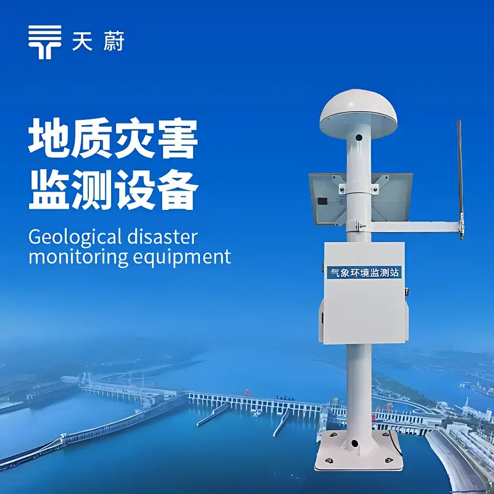
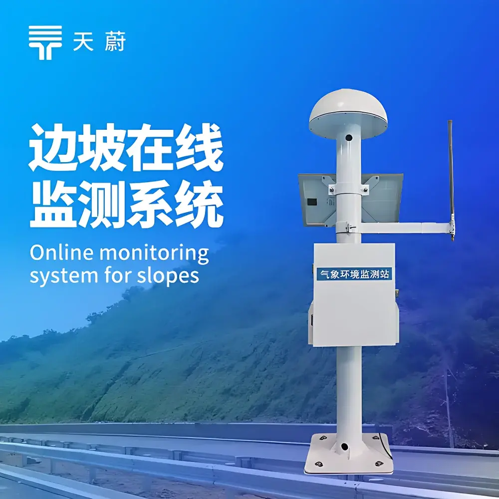
The TW WY1 GNSS Slope Monitoring Station is a purpose-built geotechnical displacement monitoring system engineered for long-term, high-reliability structural and surface deformation tracking in civil infrastructure and natural hazard mitigation applications. It operates on dual-principle sensing architecture: primary measurement relies on carrier-phase differential GNSS (Real-Time Kinematic, RTK) for millimeter-level absolute 3D position determination, while an integrated ultrasonic displacement sensor provides localized, short-baseline relative motion verification—particularly valuable during GNSS signal degradation (e.g., under canopy, near cliffs, or during ionospheric disturbance). Unlike standalone inclinometers or piezoelectric strain gauges, the WY1 delivers georeferenced, time-synchronized positional vectors traceable to ITRF frameworks, enabling quantitative assessment of slope kinematics—including horizontal translation, vertical subsidence, and rotational tilt—across baselines up to 2 km. Its design adheres to industry conventions for geodetic-grade monitoring stations per ISO 19901-7 (offshore structures) and ASTM D7928 (standard test method for in-situ soil shear strength using GNSS), supporting both static and quasi-dynamic deformation analysis.
Key Features
- Choke-ring GNSS antenna with embedded magnetic absorbing material—minimizes multipath error in complex topographic environments such as steep gorges, urban canyons, or forested slopes.
- Onboard RTK engine capable of autonomous displacement computation: outputs real-time horizontal (E/N) and vertical (U) displacement components without dependency on external cloud services.
- Multi-protocol communication stack: native support for Modbus-RTU over RS485, RTCM3 v3.x correction stream ingestion, and direct TCP/HTTP/UDP forwarding—enabling seamless integration into SCADA, IoT edge gateways, or proprietary telemetry systems.
- Hybrid power architecture: 30 W monocrystalline solar panel paired with 20 Ah LiFePO₄ battery ensures >30 days autonomy under full-duty cycle (including 4G transmission every 15 minutes).
- Embedded environmental sensor expansion port: allows daisy-chained connection of RS485-based temperature, rainfall, pore pressure, or tilt sensors—synchronizing ancillary data with GNSS epochs at firmware level.
- Local alarm logic engine: configurable thresholds for cumulative displacement, velocity, acceleration, and directional deviation—triggering relay outputs or LoRa alerts independent of network connectivity.
Sample Compatibility & Compliance
The TW WY1 is validated for deployment across heterogeneous geological and infrastructural contexts—including clay-rich landslide scarps, fractured rock slopes, earth-fill dams, reinforced concrete bridge piers, and open-pit mine walls. Its mechanical and environmental specifications meet IP67 ingress protection, MIL-STD-810G shock/vibration resistance, and CE RED Directive compliance for radio equipment. For regulatory traceability, raw RINEX 3.x observation files and NMEA 0183 GGA/VTG messages are preserved locally for ≥72 hours; all transmitted displacement vectors include timestamp precision ≤10 ns (GPS time scale) and metadata fields required under ISO/IEC 17025 Clause 7.5.2 for measurement uncertainty reporting. Platform-side data handling supports FDA 21 CFR Part 11-compliant audit trails when deployed in dam safety assurance programs governed by FERC or USACE guidelines.
Software & Data Management
The station interfaces with TW’s open-API cloud platform (accessible via HTTPS REST endpoints), which provides TLS 1.2-encrypted data ingestion, automated QC flagging (cycle slip detection, PDOP filtering, SNR thresholding), and 3D vector visualization using WebGL-based rendering—allowing users to animate temporal displacement trajectories, compute strain tensor approximations across multi-node arrays, and export time-series in CSV/NetCDF formats. All platform operations—including user role assignment, alarm rule editing, and firmware updates—are logged with immutable timestamps and operator identifiers. Edge firmware supports OTA updates signed with ECDSA-P256, ensuring supply-chain integrity. For air-gapped deployments, local SD card logging (FAT32 formatted) stores ASCII-formatted position solutions at 1 Hz with UTC synchronization via GPS PPS input.
Applications
- Early-warning monitoring of active landslides and cut-slope instability in highway/railway corridors.
- Deformation surveillance of tailings dams and leach pads under ASCE 7-22 and ICOLD Bulletin 135 protocols.
- Post-construction settlement validation for bridge abutments and foundation piles, aligned with AASHTO LRFD Bridge Design Specifications.
- Volcanic edifice deformation tracking where GNSS repeatability < 3 mm/year is required per IAVCEI standards.
- Permafrost-affected infrastructure monitoring in Arctic transport corridors, leveraging low-temperature operational envelope (−40 °C).
FAQ
What baseline length is recommended between base and rover stations?
For optimal RTK convergence and centimeter-level ambiguity resolution, maintain baseline distances ≤500 m. While functional up to 2 km, longer baselines increase reliance on atmospheric modeling and reduce availability of float/fixed solutions during high ionospheric activity.
Can the WY1 operate without cellular connectivity?
Yes. The unit performs full RTK positioning, displacement vector calculation, and local alarm triggering autonomously. LoRaWAN or wired RS485 output remains fully functional offline.
Is raw GNSS observables data accessible?
Yes—RINEX 3.04-compliant observation files (OBS) and navigation messages (NAV) are stored on microSD and available via FTP or serial dump. These support post-processing with Bernese, GAMIT/GLOBK, or RTKLIB.
How is vertical accuracy affected by terrain masking?
Elevation mask angle is configurable (default 10°). In canyon or forested settings, multipath mitigation via choke-ring antenna and SNR-weighted carrier smoothing preserves vertical repeatability within ±5 mm + 1 ppm under 50% sky visibility.
Does the system support integration with third-party SCADA platforms?
Yes—via Modbus-RTU register mapping (holding registers 40001–40100), ASCII NMEA streaming over TCP, or HTTP POST payloads in JSON schema. TW provides documented register tables and sample Python/C++ SDKs for rapid integration.