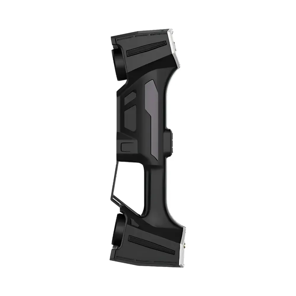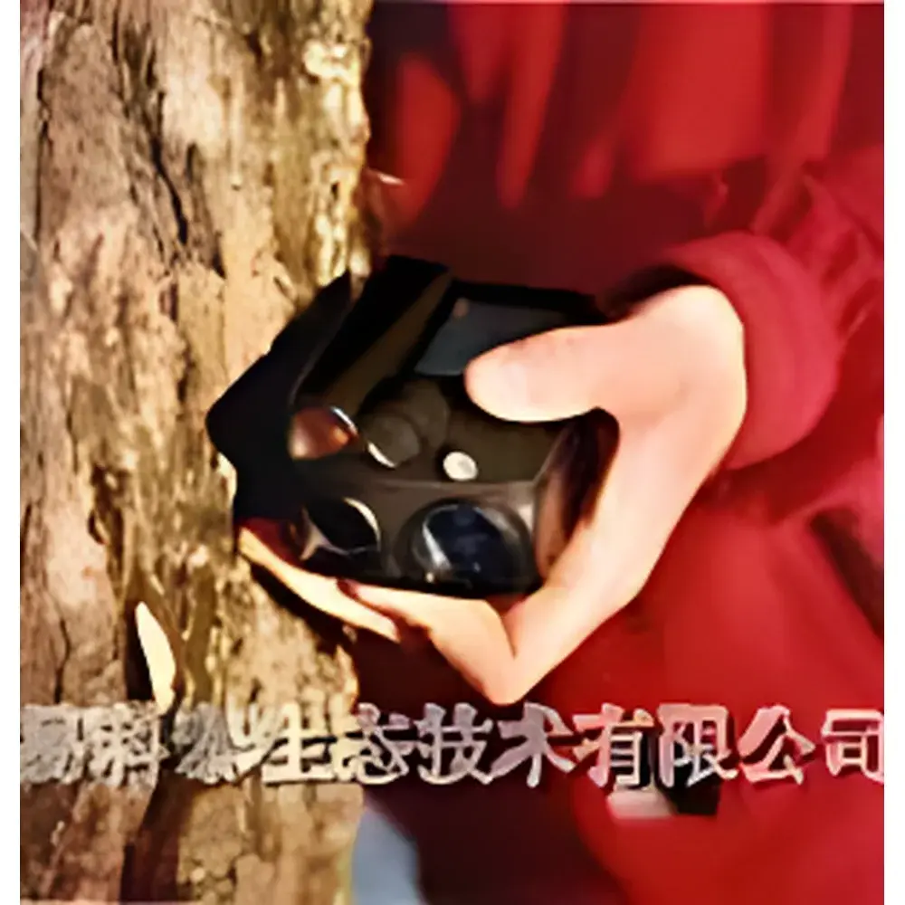
VL400 Laser & Ultrasonic Height and Distance Meter by LTI (Sweden)
| Key | Origin: Sweden |
|---|---|
| Type | Imported Instrument |
| Model | VL400 |
| Measurement Principle | Dual-mode (Class 1 Laser / Pulse-Echo Ultrasonic) |
| Dimensions | 95 × 70 × 58 mm |
| Weight | 260 g (incl. battery) |
| Power | 1×CR2 3V lithium battery |
| Power Consumption | 60 mW |
| Operating Temperature | −15 °C to +45 °C |
| Max Height Range | 0–999 m |
| Height Resolution | 0.1 m |
| Angle Range | −55° to +85° |
| Angle Resolution/Accuracy | 0.1° |
| Laser Range (diffuse target) | up to 350 m |
| Laser Range (retroreflective) | 130–900 m |
| Laser Distance Resolution | 0.5 m (<100 m), 1 m (≥100 m) |
| Laser Distance Accuracy | ±0.25 m (<100 m), ±1 m (≥100 m) |
| Ultrasonic Range (60° transducer) | ≥30 m |
| Ultrasonic Range (360° transducer) | ≥20 m |
| Ultrasonic Resolution | 0.01 m |
| Ultrasonic Accuracy | <1% of reading |
| T3 Transponder Dimensions | Ø70 mm |
| T3 Weight | 85 g (incl. AA battery) |
| T3 Power | ≤9 mW |
| Interface | Built-in infrared data port |
| Units | Switchable metric/imperial (distance/height), degree/grade/% (angle) |
Overview
The VL400 Laser & Ultrasonic Height and Distance Meter is a field-deployable, dual-sensor precision instrument engineered for forestry, ecological surveying, and terrain-based geometric measurement in challenging outdoor environments. Unlike single-technology rangefinders, the VL400 integrates Class 1 laser time-of-flight (TOF) and pulse-echo ultrasonic distance measurement within a single handheld platform—enabling reliable operation under variable visibility, canopy density, and surface reflectivity conditions. Its core design addresses the physical constraints of natural terrain: non-planar ground slopes, irregular tree crown geometry, low-reflectivity bark surfaces, and partial occlusion from foliage or precipitation. The device operates on fundamental acoustic and optical propagation principles—laser mode provides high spatial resolution for line-of-sight targets with known reflectance; ultrasonic mode leverages wide-beam emission (60° or omnidirectional 360° transducers) to measure distance to diffuse, non-reflective, or partially obscured objects where optical paths are obstructed. All measurements are georeferenced via integrated inclinometer (dual-axis tilt sensor) and angular encoder, enabling simultaneous derivation of horizontal distance, vertical height, slope angle, and elevation differential without external GNSS input.
Key Features
- Dual-sensing architecture: Independent selection between Class 1 (IEC 60825-1 compliant) laser ranging and pulse-echo ultrasonic ranging—automatically optimized per environmental feedback (e.g., rain detection triggers ultrasonic priority).
- Rain-resistant housing with IP54-rated enclosure; firmware-integrated “Rain Mode” dynamically adjusts signal processing gain and echo discrimination thresholds to suppress false returns from water droplets.
- Optical sighting system with 8× magnification and dual reticle options: red crosshair for coarse targeting and collimated laser dot for precise point acquisition—both visible under daylight conditions.
- Multi-point measurement capability: Supports sequential recording of up to 99 discrete points per session for crown profile analysis, canopy layer mapping, or vertical stratification studies.
- BAF (Basal Area Factor) calculation module: Enables direct estimation of stand basal area per hectare using standard prism-based sampling logic—calibrated for common hardwood and conifer species.
- Infrared (IrDA 1.1) data interface: Enables secure, line-of-sight transfer of raw measurement logs (distance, angle, timestamp, mode flag) to field tablets or ruggedized laptops without Bluetooth pairing overhead.
- Configurable unit system: Metric (m, cm, °) and imperial (ft, in, % grade) units selectable per parameter domain—maintains traceability to NIST or EURAMET calibration frameworks.
Sample Compatibility & Compliance
The VL400 is validated for use across heterogeneous natural substrates—including rough-bark tree trunks (Pinus sylvestris, Quercus robur), moss-covered rock faces, wet soil surfaces, and suspended conductors (e.g., overhead power lines at 11–33 kV). Its ultrasonic transducer (T3 series) meets IEC 60651 sound pressure level limits for handheld emitters and complies with EN 62209-2 SAR assessment protocols for operator proximity exposure. Laser output adheres to FDA 21 CFR 1040.10 and IEC 60825-1:2014 Class 1 safety requirements. Firmware supports audit-ready logging with embedded UTC timestamps and sensor status flags—facilitating GLP-aligned data capture in regulated forestry inventories (e.g., FSC-certified harvest planning, REDD+ carbon stock monitoring). Device calibration certificates conform to ISO/IEC 17025:2017 requirements when issued by accredited Swedish metrology laboratories (e.g., SP Technical Research Institute of Sweden).
Software & Data Management
Raw measurement files (.vl400bin) export via IrDA to proprietary desktop software (VL Manager v4.2), which performs automated coordinate transformation using local horizontal plane projection (LHP) algorithms. The software applies ISO 5725-2 defined reproducibility corrections for temperature-induced speed-of-sound drift in ultrasonic mode and compensates for atmospheric refraction in laser mode per Ciddor equation approximations. Export formats include CSV (with header metadata), DXF (for CAD integration), and GeoJSON (for GIS overlay with QGIS or ArcGIS Pro). All logged sessions retain immutable digital signatures—supporting 21 CFR Part 11-compliant electronic records when paired with validated Windows OS environments and user-authenticated login protocols.
Applications
- Forestry inventory: Tree height, DBH (via BAF), crown base height, and inter-canopy gap analysis in mixed-species stands.
- Ecological corridor assessment: Vertical structure profiling of riparian buffers and windbreak plantings.
- Utility asset management: Clearance verification of vegetation encroachment beneath transmission lines—measured at safe ground-level positions without climbing.
- Geomorphic surveying: Slope stability evaluation on forested hillsides using repeatable multi-angle height differencing.
- Wildlife habitat modeling: Understory density quantification via ultrasonic penetration depth analysis at varying azimuths.
- Educational fieldwork: Calibration exercises in physical geography curricula covering error propagation in indirect height estimation (e.g., tangent method vs. dual-sensor fusion).
FAQ
What is the maximum measurable height under dense canopy using ultrasonic mode?
Ultrasonic mode achieves reliable height determination up to 200 m in closed-canopy conifer stands when used with the TRP360PL 360° transponder—subject to ambient noise floor <55 dB(A) and wind speed <4 m/s.
Does the VL400 support real-time differential correction via external GNSS?
No—the VL400 is a self-contained geometric instrument and does not interface with RTK-GNSS receivers; however, exported coordinates can be post-processed using CORS network data in VL Manager.
Is firmware upgrade possible in-field without returning to service center?
Yes—firmware updates are delivered as signed .hex packages via IrDA; installation requires administrator-level authentication and automatic rollback if CRC validation fails.
How is measurement uncertainty quantified across operational temperature ranges?
Total expanded uncertainty (k=2) is documented per ISO/IEC 17025:2017 Annex A: ±0.35 m (height, −15°C to +25°C), ±0.55 m (+25°C to +45°C), derived from combined Type A (repeatability) and Type B (temperature coefficient, calibration drift) components.
Can the T3 transponder operate independently of the VL400 main unit?
Yes—the T3 module functions as a standalone passive reflector in laser mode or active emitter in ultrasonic mode; its AA-powered configuration enables unattended deployment for up to 18 months in low-duty-cycle monitoring scenarios.