YP-ZG02 Portable Optical Crop Height Meter by Youyunpu
| Brand | Youyunpu |
|---|---|
| Origin | Shandong, China |
| Manufacturer Type | Direct Manufacturer |
| Region of Origin | Domestic (China) |
| Model | YP-ZG02 |
| Price | USD 2,350 (approx.) |
| Measurement Range | 40–300 cm |
| Accuracy | ±1 mm |
| Measurement Principle | Enclosed Optical Time-of-Flight (ToF) Distance Sensing |
| Housing Material | Anodized Aluminum Alloy |
| Operating System | Android-based Embedded OS |
| Battery Life | >10 hours continuous operation |
| Onboard Storage | 128 GB internal flash memory |
| Wireless Connectivity | Wi-Fi 5 (802.11ac) & LTE Cat-4 |
| Max Working Distance | Up to 10 m between smartphone and measurement pole |
| Data Export Format | CSV, Excel (.xlsx), Geo-tagged JPEG |
| Language Support | English / Chinese (toggle via UI) |
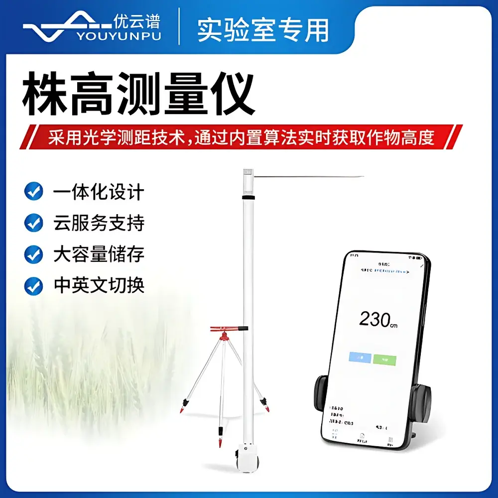
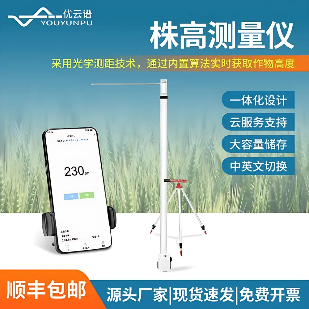
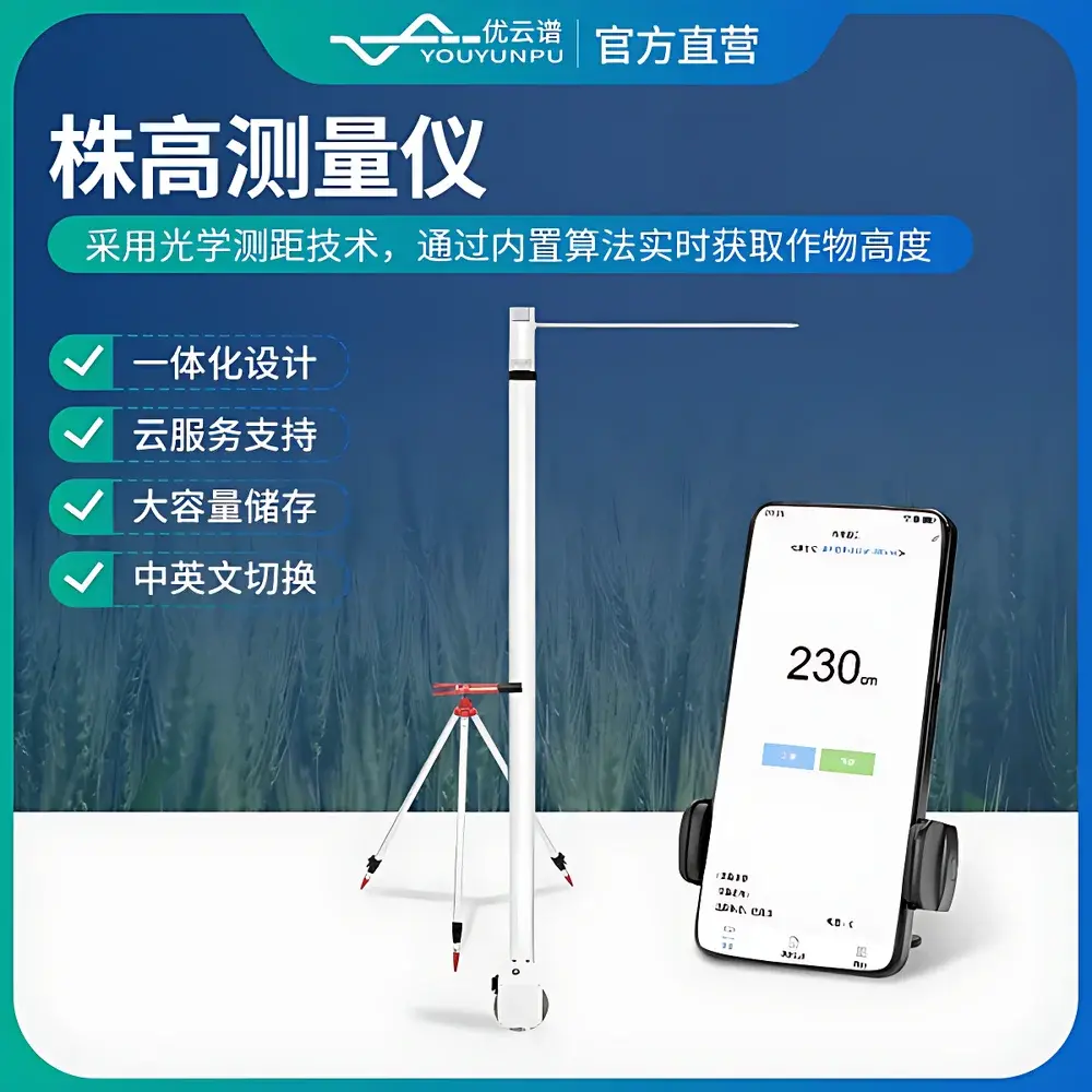
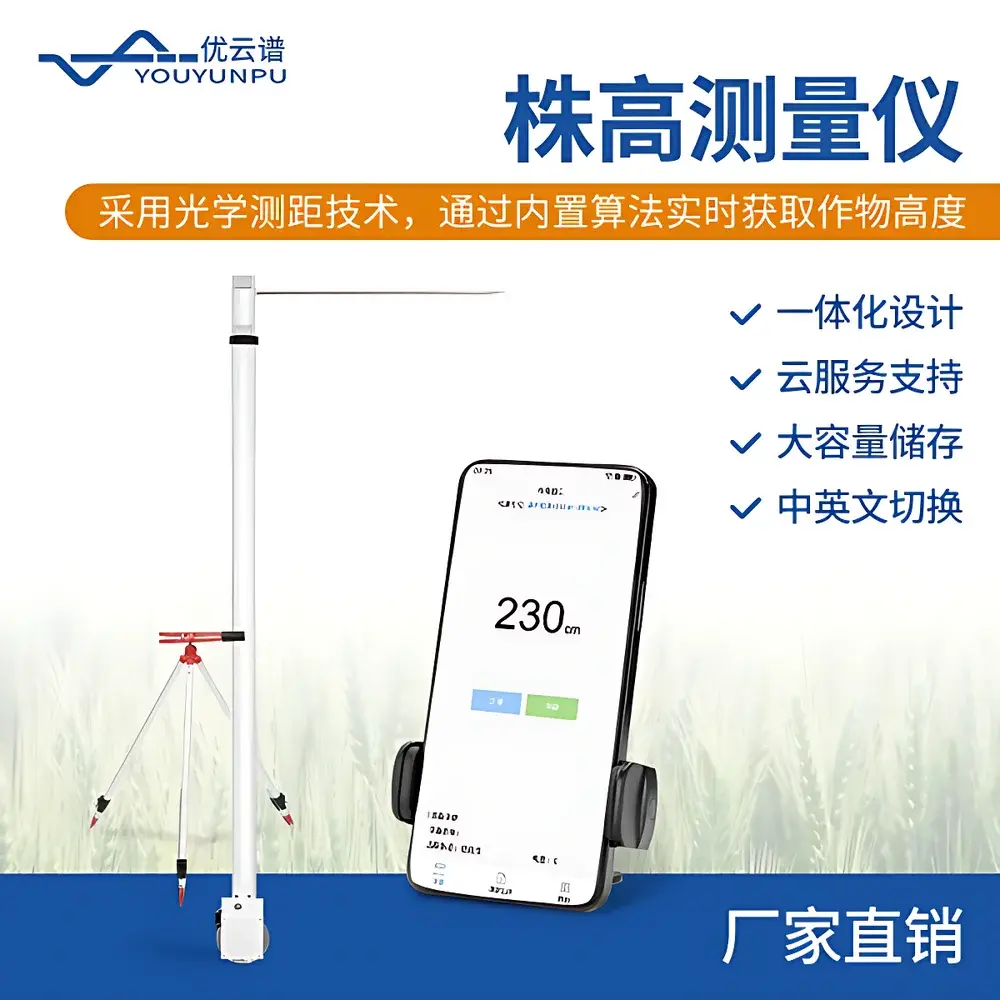
Overview
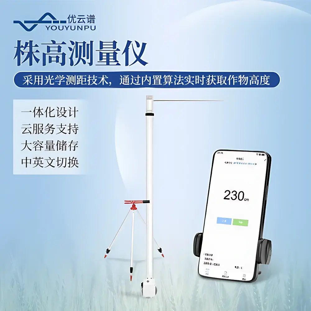
The YP-ZG02 Portable Optical Crop Height Meter is an engineered field instrument designed for high-throughput, non-destructive phenotyping of plant height in agricultural and agronomic research settings. It operates on a calibrated optical time-of-flight (ToF) distance sensing principle—distinct from conventional photogrammetry or manual ruler-based methods—where a fully enclosed, eye-safe infrared emitter and receiver module emits pulsed light and precisely computes the round-trip time to a target surface (e.g., canopy top or apical meristem). This closed-loop optical architecture eliminates ambient light interference, ensuring consistent performance under variable solar irradiance, cloud cover, or low-light field conditions. The system integrates a rigid, telescoping aluminum measurement pole with integrated bubble level and ground-stabilizing tripod base, enabling rapid deployment and repeatable vertical alignment across heterogeneous field plots. Its primary design objective is to support standardized, operator-independent height acquisition aligned with FAO crop monitoring protocols and ISO 21748:2017 (Guidance for the evaluation of measurement uncertainty).
Key Features
- Enclosed ToF optical sensor with factory-calibrated baseline—no user calibration required prior to deployment
- Integrated dual-axis digital inclinometer and bubble level for real-time tilt compensation and verticality verification
- Modular Android-based control unit with 5.5-inch sunlight-readable touchscreen and pre-installed Youyunpu FieldPheno™ app
- 128 GB onboard storage supporting timestamped metadata: GPS coordinates (GNSS-enabled), crop species ID, observer ID, growth stage code (BBCH scale), and synchronized high-res JPEG capture
- Wireless tethering mode: smartphone acts as remote display/controller within 10 m line-of-sight; optional Bluetooth 5.0 fallback for local configuration
- IP65-rated housing for dust and water resistance during extended field use in rain, dew, or high-humidity environments
- Battery-powered operation with hot-swappable 14,200 mAh Li-ion pack; supports USB-C PD fast charging and external power bank integration
Sample Compatibility & Compliance
The YP-ZG02 accommodates a broad spectrum of monocot and dicot species—including but not limited to Zea mays (maize), Triticum aestivum (wheat), Oryza sativa (rice), Glycine max (soybean), and Brassica napus (oilseed rape)—across vegetative and reproductive growth stages. It is validated for use in both flat-field and raised-bed cultivation systems, with stable readings achievable on soil, mulch, gravel, and low-canopy residue surfaces. The device conforms to IEC 61000-6-3 (EMC emission limits) and IEC 60529 (IP65 ingress protection). Data logging workflows comply with ALCOA+ principles (Attributable, Legible, Contemporaneous, Original, Accurate, Complete, Consistent, Enduring, Available) for GLP-aligned trials. Optional audit trail module supports 21 CFR Part 11-compliant electronic records when deployed with validated cloud infrastructure.
Software & Data Management
The Youyunpu FieldPheno™ software suite provides native Android application control, offline data capture, and structured metadata tagging per ISO 11783-10 (Tractor/Implement data exchange). All measurements are stored in SQLite databases with SHA-256 hash integrity verification. Export functions generate ISO-standardized CSV files compliant with MIAPPE v1.1 (Minimum Information About a Plant Phenotyping Experiment) and include embedded EXIF tags containing GPS altitude, compass heading, and sensor temperature. Cloud synchronization occurs via TLS 1.3-encrypted HTTPS POST to Youyunpu’s ISO 27001-certified SaaS platform, supporting role-based access control (RBAC), automated backup rotation, and RESTful API integration with third-party LIMS or breeding management systems (e.g., BreedBase, DMS).
Applications
- High-resolution longitudinal tracking of genotype-by-environment (G×E) height dynamics in yield trials
- Validation of UAV-derived canopy height models (CHMs) at plot-level ground truthing
- Early detection of lodging susceptibility in cereal breeding programs
- Phenotypic screening for dwarfing gene expression (e.g., Rht-B1b, sd1) under nitrogen gradient treatments
- Supporting digital twin development for crop growth simulation models (e.g., APSIM, DSSAT)
- Extension service delivery: rapid farmer-facing diagnostics for stand establishment uniformity assessment
FAQ
Does the YP-ZG02 require annual recalibration?
No—optical path stability is maintained through hermetically sealed sensor housing and NIST-traceable factory calibration. Users receive a Certificate of Conformance with each unit; field verification against certified gauge blocks is recommended every 12 months per ISO/IEC 17025 guidelines.
Can the device measure height of lodged or tilted plants?
Yes—the integrated inclinometer automatically applies angular correction to raw ToF distance values, reporting true vertical height relative to local ground plane, provided the measurement pole remains plumb.
Is raw sensor data accessible for custom algorithm development?
Yes—developers may request the binary sensor protocol documentation and SDK under NDA; raw ToF pulse timing logs and reflectance intensity arrays are exportable via USB-MSC mode.
What GNSS accuracy does the built-in positioning module achieve?
Horizontal accuracy is 2.5 m CEP (95%) with standalone GPS/Galileo; improves to <1.2 m with SBAS (WAAS/EGNOS) enabled and <0.5 m with RTK correction input via Bluetooth NTRIP client.
How is data security handled during cloud upload?
All transmissions use AES-256 encryption in transit and at rest; user accounts enforce MFA, and organizational tenants operate on logically isolated database schemas per GDPR and CCPA requirements.
Related Products


