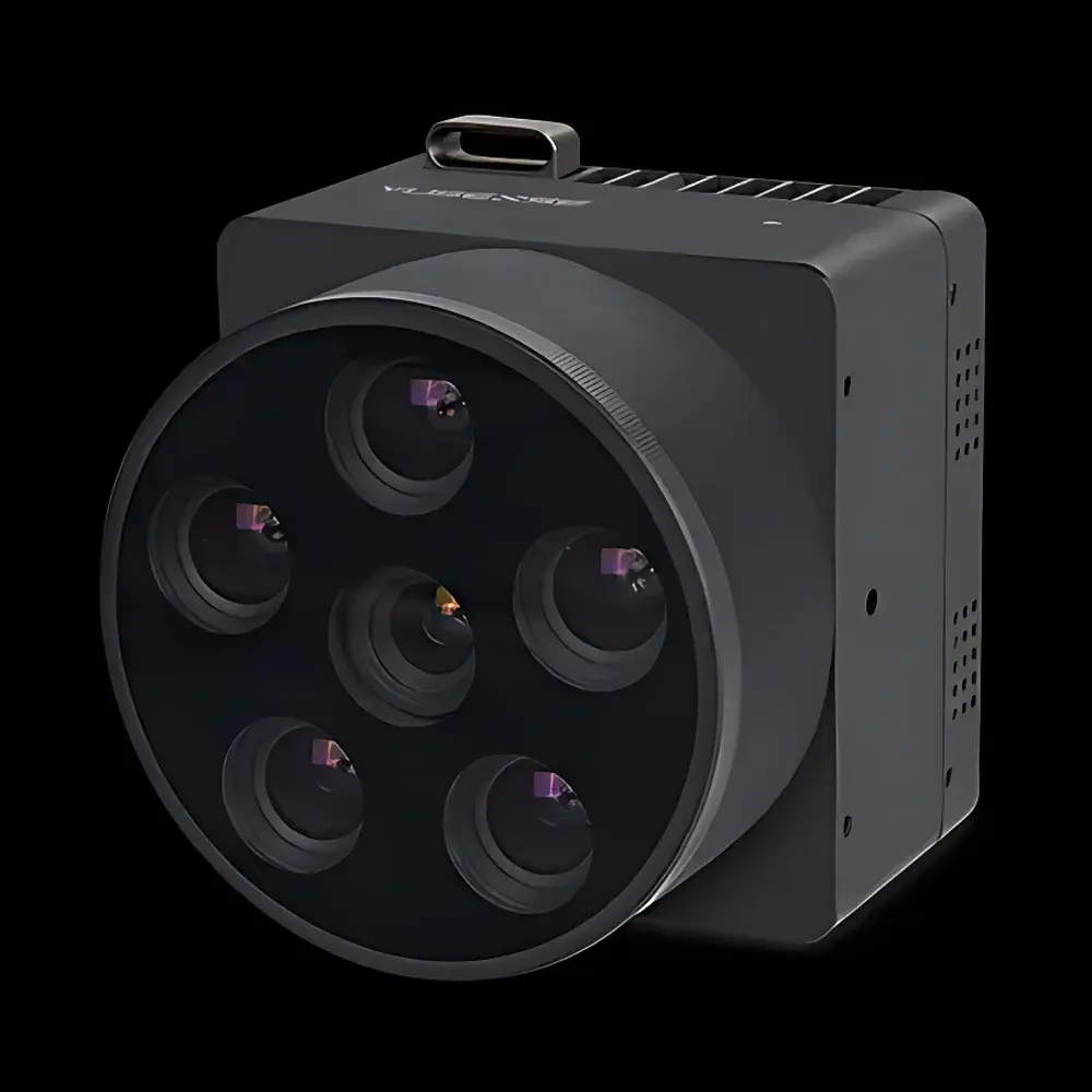
YUSENSE AQ600 Multispectral Imaging System
| Brand | YUSENSE |
|---|---|
| Model | AQ600 |
| Sensor Configuration | 5 × 3.2 MP multispectral channels + 1 × 12.3 MP RGB channel |
| Spectral Resolution | 12-bit global shutter (multispectral), 8-bit rolling shutter (RGB) |
| Frame Synchronization | <1 s across all 6 channels |
| Interface | Gigabit Ethernet, TTL serial, DJI X-PORT |
| Onboard Processing | Real-time spectral inversion and video streaming |
| Radiometric Calibration | Integrated Downwelling Light Sensor (DLS) |
| Power | 12 V DC, 10–15 W |
| Storage | 128 GB onboard SSD |
| Trigger Modes | External, timed, overlap-based |
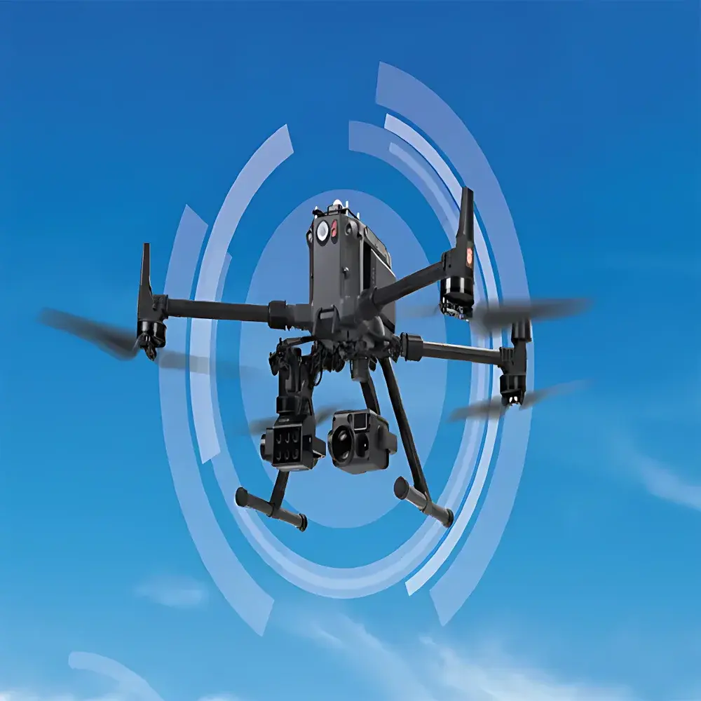
| Platform Compatibility | Multirotor & fixed-wing UAVs |
| Optical Window | Sapphire lens cover |
| Lens | Large-aperture, low-distortion optics optimized for aerial remote sensing |
Overview
The YUSENSE AQ600 Multispectral Imaging System is a high-integration, UAV-deployable remote sensing payload engineered for quantitative environmental monitoring and precision geospatial analysis. Built upon a synchronized six-channel optical architecture—comprising five discrete narrowband multispectral bands and one high-resolution RGB channel—the AQ600 enables simultaneous acquisition of spectrally resolved reflectance data at native spatial resolutions up to 3.2 megapixels per multispectral band and 12.3 megapixels for visible-color imaging. Its measurement principle relies on calibrated reflectance capture under controlled illumination conditions, with radiometric accuracy maintained via integrated downwelling light sensor (DLS) compensation and factory-applied spectral response characterization. Designed for operational robustness in field-deployed aerial platforms, the system features a sapphire optical window for scratch resistance and environmental sealing, large-aperture low-distortion lenses to minimize geometric error across wide fields of view, and hardware-level synchronization ensuring sub-second temporal alignment across all spectral acquisitions. The AQ600 supports both scientific-grade post-processing workflows and real-time decision support through onboard spectral inversion algorithms, making it suitable for time-sensitive applications such as dynamic vegetation stress mapping or rapid water quality assessment.
Key Features
- Six-channel synchronized imaging: 5 × 3.2 MP multispectral bands (user-configurable center wavelengths within 400–900 nm range) + 1 × 12.3 MP RGB channel
- High-fidelity radiometry: 12-bit global shutter for multispectral channels ensures motion artifact suppression during UAV flight; 8-bit rolling shutter for RGB maintains compatibility with standard video pipelines
- Real-time onboard processing: Embedded spectral index computation (e.g., NDVI, NDRE, CIred-edge) and H.264-encoded video output via Gigabit Ethernet or DJI X-PORT interface
- Integrated radiometric reference: Factory-calibrated downwelling light sensor (DLS) enables per-frame illumination normalization, critical for diurnal consistency and cross-flight comparability
- Flexible deployment architecture: Supports external trigger, programmable timed capture, and overlap-based triggering—enabling seamless integration into automated flight planning systems (e.g., Pix4Dcapture, DroneDeploy)
- Power-efficient design: Operates within 12 V DC input range at 10–15 W nominal load; compatible with standard UAV power distribution units and battery management systems
- Robust mechanical construction: IP-rated enclosure with sapphire front optic, thermal stabilization for stable performance across ambient temperatures from −10 °C to +50 °C
Sample Compatibility & Compliance
The AQ600 is optimized for non-contact, wide-area surface reflectance measurement across heterogeneous natural and managed landscapes. It is routinely deployed over agricultural croplands (e.g., corn, soybean, rice), forest canopies (including mixed deciduous/conifer stands), inland freshwater bodies (lakes, reservoirs, rivers), and urban-adjacent ecological corridors. All spectral bands are traceably characterized against NIST-traceable standards during manufacturing. The system complies with ISO 17025-accredited calibration protocols for radiometric stability verification and meets electromagnetic compatibility requirements per EN 61000-6-3:2011 (industrial environment emissions) and EN 61000-6-2:2016 (immunity). While not certified for aviation safety under DO-160, its mechanical and electrical interfaces conform to common UAV integration guidelines published by ASTM F38 and RTCA SC-228.
Software & Data Management
Raw AQ600 data are stored in standardized GeoTIFF format with embedded EXIF and XMP metadata—including GPS position, IMU orientation, DLS irradiance values, and per-band exposure parameters. The YUSENSE SDK provides C++ and Python APIs for custom spectral processing pipeline development. Official software tools include YUSENSE Studio (Windows/macOS), supporting batch radiometric correction, orthomosaic generation, and spectral library matching. Data export supports ENVI .hdr/.dat, ERDAS Imagine .img, and cloud-ready Cloud Optimized GeoTIFF (COG) formats. Audit trails, user authentication, and version-controlled processing logs are available in enterprise deployments to satisfy GLP-compliant documentation requirements per OECD 172 and ISO/IEC 17025:2017 Annex A.2.
Applications
- Precision agriculture: Crop health monitoring, nitrogen status estimation, irrigation scheduling, and yield prediction using red-edge and near-infrared indices
- Forestry management: Species classification, canopy density estimation, post-fire regrowth tracking, and invasive species detection
- Inland water quality assessment: Chlorophyll-a concentration mapping, suspended sediment load estimation, and harmful algal bloom (HAB) early warning
- Ecological restoration monitoring: Vegetation cover change detection, soil moisture proxy derivation, and habitat fragmentation analysis
- Infrastructure impact assessment: Post-construction land use change quantification, linear infrastructure corridor monitoring (e.g., transmission lines, pipelines)
FAQ
What spectral bands are preconfigured in the AQ600?
The standard configuration includes centered wavelengths at 490 nm (blue), 550 nm (green), 660 nm (red), 730 nm (red edge), and 840 nm (near-infrared), with full customization available upon request.
Does the AQ600 support radiometric calibration in-flight?
Yes—integrated DLS provides continuous downwelling irradiance measurement, enabling per-frame normalization. Optional reflectance panel capture workflows are supported for absolute calibration.
Can AQ600 data be processed in third-party photogrammetry software?
Yes—GeoTIFF outputs with geotags and rational polynomial coefficients (RPCs) are natively supported in Pix4Dmapper, Agisoft Metashape, and DroneDeploy.
Is firmware update capability available remotely?
Firmware updates are delivered via secure HTTPS endpoint and applied through the YUSENSE Studio interface; no physical access to the device is required.
What UAV platforms has the AQ600 been validated on?
Field validation includes DJI Matrice 300 RTK, Autel EVO II Dual 640T, Freefly Alta X, and SenseFly eBee X; integration kits are available for custom airframes.


