COMECAUSE IN-G30 Portable Canopy Analyzer
| Brand | COMECAUSE |
|---|---|
| Origin | Shandong, China |
| Manufacturer Type | Original Equipment Manufacturer (OEM) |
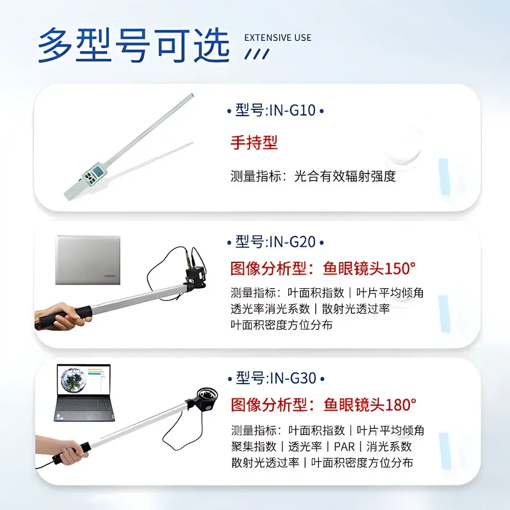
| Model | IN-G30 |
| Principle | Hemispherical Image Analysis |
| Type | Portable |
| Spectral Range | 400–700 nm |
| Lens FOV | 180° (Fisheye) |
| Resolution | 2592 × 1944 |
| PAR Measurement Range | 0–3000 μmol·m⁻²·s⁻¹ |
| Operating Temperature | −10°C to 55°C |
| Relative Humidity | ≤85% RH |
| Weight | 500 g |
| Interface | USB |
Overview
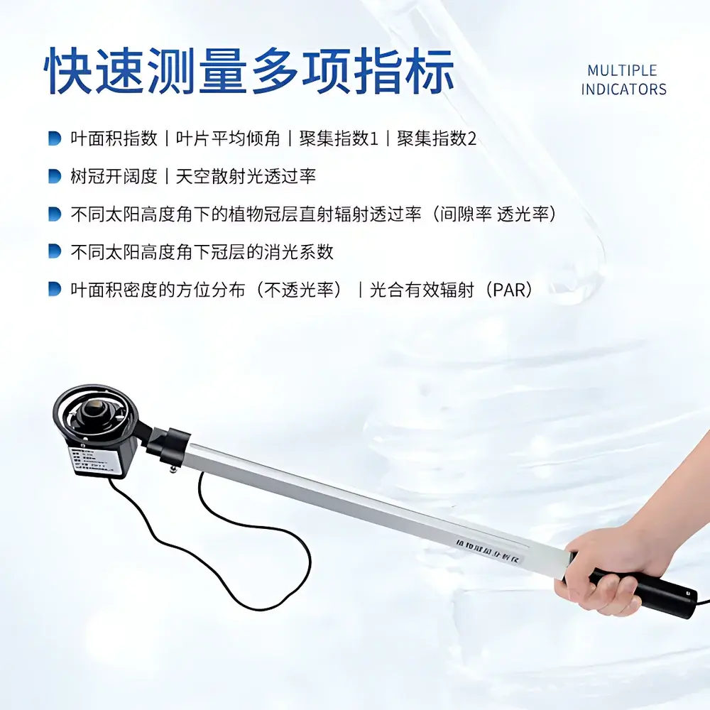
The COMECAUSE IN-G30 Portable Canopy Analyzer is a field-deployable, hemispherical imaging instrument engineered for quantitative structural and radiative characterization of plant canopies. It operates on the physical principle of gap fraction analysis derived from upward-looking fisheye photography—grounded in Beer–Lambert law assumptions and validated semi-empirical models widely adopted in canopy biophysics. By capturing full-hemispheric (180° field-of-view) digital images under natural daylight or controlled illumination, the system computes spatially resolved canopy architecture parameters—including leaf area index (LAI), foliage inclination distribution, clumping indices (CI₁ & CI₂), canopy openness, diffuse transmittance, direct beam transmittance at variable solar zenith angles, extinction coefficient, and azimuthally segmented light interception profiles. Its design prioritizes reproducibility in heterogeneous field conditions, supporting rigorous ecological monitoring, precision agronomy trials, and forest structure modeling without requiring permanent infrastructure or power grids.
Key Features
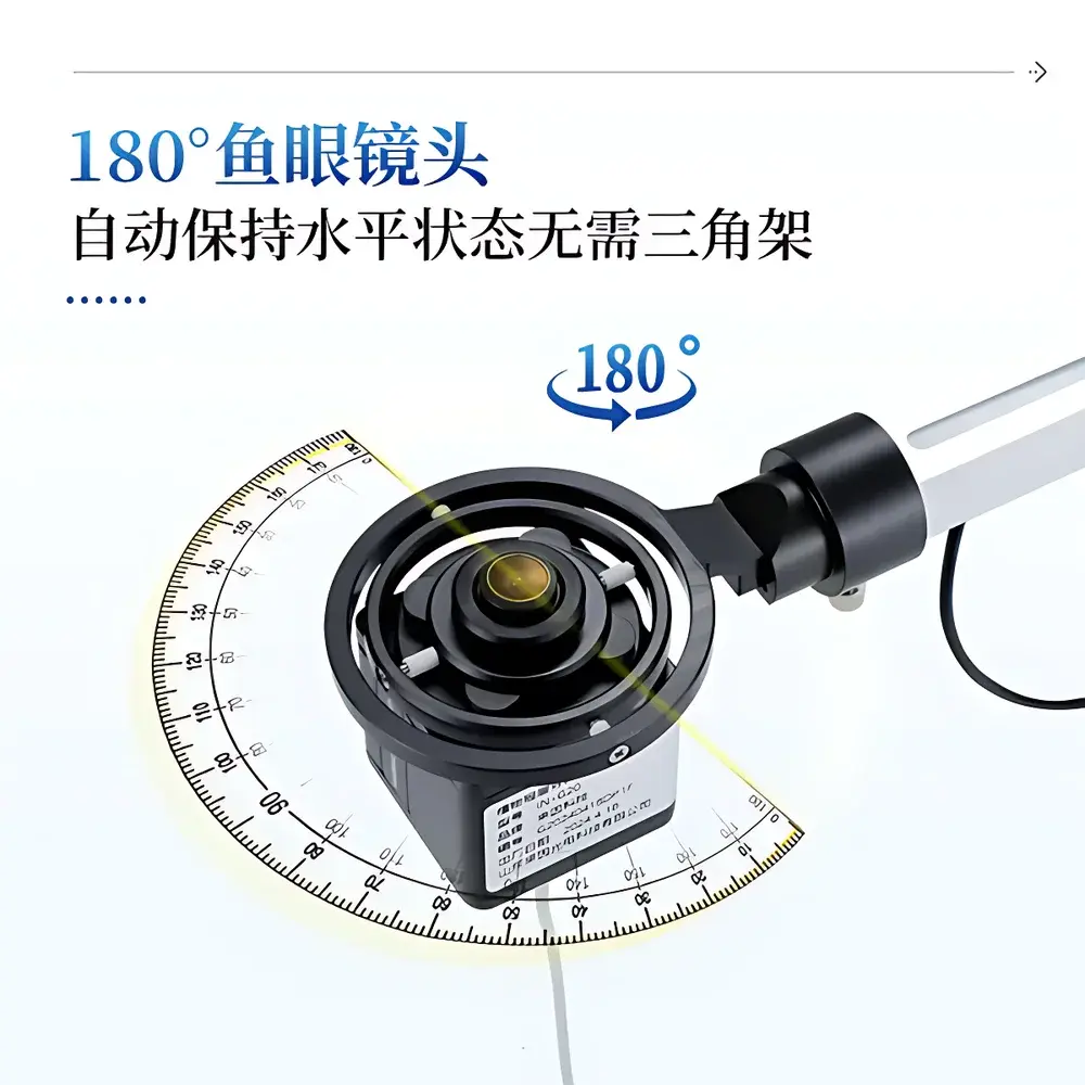
- Fisheye optical module with automatic leveling via integrated gimbal mount—enabling stable, tripod-free acquisition even on uneven terrain;
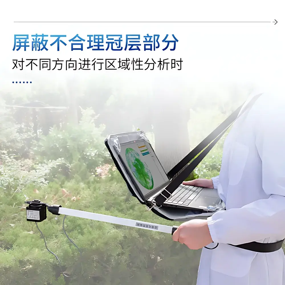
- Modular telescoping measurement pole (with integrated 25-point PAR sensor array) for stratified vertical profiling within canopies;
- High-resolution CMOS image capture (2592 × 1944 pixels) optimized for contrast-based segmentation across the photosynthetically active radiation (PAR) band (400–700 nm);
- Adaptive thresholding algorithm that eliminates user-dependent binary classification bias during gap fraction calculation;
- Configurable angular partitioning: zenith angle subdivided into ten concentric rings (0°–90°), azimuth into ten sectors (0°–360°), enabling directional LAI and light transmission mapping;
- Real-time GPS geotagging embedded in image metadata for spatial traceability and GIS-integrated analysis;
- Dual-language UI (English/Chinese) with one-touch language switching and cloud synchronization capability to secure agricultural data platforms;
- Robust environmental rating: operational between −10°C and +55°C, up to 85% relative humidity; total unit mass <500 g for extended field portability.
Sample Compatibility & Compliance
The IN-G30 is compatible with herbaceous crops, orchard trees, vineyards, shrublands, and managed forest stands. Its non-destructive, optical sampling method avoids physical disturbance to vegetation—ensuring longitudinal study integrity. While not certified to ISO 17025 or ASTM E2912 per se (as a field instrument rather than a metrology lab device), its algorithms align with internationally accepted canopy radiative transfer frameworks described in Norman & Campbell (1998), Chen & Cihlar (1996), and the FAO’s CropWat methodology. Data outputs comply with FAO-AGROCLIM and ICRAF-compatible formats for interoperability with agroecological modeling tools such as DSSAT, APSIM, and SWAT. All software-generated reports include audit-ready timestamps, operator ID, GPS coordinates, and instrument calibration status flags—supporting GLP-aligned documentation workflows.
Software & Data Management
The bundled Plant Canopy Analysis System software runs on Windows-based laptops connected via USB 2.0 interface. It supports batch processing of hemispherical images, automated masking of non-canopy elements (e.g., sky obstructions, soil exposure, edge-row artifacts), and export of tabular results in CSV and Excel-compatible formats. The software implements ISO/IEC 17025-aligned uncertainty propagation routines for LAI estimates based on pixel-level noise metrics and lens distortion correction coefficients. Cloud integration enables encrypted upload to COMECAUSE’s secure agricultural data center—accessible via role-based authentication and supporting multi-user collaboration with version-controlled datasets. All raw images and processed outputs retain embedded EXIF metadata including date/time, GPS location, sensor temperature, and battery voltage—facilitating retrospective QA/QC and regulatory review under FDA 21 CFR Part 11-compliant environments when paired with appropriate electronic signature protocols.
Applications
- Optimizing nitrogen and irrigation scheduling through LAI-driven crop growth stage modeling;
- Evaluating intercropping efficiency and canopy light partitioning in agroforestry systems;
- Validating satellite-derived vegetation indices (e.g., NDVI, EVI) using ground-truthed gap fraction profiles;
- Assessing pruning efficacy and canopy management practices in perennial horticulture;
- Monitoring seasonal phenology shifts in response to climate variability across long-term ecological research sites;
- Supporting carbon sequestration modeling by linking LAI dynamics to net primary productivity (NPP) estimates;
- Calibrating radiative transfer models used in regional climate simulations (e.g., CLM, WRF).
FAQ
What spectral range does the IN-G30 use for canopy imaging and PAR sensing?
The fisheye imager is broadband-sensitive across 400–700 nm, matching the photosynthetically active radiation (PAR) spectrum. The 25-channel PAR sensor array is also calibrated specifically to this range.
Can the system measure LAI under overcast conditions?
Yes—the hemispherical imaging approach relies on diffuse skylight geometry, making it particularly robust under cloudy or low-sun-angle conditions where direct-beam methods fail.
Is external power required during field operation?
No—the entire system (imager, pole sensors, and laptop) operates on internal lithium-ion batteries; typical continuous operation exceeds 6 hours per charge.
How is lens distortion corrected in image analysis?
Factory-applied polynomial distortion coefficients are embedded in firmware and applied automatically during image preprocessing; users may import custom calibration maps if deploying multiple units across large-scale networks.
Does the software support third-party GIS integration?
Yes—exported CSV files contain UTM-projected coordinates and structured column headers compatible with QGIS, ArcGIS Pro, and R’s sf package for spatial interpolation and kriging workflows.