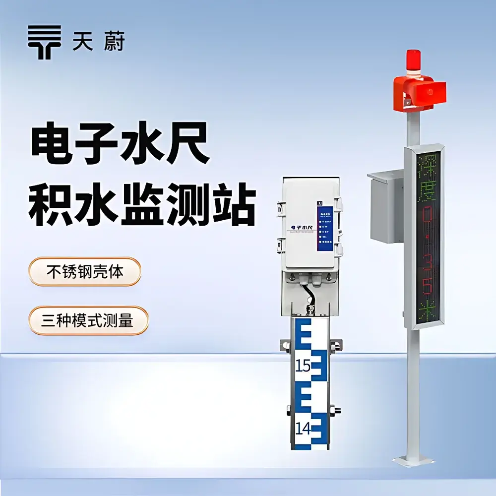
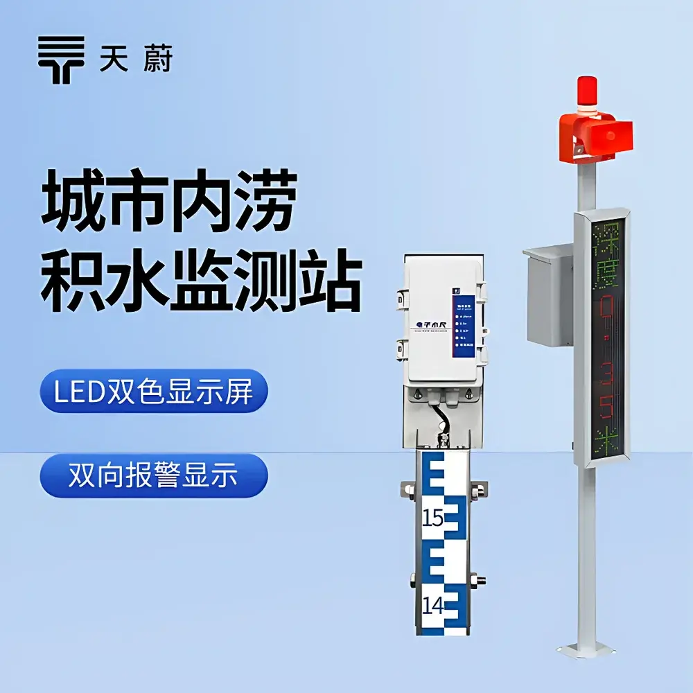
TW-JS1S Electronic Water Level Monitoring Station by Tianwei Environmental
| Brand | Tianwei Environmental (TW) |
|---|---|
| Origin | Shandong, China |
| Manufacturer Type | Direct Manufacturer |
| Country of Origin | China |
| Model | TW-JS1S |
| Power Supply | DC 10–30 V |
| Accuracy | ±0.5 cm or ±1 cm (full-scale uniform accuracy) |
| Resolution | 0.5 cm / 1 cm |
| Measuring Section Lengths | 50 cm or 80 cm (modular, unlimited sections) |
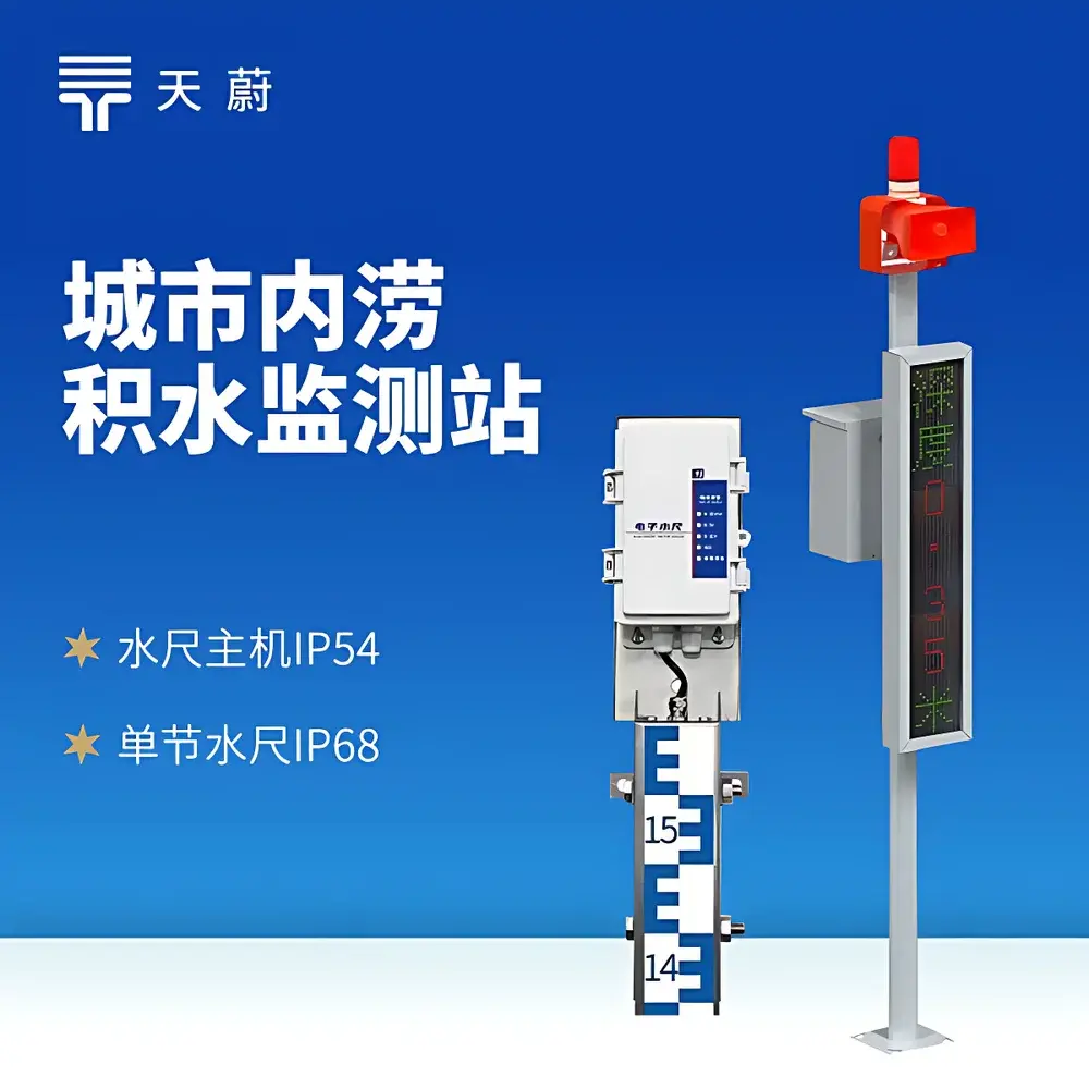
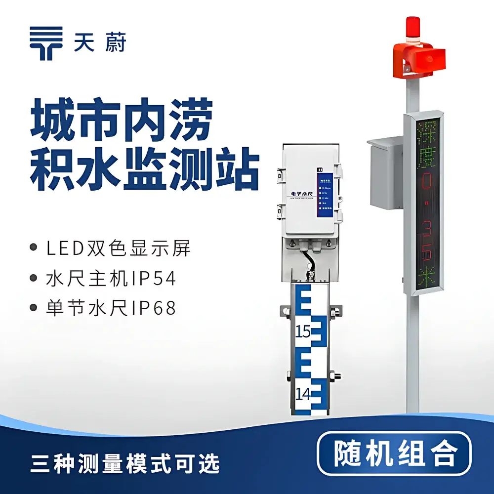
| Host Enclosure IP Rating | IP54 |
| Sensor Section IP Rating | IP68 |
| Communication Interfaces | RS485, 4G, 4–20 mA, 0–5 V, 0–10 V |
| Operating Modes | Water Depth Mode / Air Gap Mode / Tilt Compensation Mode |
| Average Power Consumption | 1 W (host), 0.05 W per section |
| Relay Outputs | 2 × 250 VAC / 30 VDC @ 3 A |
| Data Upload Interval | Configurable from 30 s to 1000 s |
| Mounting | Wall-mounted (86.2 mm mounting hole spacing, Ø10 mm holes) |
| LED Display | 102 cm × 22 cm dual-color (red/green), 16×96 dot matrix, vertical scrolling text |
| Acoustic-Optical-Voice Alarm Module | RS485-controlled, fixed voice message “Current water level is high—drive with caution”, triple alert cycle at 5 s intervals |
| Solar/AC Dual Power Option | Optional factory-configured hybrid power system with battery backup |
| Remote Configuration | Bluetooth-enabled mobile app (non-contact parameter setup) |
Overview
The TW-JS1S Electronic Water Level Monitoring Station is an industrial-grade, modular telemetry system engineered for continuous, real-time monitoring of surface water depth in urban flood-prone zones, road underpasses, drainage channels, and low-lying infrastructure. It operates on the principle of conductive water level sensing—leveraging the intrinsic electrical conductivity of natural water to detect immersion depth across discrete electrode segments. Each sensor section functions as a calibrated resistive ladder; when submerged, conductivity changes trigger digital encoding via an embedded microcontroller, enabling precise, drift-resistant measurement independent of water turbidity, sediment load, or mild chemical contamination. The system integrates a ruggedized electronic water ruler (EWR) array, a remote terminal unit (RTU) with dual-power capability, dual-color LED display, and RS485-linked acoustic-optical-voice alarm modules—all conforming to IEC 61000-6-2 (immunity) and IEC 61000-6-4 (emission) standards for electromagnetic compatibility in outdoor deployment environments.
Key Features
- Modular sensor architecture: Interchangeable 50 cm or 80 cm sections (IP68-rated stainless-steel housing); 0.5 cm resolution available only in 50 cm configuration; mixing of precision grades prohibited to maintain metrological integrity.
- Triple operational modes: Configurable for water depth, air gap (inverted installation), or tilt-compensated measurement—enabling flexible deployment on inclined surfaces or within confined enclosures.
- Dual-power RTU: Supports 10–30 VDC primary supply with optional solar/battery backup; automatic switchover ensures uninterrupted data continuity during grid failure.
- Multi-protocol telemetry: Simultaneous 4G cellular uplink (with configurable ICCID binding) and RS485 master interface (≥1500 m range, 4800 bps) for legacy SCADA integration.
- Industrial relay control: Two programmable relays (250 VAC / 30 VDC @ 3 A) support local alarm triggering, pump control, or external actuation—configurable via cloud or Bluetooth app.
- On-site visual feedback: Integrated 102 cm × 22 cm dual-color LED display provides real-time depth readout (“Current积水 depth 0.35 m”) with color-coded status: green for normal, red for threshold breach or communication fault (“———” or “0.00”).
Sample Compatibility & Compliance
The TW-JS1S is validated for use with fresh, brackish, and mildly contaminated surface waters—including stormwater runoff, municipal drainage effluent, and road runoff containing suspended solids, hydrocarbons, or de-icing salts. Its stainless-steel sensor housing and hermetically sealed internal circuitry meet ISO 9001 manufacturing requirements and comply with GB/T 19001–2016 (China National Standard for Quality Management Systems). While not certified to UL 61010 or ATEX, its IP54 (RTU) and IP68 (sensor) ratings satisfy EN 60529 for outdoor environmental exposure. All firmware and configuration protocols adhere to IEC 62443-3-3 cybersecurity baseline requirements for industrial telemetry devices. Data logging and alarm events include timestamped audit trails suitable for municipal GLP-aligned reporting frameworks.
Software & Data Management
Configuration and calibration are performed exclusively via the official Tianwei Bluetooth mobile application—supporting non-contact parameter assignment including upload server address/port, water level offset, hysteresis (recovery deadband), alarm thresholds, and transmission interval (30–1000 s). No proprietary desktop software or vendor lock-in is required. Raw data payloads follow ASCII-based Modbus RTU framing over RS485 and JSON-formatted HTTP POST over 4G. Payload structure includes UTC timestamp, sensor ID, measured depth (m), status flags (e.g., COM_ERR, SENSOR_OFFLINE), and battery voltage. Server-side parsing supports ingestion into common time-series databases (InfluxDB, TimescaleDB) and GIS platforms (QGIS, ArcGIS Online) via RESTful webhooks. Audit logs retain all configuration changes with device MAC address and operator timestamp—meeting minimum traceability criteria for municipal infrastructure maintenance records.
Applications
- Urban flood early warning: Real-time underpass and subway entrance monitoring with automated SMS/email alerts upon threshold exceedance.
- Smart drainage network management: Integration with municipal SCADA systems for dynamic pump scheduling based on upstream/downstream depth differentials.
- Road safety infrastructure: Co-deployment with variable-message signs (VMS) and traffic signal preemption logic at high-risk intersections.
- Construction site dewatering oversight: Continuous verification of sump pump performance and groundwater ingress rates during excavation.
- Ecological wetland monitoring: Long-term seasonal water level trend analysis for habitat assessment and hydrological modeling inputs.
FAQ
Can TW-JS1S sensor sections with different accuracies be combined in one installation?
No. Sections rated at ±0.5 cm and ±1 cm must not be mixed, as differing electrode pitch and signal processing algorithms compromise full-scale linearity and NIST-traceable calibration validity.
What happens if the RS485 link between RTU and LED display fails?
The display shows “———” in red digits, indicating loss of serial handshake—no fallback numeric rendering is performed to prevent misinterpretation of stale data.
Is solar power integration factory-default or field-upgradable?
Solar/battery hybrid operation requires pre-order specification and factory-level firmware and hardware provisioning; field retrofitting is not supported due to charge controller and battery management system (BMS) integration constraints.
Does the voice alarm module support custom audio messages?
No. The embedded voice prompt is fixed firmware content (“Current water level is high—drive with caution”) per national emergency messaging guidelines for public road infrastructure.
How is tilt compensation implemented in Tilt Mode?
An onboard MEMS accelerometer measures inclination angle relative to gravity; depth values are mathematically corrected using trigonometric projection, requiring initial zero-point calibration at known horizontal orientation.