Geotech AquaVISION Groundwater Velocity and Direction Profiling System
| Brand | Geotech (UK) |
|---|---|
| Origin | USA |
| Manufacturer Type | Authorized Distributor |
| Origin Category | Imported |
| Model | AquaVISION |
| Price | USD 42,000 (FOB) |
Overview
The Geotech AquaVISION Groundwater Velocity and Direction Profiling System is a field-deployable, borehole-based optical profiling instrument engineered for high-resolution, in-situ characterization of groundwater flow dynamics within existing monitoring wells or completed boreholes. It operates on the principle of particle image velocimetry (PIV) combined with real-time video microscopy, enabling direct observation and quantitative measurement of advective groundwater motion at the millimeter scale. Unlike indirect methods such as hydraulic gradient estimation or slug test interpretation, AquaVISION delivers spatially resolved, depth-specific velocity vectors—magnitude (0–30 mm/s) and direction—by tracking naturally occurring or introduced colloidal particles within the aquifer matrix. Its design conforms to accepted field hydrogeological practice for characterizing low-permeability zones, fractured media, and heterogeneous sediments where traditional Darcy-based assumptions break down.
Key Features
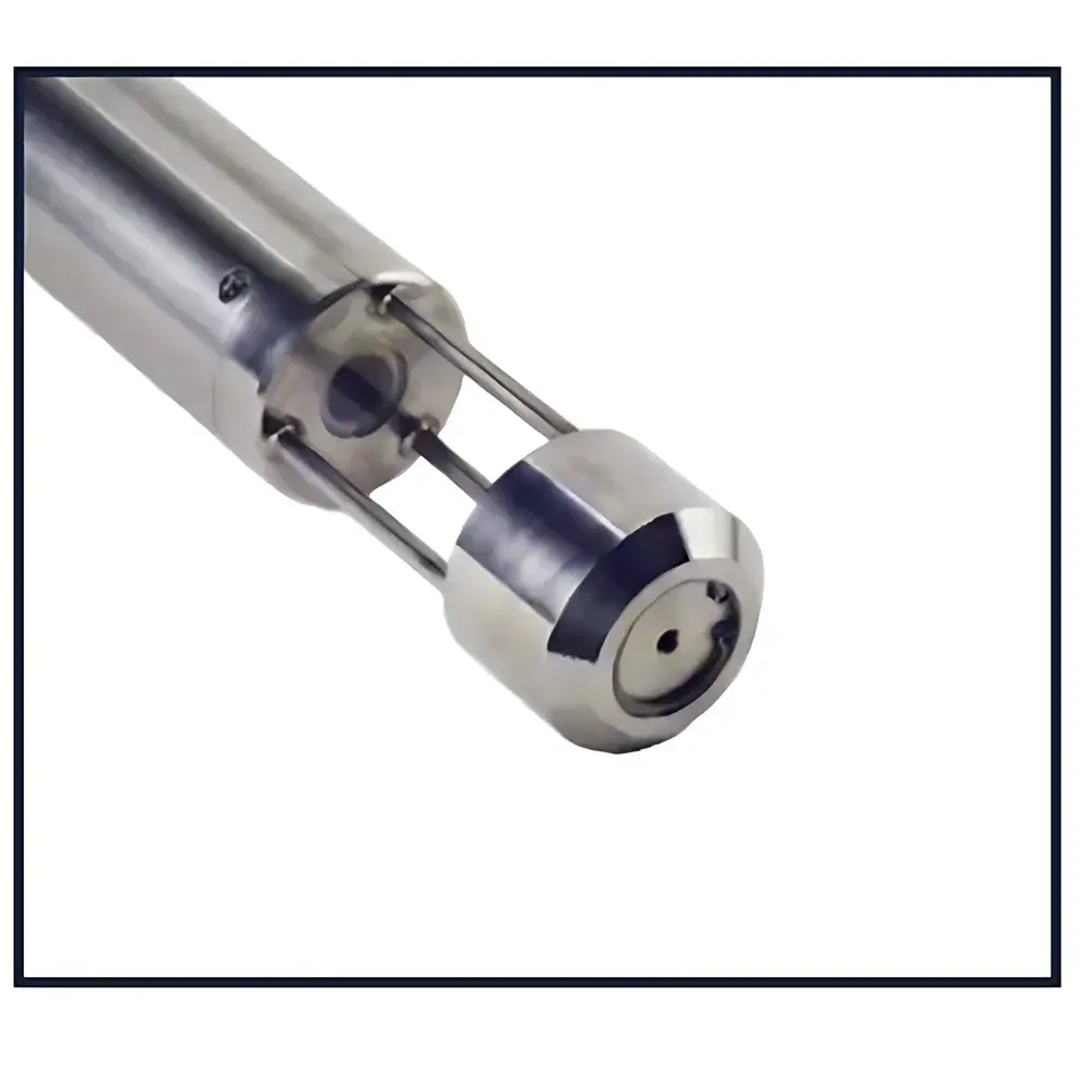
- Real-time, depth-referenced groundwater velocity and directional vector profiling via integrated colloid-observation video microscope
- Digital magnetic compass (±1.5° heading accuracy) co-registered with optical axis for true azimuthal orientation
- High-sensitivity, low-light CMOS imaging system optimized for turbid groundwater conditions
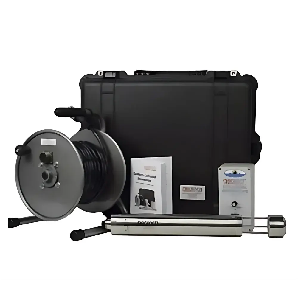
- Modular probe architecture with Kevlar-reinforced polyurethane-jacketed cable (standard 61 m / 200 ft; optional up to 305 m / 1000 ft)
- Field-rugged lens control unit supporting USB serial interface for digital compass data and ExpressCard-based real-time video transmission (54 mm form factor)
- AC/DC dual-power operation with battery-backed field portability and extended deployment capability
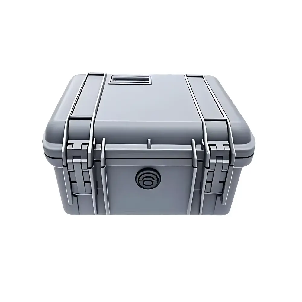
- IP68-rated underwater probe housing rated for depths up to 300 m (1000 ft) water column pressure
Sample Compatibility & Compliance
AquaVISION is compatible with standard 2-inch (5.08 cm) and larger diameter monitoring wells, including PVC, stainless steel, and slotted casing configurations. It requires no well modification or additional piezometers, aligning with ASTM D5092-21 (Standard Practice for Design and Installation of Ground Water Monitoring Wells) and EPA SW-846 Method 9060A (Groundwater Sampling Guidance). The system supports GLP-compliant data acquisition through AquaLITE’s audit-trail-enabled session logging, timestamped metadata embedding (depth, UTC time, compass heading, frame rate), and exportable raw video sequences (.avi) alongside processed vector datasets (.csv, .xlsx). All firmware and software comply with IEC 61000-6-3 (EMC emissions) and IEC 61000-6-2 (immunity) standards for field instrumentation.
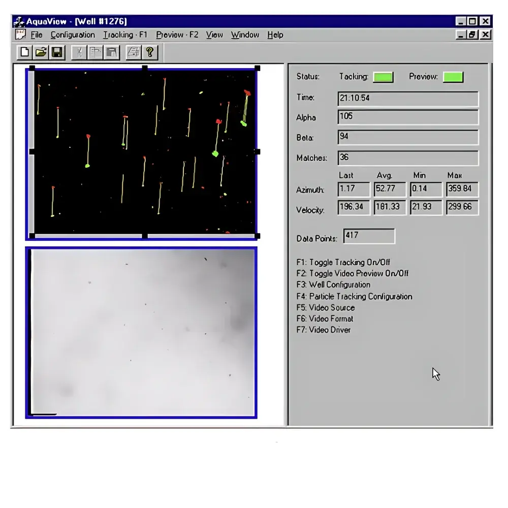
Software & Data Management
AquaLITE software serves as the unified interface for system control, real-time visualization, and post-processing. It simultaneously renders live video feed and dynamically overlays particle displacement vectors using configurable PIV kernel sizes and temporal averaging windows. Users may adjust contrast, gamma, motion threshold sensitivity, and background subtraction parameters to accommodate variable aquifer clarity (NTU range: 1–100). Vector maps—displayed as directional arrows scaled to magnitude—can be exported as georeferenced PNG/SVG or imported into GIS platforms (e.g., ArcGIS Pro, QGIS) via depth-aligned CSV files containing X/Y/Z coordinates, velocity (mm/s), azimuth (°), and confidence metrics. Statistical summaries include mean velocity per depth interval, directional standard deviation, bivariate directional rose diagrams, and time-series stability indices—all exportable in PDF or PowerPoint-ready formats. Software validation documentation supports FDA 21 CFR Part 11 compliance for regulated environmental investigations.
Applications
- Calibration and validation of numerical groundwater flow and transport models (MODFLOW, FEFLOW, GMS)
- Site characterization for remediation design—especially plume migration analysis and capture zone delineation
- Performance assessment of permeable reactive barriers (PRBs) and recirculating well systems
- Tidal influence quantification in coastal aquifers via diurnal velocity amplitude and phase lag analysis
- Low-flow zone identification in fine-grained sediments where hydraulic conductivity < 1 × 10⁻⁶ cm/s
- Forensic hydrogeology—providing court-admissible evidence of contaminant pathway directionality and residence time estimates
- Micro-scale flow heterogeneity mapping in fractured bedrock or karst conduits
FAQ
What is the minimum detectable groundwater velocity?
The system reliably resolves velocities ≥0.2 mm/s under typical field conditions with natural colloids; detection limit improves to ≥0.05 mm/s when fluorescent microspheres are introduced.
Can AquaVISION operate in highly turbid or iron-stained groundwater?
Yes—the software includes adaptive histogram equalization and spectral filtering algorithms optimized for NTU > 50 conditions; optional near-infrared illumination module available upon request.
Is depth calibration traceable to NIST standards?
Cable length measurement is factory-calibrated against NIST-traceable laser interferometry; depth encoder resolution is ±1 mm per meter with temperature-compensated strain gauge feedback.
Does the system support automated multi-depth profiling?
Yes—AquaLITE supports programmable step-and-hold sequences with user-defined depth intervals (minimum 1 cm), dwell times (1–300 s), and auto-triggered video capture.
What training and technical support options are available?
Geotech provides certified field operator training (2-day onsite or virtual), ISO/IEC 17025-aligned method validation templates, and 24/7 remote diagnostics support with guaranteed 4-hour response for critical deployments.