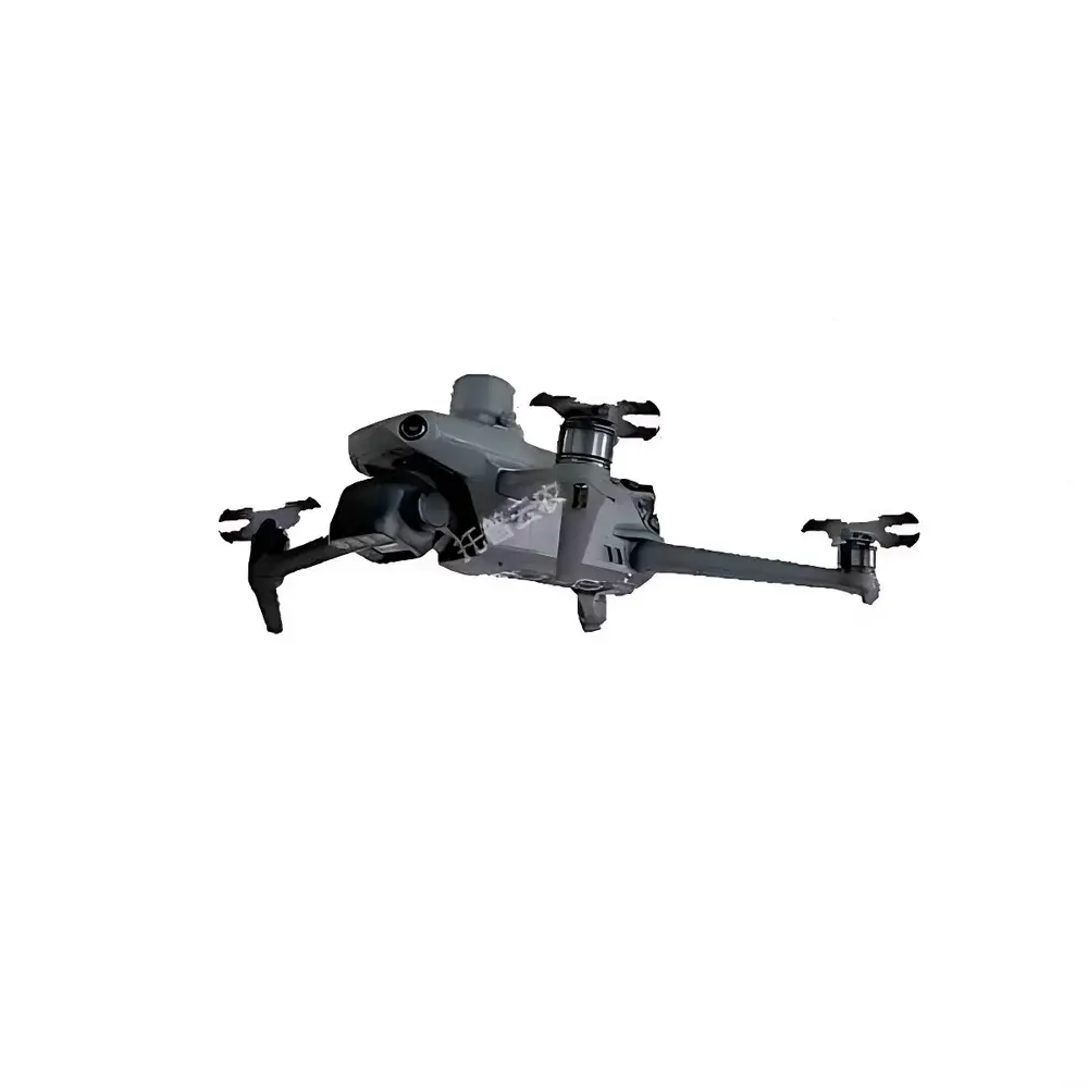
TopCloud-Agri TP-WRJ-SF Hand-Controlled Low-Altitude UAV Phenotyping System for Plant Physiology & Field-Scale Crop Monitoring
| Brand | TopCloud-Agri |
|---|---|
| Origin | Zhejiang, China |
| Manufacturer Type | OEM Producer |
| Regional Category | Domestic (China) |
| Model | TP-WRJ-SF |
| Pricing | Upon Request |
Overview
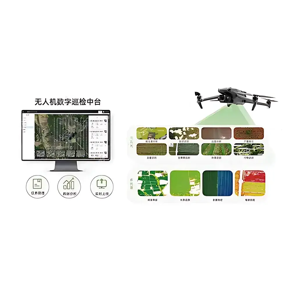
The TopCloud-Agri TP-WRJ-SF Hand-Controlled Low-Altitude UAV Phenotyping System is a field-deployable, multi-sensor aerial platform engineered for high-resolution, non-destructive plant phenotyping and precision agronomic monitoring. Unlike fully autonomous airport-based systems, the TP-WRJ-SF is designed for operator-guided flight missions—enabling adaptive, real-time decision-making in dynamic field conditions while retaining full compatibility with AI-driven analytics pipelines. Its core measurement architecture integrates concurrent optical, spectral, thermal, and structural sensing modalities: visible-light imaging (40 MP wide-angle + 40 MP zoom), 5-band multispectral + RGB imaging, hyperspectral capture (400–1000 nm, 1200 bands, 2.5 nm spectral resolution), uncooled microbolometer thermal imaging (1280×1024, 8–14 µm), and time-of-flight LiDAR (70° × 75° FOV, ±2 cm RMS accuracy at 150 m). Data acquisition adheres to standardized radiometric calibration protocols traceable to NIST-referenced reflectance panels and blackbody sources, ensuring inter-temporal and inter-platform data comparability required for longitudinal phenotypic studies and regulatory-compliant trial reporting.
Key Features
- Operator-guided low-altitude flight control with manual override capability—optimized for variable canopy heights, irregular field boundaries, and rapid response to emergent agronomic events (e.g., localized disease outbreaks or irrigation failures).
- Modular sensor payload configuration: interchangeable mounting interfaces support simultaneous or sequential deployment of visible, multispectral, hyperspectral, thermal, and LiDAR modules without mechanical recalibration.
- RTK-enhanced GNSS positioning (1 cm + 1 ppm horizontal, 1.5 cm + 1 ppm vertical) synchronized with IMU and visual-inertial odometry for sub-decimeter georeferencing of all imagery and point clouds.
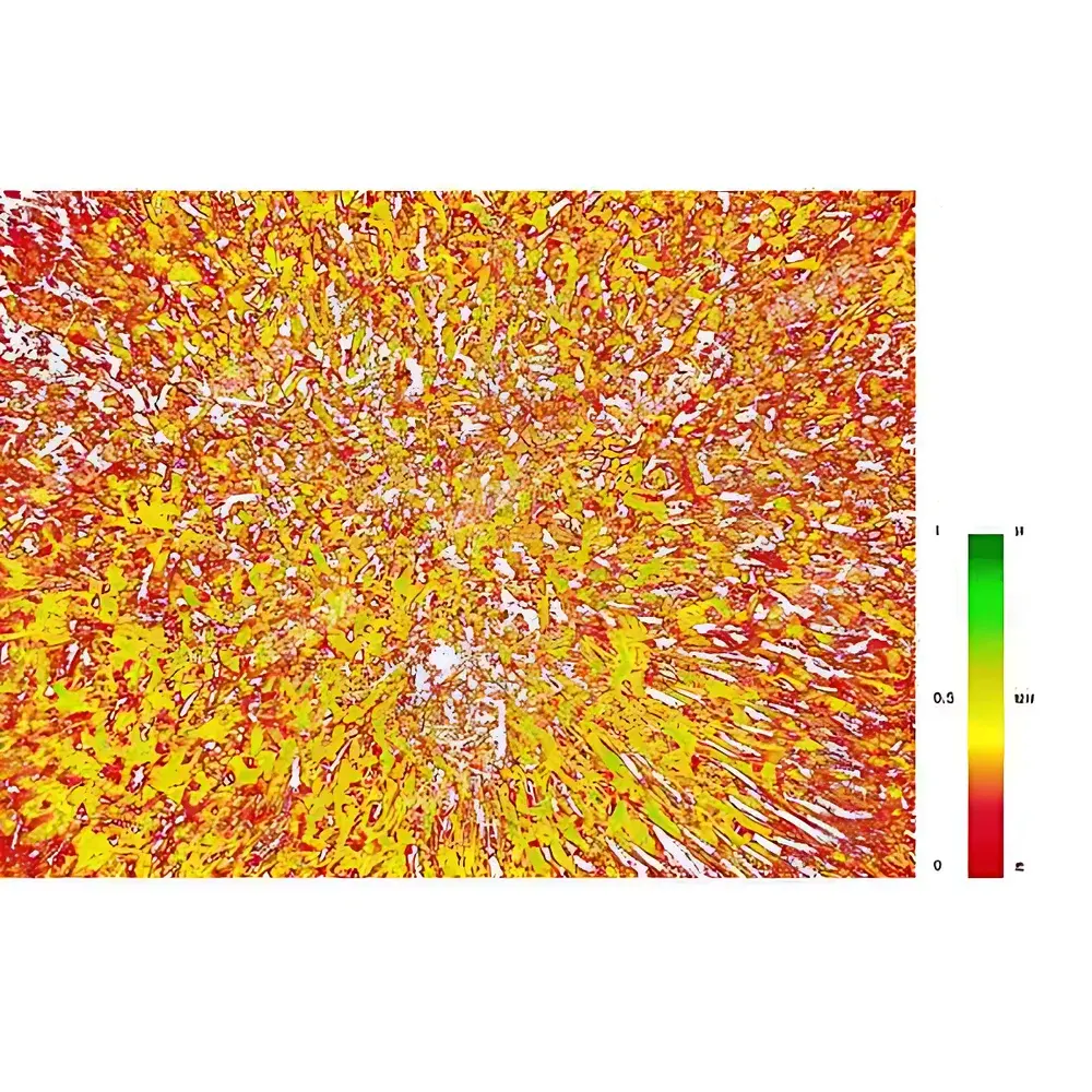
- Onboard preprocessing firmware performs real-time radiometric correction, lens distortion compensation, and geo-tagging—reducing post-processing latency and enabling near-real-time visualization of orthomosaics and vegetation index maps (NDVI, SR, DVI, EVI, NDRE, etc.).
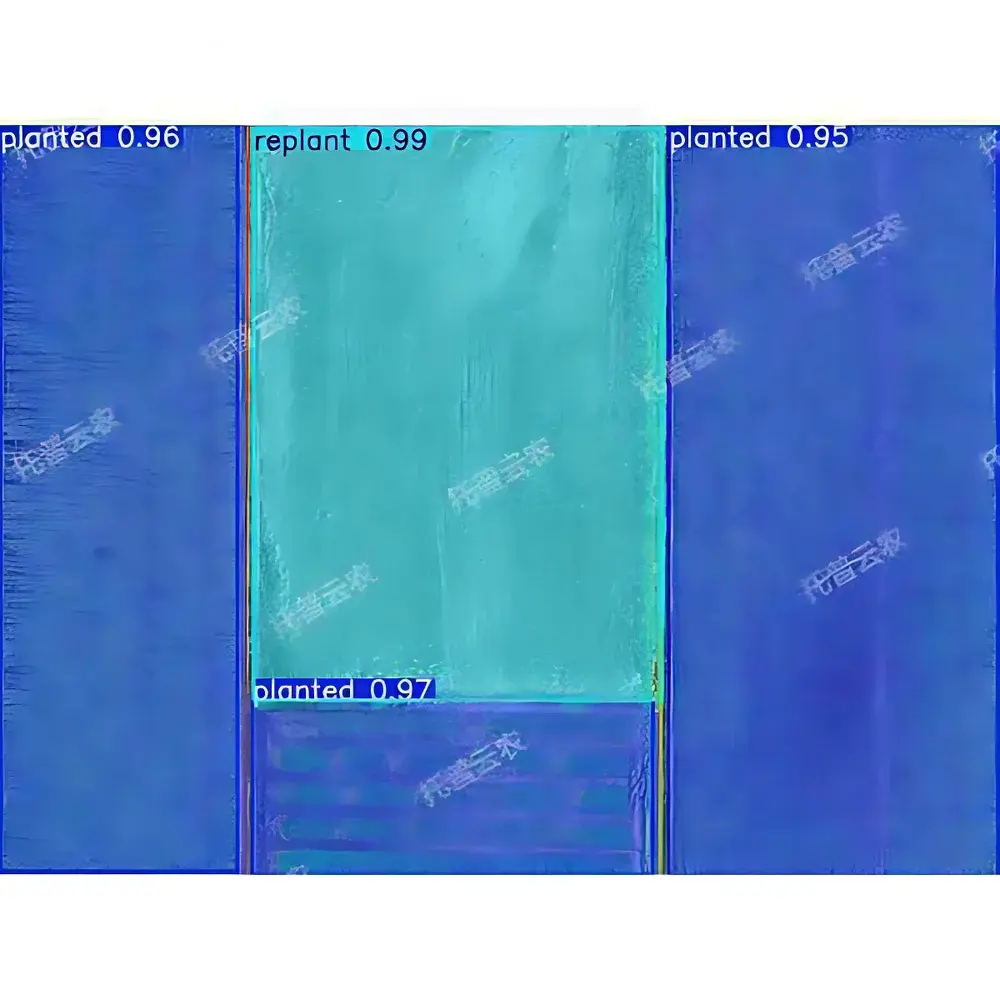
- Embedded AI inference engine supports edge-level execution of pre-trained models for crop emergence detection, lodging quantification, tassel counting (maize), panicle density estimation (rice/wheat), and thermal stress indexing—minimizing cloud dependency and preserving data sovereignty.
Sample Compatibility & Compliance
The TP-WRJ-SF system is validated for use across major staple and horticultural crops—including rice, wheat, maize, soybean, cotton, and orchard species—under field conditions compliant with ISO 11120 (aerial remote sensing of vegetation) and ASTM E2923-22 (standard guide for unmanned aircraft systems in agricultural applications). All spectral data products conform to FAO’s Agroecological Zoning Framework metadata requirements. Thermal and LiDAR-derived structural parameters (e.g., canopy height model, CHM; leaf area index, LAI; fractional cover) are interoperable with CropSyst, APSIM, and DSSAT simulation environments. The system meets IP54 ingress protection standards for dust and water resistance, supporting operation in ambient temperatures from –10°C to +45°C and wind speeds up to 12 m/s.
Software & Data Management
The proprietary TopCloud FieldInsight™ software suite provides a secure, role-based web interface for mission planning, data ingestion, batch processing, and analytical reporting. It supports DICOM-like metadata embedding per image frame, including GPS timestamp, sensor gain settings, exposure duration, and calibration coefficients. Audit trails log all user actions, model versioning, and parameter adjustments in accordance with GLP principles. Export formats include GeoTIFF (orthomosaics), ENVI-compatible BIL/BIP (hyperspectral cubes), LAS/LAZ (LiDAR point clouds), and CSV/JSON (phenotypic trait tables). Integration with third-party LIMS and farm management information systems (FMIS) is enabled via RESTful API and OGC SensorThings API compliance.
Applications
- High-throughput phenotyping trials: Quantitative assessment of genetic lines under abiotic (drought, heat, salinity) and biotic (blight, rust, aphid infestation) stress regimes.
- Dynamic crop health surveillance: Detection of early-stage nutrient deficiencies (N, K, Fe), water stress gradients, and pathogen-induced chlorosis prior to visible symptom onset.
- Yield forecasting: Correlation of panicle/tassel counts, grain-filling stage progression, and canopy temperature differentials with final yield metrics using regression models trained on historical ground-truth datasets.
- Regulatory compliance monitoring: Verification of land-use classification (non-grain/non-agricultural zones), residue mapping (plastic mulch, pesticide containers), and open-burning detection (via thermal anomaly clustering).
- 3D canopy architecture analysis: Derivation of structural traits—including canopy closure ratio, light penetration coefficient, and vertical leaf distribution—from fused LiDAR + photogrammetric point clouds.
FAQ
Is the TP-WRJ-SF certified for commercial operation under EASA or FAA regulations?
The platform complies with Annex II UAS class identification labels (C3) per EU 2019/947 and meets Part 107 operational limits in the U.S.; however, country-specific type certification must be obtained by the end-user through local aviation authorities.
Can raw hyperspectral data be exported for custom spectral unmixing or machine learning model development?
Yes—full-resolution, radiometrically calibrated hyperspectral cubes (in ENVI .hdr/.bin format) are accessible via secure SFTP or local SSD extraction, including wavelength calibration files and dark current reference frames.
Does the system support integration with existing weather station networks or soil moisture sensor arrays?
FieldInsight™ accepts time-synchronized external sensor inputs via Modbus TCP or MQTT, enabling spatiotemporal fusion of aerial phenotypes with microclimate and edaphic variables.
What level of technical support and algorithm update frequency is provided post-purchase?
TopCloud-Agri offers annual software maintenance contracts including quarterly AI model updates, firmware patches, and access to a dedicated agronomy support team with Ph.D.-level expertise in plant physiology and remote sensing.
Are calibration certificates traceable to national metrology institutes included with each sensor module?
Each multispectral, thermal, and LiDAR module ships with a factory calibration report referencing NIST-traceable standards; on-site recalibration services are available upon request.