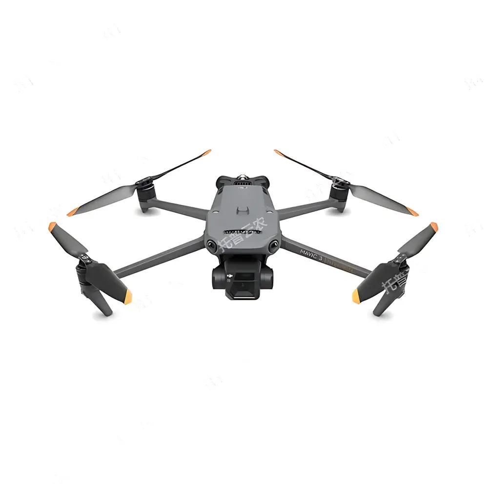
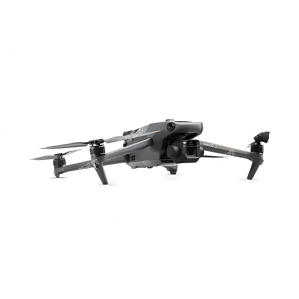
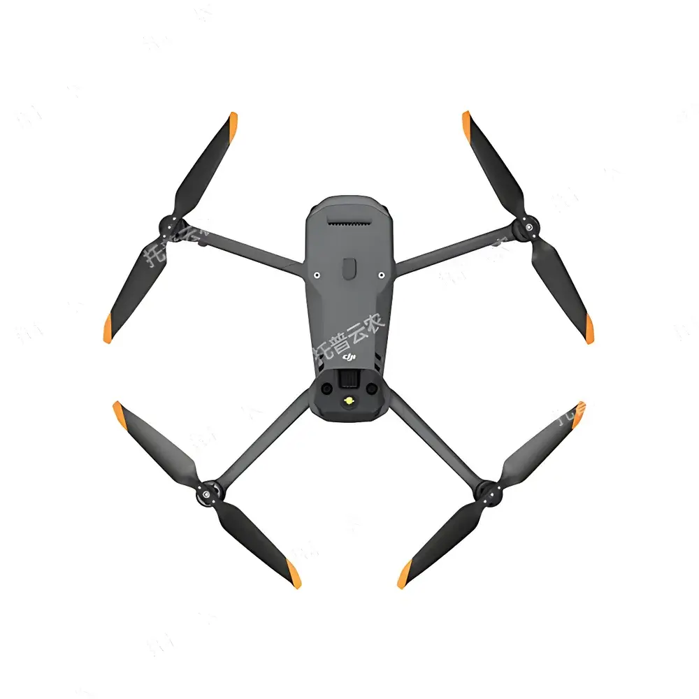
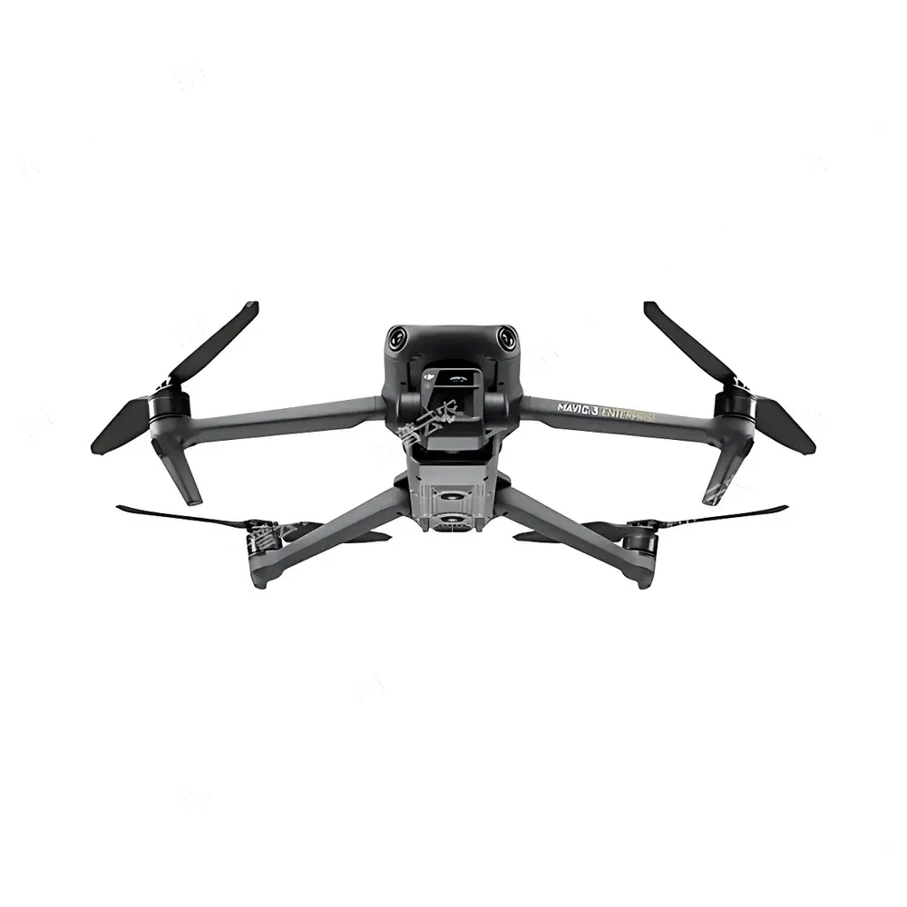
Top Cloud-agri TP-DGP Multispectral UAV Platform for Plant Phenotyping
| Brand | Top Cloud-agri |
|---|---|
| Origin | Zhejiang, China |
| Manufacturer Type | OEM/ODM Producer |
| Country of Origin | China |
| Model | TP-DGP |
| Pricing | Available Upon Request |
| Flight Endurance | >40 min |
| Max Operational Radius | 15 km |
| Horizontal Speed | 21 m/s |
| Wind Resistance | 12 m/s |
| RTK Positioning Accuracy | 1 cm + 1 ppm (horizontal), 1.5 cm + 1 ppm (vertical) |
| Visible Light Camera | 4/3" CMOS, 20 MP, 84° FOV, 24 mm equiv. focal length, JPEG/DNG output |
| Multispectral Sensor | 1/2.8" CMOS, 5 MP, 73.91° diagonal FOV (61.2° × 48.1°), 25 mm equiv. focal length, 5-band spectral configuration (G: 560 nm ±16 nm, R: 650 nm ±16 nm, RE: 730 nm ±16 nm, NIR: 860 nm ±26 nm), TIFF output, gain range 1×–32× |
| Operating Temperature | −10 °C to 40 °C |
| Real-time Video Transmission | 1080p/30fps |
Overview
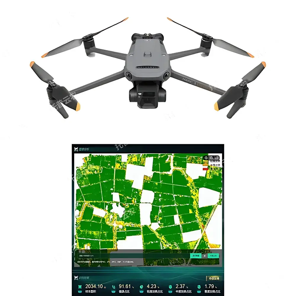
The Top Cloud-agri TP-DGP Multispectral UAV Platform is an integrated aerial phenotyping system engineered for high-throughput, non-destructive plant trait quantification in field-based agricultural research and precision farming operations. Built upon a robust rotary-wing airframe with RTK-enhanced GNSS navigation, the platform employs synchronized multispectral imaging—capturing reflectance data across five discrete spectral bands (Green, Red, Red Edge, Near-Infrared)—to derive biophysically meaningful vegetation indices such as NDVI, NDRE, GNDVI, and CIrededge. These indices serve as quantitative proxies for chlorophyll content, canopy structure, water status, nitrogen use efficiency, and early-stage biotic/abiotic stress responses. Unlike passive satellite or manned aircraft remote sensing, the TP-DGP operates at low-altitude (<120 m AGL), delivering ground sampling distances (GSD) down to 2.5 cm/pixel—enabling sub-plot resolution analysis essential for breeding trials, variety evaluation, and genotype-by-environment interaction studies. Its design adheres to ISO 11783-12 (precision agriculture data exchange) and supports interoperability with FAO’s WaPOR framework for water productivity assessment.
Key Features
- Automated flight mission planning with georeferenced waypoint navigation and adaptive terrain-following mode for consistent GSD across variable topography.
- Dual-sensor payload architecture: Co-aligned 20-megapixel RGB camera and 5-band multispectral imager with calibrated radiometric response and on-board dark-frame correction.
- On-device preprocessing pipeline including radiometric calibration, vignetting compensation, and geometric distortion correction using embedded IMU/GNSS fusion.
- Real-time telemetry and live video feed (1080p/30fps) via OcuSync 3.0 transmission protocol with encrypted bidirectional control link.
- RTK+PPK hybrid positioning support ensuring centimeter-level absolute geolocation accuracy—critical for longitudinal monitoring and change detection across growing seasons.
- Modular software-defined payload interface enabling future integration of thermal, LiDAR, or hyperspectral modules without airframe modification.
- Extended operational endurance (>40 minutes at 80% battery load) and 15 km line-of-sight range compliant with EASA UAS Class C1 regulatory thresholds.
Sample Compatibility & Compliance
The TP-DGP platform is validated for deployment over diverse agronomic species—including Zea mays, Oryza sativa, Triticum aestivum, Solanum lycopersicum, and Brassica napus—across growth stages from emergence through senescence. Its spectral bandpass alignment conforms to ASTM E2593-21 standards for vegetation index reproducibility, while raw image metadata embedding complies with EXIF 2.31 and XMP 6.0 specifications for traceable data provenance. The system meets CE RED Directive 2014/53/EU for radio equipment, RoHS 2011/65/EU for hazardous substance restriction, and IP43 ingress protection rating for dust and rain resistance during field operations. All firmware and cloud-based analytics modules are designed to align with ISO/IEC 27001 information security management requirements.
Software & Data Management
The proprietary TopCloud FieldAnalytics™ suite provides end-to-end workflow automation—from mission planning and orthomosaic generation to pixel-wise trait extraction and statistical reporting. Orthorectified multispectral mosaics are processed using structure-from-motion (SfM) photogrammetry and bundle adjustment algorithms, yielding georeferenced GeoTIFFs with embedded RPC metadata. Vegetation index maps are generated via band math operations compliant with USDA ARS’s CropScan methodology. The platform supports FDA 21 CFR Part 11-compliant audit trails for all processing steps, user actions, and parameter modifications. Data export options include CSV (for statistical analysis in R/Python), Shapefile (for GIS integration), and PDF reports with embedded confidence intervals and coefficient-of-variation metrics. Integration with third-party LIMS and ELN systems is enabled via RESTful API endpoints supporting OAuth 2.0 authentication and JSON-LD schema mapping.
Applications
- High-throughput phenotyping in public and private crop breeding programs, particularly for traits linked to drought tolerance, nitrogen use efficiency, and disease resistance.
- Dynamic yield forecasting using time-series NDVI/NDRE trajectories calibrated against harvest-weighted ground truth datasets.
- Early detection of Fusarium graminearum infection in wheat via red-edge reflectance anomalies prior to visible symptom onset.
- Maize male tassel localization and ablation guidance for hybrid seed production—reducing manual labor by >70% while maintaining >98.5% recognition accuracy under field conditions.
- Soil-plant-atmosphere continuum modeling through synchronized acquisition of canopy reflectance, microclimate (via integrated weather stations), and soil moisture profiles.
- Regulatory compliance monitoring for EU Green Deal initiatives, including mandatory nutrient management plans and pesticide use reduction targets.
FAQ
What spectral bands does the TP-DGP multispectral camera capture, and are they factory-calibrated?
The sensor captures five discrete bands: Green (560 nm ±16 nm), Red (650 nm ±16 nm), Red Edge (730 nm ±16 nm), and Near-Infrared (860 nm ±26 nm). Each unit undergoes NIST-traceable radiometric calibration prior to shipment, with certificate-of-conformance included in delivery documentation.
Can the platform operate beyond visual line of sight (BVLOS) under current aviation regulations?
BVLOS operation requires country-specific authorization (e.g., FAA Part 107 waiver in the US, EASA SAIL level certification in EU). The TP-DGP’s redundant communication links and fail-safe return-to-home logic meet baseline technical prerequisites for such approvals.
Is raw sensor data accessible for custom algorithm development?
Yes—unprocessed TIFF frames with embedded radiometric metadata (DN values, exposure time, gain setting, GPS timestamp, and IMU orientation quaternions) are fully accessible via SD card or direct USB-C transfer.
How frequently are firmware and analytical model updates released?
Firmware updates are issued quarterly; machine learning models for trait detection (e.g., tassel counting, lodging classification) receive biannual retraining using anonymized, aggregated field data from global deployment sites.
Does the system support integration with existing farm management software (e.g., Climate FieldView, Granular, AgLeader)?
Native connectors are available for major FMS platforms via ISOXML 4.3 and ADAPT protocols; custom middleware development is supported under NDA for enterprise clients.
Related Products