Top Cloud-agri TP-GTL-AR Series Cross-Aisle High-Throughput Plant Phenotyping Platform
| Brand | Top Cloud-agri |
|---|---|
| Origin | Zhejiang, China |
| Manufacturer Type | OEM Manufacturer |
| Region of Origin | Domestic (China) |
| Model | TP-GTL-AR Series |
| Pricing | Available Upon Request |
Overview
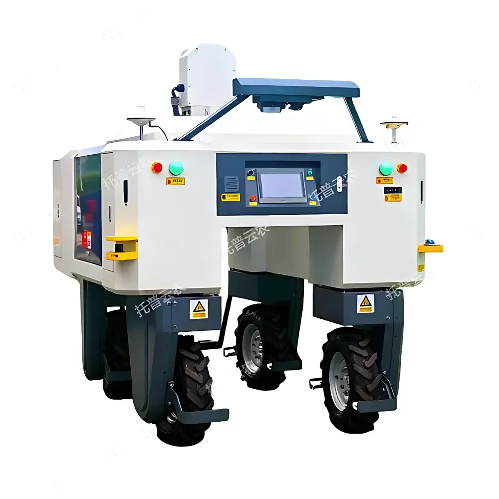
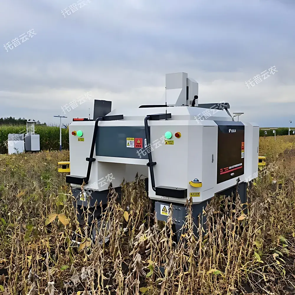
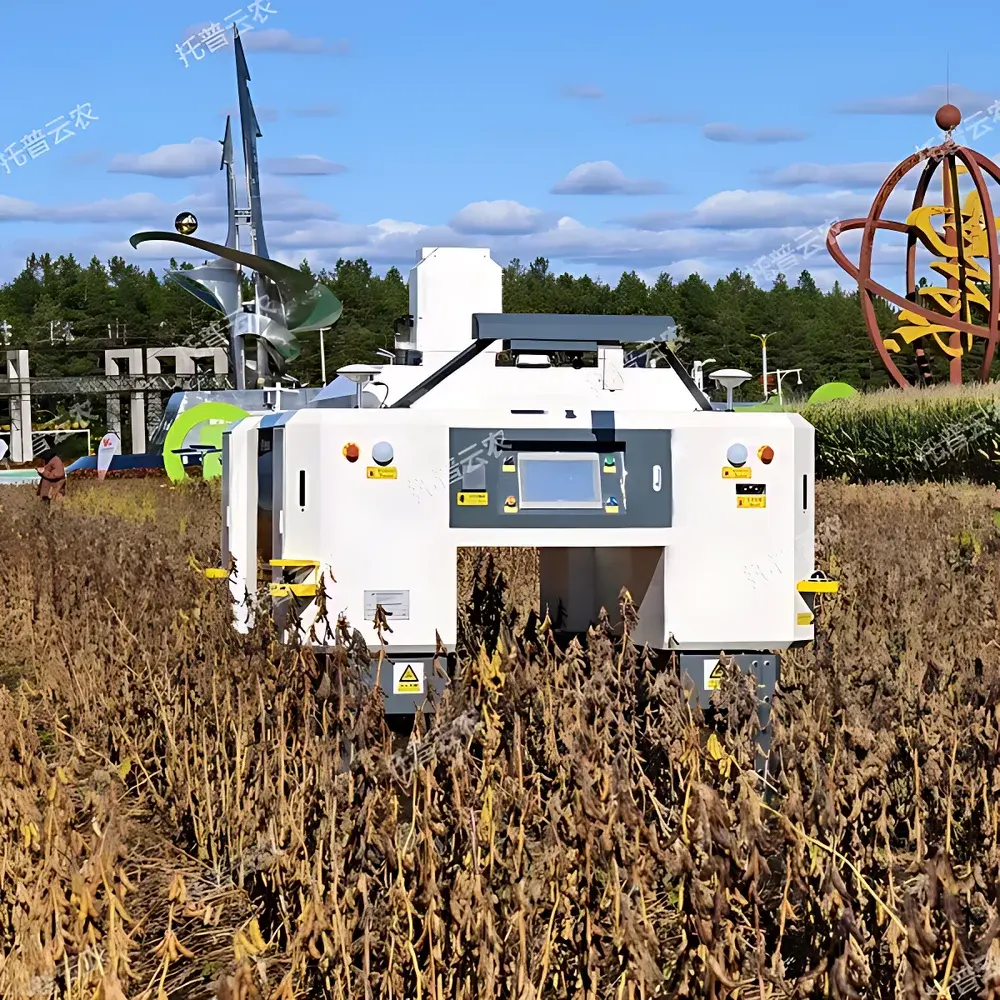
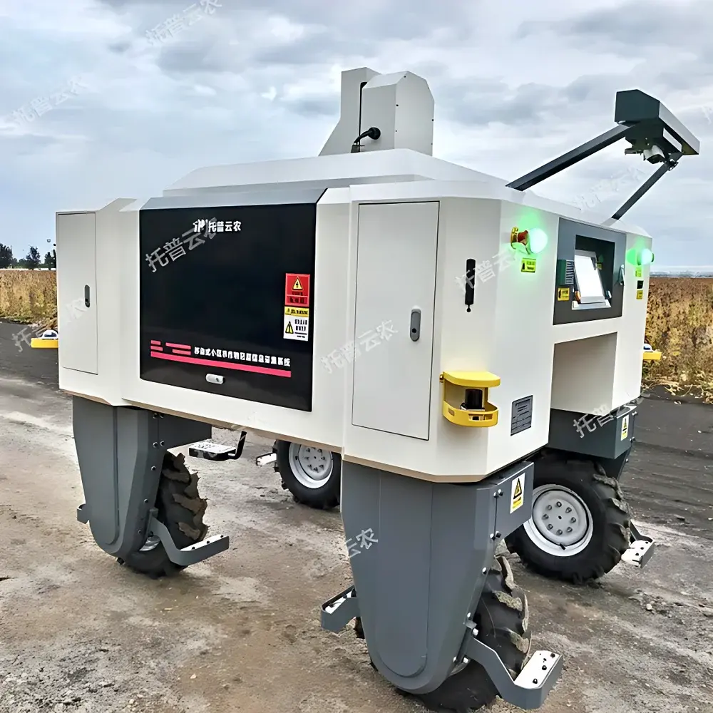
The Top Cloud-agri TP-GTL-AR Series Cross-Aisle High-Throughput Plant Phenotyping Platform is an autonomous, field-deployable robotic system engineered for non-destructive, multi-modal phenotypic data acquisition across agricultural and horticultural research environments. Designed specifically for structured field layouts—including raised beds, furrows, and inter-row pathways—the platform operates as a self-propelled cross-aisle vehicle capable of traversing between crop rows without soil compaction or plant disturbance. Its core measurement architecture integrates synchronized optical sensing modalities: visible-light RGB imaging, hyperspectral reflectance spectroscopy (400–1000 nm), thermal infrared radiometry, and active 3D depth mapping (via structured-light or LiDAR). This multi-sensor fusion enables simultaneous quantification of morphological, physiological, and biophysical traits—including canopy architecture, chlorophyll distribution, stomatal conductance proxies, thermal stress indices, and structural biomass metrics—within natural daylight or controlled greenhouse illumination conditions. The system adheres to principles of quantitative plant phenomics as defined by the International Plant Phenotyping Network (IPPN), supporting reproducible, scalable, and metadata-rich experimental workflows aligned with FAIR (Findable, Accessible, Interoperable, Reusable) data standards.
Key Features
- Autonomous Navigation & Field Adaptation: Combines RTK-GNSS positioning (≤2 cm horizontal accuracy), laser-based SLAM (Simultaneous Localization and Mapping), and stereo vision for real-time obstacle detection and dynamic path replanning in unstructured field terrain. Supports pre-defined route scripting via georeferenced GIS layers and adaptive speed modulation based on sensor payload load and terrain slope.
- Modular Sensor Configuration: Four standardized configurations (TP-GTL-AR, TP-GTL-ARG, TP-GTL-ARG1, TP-GTL-ARG2) allow progressive integration of imaging modalities—RGB only; RGB + hyperspectral; RGB + hyperspectral + thermal IR; or full suite including depth/LiDAR—enabling protocol-specific hardware optimization without platform replacement.
- Multi-Spectral Trait Extraction: Delivers >30 vegetation indices (e.g., NDVI, GVI, PRI, MCARI) from calibrated hyperspectral cubes; computes canopy temperature gradients and emissivity-corrected thermal profiles; quantifies 3D plant height, LAI, projected leaf area, and canopy closure density from sub-centimeter-resolution depth maps.
- Integrated Control & Processing Software: Proprietary software suite provides centralized hardware orchestration, automated image registration (georeferencing + orthorectification), batch processing pipelines, and model-driven trait extraction using crop-specific segmentation algorithms (e.g., maize tassel detection, wheat spike counting, soybean lodging classification).
- Operational Safety & Data Integrity: Complies with ISO 13857 mechanical safety clearance requirements and IEC 62471 photobiological safety standards for all integrated emitters. Includes dual-channel emergency stop circuits, acoustic proximity alerts (1 m detection radius), encrypted Wi-Fi 5 (802.11ac) transmission, and AES-256 encrypted local storage with expandable SSD capacity (up to 2 TB).
Sample Compatibility & Compliance
The platform is validated for use with herbaceous and semi-woody dicot and monocot species grown under standard agronomic field spacing (row widths ≥ 0.5 m) or greenhouse bench systems. It supports both seasonal annuals (e.g., Arabidopsis thaliana, maize, rice, tomato) and perennial crops (e.g., grapevine, blueberry) when deployed during vegetative and early reproductive stages. All imaging modules meet CE marking requirements for electromagnetic compatibility (EN 61000-6-3/4) and low-voltage directive (2014/35/EU). Hyperspectral and thermal modules are traceably calibrated against NIST-traceable reference panels (Spectralon® and Blackbody sources). Data export formats comply with MIAPPE v1.1 metadata schema and support direct ingestion into PlantCV, R/Bioconductor phenotyping pipelines, and FAIR-aligned repositories such as Phenome Networks or EGA.
Software & Data Management
The embedded control interface runs on a Linux-based real-time OS with deterministic scheduling for sensor synchronization (±5 ms inter-modal timing jitter). Data acquisition software includes built-in GLP-compliant audit trails: timestamped operator login/logout logs, sensor calibration history, raw-to-derived data provenance tracking, and immutable checksum hashing (SHA-256) for all exported datasets. Export options include CSV, GeoTIFF, HDF5, and NetCDF4 formats with embedded CF-1.8 metadata conventions. Remote access supports secure SSH tunneling and TLS 1.3–encrypted API endpoints for integration with LIMS or ELN platforms. Software updates are delivered via signed OTA packages with rollback capability and version-controlled changelogs aligned with ISO/IEC 12207 lifecycle management standards.
Applications
- High-resolution QTL mapping and genome-wide association studies (GWAS) requiring temporal trait trajectories across hundreds of genotypes.
- Non-invasive monitoring of abiotic stress responses (drought, heat, salinity) through combined thermal dissipation efficiency and spectral water index analysis.
- Early-stage disease phenotyping using hyperspectral anomaly detection (e.g., spectral shifts preceding visible symptom onset in Fusarium infection).
- Canopy light interception modeling for yield prediction, integrating LAI time-series with PAR sensor arrays.
- Regulatory-compliant field trial documentation under OECD Test Guidelines 511 (Plant Biotechnology) and EPA OPPTS 850.4400 (Plant Pest Resistance).
FAQ
What environmental conditions limit operational deployment?
The platform is rated IP54 for dust and water resistance and operates within −10°C to +45°C ambient temperatures. Heavy rainfall (>10 mm/h) or sustained fog reduces LiDAR and depth sensor reliability; thermal imaging requires ≥20% relative humidity to minimize atmospheric absorption artifacts.
Can the system be integrated with existing weather station networks?
Yes—via Modbus RTU or MQTT protocols, enabling synchronous acquisition of microclimate variables (PAR, VPD, wind speed) alongside phenotypic data for multivariate stress modeling.
Is source code for the image analysis algorithms available?
Core segmentation and index calculation modules are closed-source but fully documented in IEEE-compliant technical notes; Python API wrappers and trained model weights (PyTorch format) are provided under a research-use license for method validation and extension.
How is geometric distortion corrected across heterogeneous sensor fields-of-view?
Each modality undergoes factory-calibrated lens distortion correction using Zhang’s method; multi-sensor co-registration employs iterative closest point (ICP) alignment with fiducial markers placed at row ends, achieving sub-pixel (<0.3 px RMS) spatial congruence across modalities.
Does the system support compliance with FDA 21 CFR Part 11 for regulated trials?
Electronic records generated meet ALCOA+ principles; however, full Part 11 compliance (e.g., digital signatures, biometric authentication) requires optional GxP add-on module and site-specific validation documentation per Annex 11 of EU GMP guidelines.
Related Products


