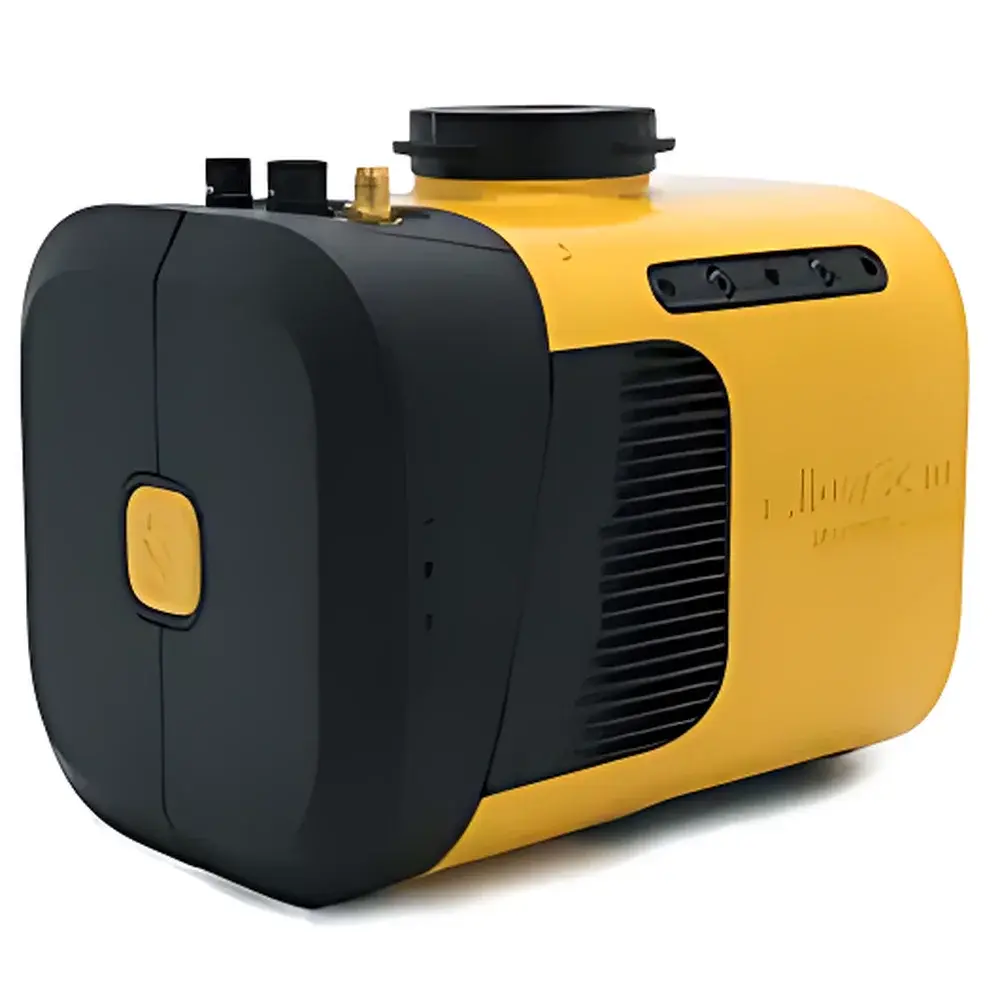
YellowScan Mapper+ Airborne LiDAR System
| Origin | France |
|---|---|
| Manufacturer Type | Authorized Distributor |
| Origin Category | Imported |
| Model | YellowScan Mapper+ |
| Pricing | Available Upon Request |
Overview
The YellowScan Mapper+ is a fully integrated airborne LiDAR (Light Detection and Ranging) system engineered for high-precision, lightweight UAV-based topographic and 3D structural mapping. Built around the Livox AVIA solid-state scanning lidar sensor—featuring non-repetitive scanning patterns and high angular resolution—the Mapper+ employs time-of-flight (ToF) measurement principles to deliver dense, georeferenced point clouds with sub-centimeter spatial accuracy. Its tightly coupled GNSS/IMU architecture ensures robust trajectory reconstruction under dynamic flight conditions, enabling reliable direct georeferencing without ground control points (GCPs) in many operational scenarios. Designed specifically for integration with medium-to-long endurance multirotor and fixed-wing drones—including the Ecodrone® series—the system operates as a turnkey solution for low-altitude remote sensing missions requiring rapid deployment, repeatability, and metrological traceability.
Key Features
- Compact, self-contained airborne LiDAR unit weighing under 1.2 kg (excluding mounting hardware), optimized for Class I–III UAV platforms
- Livox AVIA laser scanner with 0.1° angular resolution, 200 kHz maximum pulse repetition frequency, and dual-return capability
- High-performance GNSS/IMU navigation core supporting GPS, GLONASS, Galileo, and BeiDou constellations with RTK/PPK post-processing compatibility
- Integrated thermal management and vibration-damping housing compliant with IP54 environmental rating
- Plug-and-play interface via Ethernet and UART; supports standard MAVLink telemetry for synchronized flight metadata logging
- Onboard storage (64 GB internal SSD) with automatic file segmentation and checksum validation for data integrity assurance
Sample Compatibility & Compliance
The Mapper+ is compatible with fixed-wing and VTOL UAV platforms capable of sustaining ≥30 minutes of continuous flight at altitudes between 30 m and 150 m AGL, with forward speeds ranging from 5 to 15 m/s. It supports both PPK (Post-Processed Kinematic) and RTK (Real-Time Kinematic) workflows, aligning with ISO 19115-1:2014 metadata standards and ASTM E2921-22 guidelines for UAV-based LiDAR data acquisition. All firmware and software components comply with EU RoHS 3 and CE directives. Data outputs conform to ASPRS LAS 1.4 specification and support interoperability with industry-standard GIS platforms including ArcGIS Pro, QGIS, and Global Mapper. The system design adheres to GLP-aligned documentation practices for field data provenance, including embedded timestamping, IMU bias logging, and GNSS signal quality metrics.
Software & Data Management
CloudStation is YellowScan’s proprietary desktop application for end-to-end point cloud processing, supporting immediate post-flight visualization, filtering, classification, and export. It implements EDL (Elevation Difference-based) noise filtering, automated flight line alignment, and customizable terrain modeling (DTM/DSM generation). Users can perform cross-sectional analysis, volume calculations, and generate orthomosaic-ready intensity rasters—all within a single GUI environment. Optional modules include colorization via external RGB camera synchronization (e.g., Sony RX0 II or FLIR Tau2), strip adjustment using iterative closest point (ICP) algorithms, and batch processing pipelines compliant with ISO/IEC 17025 audit requirements. LiveStation—an optional real-time onboard monitoring tool—displays live 3D point cloud rendering during flight, overlays GNSS fix status and IMU health indicators, and records synchronized telemetry logs for forensic QA/QC review. Both applications maintain full audit trails per FDA 21 CFR Part 11 Annex 11 recommendations when deployed in regulated environmental monitoring contexts.
Applications
- Forest structure analysis: canopy height modeling (CHM), biomass estimation, and understory penetration assessment
- Agricultural phenotyping: crop height mapping, row spacing validation, and seasonal growth stage quantification
- Environmental monitoring: erosion tracking, wetland delineation, and post-disturbance vegetation recovery assessment
- Mining and quarry surveying: stockpile volumetrics, pit wall stability analysis, and haul road condition mapping
- Archaeological prospection: micro-topographic feature detection beneath vegetation canopies (e.g., earthworks, buried foundations)
- Power infrastructure inspection: conductor sag analysis, tower clearance verification, and right-of-way vegetation encroachment monitoring
- Topographic mapping for civil engineering: contour generation, floodplain modeling, and construction site progress tracking
FAQ
What GNSS correction methods does the Mapper+ support?
It natively supports both RTK (real-time corrections via NTRIP/CORS networks) and PPK (post-processed kinematic) workflows using RINEX-compliant log files.
Can the Mapper+ be used without an external RGB camera?
Yes—the system delivers geometrically accurate, intensity-encoded point clouds independently; colorization is an optional enhancement requiring synchronized camera integration.
Is CloudStation compatible with macOS or Linux operating systems?
CloudStation is currently Windows 10/11 (64-bit) only; virtualized environments are not officially supported due to GPU-accelerated rendering dependencies.
Does the Mapper+ meet aviation regulatory requirements for BVLOS operations?
While the sensor itself complies with EN 301 222-1 and FCC Part 15B emission limits, BVLOS authorization depends on national aviation authority approvals (e.g., EASA SAIL level, FAA Part 107 waivers) and platform-specific airworthiness certification.
How is calibration maintained across field deployments?
Factory calibration is performed prior to shipment; users receive a certificate of calibration traceable to NIST standards. Field recalibration is not required under normal operating conditions but may be advised after mechanical shock or thermal cycling beyond specified ranges.