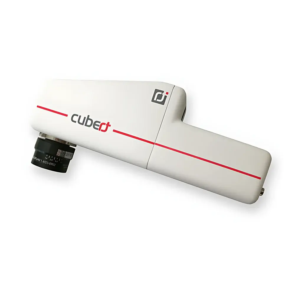
Cubert S185 Snapshot Hyperspectral Imaging Camera
| Brand | Cubert |
|---|---|
| Origin | Germany |
| Model | S185 |
| Spectral Range | 450–950 nm |
| Spectral Resolution | 8 nm @ 532 nm |
| Spatial Resolution (IFOV) | 1 mm |
| Imaging Resolution | 1.0 MP × 2 (dual CCD) |
| Field of View Options | 10 mm, 23 mm, 35 mm (TFOV) |
| Frame Rate | 5 Hyperspectral Cubes/s |
| Spectral Sampling Interval | 4 nm |
| Number of Spectral Bands | 125 |
| Bit Depth | 12-bit |
| Exposure Time | 0.1–1000 ms |
| Operating Temperature | 0–40 °C |
| Weight | 490 g |
| Power Supply | DC 12 V, 8 W |
| Interface | C-mount |
| GPS Trigger Module | Integrated |
| Wireless Control | Wi-Fi enabled |
Overview
The Cubert S185 is a snapshot-based, frame-sequential hyperspectral imaging camera engineered for high-fidelity spectral-spatial data acquisition in dynamic field environments. Unlike push-broom or scanning systems, the S185 employs a dual-CCD, Fabry–Pérot filter array architecture to capture all spectral bands simultaneously across the full field of view—enabling true snapshot acquisition of complete hyperspectral cubes (x, y, λ) without motion-induced artifacts. Its core optical design eliminates moving parts, ensuring mechanical robustness and measurement stability under vibration-prone conditions such as UAV-mounted operation. With a spectral coverage from 450 to 950 nm and 125 discrete bands sampled at 4 nm intervals, the S185 delivers calibrated reflectance data suitable for quantitative spectral analysis in visible and near-infrared (VNIR) domains. The system achieves a spectral resolution of 8 nm at 532 nm—optimized for chlorophyll absorption features, water band characterization, and mineralogical discrimination—while maintaining spatial fidelity through a 1 mm instantaneous field of view (IFOV) and selectable focal lengths (10–50 mm C-mount lenses).
Key Features
- Snapshot acquisition: Full hyperspectral cube captured in ≤1 ms—no line-by-line scanning or temporal misregistration
- Dual 1.0-megapixel Si CCD sensors enabling synchronized spectral channel readout with 12-bit digitization
- Integrated GPS-triggered acquisition module supporting georeferenced data logging without external INS
- Wi-Fi-enabled remote configuration and real-time preview—ideal for ground-based survey and UAV telemetry integration
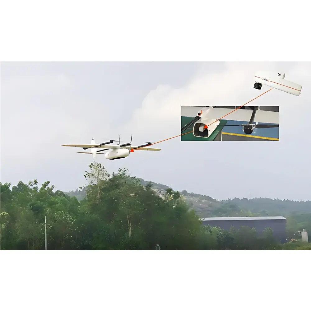
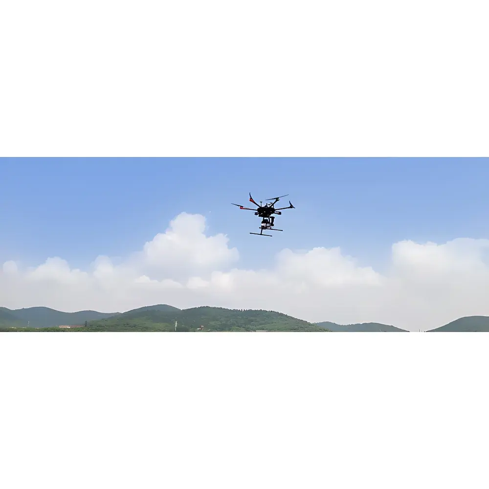
- Lightweight (490 g), low-power (12 V DC, 8 W) design optimized for fixed-wing and VTOL UAV platforms including VTOL-5 and A660 systems
- C-mount lens interface with interchangeable optics (10 mm, 16 mm, 23 mm, 35 mm, 50 mm) for flexible ground sampling distance (GSD) control
- No moving optical components—ensures long-term calibration stability and resistance to mechanical wear during repeated deployment
Sample Compatibility & Compliance
The S185 is designed for non-contact, passive reflectance measurement of natural and engineered surfaces under ambient illumination or controlled lighting. It complies with ISO 17025-relevant traceability principles for spectral radiometric calibration and supports NIST-traceable calibration workflows via factory-provided white reference and dark current characterization. While not certified to specific regulatory standards (e.g., FDA 21 CFR Part 11), its data structure—including embedded timestamps, GPS coordinates, exposure metadata, and sensor temperature logs—meets GLP-aligned documentation requirements for environmental monitoring, agricultural research, and archaeological prospection. The system’s spectral response is validated against ASTM E275 and ISO 11664-2 for VNIR instrumentation performance.
Software & Data Management
The S185 ships with Cubert’s proprietary HyperSpectra Studio, a cross-platform application supporting real-time cube acquisition, batch processing, and spectral library matching. The software enables automated orthorectification and large-area mosaic generation using onboard GPS and inertial metadata—eliminating dependency on post-flight INS solutions. Key analytical modules include vegetation index computation (NDVI, EVI, PRI, MCARI), supervised and unsupervised spectral classification (K-means, SVM), endmember extraction (N-FINDR), and time-series spectral trajectory analysis. An open API (C++/Python) provides direct access to raw cube buffers, calibration matrices, and sensor configuration registers—facilitating integration into custom GIS pipelines, machine learning training frameworks, or autonomous decision engines. All data exports conform to ENVI .hdr/.dat, GeoTIFF, and HDF5 formats with embedded geospatial metadata.
Applications
- Agricultural remote sensing: Crop health assessment, nutrient deficiency mapping, irrigation optimization, and early disease detection via spectral anomaly identification
- Environmental monitoring: Wetland delineation, soil organic carbon estimation, invasive species detection, and coastal sediment characterization
- Geoscience & mining: Lithological mapping, alteration zone identification, and hyperspectral mineral classification (e.g., clays, iron oxides, carbonates)
- Ecological research: Canopy biochemical parameter retrieval (chlorophyll, carotenoids, lignin), phenological stage tracking, and biodiversity indexing
- Cultural heritage: Pigment identification in frescoes and manuscripts, degradation pattern analysis, and subsurface feature visualization in archaeological sites
- Industrial QA: Coating uniformity inspection, material sorting, and counterfeit product screening based on spectral fingerprinting
FAQ
Does the S185 require external inertial navigation for georeferencing?
No—the integrated GPS trigger module enables time-synchronized positioning; combined with flight path metadata, it supports accurate orthomosaic generation without INS.
Can the S185 operate in real time on the ground?
Yes—Wi-Fi streaming and live preview allow immediate spectral validation during field surveys or laboratory setups.
Is spectral calibration transferable between units?
Each unit undergoes individual factory calibration; spectral response functions are embedded in metadata and preserved across firmware updates.
What UAV integration support is provided?
Cubert offers documented mounting interfaces, power management guidelines, and flight controller synchronization protocols for DJI, Auterion, and PX4-based platforms.
How is radiometric accuracy maintained over temperature fluctuations?
Onboard thermal sensors monitor detector temperature; dark current and gain corrections are applied per acquisition using embedded lookup tables derived from thermal characterization.
Related Products