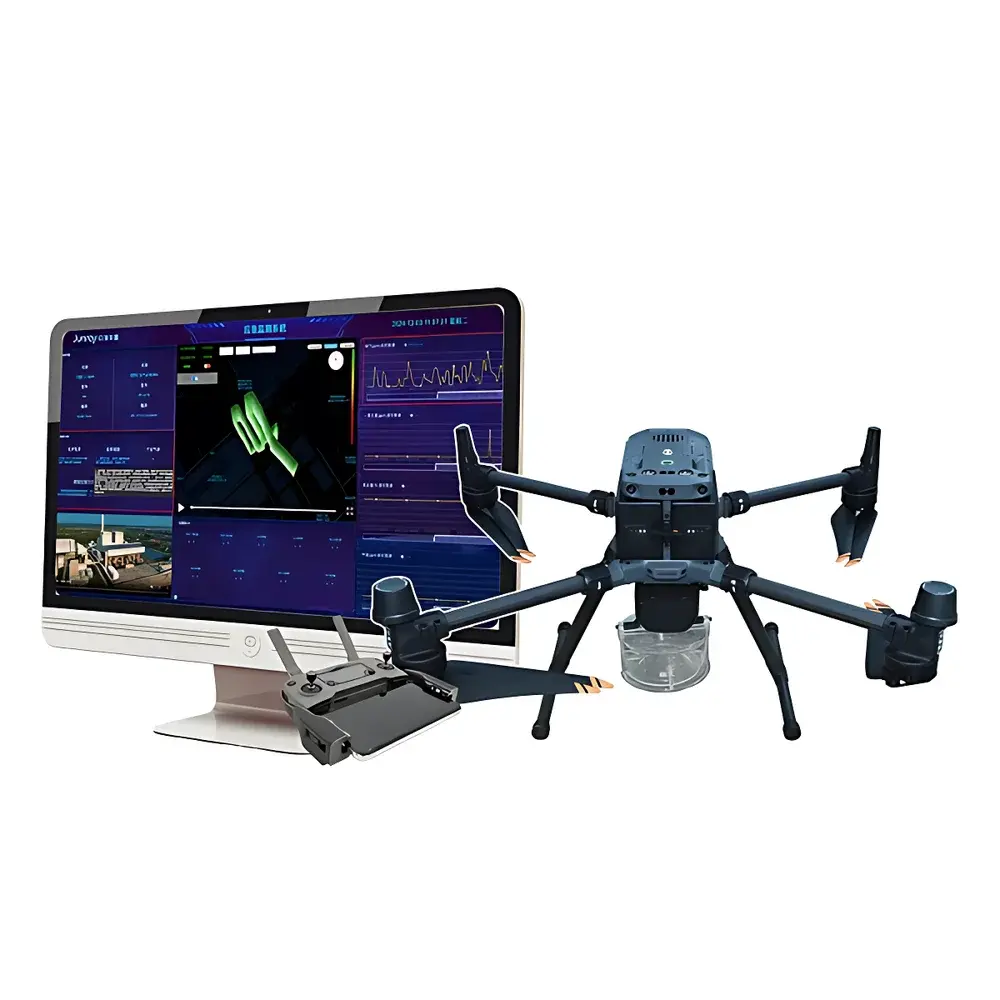
Junray Junray Emergency Environmental Monitoring Cloud Platform
| Brand | Junray |
|---|---|
| Origin | Shandong, China |
| Manufacturer Type | Manufacturer |
| Country of Origin | China |
| Model | Emergency Monitoring Cloud Platform |
| Pricing | Upon Request |
Overview
The Junray Emergency Environmental Monitoring Cloud Platform is a unified, real-time software infrastructure engineered for integrated deployment across heterogeneous mobile sensing platforms—including unmanned aerial vehicles (UAVs), mobile ground-based survey vehicles (“drive-by” or “mobile lab” units), and quadruped robotic platforms (“robotic dogs”). It operates on a distributed sensor data ingestion architecture, leveraging standardized telemetry protocols (e.g., MQTT, HTTP/HTTPS with TLS 1.2+) to aggregate time-synchronized environmental measurements—such as gas concentrations (VOCs, CO, NO₂, SO₂, O₃, H₂S, NH₃), particulate matter (PM₁, PM₂.₅, PM₁₀), meteorological parameters (wind speed/direction, temperature, humidity, pressure), and radiation dose rates—from field-deployed instruments. The platform implements a layered data processing pipeline: raw sensor telemetry undergoes protocol normalization, timestamp alignment, outlier filtering (using robust statistical thresholds), and unit harmonization prior to storage in a time-series-optimized database. Its core purpose is to support regulatory-compliant environmental incident response workflows under ISO 14001, ISO 22301 (Business Continuity), and national emergency response frameworks—enabling rapid situational awareness, exposure assessment, plume modeling integration, and command-and-control coordination during chemical spills, industrial accidents, wildfire smoke events, or hazardous material releases.
Key Features
- Multi-Modal Sensor Integration: Native support for standardized data ingestion from UAV-mounted miniaturized GC-PID/FID sensors, vehicle-integrated multi-gas analyzers (e.g., electrochemical, NDIR, photoionization), and robot-mounted low-power environmental sensor suites—ensuring interoperability without proprietary lock-in.
- Real-Time Telemetry & Low-Latency Communication: Dual-mode 4G LTE and 5G NR connectivity with automatic failover; configurable QoS policies and adaptive bandwidth allocation ensure sub-second transmission latency for critical alerts (<500 ms end-to-end under nominal network conditions) and reliable delivery even in degraded signal environments.
- Geospatially Anchored Analytics Engine: Built-in GIS module supports dynamic mapping of concentration gradients, real-time plume dispersion overlays (compatible with AERMOD and CALPUFF export formats), trajectory interpolation, and spatial interpolation (IDW, Kriging) for gap-filling in sparse sampling zones.
- Auditable Decision Support Workflow: Rule-based alerting engine with configurable thresholds per parameter and location zone; generates traceable incident logs with timestamps, operator IDs, and source device metadata—designed to meet GLP audit requirements and support 21 CFR Part 11–compliant electronic records where validated client-side signing is deployed.
- Remote Command & Control Interface: Secure WebSocket-based control layer enabling remote UAV flight path adjustment (via MAVLink-compatible API), robotic dog waypoint navigation, and mobile lab instrument parameter reconfiguration—all authenticated via role-based access control (RBAC) with SAML 2.0 identity federation support.
Sample Compatibility & Compliance
The platform does not perform physical sample acquisition or laboratory analysis; rather, it serves as the central orchestration and analytics layer for field-deployed instrumentation. It accepts structured sensor output conforming to IEEE 1451.0 (Transducer Electronic Data Sheet) templates and MODBUS TCP/RTU payloads. Data models align with ISO/IEC 11179 metadata registry standards. For regulatory reporting, the system supports automated generation of EPA Form R–compatible summaries and EU E-PRTR submission packages. All data storage and transmission comply with GDPR Article 32 technical safeguards and NIST SP 800-53 Rev. 5 controls for confidentiality and integrity.
Software & Data Management
Deployed as a containerized application stack (Docker + Kubernetes) on-premises or in private cloud environments, the platform includes PostgreSQL with TimescaleDB extension for time-series optimization, Redis for caching and session management, and Apache Kafka for high-throughput event streaming. All user interactions are logged with immutable audit trails. Role-based permissions govern access to raw telemetry, processed metrics, map layers, and command interfaces. Data export supports CSV, GeoJSON, NetCDF-4, and custom XML schemas for integration with third-party GIS or incident management systems (e.g., ESRI ArcGIS, Palantir Foundry, IBM Maximo). Optional FIPS 140-2 validated cryptographic modules are available for government deployments requiring NIST compliance.
Applications
- Rapid response to industrial chemical releases (e.g., chlorine, ammonia, HF) with dynamic hazard zone delineation
- Wildfire smoke characterization and downwind population exposure estimation
- Post-disaster environmental triage (e.g., flood-affected wastewater infrastructure, damaged storage tanks)
- Perimeter monitoring during large-scale construction or demolition activities involving asbestos or heavy metals
- Validation and verification of fixed-site air quality monitoring networks during maintenance outages
FAQ
Does the platform support integration with legacy fixed-site monitoring stations?
Yes—via Modbus TCP, OPC UA, or RESTful API adapters; historical data synchronization and cross-platform calibration validation tools are included.
Can the system operate offline or in low-connectivity field environments?
Edge computing modules can be deployed on UAVs, vehicles, or robots to perform local preprocessing and store telemetry for delayed sync upon reconnection.
Is the platform validated for use in regulated environmental reporting?
While the software itself is not FDA- or EPA-certified, its architecture and audit logging capabilities are designed to support validation per ISO/IEC 17025 and ASTM D7419 for environmental data management systems.
What cybersecurity certifications does the platform hold?
The current release complies with ISO/IEC 27001 Annex A controls; penetration testing reports and SOC 2 Type II attestation documentation are available under NDA.
How is firmware and sensor calibration managed across heterogeneous devices?
A centralized device management console provides over-the-air (OTA) firmware updates, calibration certificate upload tracking, and drift compensation profile assignment per sensor serial number and installation date.