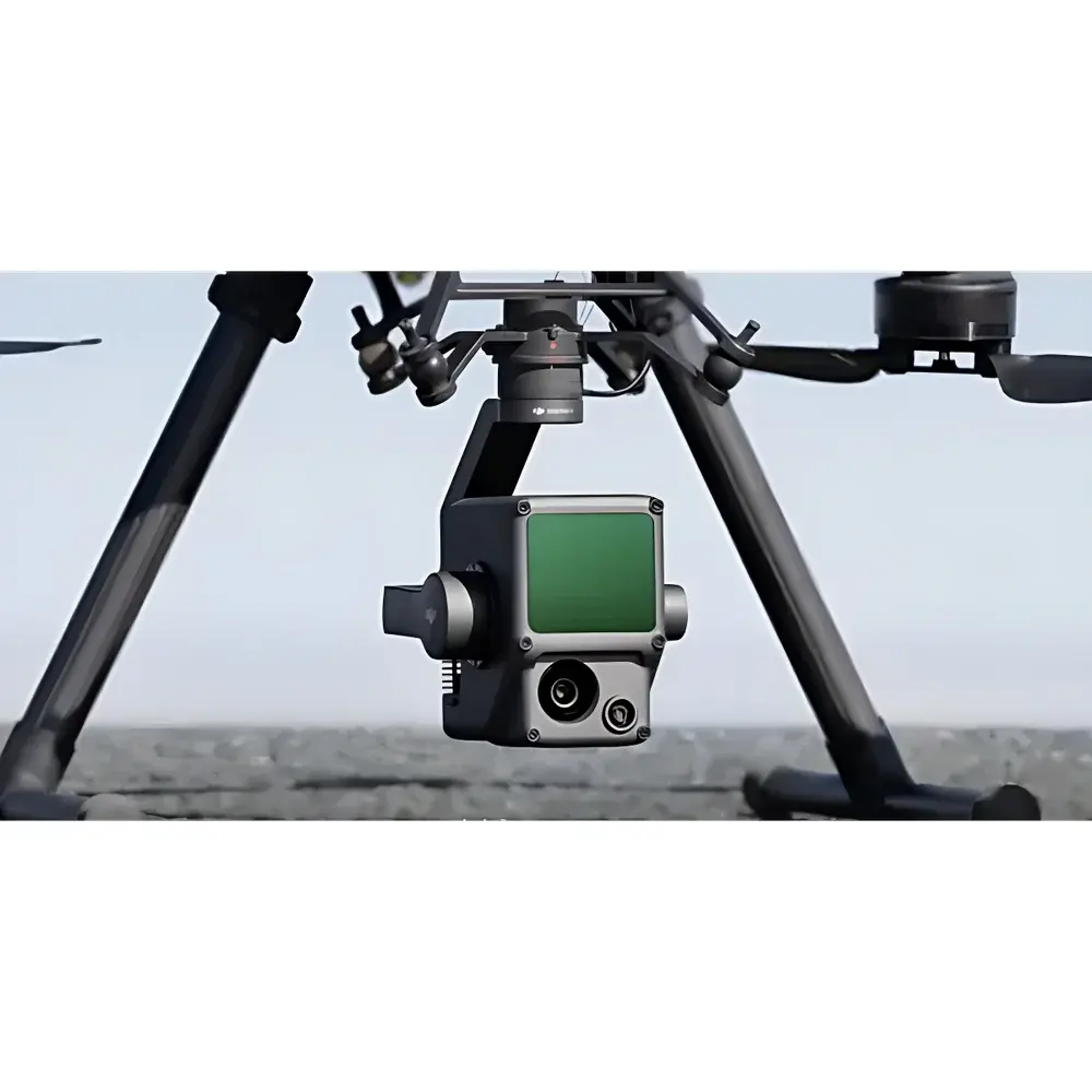
DJI Zenmuse L1 LiDAR Sensor
| Brand | DJI |
|---|---|
| Origin | Shanghai, China |
| Manufacturer Type | Authorized Distributor |
| Product Category | Domestic |
| Model | Remote Sensing System |
| Pricing | Upon Request |
| Dimensions | 152 × 110 × 169 mm |
| Weight | ~900 g |
| Power Consumption | 30 W |
| IP Rating | IP44 |
| Compatible Platform | DJI Matrice 300 RTK |
| Operating Temperature | −20 °C to +50 °C |
| Storage Temperature | −20 °C to +60 °C |
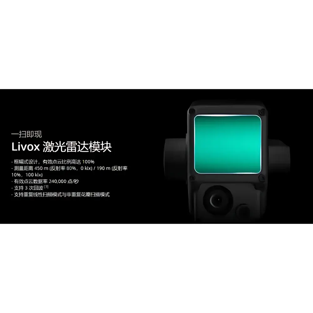
| Maximum Range | 450 m (80% reflectivity, 0 klx) / 190 m (10% reflectivity, 100 klx) |
| Point Cloud Rate | 320,000 pts/s (single return), 640,000 pts/s (multi-return) |
| Horizontal Accuracy | 250 mm @ 50 m |
| Vertical Accuracy | 125 mm @ 50 m |
| Ranging Accuracy | ±75 mm @ 100 m |
| Max Returns per Pulse | 3 |
| Scan Patterns | Repetitive Linear Scanning / Non-repetitive Petal Scanning |
| FOV | 70.4° × 4.5° (linear), 70.4° × 77.2° (petal) |
| Laser Safety Class | Class 1 |
| IMU Update Rate | 200 Hz |
| Accelerometer Range | ±8 g |
| Gyroscope Range | ±2000 °/s |
| Heading Accuracy | 0.18° (real-time), 0.08° (post-processed) |
| Pitch/Roll Accuracy | 0.03° (real-time), 0.025° (post-processed) |
| Mapping Camera | 1-inch CMOS, 20 MP, f/2.8–f/11, 8.8 mm / 24 mm (equiv.), mechanical/electronic shutter (1/2000–8 s / 1/8000–8 s), ISO 100–12800 (photo) |
| Gimbal | 3-axis (pitch/roll/pan), ±0.01° stabilization, pitch −120° to +30°, pan ±320° |
| Data Storage | microSD UHS-I / Class 10, up to 256 GB |
| Output Formats | LAS, PLY, PNTS, S3MB, PCDS (point cloud) |
Overview
The DJI Zenmuse L1 is a fully integrated LiDAR sensor system engineered for high-accuracy geospatial data acquisition in airborne remote sensing applications. Built upon Livox’s proprietary non-repetitive petal scanning architecture and coupled with a high-resolution 20-megapixel mapping camera, inertial measurement unit (IMU), and precision 3-axis gimbal stabilization, the L1 delivers synchronized LiDAR point clouds and photogrammetric imagery in a single payload. Its core operating principle relies on time-of-flight (ToF) laser ranging: pulsed near-infrared lasers (905 nm) are emitted, reflected from terrain or objects, and detected by a high-sensitivity photodiode array; distance is computed using the known speed of light and measured round-trip time. The system supports up to three returns per pulse—enabling penetration through vegetation canopies to capture ground-level elevation data—and achieves ±75 mm ranging accuracy at 100 m. Designed for seamless integration with the DJI Matrice 300 RTK platform and DJI Terra software, the L1 conforms to operational requirements for survey-grade topographic mapping, corridor analysis, forestry inventory, and environmental change monitoring under real-world field conditions.
Key Features
- Triple-return LiDAR engine delivering up to 640,000 points per second for dense, structurally resolved point clouds
- Non-repetitive petal scanning pattern (70.4° × 77.2° FOV) enabling uniform spatial coverage without scan line artifacts
- Real-time colorized point cloud generation via synchronized 20 MP RGB imaging with 1-inch CMOS sensor and calibrated lens (8.8 mm / 24 mm equivalent)
- High-fidelity inertial navigation: 200 Hz IMU update rate, post-processed heading accuracy of 0.08°, and pitch/roll stability of ±0.025°
- Ruggedized housing rated IP44 for dust and splash resistance, validated across −20 °C to +50 °C operational envelope
- Onboard real-time kinematic (RTK) positioning support when paired with M300 RTK, enabling centimeter-level absolute georeferencing without ground control points (GCPs)
- Dual scanning modes: repetitive linear for structured corridor surveys and non-repetitive petal for wide-area mapping efficiency
Sample Compatibility & Compliance
The Zenmuse L1 is optimized for deployment on the DJI Matrice 300 RTK UAV platform via SKYPORT quick-mount interface. It acquires georeferenced data suitable for compliance with national and international geospatial standards including ASPRS Accuracy Standards for Digital Geospatial Data (2015), ISO 19115 metadata schema, and national cadastral mapping specifications. While not certified for aviation regulatory approval as a standalone airborne system, its data outputs—including LAS, PLY, and S3MB—are compatible with industry-standard GIS and CAD workflows used in engineering surveys compliant with ASTM E2925 (Standard Practice for Airborne LiDAR Data Acquisition) and ISO/IEC 17025-accredited processing pipelines. The Class 1 laser classification ensures operator safety without additional protective equipment during routine flight operations.
Software & Data Management
DJI Terra serves as the primary post-processing environment for L1 data, offering end-to-end workflow automation: GNSS/IMU trajectory optimization (POS), point cloud classification (ground/non-ground), intensity normalization, RGB fusion, DSM/DTM generation, and textured 3D mesh reconstruction. All raw sensor data—including IMU logs, LiDAR timestamps, JPEG images, and binary point streams—are stored onboard via UHS-I microSD cards (up to 256 GB). Terra supports audit-ready export formats: LAS/LAZ (ASPRS-compliant), PLY (with vertex color attributes), and S3MB for web-based visualization. For enterprise deployments, Terra’s batch processing API enables integration into automated QA/QC pipelines aligned with GLP documentation practices, though native FDA 21 CFR Part 11 electronic signature functionality is not implemented.
Applications
- Topographic & Bathymetric Surveying: Generation of bare-earth digital terrain models (DTMs) beneath forest canopies using multi-return echo discrimination
- Power Line Corridor Analysis: Automated conductor-to-vegetation clearance assessment via classified point clouds and rule-based distance computation
- Forestry Inventory: Derivation of canopy height models (CHMs), tree count, crown diameter, and biomass proxies from vertical structure metrics
- Geohazard Monitoring: Multi-temporal comparison of slope deformation, landslide volume estimation, and erosion quantification
- Urban Digital Twin Development: High-fidelity 3D city modeling with geometric fidelity and photorealistic texture mapping
- Environmental Impact Assessment: Pre- and post-construction terrain change detection for mining, infrastructure, and reclamation projects
FAQ
What is the maximum effective range of the L1 under low-reflectivity conditions?
The L1 maintains reliable detection up to 190 meters when targeting surfaces with 10% reflectivity under high ambient illumination (100 klx).
Does the L1 require ground control points (GCPs) for survey-grade accuracy?
No—when flown with an RTK-enabled Matrice 300 RTK and processed in DJI Terra, horizontal and vertical accuracies of 250 mm and 125 mm respectively (at 50 m) are achievable without GCPs.
Can the L1 operate in rainy or foggy conditions?
The IP44 rating provides protection against water splashes but does not guarantee performance in sustained precipitation or dense fog, which attenuate near-infrared laser transmission.
Is the L1 compatible with third-party processing software such as CloudCompare or ArcGIS Pro?
Yes—standardized output formats (LAS, PLY, OBJ) ensure full interoperability with commercial and open-source geospatial analysis tools.
How is radiometric calibration handled for the integrated mapping camera?
The camera applies factory-calibrated lens distortion correction and embedded EXIF metadata (including GPS, IMU, and exposure parameters) to support rigorous bundle adjustment in photogrammetric workflows.