AZ IRRIScope Smart Irrigation Guidance System
| Brand | AZ (Beijing Aozuo) |
|---|---|
| Origin | Beijing, China |
| Manufacturer Type | Manufacturer |
| Product Category | Domestic |
| Model | IRRIScope |
| Instrument Type | Soil Moisture & Water Potential Analyzer |
| Wind Speed Range | 0–60 m/s |
| Wind Speed Resolution | 0.1 m/s |
| Wind Speed Accuracy | ±0.3 m/s RMS (WG ≤ 5 m/s), ±3% RMS (WG > 5 m/s), ±5% RMS (WG > 50 m/s) |
| Wind Direction Range | 0–360° |
| Wind Direction Resolution | 1° |
| Wind Direction Accuracy | ±2° (WG > 2 m/s) |
| Air Temperature Range | −30 to +70 °C |
| Air Temperature Resolution | 0.01 °C |
| Air Temperature Accuracy | ±0.5 °C |
| Relative Humidity Range | 0–100% RH |
| Relative Humidity Resolution | 0.1% RH |
| Relative Humidity Accuracy | ±3% RH (10–90% RH) |
| Atmospheric Pressure Range | 300–1100 hPa |
| Pressure Resolution | 0.01 hPa |
| Pressure Accuracy | ±0.5 hPa (@ 20 °C) |
| Photosynthetic Photon Flux Density (PPFD) / Illuminance Range | 0–150 klx |
| Illuminance Resolution | 30 lx |
| Illuminance Accuracy | ±3% of reading or ±3 lx/min |
| Rainfall Measurement Range | 0–8 mm/min |
| Rainfall Resolution | 0.2 mm |
| Soil Volumetric Water Content (VWC) Range | 0–60% |
| VWC Accuracy | ±2% |
| Soil Temperature Range | −40 to +80 °C |
| Soil Temperature Accuracy | ±0.2 °C typical, ±0.5 °C full scale |
Overview
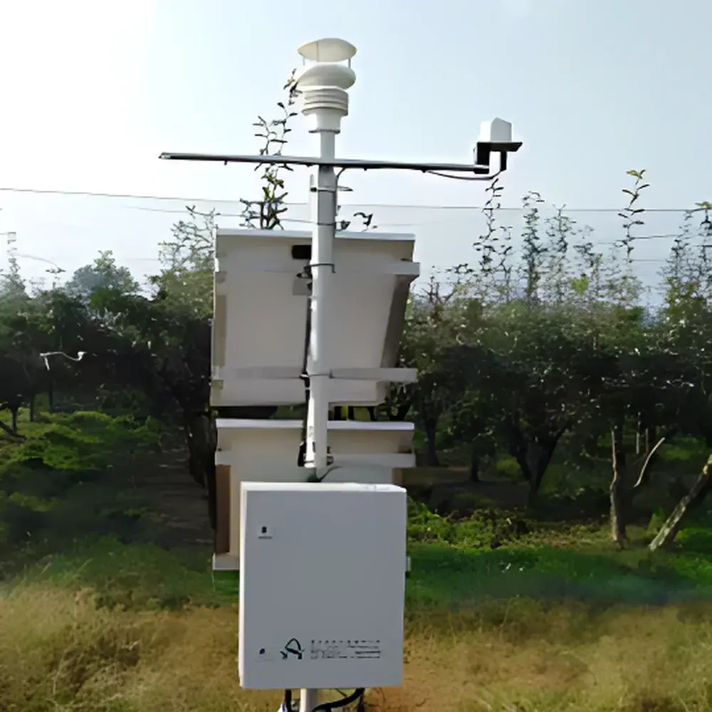
The AZ IRRIScope Smart Irrigation Guidance System is an integrated environmental monitoring and agronomic decision-support platform engineered for precision water management in large-scale agricultural operations, irrigation districts, and research institutions. Unlike conventional point-based soil moisture sensors, the IRRIScope employs a multi-sensor field station architecture coupled with real-time evapotranspiration modeling to deliver spatially scalable, crop-specific irrigation recommendations. Its core operational principle rests on the FAO-56 Penman-Monteith methodology for calculating reference evapotranspiration (ET0), dynamically adjusted by crop-specific coefficients (Kc) that vary according to phenological stage, local climate conditions, soil hydraulic properties, and irrigation method. The system continuously assimilates in-situ meteorological data—including wind speed and direction, air temperature and humidity, atmospheric pressure, photosynthetic irradiance, and precipitation—alongside volumetric soil water content (VWC) and soil temperature profiles across active root zones. By integrating these parameters into a time-resolved water balance model, the IRRIScope determines both the optimal timing and volume of irrigation events required to maintain soil water status within the crop’s functional range—thereby minimizing deep percolation and runoff while maximizing transpirational efficiency and yield stability.
Key Features
- Multi-parameter field station with calibrated sensors for wind, temperature, humidity, pressure, light, rainfall, soil VWC, and soil temperature—each meeting ISO 20607 (agricultural meteorology) and ASTM D5092 (soil moisture sensor performance) baseline specifications.
- Real-time ET0 and ETc computation using FAO-56 Penman-Monteith equations, with Kc lookup tables preloaded for wheat, maize, rice, cotton, soybean, and other major agronomic species.
- Root-zone soil moisture profiling with temporal visualization of water depletion dynamics across defined depth intervals (e.g., 10 cm, 20 cm, 40 cm).
- Dynamic irrigation scheduling engine that factors historical irrigation records, current soil water deficit, crop growth stage, irrigation system type (drip, sprinkler, flood), and soil texture class (clay, loam, sand).
- Web- and mobile-accessible interface supporting push notifications for irrigation alerts, threshold breaches, and maintenance reminders.
- Modular architecture enabling concurrent guidance for multiple crops and fields, with configurable user-defined irrigation zones and rotation schedules.
- Open API and Modbus RTU/ASCII protocol support for integration with third-party automated irrigation controllers, SCADA systems, and farm management software (FMS).
Sample Compatibility & Compliance
The IRRIScope is validated for deployment in diverse soil types—including sandy loam, silty clay, and volcanic ash soils—with sensor calibration traceable to NIST-traceable reference standards where applicable. It complies with ISO 11274 (soil water retention characterization), ISO 10390 (soil pH and electrical conductivity measurement), and supports GLP-aligned data logging for regulatory reporting. All meteorological sensors conform to WMO Guide to Instruments and Observing Methods (CIMO Guide, Chapter 12) requirements for agricultural applications. Data integrity is maintained through onboard timestamping, checksum validation, and optional encrypted SD card storage. The system meets CE marking requirements for electromagnetic compatibility (EN 61326-1) and environmental protection (EN 60529 IP67 enclosure rating for field modules).
Software & Data Management
The IRRIScope operates with AZ AgriCloud™—a secure, browser-based platform supporting role-based access control (RBAC), audit trails, and data export in CSV, NetCDF, and JSON formats. All raw and processed measurements are stored with ISO 8601-compliant timestamps and metadata tags (sensor ID, location coordinates, calibration date, operator ID). Software modules include: (1) ET Trend Analyzer with comparative ET0/ETc overlay charts; (2) Soil Water Depletion Dashboard with customizable thresholds; (3) Irrigation Logbook with event tagging (manual vs. auto-triggered); and (4) Multi-field Portfolio Manager for aggregated water use efficiency (WUE) metrics. Optional FDA 21 CFR Part 11 compliance package available upon request, including electronic signatures, audit trail review, and data archival policies aligned with ALCOA+ principles (Attributable, Legible, Contemporaneous, Original, Accurate, Complete, Consistent, Enduring, Available).
Applications
- Large-scale commercial farms requiring field-level irrigation optimization under variable-rate or zone-based water allocation policies.
- Irrigation districts implementing demand-based water distribution and aquifer sustainability programs.
- Research stations conducting controlled studies on crop water productivity, drought resilience, or deficit irrigation strategies.
- Government agencies executing national water conservation initiatives, such as China’s “Three Red Lines” policy or FAO’s Water Productivity Framework.
- Smart greenhouse and protected cultivation facilities integrating with fertigation and climate control systems.
- Academic departments in agronomy, hydrology, and environmental engineering performing long-term edaphic-climatic correlation analysis.
FAQ
How does the IRRIScope differ from standard soil moisture sensors?
It integrates real-time micrometeorological inputs with crop physiological models to generate actionable irrigation decisions—not just static moisture readings.
Can the system operate offline in remote areas with limited connectivity?
Yes: field modules store 90+ days of high-resolution sensor data locally and synchronize automatically when cellular or LoRaWAN connectivity resumes.
Is calibration required after installation?
Factory calibration is provided for all sensors; optional field recalibration kits and procedures are available for soil VWC probes based on gravimetric validation protocols.
Does the software support integration with existing farm management platforms?
Yes—via RESTful API, MQTT, or Modbus TCP/RTU; documented integration guides and sandbox environments are provided for developers.
What is the recommended maintenance interval for field sensors?
Biannual visual inspection and cleaning; annual verification of thermistor and capacitive VWC probe performance against reference standards is advised.
Related Products


