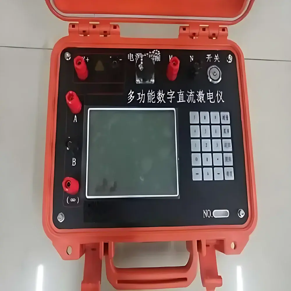
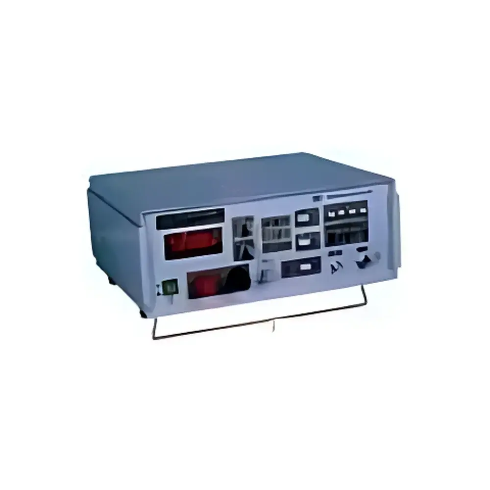
HengaoDe HAD-MDIP-3 Multifunctional Digital DC Resistivity & Induced Polarization (IP) Meter with 24-bit A/D and ARM Microcontroller
| Brand | HengaoDe |
|---|---|
| Origin | Beijing, China |
| Manufacturer Type | Authorized Distributor |
| Country of Origin | China |
| Model | HAD-MDIP-3 |
| Price | USD 1,390 (FOB Beijing) |
| Voltage Range | ±32 V |
| A/D Resolution | 24-bit |
| Voltage Accuracy | ±5‰ @ >3 mV |
| Voltage Resolution | 1 µV |
| Current Range | 0–5 A |
| Current Accuracy | ±5‰ |
| Current Resolution | 10 µA |
| Chargeability (M_s) Accuracy | ±5‰ |
| Input Impedance | ≥50 MΩ |
| Power Line Interference Rejection | >80 dB |
| SP Compensation | Full-scale real-time automatic tracking |
| DA Compensation | Yes |
| Max Supply Voltage | 1000 V |
| Max Supply Current | 5 A |
| Max Output Power | 5000 W |
| Pulse Duration | 0.5–60 s (on/off) |
| Overvoltage/Overcurrent Protection | Integrated |
| Data Interface | USB 2.0 high-speed |
| Battery | 11.1 V / 9.6 Ah Li-ion (26 h continuous operation) |
| External Power | 12 V DC input |
| IP Rating | IP65 |
| Operating Temperature | −10 °C to +50 °C |
| Dimensions | 280 × 240 × 125 mm |
| Display | 5.7″ monochrome LCD (sunlight-readable) |
| Internal Storage | ≥32 GB |
Overview
The HengaoDe HAD-MDIP-3 is a field-deployable, multifunctional digital direct-current (DC) resistivity and induced polarization (IP) meter engineered for geophysical exploration and near-surface subsurface characterization. It operates on the principles of galvanic current injection and potential difference measurement across electrode arrays—applying controlled DC current pulses into the ground and recording decaying voltage responses to derive apparent resistivity (ρa) and chargeability (Ms) parameters. Its core architecture integrates a 24-bit analog-to-digital converter (A/D) with an ARM-based microcontroller platform, ensuring high-resolution signal acquisition, low-noise performance, and deterministic timing control essential for time-domain IP (TDIP) surveys. Designed for rugged outdoor use, the instrument supports standard Wenner, Schlumberger, dipole-dipole, and gradient array configurations, enabling quantitative interpretation of subsurface heterogeneity related to lithology, fluid saturation, clay content, and metallic mineralization.
Key Features
- 24-bit high-fidelity A/D conversion with 1 µV voltage resolution and 10 µA current resolution for precise low-amplitude signal capture
- Real-time automatic self-potential (SP) compensation across full measurement range, minimizing drift-induced artifacts in long-duration surveys
- Digital active compensation (DA) circuitry for stable baseline referencing under variable ground coupling conditions
- Programmable pulse timing: independent control of current-on (0.5–60 s) and current-off (0.5–60 s) intervals to optimize chargeability decay sampling
- Integrated overvoltage (up to 1000 V) and overcurrent (up to 5 A) protection circuits compliant with IEC 61000-4-5 surge immunity requirements
- IP65-rated enclosure with sealed membrane keypad and sunlight-readable monochrome LCD display for all-weather operability
- Onboard ≥32 GB non-volatile storage with timestamped data logging, supporting multi-channel synchronized acquisition
- USB 2.0 interface for rapid data offload and firmware updates; no proprietary drivers required
- Extended battery life: 26 hours continuous operation on rechargeable 11.1 V / 9.6 Ah lithium-ion pack
Sample Compatibility & Compliance
The HAD-MDIP-3 is intended for use with standard non-polarizing electrodes (Cu/CuSO4, Pb/PbCl2) and compatible cable reels (e.g., 50–200 m multi-core geophone-grade cables). It meets functional requirements specified in ASTM D6432-20 (Standard Guide for Using the Surface Electrical Resistivity Method for Subsurface Investigations), ISO 18674-3:2017 (Geotechnical investigation and testing — Geophysical investigation — Part 3: Electrical resistivity and induced polarization methods), and Chinese national standard GB/T 32510-2016 (Geophysical instruments — Technical requirements for DC resistivity and IP meters). Input impedance ≥50 MΩ ensures minimal loading error when measuring high-resistivity formations or dry soils. The instrument’s 80+ dB power-line interference rejection enables reliable operation in proximity to AC infrastructure without external notch filtering.
Software & Data Management
Data acquired by the HAD-MDIP-3 is stored in open binary format with embedded metadata (array geometry, electrode spacing, pulse parameters, GPS timestamps if externally synced). Export options include CSV and SEG-2 compatibility for interoperability with industry-standard processing suites (e.g., RES2DINV, EarthImager, AGI EarthImager 2D). Firmware supports GLP-compliant audit trails: each measurement record contains operator ID, calibration status flag, environmental temperature/humidity (via optional external sensor), and checksum-verified integrity validation. Remote configuration and batch parameter upload are supported via ASCII command protocol over USB—enabling automated survey scripting and integration into QA/QC workflows aligned with ISO/IEC 17025 laboratory accreditation criteria.
Applications
- Engineering site characterization: detection of karst voids, abandoned mine workings, and paleochannels prior to foundation design
- Environmental geophysics: mapping leachate plumes, landfill boundaries, and saline intrusion zones in coastal aquifers
- Geotechnical hazard assessment: identifying slip surfaces in landslide-prone slopes and seepage pathways beneath earthen dams
- Cultural heritage investigations: non-invasive subsurface mapping of buried archaeological features (walls, tombs, ditches)
- Infrastructure evaluation: assessing subgrade integrity beneath roadways, railway embankments, and bridge abutments
- Mineral exploration: reconnaissance-scale targeting of sulfide-bearing zones using chargeability anomalies
FAQ
What electrode configurations does the HAD-MDIP-3 support?
It natively supports Wenner, Schlumberger, dipole-dipole, and gradient arrays via programmable electrode switching sequences. Custom array definitions can be loaded from external configuration files.
Is the instrument compatible with standard geophysical data inversion software?
Yes—exported data conforms to SEG-2 and CSV formats accepted by RES2DINV, EarthImager, and GMG GeoTools. Array geometry and measurement metadata are preserved in header fields.
Does the device meet regulatory requirements for field-deployed instrumentation?
It complies with electromagnetic compatibility (EMC) Class B limits per CISPR 32 and carries CE marking for conformity with EU Directive 2014/30/EU (EMC Directive) and 2014/35/EU (LVD Directive).
Can the HAD-MDIP-3 perform time-lapse (4D) monitoring?
Yes—its deterministic timing engine and onboard clock synchronization support repeatable survey reoccupation with sub-second timestamp accuracy, enabling temporal resistivity change analysis.
What maintenance is required for long-term field reliability?
Annual verification of A/D linearity and current source stability against NIST-traceable reference standards is recommended. No routine calibration is required between verifications due to onboard self-diagnostic routines.