AisaFENIX Full-Spectrum Airborne Hyperspectral Imaging System
| Origin | Finland |
|---|---|
| Manufacturer Type | Authorized Distributor |
| Origin Category | Imported |
| Model | AisaFENIX |
| Pricing | Upon Request |
Overview
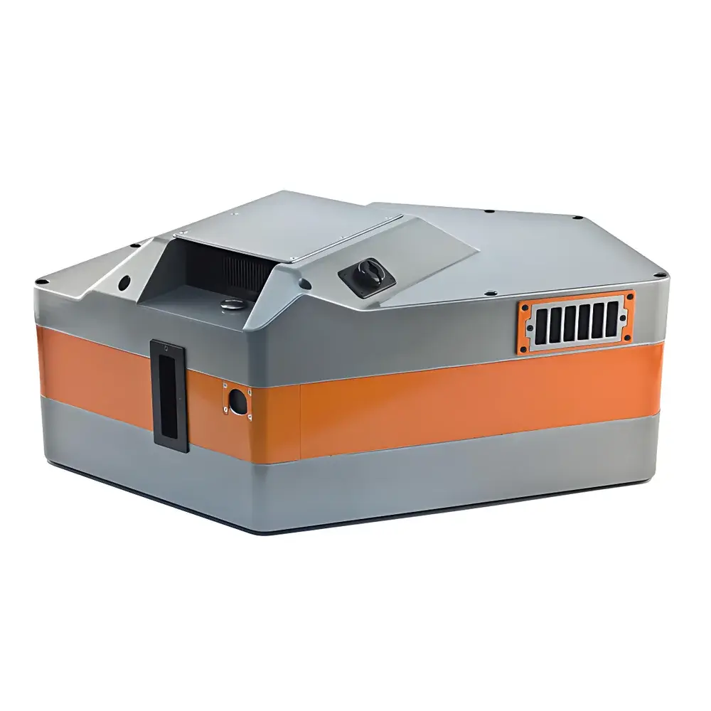
The AisaFENIX Full-Spectrum Airborne Hyperspectral Imaging System is a next-generation, integrated push-broom spectrometer designed for high-fidelity remote sensing from manned aircraft and UAV platforms. Engineered by Specim (a Part of Konica Minolta), it unifies visible–near-infrared (VNIR) and shortwave infrared (SWIR) spectral acquisition into a single, co-registered data cube spanning 380–2500 nm—covering the full solar-reflective region critical for material identification, biochemical property estimation, and surface characterization. Unlike legacy dual-sensor architectures, AisaFENIX employs a single optical train with dichroic beam-splitting and parallel VNIR/SWIR detection paths, eliminating spatial misregistration, radiometric discontinuity, and temporal latency between bands. Its core measurement principle is based on spatial-scanning spectroscopy: as the platform moves forward, each line of the 384-pixel cross-track array captures a full spectrum across >620 calibrated channels per band, generating georeferenced hypercubes with sub-pixel smile and keystone distortion (<0.2 pixel). This architecture ensures high reproducibility in quantitative reflectance retrieval under variable illumination and atmospheric conditions—essential for time-series monitoring and multi-site comparative analysis.
Key Features
- Full-spectrum coverage from 380 nm to 2500 nm in a single acquisition, delivering one co-registered hyperspectral data cube
- High optical throughput (>65% average transmission) and polarization-insensitive design, ensuring stable radiometric response across diverse surface orientations and sun angles
- Low geometric distortion: smile and keystone errors < 0.2 pixels—enabling direct pixel-to-pixel spectral comparison without post-acquisition correction
- Compact, ruggedized airborne form factor: 15 kg total mass, volume reduced by 75% vs. conventional dual-instrument setups
- VNIR channel (380–970 nm): 344 spectral bands @ ~3.5 nm resolution; SWIR channel (970–2500 nm): up to 275 bands @ ~10 nm resolution (configurable binning)
- High signal fidelity: peak SNR of 500–1000:1 (VNIR) and 900:1 (SWIR), achieved via cooled MCT detector (Stirling) and low-noise CMOS imaging
- F/2.4 aperture with 32.3° field-of-view and 0.084° instantaneous field-of-view (IFOV), supporting ground sampling distances (GSD) down to 1 m at 660 m altitude
Sample Compatibility & Compliance
AisaFENIX is optimized for reflective surface imaging under daylight illumination, supporting applications requiring compliance with international remote sensing standards including ASTM E2593 (Standard Guide for Airborne Hyperspectral Imaging), ISO 19130-2 (Geographic information — Imagery sensor models), and CE marking for airborne electronic equipment. Its radiometric calibration traceability follows NIST-traceable procedures, with factory-provided wavelength and radiance calibration files delivered with every system. The instrument meets environmental operating specifications per MIL-STD-810G for vibration, shock, and thermal stability (operating range: +5°C to +40°C; storage: −20°C to +50°C). No user-side optical alignment or spectral stitching is required—ensuring operational readiness and repeatability across campaigns and operators.
Software & Data Management
The system integrates with Specim’s proprietary INSIGHT software suite, providing real-time preview, radiometric correction, georeferencing (via optional GNSS/IMU integration), and export to industry-standard formats (ENVI .hdr/.bin, GeoTIFF, HDF5). Calibration metadata—including dark current, flat-field, spectral response, and IFOV maps—is embedded in output files to support FAIR (Findable, Accessible, Interoperable, Reusable) data principles. For regulated environments (e.g., environmental monitoring under EPA protocols or agricultural subsidy verification), INSIGHT supports audit-ready logging and configurable user access control. Raw data streams are captured at up to 130 fps (full frame), with 12-bit (VNIR) and 16-bit (SWIR) Camera Link output—compatible with third-party processing pipelines implementing ENVI, Python (scikit-image, hylite), or MATLAB-based spectral unmixing and classification workflows.
Applications
- Precision Agriculture: Quantitative mapping of chlorophyll content, water stress (NDWI, PRI), nitrogen status, and early-stage biotic/abiotic stress—supporting variable-rate application and yield forecasting
- Environmental Monitoring: Detection of algal blooms, suspended sediments, heavy metal contamination in water bodies, and post-disaster land-cover change assessment
- Geological & Mining Exploration: Mineral identification (e.g., clays, carbonates, sulfides) via diagnostic absorption features in SWIR, enabling lithological mapping and alteration zone delineation
- Urban Remote Sensing: Impervious surface mapping, rooftop material classification, and vegetation health indexing for smart city planning and heat island analysis
- Defense & Security: Camouflage detection, concealed object identification, and wide-area persistent surveillance using spectral anomaly detection algorithms
FAQ
Does AisaFENIX require external radiometric calibration before each flight?
No—factory-applied radiometric and spectral calibration is stable over time and temperature; only periodic validation using onboard calibration sources or ground reference panels is recommended.
Can AisaFENIX be integrated with RTK-GNSS and IMU systems?
Yes—INSIGHT supports direct synchronization with industry-standard GNSS/IMU units (e.g., Applanix APX, NovAtel SPAN) for centimeter-level geopositioning and orthorectification.
What data formats are supported for downstream analysis?
Native output includes ENVI-compatible header-binary pairs, GeoTIFF with embedded projection metadata, and HDF5 for hierarchical storage of multi-dimensional cubes and ancillary calibration data.
Is real-time onboard processing available?
Real-time preview and basic radiometric correction are supported; advanced processing (e.g., endmember extraction, classification) is performed post-mission using desktop or cloud-based computing resources.
How is thermal stability managed in the SWIR detector?
The MCT focal plane array is actively cooled via an integrated Stirling cryocooler, maintaining detector temperature at −80°C ± 0.5°C for optimal dark current suppression and long-term SNR consistency.
Related Products