COMECAUSE IN-G20 Portable Canopy Analyzer for Leaf Area Index (LAI) and Crop Growth Monitoring
| Brand | COMECAUSE |
|---|---|
| Origin | Shandong, China |
| Manufacturer Type | Direct Manufacturer |
| Model | IN-G20 |
| Principle | Hemispherical Image Analysis (Fisheye Photography + PAR Sensing) |
| Type | Portable Field Instrument |
| Field of View | 150° Fisheye Lens |
| PAR Spectral Range | 400–700 nm |
| PAR Measurement Range | 0–2000 μmol·m⁻²·s⁻¹ |
| Angular Resolution | Zenith Angle 0°–75° (10 zones), Azimuth 0°–360° (10 zones) |
| Image Sensor Resolution | 768 × 494 pixels |
| Probe Dimensions | Ø60 mm × 100 mm |
| Weight | 500 g (probe only) |
| Operating Temperature | 0–55 °C |
| Interface | USB 2.0 |
| GPS Integration | Real-time geotagging (latitude/longitude) |
Overview
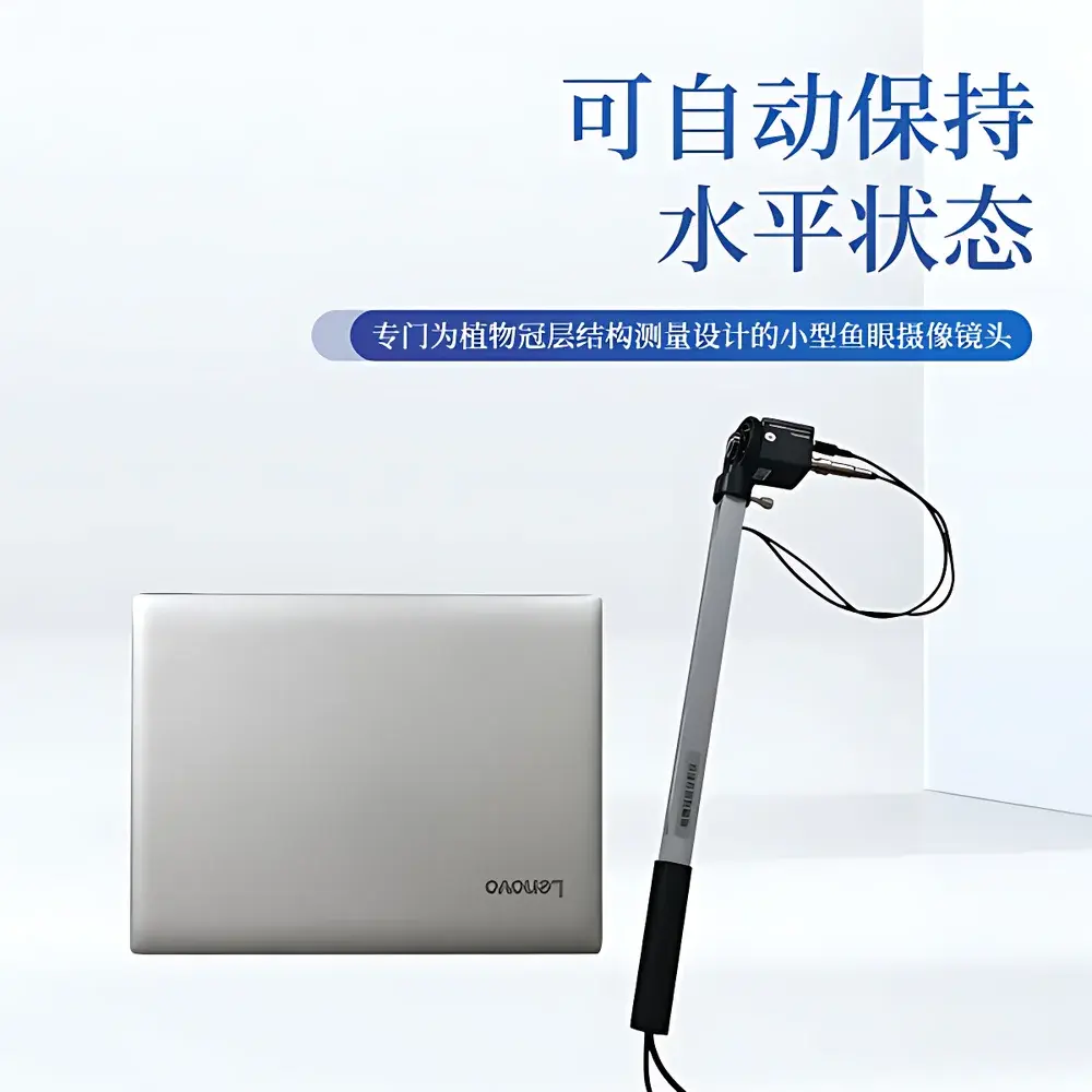
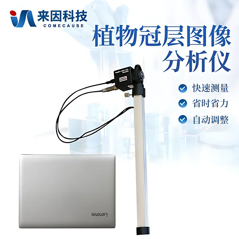
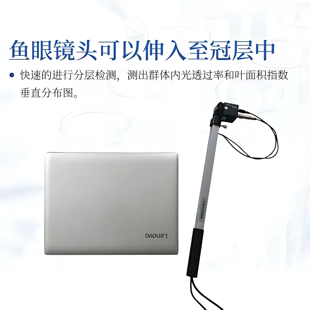
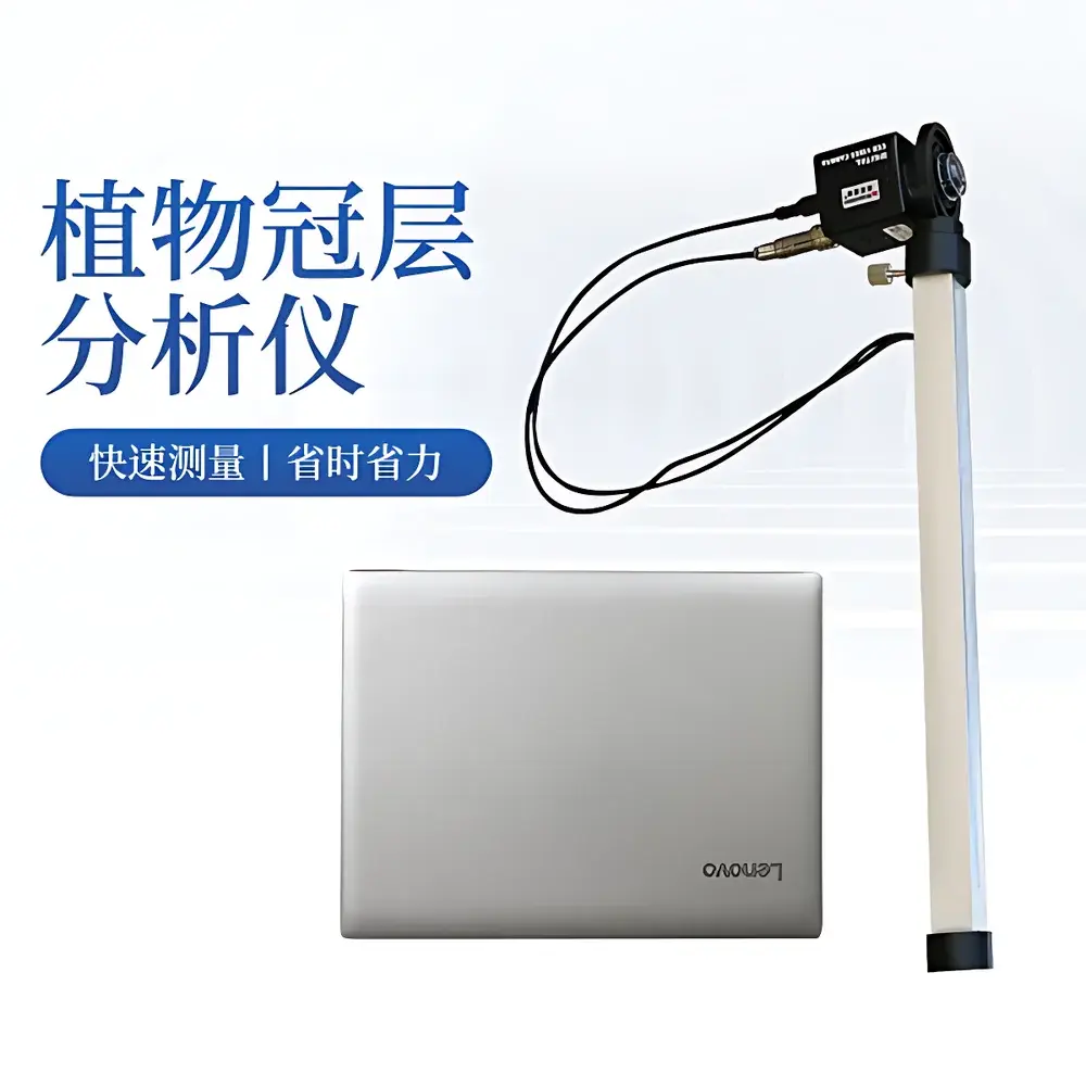
The COMECAUSE IN-G20 Portable Canopy Analyzer is an integrated field instrument engineered for rapid, non-destructive quantification of canopy structural and radiative properties in agricultural and ecological research. It operates on the widely accepted hemispherical photography principle—based on the Beer–Lambert law and validated assumptions of random leaf orientation and spatial homogeneity—to derive canopy architecture parameters from fisheye imagery and concurrent photosynthetic photon flux density (PPFD) measurements. Unlike destructive or time-intensive point-sampling methods, the IN-G20 captures a full 150° hemispherical view of the sky through a calibrated fisheye lens mounted on a lightweight articulating arm, enabling single-position acquisition of canopy gap fraction across defined zenith and azimuth sectors. This approach eliminates operator dependency in repeated manual sampling while preserving spatial context essential for modeling light interception, carbon assimilation, and crop growth dynamics.
Key Features
- Fisheye imaging probe with automatic horizon-leveling gimbal mount—no tripod required; maintains optical axis perpendicular to gravity during handheld operation.
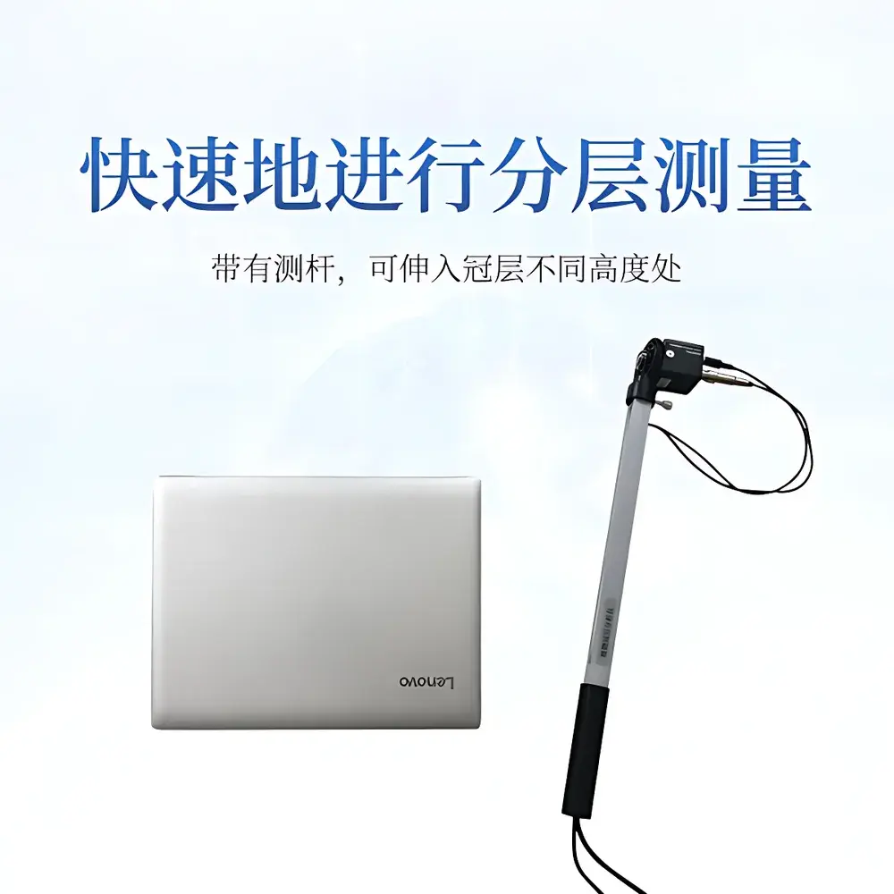
- Integrated 25-sensor PAR measurement rod (swivel arm) co-located with the imaging head, enabling simultaneous spatially registered PPFD profiling beneath the canopy at multiple heights.
- Configurable angular partitioning: zenith angle segmented into 10 discrete bands (0°–75°), azimuth into 10 sectors (0°–360°), supporting layered LAI estimation and directional gap fraction analysis.
- Threshold-adjustable image segmentation algorithm—users manually exclude non-canopy elements (e.g., soil exposure, gaps due to missing plants, edge-row artifacts) prior to calculation, improving parameter robustness under heterogeneous field conditions.
- Real-time GPS geotagging embedded in image metadata, ensuring traceable spatial referencing for longitudinal monitoring and GIS integration.
- USB-connected architecture compatible with Windows-based field laptops; includes hardware encryption dongle for software license management and data integrity assurance.
Sample Compatibility & Compliance
The IN-G20 is optimized for use across herbaceous and low-to-mid stature crops (e.g., wheat, maize, soybean, rice, alfalfa) and natural grassland or shrubland canopies up to ~3 m height. Its compact probe design allows insertion into dense stands without significant disturbance. While not certified to ISO/IEC 17025 for metrological accreditation, the instrument adheres to methodological conventions established in ISO 11727:2015 (optical measurement of plant canopy structure) and aligns with USDA ARS and FAO protocols for LAI validation via indirect optical methods. Data output formats comply with CF Standard Names (Climate and Forecast Metadata Conventions) for interoperability with agronomic modeling platforms such as APSIM and DSSAT.
Software & Data Management
The bundled Plant Canopy Analysis System (PCAS v3.2) provides a validated workflow for image preprocessing, mask definition, gap fraction computation, and parameter derivation—including LAI, mean leaf inclination angle (MLA), diffuse non-interceptance (DIFN), direct beam transmittance at user-defined solar zenith angles, extinction coefficient (k), and azimuthal leaf area density distribution. All processing steps are logged with timestamps and operator ID. Export options include CSV (tabular metrics), GeoTIFF (georeferenced canopy maps), and XML (metadata-rich structured output). Raw and processed data synchronize automatically to the COMECAUSE Cloud Agricultural Data Center—a secure, role-based platform supporting multi-user collaboration, version-controlled datasets, and audit trails compliant with GLP documentation requirements.
Applications
- High-throughput phenotyping trials evaluating canopy architecture traits under drought, nitrogen stress, or breeding selection pressure.
- Calibration and validation of satellite- and UAV-based LAI retrieval algorithms using ground-truth reference measurements.
- Dynamic monitoring of canopy closure progression in precision agriculture systems to inform irrigation scheduling and nitrogen top-dressing decisions.
- Ecological studies of light gradient stratification in agroforestry systems or successional vegetation plots.
- Teaching laboratories in plant physiology, crop ecology, and remote sensing courses—supporting hands-on instruction in optical biophysics and radiative transfer theory.
FAQ
What is the theoretical basis for LAI calculation in the IN-G20?
The instrument applies the spherical cap integration method derived from the Goudriaan (1977) and Norman & Campbell (1989) models, using gap fraction measured across discretized zenith angles to solve the inversion problem under assumed leaf angle distribution (LAD) classes (e.g., planophile, erectophile).
Can the IN-G20 be used under cloudy or overcast conditions?
Yes—diffuse sky conditions improve contrast between canopy elements and background, enhancing gap fraction detection accuracy; however, the PAR sensor remains fully functional for absolute irradiance quantification regardless of sky condition.
Is the software compatible with macOS or Linux operating systems?
No—the PCAS software is built exclusively for Windows 10/11 (64-bit) and requires .NET Framework 4.8 and DirectX 12 support; virtualization is not recommended due to USB device driver constraints.
How is measurement repeatability ensured across operators?
The auto-leveling gimbal and standardized probe height protocol (defined relative to ground or crop base) minimize inter-operator variability; calibration certificates for the fisheye lens distortion model and PAR sensor response curve are provided with each unit.
Does the system meet FDA 21 CFR Part 11 requirements for electronic records?
While the cloud platform supports audit trails and electronic signatures, full Part 11 compliance requires site-specific validation by the end user’s QA department; the system provides all necessary technical controls (e.g., password protection, change logs, immutable archives) to facilitate such validation.