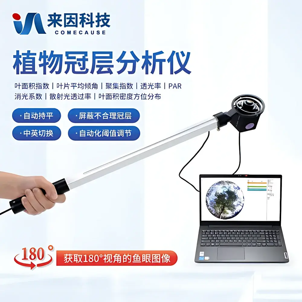
COMECAUSE IN-G30 Portable Canopy Analyzer for Crop Growth Monitoring
| Brand | COMECAUSE |
|---|---|
| Origin | Shandong, China |
| Manufacturer Type | Direct Manufacturer |
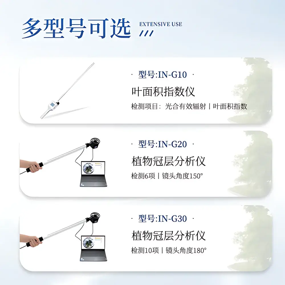
| Model | IN-G30 |
| Principle | Hemispherical Image Analysis (Fisheye Photography) |
| Type | Portable |
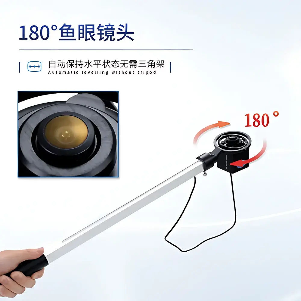
| Lens FOV | 180° |
| Resolution | 2592 × 1944 |
| PAR Spectral Range | 400–700 nm |
| PAR Measurement Range | 0–3000 µmol·m⁻²·s⁻¹ |
| Weight | 500 g |
| Operating Temperature | −10°C to +55°C |
| Relative Humidity | ≤85% RH |
| Interface | USB |
| Software | Plant Canopy Analysis System v3.x |
| GPS Integration | Built-in GNSS module with real-time coordinate logging |
| Data Output | LAI, Mean Leaf Angle, Clumping Index (CI₁ & CI₂), Canopy Openness, Diffuse Transmittance, Direct Beam Transmittance (by solar zenith angle), Extinction Coefficient (k), Azimuthal LAI Distribution, PAR Profile |
| Environmental Compliance | Designed for field-deployable GLP-aligned data collection in agronomic research |
Overview
The COMECAUSE IN-G30 Portable Canopy Analyzer is an engineered field instrument for non-destructive, quantitative assessment of plant canopy architecture and light interception dynamics. It operates on the established principle of hemispherical photography—capturing upward-looking fisheye images of the sky through the canopy—and applying validated gap fraction analysis to derive structural and radiative parameters. Rooted in Beer-Lambert law assumptions and semi-empirical modeling of light attenuation through vegetative media, the IN-G30 implements a widely accepted theoretical framework used across peer-reviewed ecological and agronomic studies. Its design prioritizes field robustness, measurement repeatability, and operational efficiency under variable ambient conditions, enabling researchers and agronomists to collect spatially referenced canopy metrics without requiring permanent infrastructure or laboratory calibration environments.
Key Features
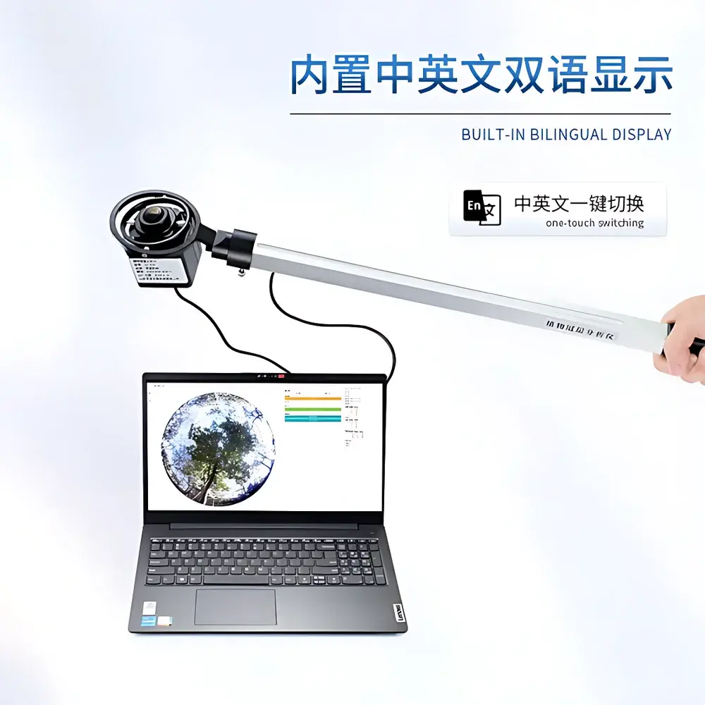
- Fisheye optical head with automatic horizon leveling via integrated gimbal mount—eliminates need for tripods and ensures consistent image geometry across uneven terrain.
- Extendable measurement arm (swing arm) with 180° fisheye lens at tip, allowing precise vertical and horizontal positioning within canopy layers for stratified LAI and PAR profiling.
- Dual-sensor hybrid probe: CMOS imaging sensor (2592 × 1944 resolution) co-located with 25 calibrated PAR sensors along the measurement rod, enabling synchronized optical and radiometric data acquisition.
- Real-time GNSS geotagging: embedded multi-constellation receiver logs latitude, longitude, altitude, and timestamp for every captured image and derived parameter set—critical for spatial interpolation and GIS integration.
- Adaptive thresholding algorithm: software automatically determines optimal pixel classification thresholds based on local histogram statistics, minimizing operator bias and improving inter-user reproducibility.
- Modular region-of-interest definition: users can partition the hemispherical image into up to 10 zenith angle zones and 10 azimuthal sectors—supporting directional analysis of canopy heterogeneity, edge effects, or row-crop orientation.
- Bilingual UI (English/Chinese) with one-touch language toggle; all menus, prompts, and report exports maintain full linguistic consistency.
Sample Compatibility & Compliance
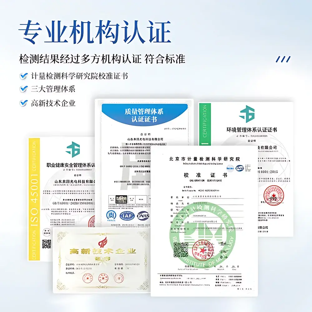
The IN-G30 is optimized for herbaceous and woody vegetation across agricultural, horticultural, silvicultural, and ecological monitoring applications—including but not limited to cereal crops, orchards, vineyards, pasture systems, and forest understory surveys. It requires no sample preparation, destructive sampling, or leaf-level contact. All measurements are conducted in situ under natural illumination. The system adheres to internationally recognized methodologies described in ISO 11727:2019 (optical methods for plant canopy characterization) and aligns with USDA ARS protocols for LAI validation. While not certified to IEC 61000-6-3 or FDA 21 CFR Part 11 out-of-the-box, its data export architecture supports audit-trail-ready workflows compatible with GLP and GMP-compliant agronomic trials when deployed with version-controlled software and documented SOPs.
Software & Data Management
The bundled Plant Canopy Analysis System (v3.x) runs on Windows-based laptops and provides end-to-end processing—from raw fisheye image import to parameter quantification and visualization. The software includes batch processing capability, metadata embedding (GPS, time, user ID), customizable reporting templates (PDF/CSV/XLSX), and cloud synchronization via secure HTTPS API to the COMECAUSE AgriCloud platform. Each registered device receives a dedicated cloud account with role-based access control, encrypted data storage, and revision history tracking. All exported datasets include embedded EXIF tags and machine-readable JSON sidecar files compliant with FAIR (Findable, Accessible, Interoperable, Reusable) data principles. Local data persistence is ensured via USB transfer and offline analysis mode.
Applications
- Dynamic LAI monitoring throughout crop phenological stages to inform nitrogen application timing and irrigation scheduling.
- Evaluating canopy closure rate and uniformity in precision breeding trials for drought-tolerant or high-density cultivars.
- Quantifying light penetration profiles in agroforestry systems to optimize shade-tolerant intercropping configurations.
- Validating radiative transfer models (e.g., SAIL, 4SAIL) using ground-truth gap fraction maps.
- Assessing canopy structural response to abiotic stressors (heat, water deficit, salinity) in long-term ecological observatories.
- Supporting remote sensing ground truthing campaigns by providing sub-field-scale reference data for satellite and UAV-based NDVI/LAI inversion algorithms.
FAQ
What is the minimum recommended distance between the fisheye lens and the upper canopy surface during measurement?
A minimum clearance of 0.5 m is advised to avoid lens vignetting and ensure full hemispherical coverage; however, the extendable arm allows adjustment down to 0.2 m for low-stature crops.
Can the IN-G30 be used under overcast conditions?
Yes—diffuse skylight enhances contrast in gap fraction detection, making overcast days suitable for reliable LAI estimation; direct-beam transmittance calculations require concurrent solar position data, which the built-in GNSS+RTC module provides.
Is the PAR sensor array factory-calibrated, and is recalibration traceable to NIST standards?
Each 25-sensor rod undergoes individual spectral responsivity calibration against a NIST-traceable tungsten-halogen reference source; calibration certificates are supplied with each unit and archived in the cloud dashboard.
Does the software support third-party GIS integration (e.g., QGIS or ArcGIS)?
Yes—exported CSV and GeoJSON files contain WGS84 coordinates, timestamps, and parameter fields mapped to OGC-compliant schema conventions, enabling direct layer import and spatial statistics workflows.
How is data security handled in the AgriCloud platform?
All transmissions use TLS 1.3 encryption; stored data is AES-256 encrypted at rest; account access enforces two-factor authentication and session timeout policies compliant with ISO/IEC 27001 Annex A.8.2.3.