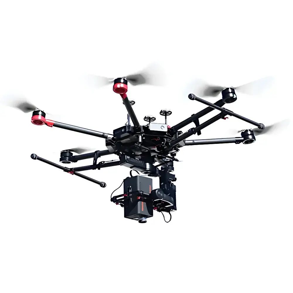
Dualix Spectral Imaging GaiaSky-mini2-VN Push-Broom Airborne Hyperspectral Imaging System
| Brand | Dualix Spectral Imaging |
|---|---|
| Origin | Sichuan, China |
| Model | GaiaSky-mini2-VN |
| Imaging Principle | Push-broom scanning |
| Platform Compatibility | Rotary-wing UAVs (e.g., DJI M600 Pro, S1000+), airships, helicopters |
| Spectral Range | 400–1000 nm |
| Spectral Resolution | 3.5 nm (at 30 µm slit width) |
| Numerical Aperture | f/2.8 |
| Sensor | Sony ICX674 CCD |
| Pixel Pitch | 4.54 µm |
| Output Bit Depth | 14-bit |
| Interface | USB 3.0 |
| Operating Voltage | 12–19 V DC |
| Power Consumption | 45 W |
| Image Resolution | 960 × 1040 pixels |
| Spatial Sampling (IFOV) | 0.16 m @ 300 m AGL, 17 mm lens |
| Horizontal FOV | 28.7° (@17 mm), 26.7° (@18.5 mm), 21.5° (@23 mm) |
| Ground Coverage Width | 154 m (@17 mm, 300 m) |
| Scan Rate | 160 line images/s |
| Weight | 1.5 kg (integrated camera + controller) |
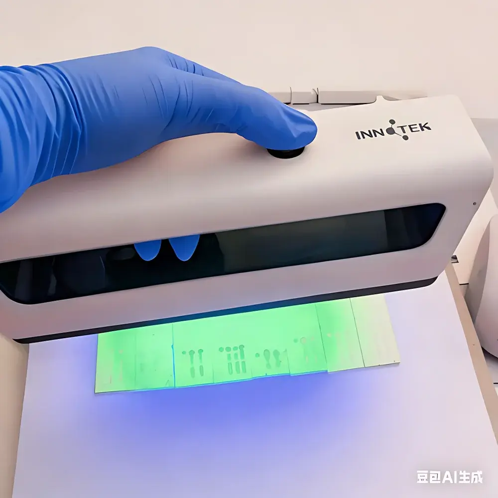
| Storage | 240 GB SSD |
| Mounting Envelope | ≥330 × 200 × 260 mm (H×W×D) |
Overview
The Dualix Spectral Imaging GaiaSky-mini2-VN is an integrated push-broom airborne hyperspectral imaging system engineered for deployment on rotary-wing unmanned aerial vehicles (UAVs), including the DJI M600 Pro and S1000+. Unlike whiskbroom or snapshot systems, the GaiaSky-mini2-VN employs a true push-broom architecture—capturing spectral data line-by-line as the platform moves forward—enabling high-fidelity, spatially contiguous hypercubes with minimal motion-induced distortion. Its proprietary internal scanning mechanism and active stabilization subsystem mitigate vibration artifacts inherent in small UAV platforms, ensuring radiometric consistency and geometric fidelity without reliance on high-grade inertial navigation systems (INS). Designed for operational efficiency in field-deployable remote sensing, the system delivers calibrated reflectance data across the visible to near-infrared (VNIR) spectrum (400–1000 nm) at 3.5 nm spectral resolution, supporting quantitative spectral analysis under variable illumination and atmospheric conditions.
Key Features
- Fully integrated design: Camera and controller co-located in a single 1.5 kg enclosure, eliminating external cabling and reducing integration complexity.
- Vibration-resilient optics and scanning: Patented internal linear scan actuation synchronized with UAV motion, enabling stable line acquisition at up to 160 lines per second.
- Real-time onboard processing: On-device computation of 18 standardized vegetation indices—including NDVI, EVI, ARVI, NDWI, PRI, SIPI, NDNI, CRI1/2, ARI1/2, MSI, and NDII—with configurable thresholds and export-ready metadata tagging.
- Live telemetry and preview: Integrated auxiliary visible-light viewfinder provides real-time “what-you-see-is-what-you-get” framing; full-resolution hyperspectral previews streamed via low-latency radio link to ground control station (GCS).
- Automated georeferenced acquisition: GCS-based mission planning supports point-wise or grid-based flight path definition with dynamic ROI selection and automatic image stitching using embedded GPS/IMU fusion (no external INS required).
- Preprocessing suite: Radiometric calibration, dark current subtraction, flat-field correction, and empirical line-based reflectance conversion—all executable in batch mode with user-defined LUTs and sensor-specific correction coefficients.
- Open data architecture: Outputs standard ENVI-compatible BIL/BIP formats (.hdr/.dat), with embedded geotags (WGS84), band centers, FWHM, and acquisition timestamps compliant with ISO 19115 metadata conventions.
Sample Compatibility & Compliance
The GaiaSky-mini2-VN is optimized for surface-level remote sensing of heterogeneous natural and anthropogenic targets—including vegetated canopies, soil substrates, inland water bodies, urban infrastructure, and military camouflage materials. Its 400–1000 nm spectral coverage enables detection of key biochemical absorption features (e.g., chlorophyll-a at 680 nm, water at 970 nm, cellulose at 2100 nm second harmonic, nitrogen-related bands near 1510 nm). The system meets functional requirements for ASTM E2907-23 (Standard Practice for Hyperspectral Imaging Data Acquisition), supports GLP-aligned data provenance through audit-trail-enabled acquisition logs, and conforms to USGS/NASA Landsat-style radiometric calibration traceability protocols. While not certified to ISO/IEC 17025, its factory calibration certificates include NIST-traceable lamp-based spectral responsivity curves and uniformity maps.
Software & Data Management
The bundled Dualix HyperStudio software provides end-to-end workflow support—from mission configuration and real-time monitoring to post-acquisition orthorectification, spectral library matching (USGS, ECOSTRESS, SPECCHIO), and custom index derivation. All processing modules are scriptable via Python API (compatible with SciPy, scikit-learn, and GDAL), enabling integration into automated analytical pipelines. Raw data is stored on an embedded 240 GB SSD with wear-leveling and journaling file system; exported datasets include sidecar XML files containing full acquisition parameters (exposure time, GPS position, attitude quaternions, temperature logs). Exported ENVI headers embed wavelength arrays with FWHM values and detector gain settings, satisfying FAIR (Findable, Accessible, Interoperable, Reusable) data principles for academic and regulatory reporting.
Applications
- Agricultural monitoring: High-resolution crop health assessment, nutrient deficiency mapping (N, K, Mg), irrigation stress detection, and yield prediction via time-series NDVI/EVI/MSI trajectories.
- Environmental surveillance: Wetland delineation, algal bloom identification in reservoirs, soil organic carbon estimation, and post-wildfire vegetation recovery tracking.
- Geological reconnaissance: Lithological mapping using diagnostic absorption features (e.g., kaolinite at 2160 nm, goethite at 480 nm), mine spoil characterization, and acid mine drainage plume detection.
- Defense & security: Camouflage detection via spectral anomaly analysis, concealed object identification under foliage (Spectral Unmixing + SAM classification), and battlefield change detection.
- Urban remote sensing: Impervious surface quantification, rooftop material classification, and heat island effect modeling using thermal-inertial proxies derived from VNIR water vapor indices.
FAQ
What UAV platforms are officially validated for GaiaSky-mini2-VN integration?
The system has been fully tested and mechanically/electrically qualified for DJI Matrice 600 Pro and S1000+ platforms. Integration kits—including vibration-damped mounting brackets, CAN/UART interface adapters, and power regulation modules—are available upon request.
Does the system support radiometric calibration in-flight?
Yes—via optional integrated irradiance sensor (Dualix DRS-1) and automated downwelling light capture during pre-flight and mid-mission calibration checks, enabling absolute reflectance retrieval under non-Lambertian illumination.
Can I run custom machine learning models onboard?
While real-time inference is limited to precompiled vegetation indices, the exported hypercubes are fully compatible with TensorFlow, PyTorch, and ENVI’s Deep Learning Module for offline supervised classification, endmember extraction, and anomaly detection.
Is raw data accessible without proprietary software?
Yes—binary .dat files follow ENVI BIL format with human-readable .hdr headers. Band centers, pixel geometry, and acquisition timestamps are exposed as plain-text fields, permitting direct ingestion into QGIS, R (hyperSpec), or MATLAB without license dependencies.
What level of geometric accuracy can be expected without RTK-GNSS?
Using standard GNSS (±2.5 m CEP) and onboard IMU, geolocation accuracy is ±5–8 m RMS in open-sky conditions. With optional RTK upgrade and ground control points (GCPs), sub-meter orthorectification (<0.5 m CE90) is achievable.